WxUSAF
-
Posts
26,470 -
Joined
-
Last visited
Content Type
Profiles
Blogs
Forums
American Weather
Media Demo
Store
Gallery
Everything posted by WxUSAF
-
You can take the “woe is us it will never snow again” crap to the NYC subforum.
-
I’m guessing maybe that’s some brightbanding? CC radar would suggest that.
-
6z gfs squashed everything a little too much. 12z phases northern stream a little too much. Average them together = boom.
-
We had a few small events in 14-15 prior to mid-February, but people here were absolutely losing their minds because SNE was having an absolute parade of KUs and we were smoking cirrus. The 3-4 weeks starting at Valentine’s Day changed our opinion quickly of that winter.
-
Dang…6z teases like 4 times and can’t quite get it together once.
-
Yeah baby
-
Are you looking at literally anything besides the snow map?
-
Possibly. There’s a constant stream of gulf moisture into our area starting on the 4th.
-
Maybe we're looking for different things.
-
Euro op only runs to D10.
-
Departures for the month to date: BWI: +2.9F IAD: +3.2F DCA: +1.9F These will go up from here obviously through next Thursday or so. I’d guess another 1-2.5F in total? Then last few days of the year look BN. I’d guess we end around +4.5F?
-
I’m perhaps in the minority in that I’d still be happy with a mixed event. Of the little bit of snow we already get per year, even less of it comes in pure snow events. I’ll take 3-5” that mixes to rain afterward. Just give me some snow I can take a nice Jebwalk in and watch from my window.
-
Then it would be suppressed. Hopefully we cash in during the 48 hours the MJO is in phase 8 in early February
-
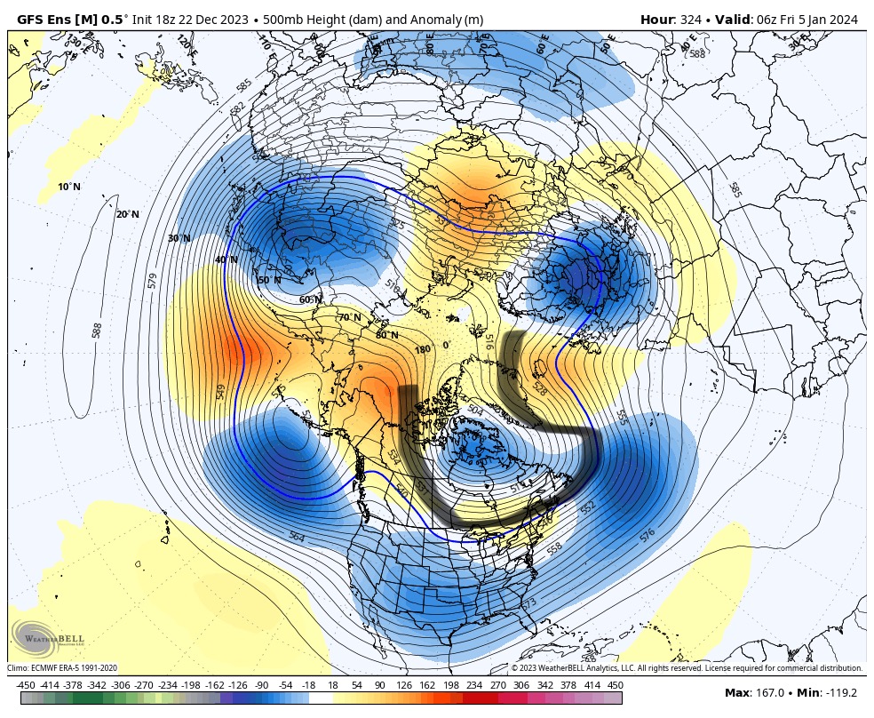
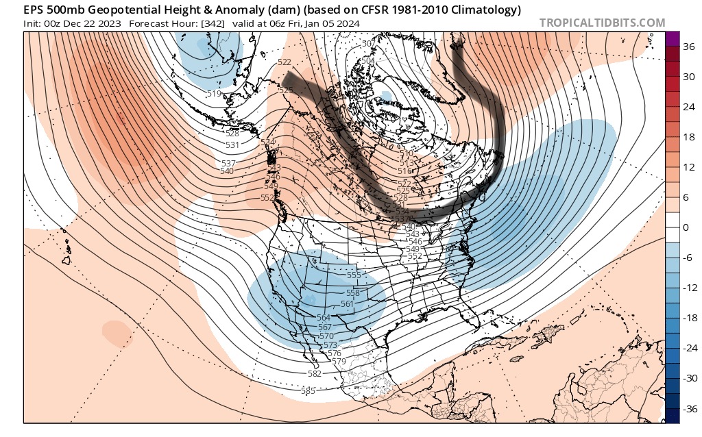
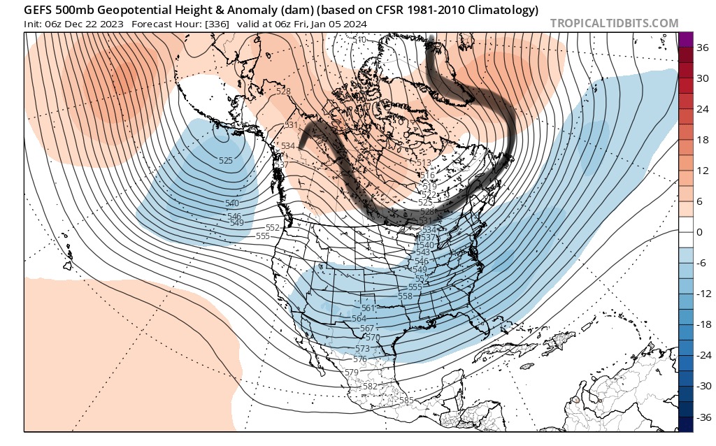
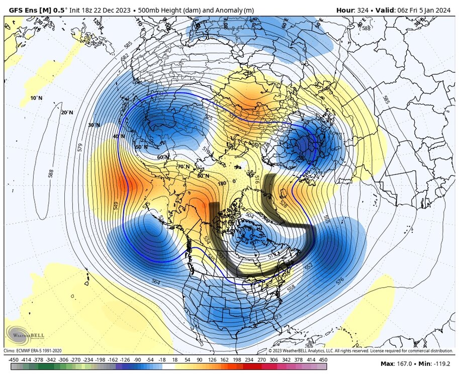
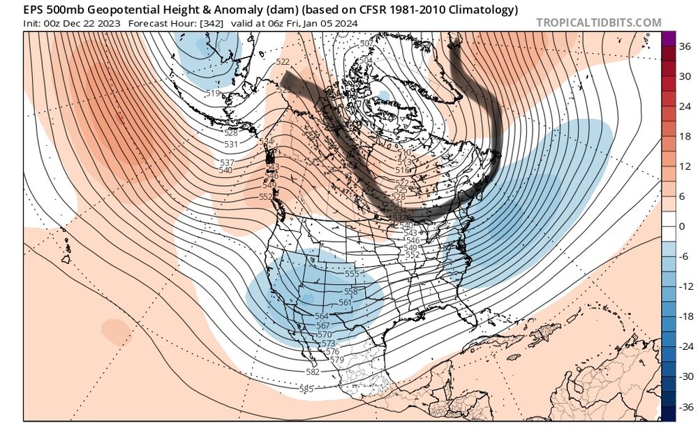
Forgive my bad finger drawing on my phone, but I wanted to highlight this shape in the longwave pattern. This is The Look. Northerly flow into the Midwest and Great Lakes supplying cold air, east-west over us and to our north, troughing in the 50/50 region, and then ridging in Greenland for the -NAO. That broad flat bowl look is what @Bob Chill was mentioning recently.

-
Called it way before Webb
-
Can’t be. I’ve heard in very good authority that cold is getting cankicked and it’s going to stay warm for awhile. #natgas
-
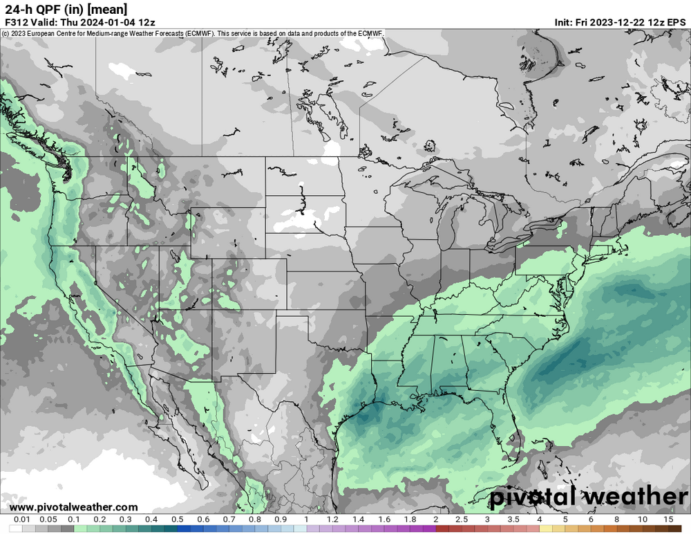
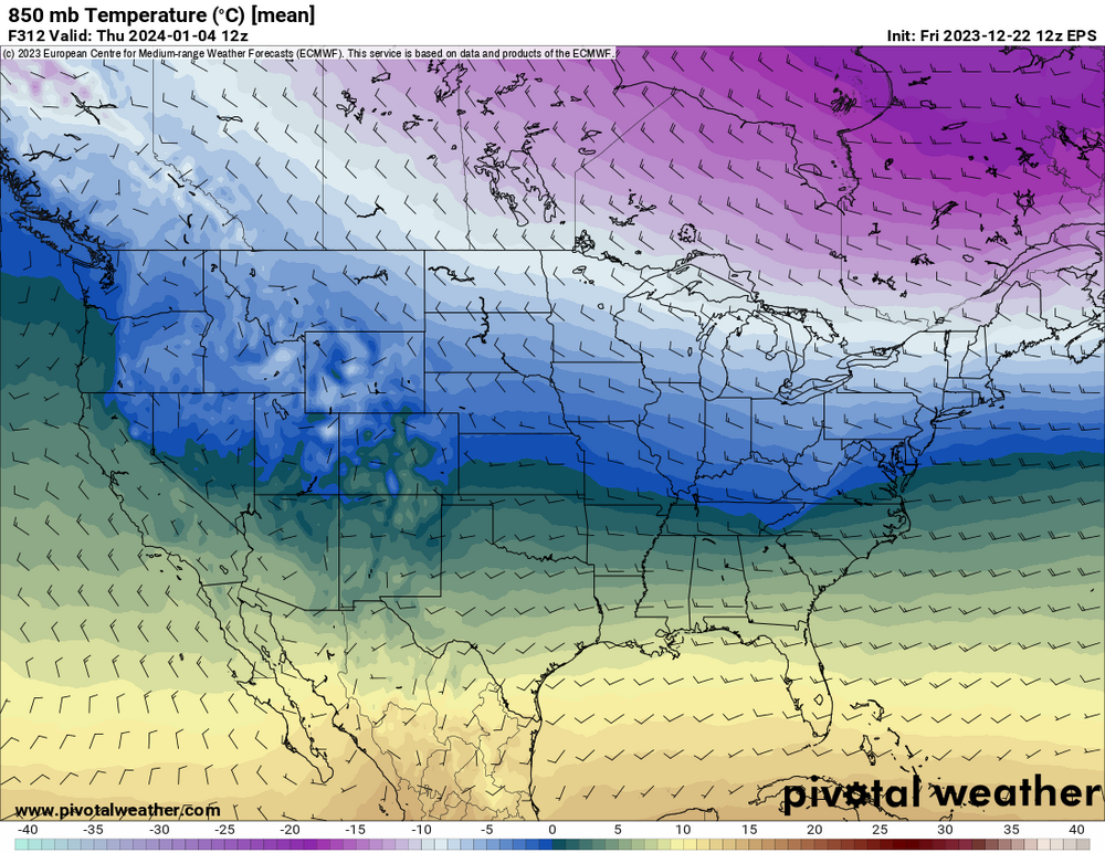
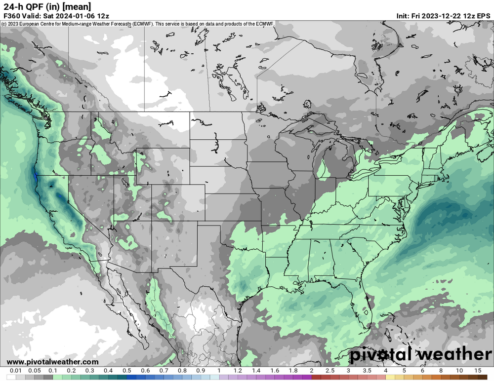
Haven’t seen EPS yet, but otherwise an encouraging 12z suite to my eye. 3 big globals all show some light snow/snow showers in the area late next week as cold air arrives and are setting up well beyond D10. GEFS and GEPS show the Jan 4-6 period is very compelling. GEFS also again around Jan 1-2.
-
Certainly could be snow showers with this TPV passage. But the option for something more is there if things shake out.
-
As much as it feels the opposite, we still get below freezing much more than we get above 90.
-
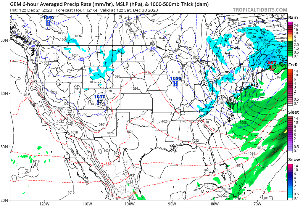
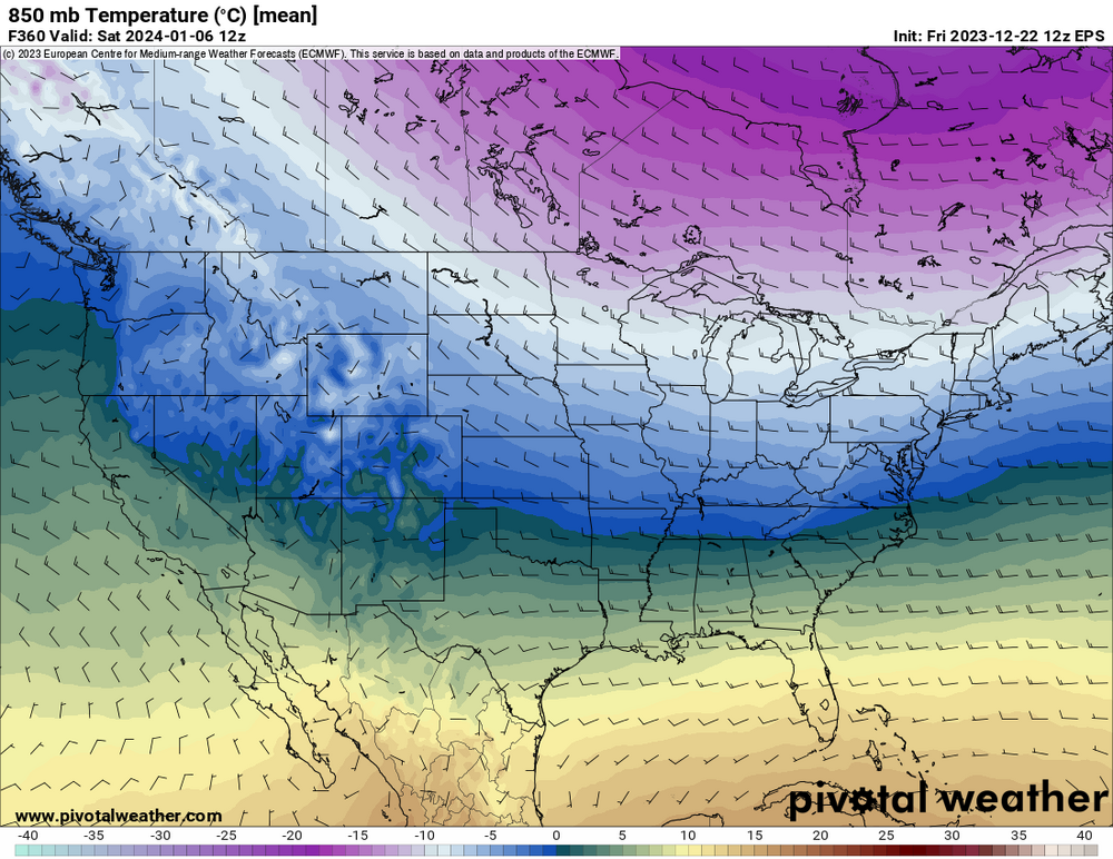
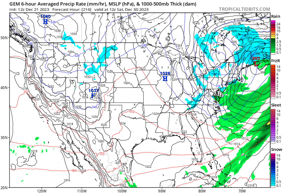
This is what I’m watching now basically. Our pattern change is within range and how next weeks event brings in colder air and establishes an eastern trough is key to whatever comes after. GFS, at least last nights euro, and now GGEM as well phase in a piece of the TPV and drop it almost due south late next week. Then more shortwaves over central Canada broaden it out. Some earlier runs phased in colder air earlier. It’s too early to say what differences in this may ultimately impact future snow chances because we don’t have a discreet threat afterward (yet). But what I don’t want to see is next week turn into a cutoff low that doesn’t drag in cold air and start an eastern trough. That’s the cankick scenario.
-
I meant exceeding everything since is a very low bar. Jan 22 was very good.
-
Yes, but that’s a low bar.
-
6z gfs has coastals in both those periods. Just skims @CAPE on the 2nd, then suppressed for RIC on the 6th.
-
Webb would gaslight us and say it’s good because it’s laying down snow in the upper Midwest