WxUSAF
-
Posts
26,472 -
Joined
-
Last visited
Content Type
Profiles
Blogs
Forums
American Weather
Media Demo
Store
Gallery
Everything posted by WxUSAF
-
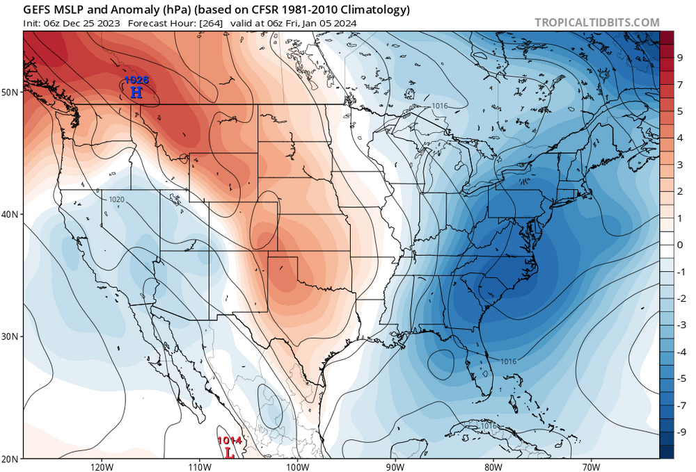
The point is that the -PNA is already on its way out as a ridge builds in and the +EPO heads toward an Aleutian low.
-
It’s an interesting argument on Twitter and I’m not sure how if this is really a disagreement or just confusion. But it seems 12z eps was a pretty huge outlier from a long trend. So either way I’d wait for some confirmation before jumping off a cliff.
-
That plus a SSW will favor a trough east of the Rockies at some time lag after it happens. So if it happens around the 7th, the SSW would start helping that pattern around the 15-20th.
-
Solid ensemble agreement for the period around the 6/7th. Still a ways to go. I also like seeing signs that any “mild/relax” period will be pretty short lived. Can already see off/on hints of the trough undercutting the NAO and also reestablishing an aleutian low.
-
Lol oh man, that’s like 3 nut punches in a row on the gfs
-
Yeah, freezing level is like 950mb in that deform band. It’s low, but also not right at the surface. So I think it would be pouring slush bombs at 34 if it happened like that. But it “should” be a 30-32F pasting.
-
I think I agree that there would be at least some snow in that deform band on the back with that look. But the torched boundary layer at that point is pretty alarming and discouraging.
-
“Base State: A New Normal (TM)”
-
Left some points on the board, but that’s a solid first half.
-
Kyle Hamilton = pretty, pretty, pretty, pretty good.
-
Just need to come out of this game healthy. Please.
-
lol, I literally looked at this and thought this gfs storm really has it all, Hoffman is even fringed!
-
Don’t hold us in suspense!
-
Prohibition on post D10 snow maps is rescinded for Christmas.
-
Wooo baby, GFS brings some Christmas magic!!
-
Merry Christmas! All I want for Christmas is for @psuhoffman’s seasonal snowfall forecast to come true! Go Ravens!
- 993 replies
-
- 10
-

-
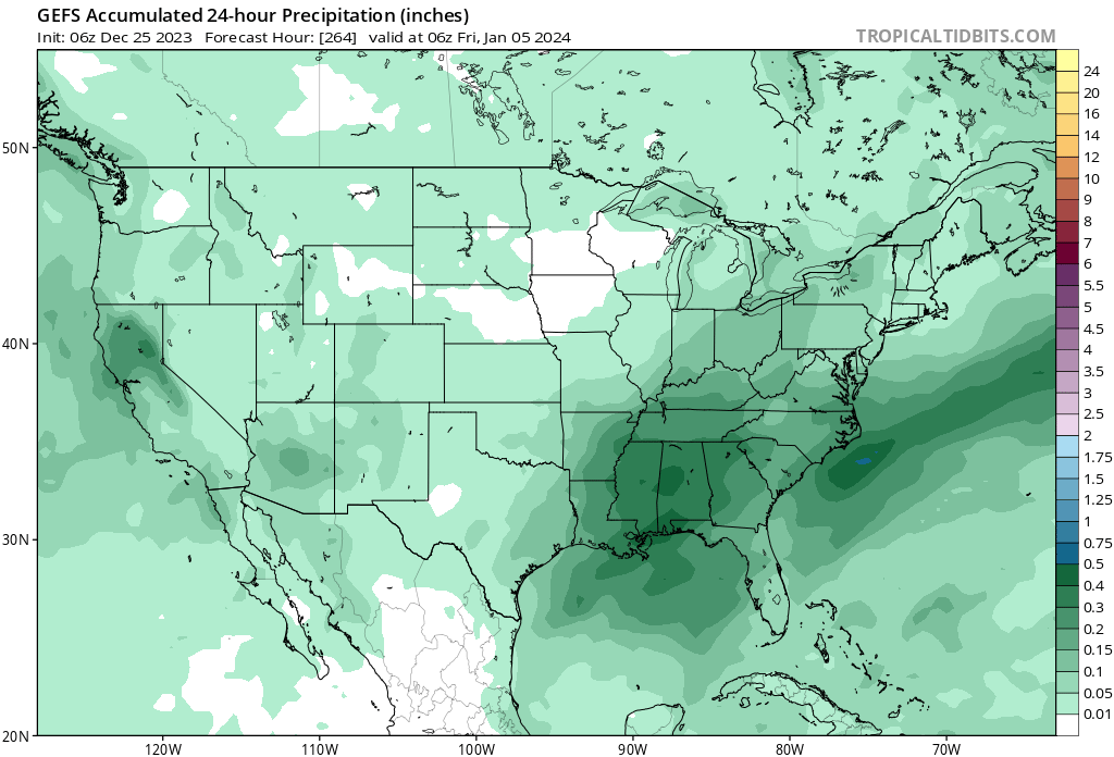
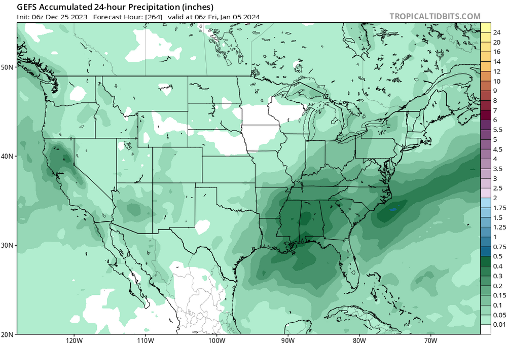
GEFS also seems to like that 4-5th.
-
Ha, was about to say HH was tee’d up at the end.
-
lol I was not very eloquent here and everyone interpreted this as the opposite of what I meant
-
I’m not there yet, but getting there. Yeah, more northern stream than previously advertised.
-
I’m not quite ready to say I’d be surprised if we’re totally skunked through say January 10, but we’re heading in that direction.
-
If our early January HECS doesn’t lock in on the guidance by tomorrow than winter is cancelled!!
-
Don’t care that much, but I seem to be one of the very few people who can’t click on post reactions to see who reacted. Phone and computer, neither works for me.
-
And GFS/GEFS has a notable strong vortex bias, so extra encouraging to see it onboard as well. Assuming this holds and we get an official SSW around the 3rd, question becomes how fast it impacts the troposphere on our side of the planet.
-