Cfa
-
Posts
4,548 -
Joined
-
Last visited
Content Type
Profiles
Blogs
Forums
American Weather
Media Demo
Store
Gallery
Everything posted by Cfa
-
Highest temp of the year at 96. I also hit 96 in July but today was a few tenths of a degree hotter. Crazy. Still the lowest summer max temp since I moved here, all summers have seen upper 90’s. We’ll see what tomorrow holds.
-

Extended summer stormlover74 future snow hole banter thread 23
Cfa replied to BxEngine's topic in New York City Metro
I can’t explain why but Lee is giving me vibes I haven’t felt since Sandy became a tropical depression. This isn’t to say I think Lee will impact us directly, the east coast is very long, but I feel like I’ve seen this before, and I’m not buying the fish storm talk just yet. With Sandy I just knew, I’m not there yet with Lee. I’m just hoping this isn’t an “If Sandy occurred a month earlier it would’ve been worse” situation. -
Town of Brookhaven, I’m on the North Shore.
-
93 today, 94 yesterday, 92 the day before. First heat wave here since late July (7/26-7/29).
-
High of 92 here, currently 85. Perfection.
-
3 90’s this August vs 17 90’s last August.
-
This rain is so cold, I’m disgusted.
-
91/65 split here, currently 85. I don’t get the 2009 comparisons, that summer felt cooler, cloudier, and wetter than 2023 from what I can remember.
-
89/57 split today.
-
2.13” here, bust??
-
^^^This is my first year seeing them ever, none by me luckily.
-
1.60” spread across 3 rounds of storms. Booming thunder and frequent lightning, 208 strikes recorded on my lightning detector, far less than reality. The best winds went to my south, it was very meh up here, but still by far the best pure thunderstorm event of the year. Glad I didn’t miss it.
-
0.13” so far. Meh.
-
74 and windy, some of these gusts are pretty potent, I just had to avoid walking under some trees. Light rain fell apart on arrival, only sporadic raindrops at best. High of 78, and a heavy rain induced low of 69. 1.05” today, all of it from this morning.
-
Weird considering the literal coast is clear, for now. Last summer I flew from JFK to Charlotte and the pilot announced we’d be flying over the Appalachians to avoid storms (in the same area as today’s storms) but instead we hugged the coast all the way down.
-
I’d say 111 degrees at EWR or LGA is within the realm of possibility but not Central Park. KNYC is a lost cause.
-
Overcast now, sky was mostly clear. I’m starting to really hate it here, I need a tropical storm or something, LI weather is so boring.
-
Just over an inch here, steamy now with the clouds clearing out.
-
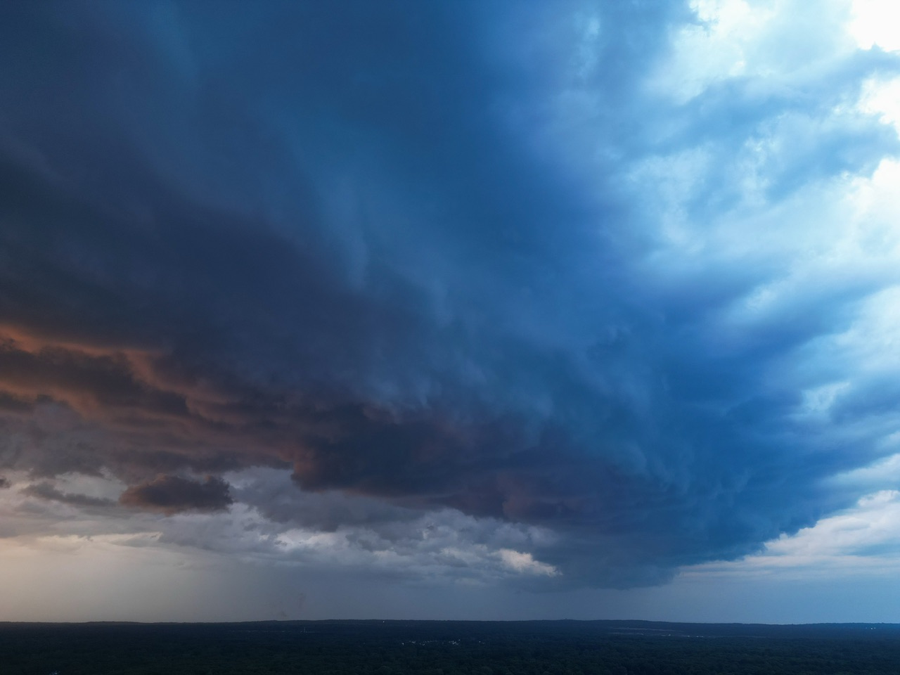
First time getting to use the drone during a thunderstorm, this minor shelf cloud came as a surprise as it was completely invisible from ground level. I didn’t get to do much since it started raining very shortly after I started flying and it was too dark when it stopped raining. Lighting gif was looking to the east after the storms passed. The strong breeze left the street littered with small branches. Not much rain unfortunately, we could've used another soaking, especially going into yet another dry pattern.

-
These videos coming out of DC are intense.
-
High of 93 here, down to 86. Heat wave day 4, day 5 with a heat index above 100. Last 7 days: 90/73, 87/67, 89/67, 92/64, 92/74, 95/72, 93/75
-
High of 95, low of 72, currently 88. Humidity much more tolerable today.
-
Garden variety thunderstorms, nothing crazy but nice to have, narrow miss for my PWS with 0.01”, but just to the south I’m experiencing downpour number #2, I’d say slightly more than a quarter of an inch has fallen here with these storms. 92/74 split today, 92/64 yesterday. Noticeably more humid today with dews sustained at 80 for several hours.
-
91/79/110 on my Kestrel in Huntington. 87/80/102 at my PWS. High of 92 so far there.
-
High of 92 today, 89.4 yesterday, the literal worst almost-90 in existence. I have to tally up my 90’s.