

John1122
-
Posts
10,682 -
Joined
-
Last visited
Content Type
Profiles
Blogs
Forums
American Weather
Media Demo
Store
Gallery
Everything posted by John1122
-
11/12/19 Tennessee Valley Early Winter Event
John1122 replied to BlunderStorm's topic in Tennessee Valley
No November day will top November 25th, 1950. High 8, low -7 here. 8 inches of snow on the ground. It was -8 in Allardt that morning. Which may be the all time record low for November in Tennessee since a lot of stations weren't up back then. It was also -7 in Jamestown that morning and -6 in Monteagle. -
11/12/19 Tennessee Valley Early Winter Event
John1122 replied to BlunderStorm's topic in Tennessee Valley
This is the kind of day I enjoy in winter. It snowed all day long, no melting, temps stayed in the lower 20s. Very unusual to see this wintry an air mass this early. -
11/12/19 Tennessee Valley Early Winter Event
John1122 replied to BlunderStorm's topic in Tennessee Valley
Still snowing here as well. Quarter sized flakes out there. Upslope has added about 1/2 today. -
11/12/19 Tennessee Valley Early Winter Event
John1122 replied to BlunderStorm's topic in Tennessee Valley
1.25 inches. About 1/2 what the more optimistic models were spitting out here but pretty close to what the HRRR was showing towards the event approaching, which was around 1 inch. It closed schools here, so the kids are happy with it too. -
11/12/19 Tennessee Valley Early Winter Event
John1122 replied to BlunderStorm's topic in Tennessee Valley
Not a huge event, but November accumulations outside the last 10 days of the month aren't very common. This one gave us a preview of some model biases to keep in mind as winter unfolds. Hopefully this is the first of many tracking situations that actually works out for us to some extent. -
11/12/19 Tennessee Valley Early Winter Event
John1122 replied to BlunderStorm's topic in Tennessee Valley
Back edge is moving over me now. The snow band is expanding, cold air seems to be passing through the moisture faster or maybe it's being enhanced more, but I'll bet Knox-East and NE exceed WWA criteria. -
11/12/19 Tennessee Valley Early Winter Event
John1122 replied to BlunderStorm's topic in Tennessee Valley
I-75 in southern Campbell from a friend on his way to work.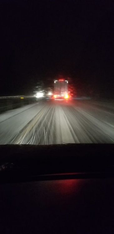
-
11/12/19 Tennessee Valley Early Winter Event
John1122 replied to BlunderStorm's topic in Tennessee Valley
Closing in on an inch, it's just been pouring for the last hour + now. -
11/12/19 Tennessee Valley Early Winter Event
John1122 replied to BlunderStorm's topic in Tennessee Valley
The burst of sleet here laid down a coating of ice that actually aided in sticking of everything. The sleet pellets were oddly large. Guess it was the big flakes melting and refreezing. -
11/12/19 Tennessee Valley Early Winter Event
John1122 replied to BlunderStorm's topic in Tennessee Valley
Moderate to heavy snow now, but its booking out of here. Hopefully we can get some rotation back this way. Not sure that we have much more than 30 minutes or so left though. Ground, decks, cars etc covered. -
11/12/19 Tennessee Valley Early Winter Event
John1122 replied to BlunderStorm's topic in Tennessee Valley
Still a good portion of what's falling is sleet. The warm nose is apparently potent up there somewhere. -
11/12/19 Tennessee Valley Early Winter Event
John1122 replied to BlunderStorm's topic in Tennessee Valley
Sleet/snow mix has finally started. Looks like maybe 2 hours of precip still to go for my area. -
11/12/19 Tennessee Valley Early Winter Event
John1122 replied to BlunderStorm's topic in Tennessee Valley
Down to 32 but still no precip. Just misty. See that Crossville is picking up LT snow now. That's basically upstream for me. -
11/12/19 Tennessee Valley Early Winter Event
John1122 replied to BlunderStorm's topic in Tennessee Valley
Precip has died here and upstream of here. Will see if the precip in the mid state can get here, thinking I'll be lucky to get dusting at this point. -
11/12/19 Tennessee Valley Early Winter Event
John1122 replied to BlunderStorm's topic in Tennessee Valley
Looks like the precip is breaking up for a bit, right as the changeover was getting close. -
11/12/19 Tennessee Valley Early Winter Event
John1122 replied to BlunderStorm's topic in Tennessee Valley
Changing over at elevation above me. I'd guess 2500 feet is changed. -
11/12/19 Tennessee Valley Early Winter Event
John1122 replied to BlunderStorm's topic in Tennessee Valley
Down to 39 now. Snow is breaking out in Fentress on the radar. -
11/12/19 Tennessee Valley Early Winter Event
John1122 replied to BlunderStorm's topic in Tennessee Valley
The snow line looks like it's moving at about 25 mph. Its about 75 miles WNW of me. -
11/12/19 Tennessee Valley Early Winter Event
John1122 replied to BlunderStorm's topic in Tennessee Valley
Somerset is 34 but with rain still. Hopefully it's close to switching over. A shame to waste QPF at that temp. -
11/12/19 Tennessee Valley Early Winter Event
John1122 replied to BlunderStorm's topic in Tennessee Valley
-
11/12/19 Tennessee Valley Early Winter Event
John1122 replied to BlunderStorm's topic in Tennessee Valley
It's a potent from. My area is modeled to be around 23 by day break. -
11/12/19 Tennessee Valley Early Winter Event
John1122 replied to BlunderStorm's topic in Tennessee Valley
Just absolutely pouring rain right now. I always hate the hours waiting on a changeover, using up QPF. Wouldn't be shocked to see it fall apart here as shown on some modeling and see it redevelop over the eastern areas. Looks ragged downstream in the cold, without that enhancement on the front the far eastern areas look like they might get, I'm thinking maybe 1/2 inch for me. -
11/12/19 Tennessee Valley Early Winter Event
John1122 replied to BlunderStorm's topic in Tennessee Valley
Gusty NW winds, temp is 46, looks like you get from 50-40 in a big hurry then it slowly falls into the 30s. Looks like its taking 34-35 to switch. -
11/12/19 Tennessee Valley Early Winter Event
John1122 replied to BlunderStorm's topic in Tennessee Valley
Cold push is on the western edge of the Plateau. 42 in Somerset Ky. 52 in Williamsburg. 41 in Livingston, 50 in Crossville. -
Tennessee Valley 2019 Fall Speculation/Forecasting
John1122 replied to AMZ8990's topic in Tennessee Valley
The 1954 December warmth blend into about 10 days of Jan 1955. Mid month there was a 6 inch snow event. Last 10 days of Jan were well BN, snow showery, some trace events, some quarter to .5 inch events and a 1 inch event. Low for the month was 0 on Jan 29th. February was up and down the first 10 days, some rain, some light snow. Mid month there was a 3.75 inch snow event on the 11th, and a -5 low on the 13th with 1.25 inches of snow on the 14th. March of 1955 was a roller coaster with big warm ups and a few cold shots including a frigid last week of the month, snowed 5 times but trace amounts. March ended up normal temp wise for the month. April was full blown warm spring. Nov 2.5 inches -5.5 bn temps December 3.75 inches -4 January 8.5 inches -2.5 February 5.5 inches. -1 March 5x trace amounts. N So roughly 19 inches here that winter, Nov-Feb were all BN with Nov being the coldest month relative to normal.- 574 replies
-
- 2
-

-
- early winter
- leaves changing
- (and 3 more)


