Damage In Tolland
-
Posts
116,820 -
Joined
Content Type
Profiles
Blogs
Forums
American Weather
Media Demo
Store
Gallery
Everything posted by Damage In Tolland
-
 This obviously is all just way over your head . Enjoy the cool crisp next month I guess
 -
The issue is you believe all those posts that Kook Kenny posts I never said it would be . I said at the time it was .. and it was. The thing is there’s no cool.. it isn’t overly hot but dews near or over 70 for weeks is fine
-
Talking to ACATT. All 3 of them
-
No fresh Canadian airmasses . It ain’t the heat , it’s the humidity. Nino Aug/Sept famous for
-
It’s a very humid pattern from today onwards. Not many 90’s thru early Augdewst.. but daily dews to enjoy
-
ACATT twosome tonight making up all kinds of false information etc. . Would be nice for some of our other fellow posters to put them in their place . I’ve fought the fight alone so far . Anyone else tired of their shit that wants to help ?
-
Since you’re actively tracking BDL data , please post that instead of a station in the N ATL. Thanks !
-
Last few weeks ? It was hot and humid until middle of last week
-
There were posters calling today COC. From your ACATT crew. While dews were 66-70 all day
-
Have not had one single storm . Mother Nature balancing it all out.
-
All anyone has to do is scroll back over the last two days
-
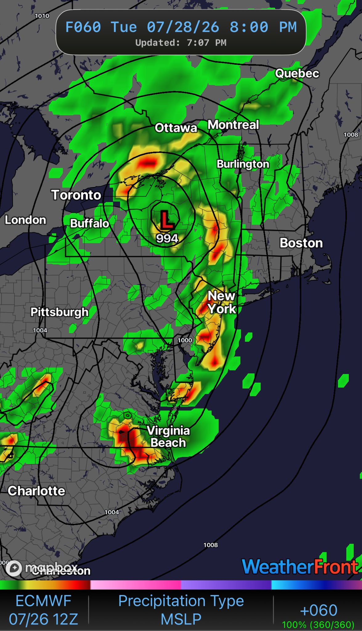
You were posting maps and teen boy tweets you follow of a wild Noreaster , 5-10” of rain and even told Wiz he’d wash down the CT River. People were posting about everyone needing arcs to get around . Meanwhile those in the know recognized yesterday this was a wagons west event
-
Another boring event . A narrow zone may get 3-6” and a few cars get stuck for an hour . Riveting
-
Wags west
-
Yup. Even today 67/68 dews feels good
-
Feels nice to get these high dews back today
-
Guys talking about arcs and 1/100 year flooding yeah
-
How many deep are you?still on board for a wild storm ?
-
Congrats on Jack !
-
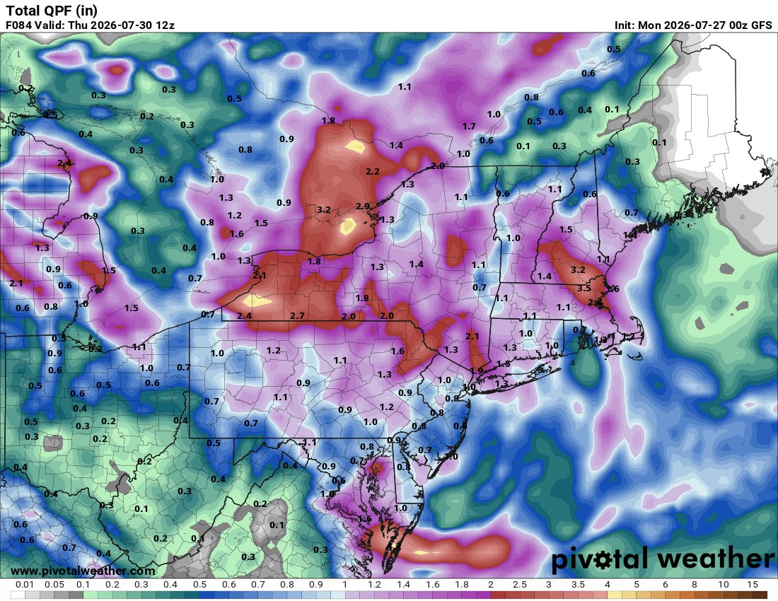
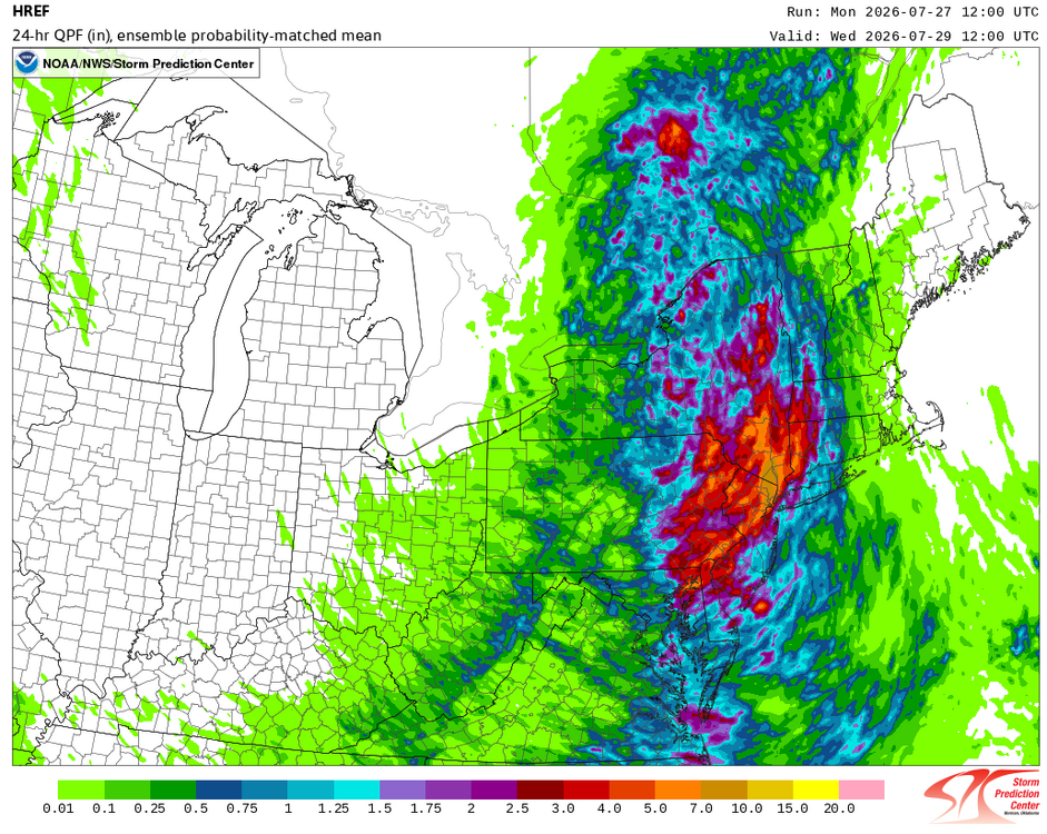
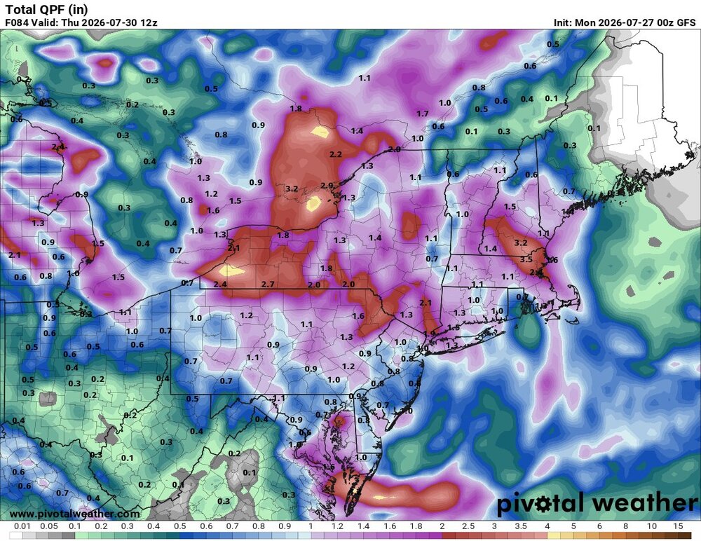
3k is the much more likely scenario. Most towns get .50.-2” and a few get a bit more . And it’s got the jack where you’d think it would be to the NW. Also notice it lost that ridiculous Noreaster it had. So many wild tweets and posts about a July Noreaster lol. It’s a closed ULL over NY state. As boring as it gets unless someone sees a spinner or something
-
Most folks don’t need it . Certainly not 4 straight days of it which many will get especially EMA up into Maine
-
Another event that will end as mundane and boring as possible in the summer of extreme bore. Hopefully it still cuts west
-
Wagons NW

-
No . You are thinking about early month . Nailed the last one as well
-
The whole thing went from SNE Jack to mainly NY state . You haven’t been looking daily while on vaca . We will get some rain obviously but wagons west for 1-5”+ etc .Pretty evident today