bearman
-
Posts
593 -
Joined
-
Last visited
Content Type
Profiles
Blogs
Forums
American Weather
Media Demo
Store
Gallery
Everything posted by bearman
-
Yes they are I am in west Knoxville so I should be good. Hopefully the East can get some love.
-
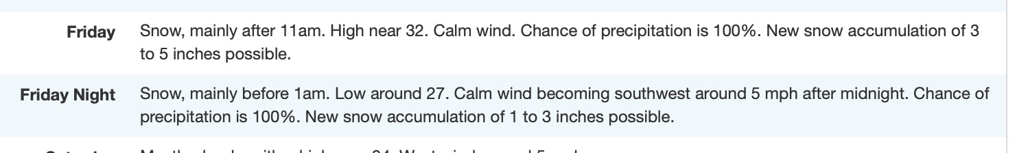
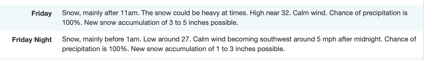
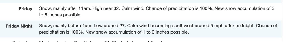
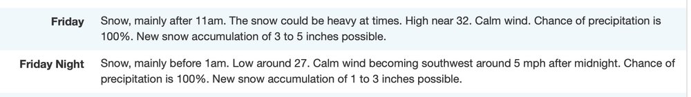
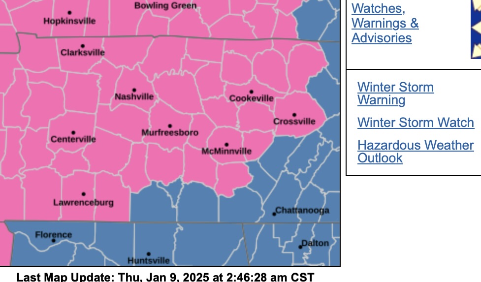
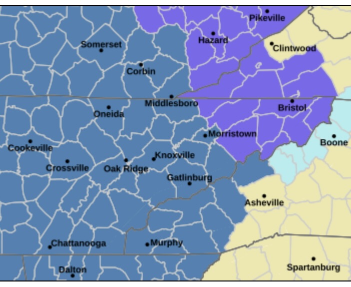
New discussion Area Forecast Discussion National Weather Service Morristown TN 358 AM EST Fri Jan 10 2025 ...New SHORT TERM, LONG TERM... .SHORT TERM... (Today and tonight) Issued at 254 AM EST Fri Jan 10 2025 1. A winter storm will impact the area today into Saturday morning with widespread accumulating snow. Snow may be mixed with sleet and freezing across southeast Tennessee, southwest North Carolina and far east Tennessee. Winter Storm Warning in effect for the entire area. 2. Confidence is high for moderate to heavy snow accumulations for areas west of interstate 81 and 75, and low to moderate east. 3. A mountain wave high wind event for the far east Tennessee mountains and foothills for this afternoon and evening. Southerly winds of 15 to 30 mph with gusts to 45 mph. 4. The downslope mountain wave winds will limit the snow accumulations across the eastern side of the valley and foothills. Discussion: A complex and significant winter storm will move across the area today through Saturday morning. Snow showers and flurries will continue across the mountains and foothills of far east Tennessee and southwest Virginia much of Saturday. Bottom Line: Lower confidence on snowfall amounts across the eastern Tennessee valley, southeast Tennessee, and southwest Virginia due to greatest potential of mixed precipitation of snow, sleet, and freezing rain. Downslope winds off the far east Tennessee mountains will produce compression warming over the east side of the valley limiting snowfall there. However, MOST IMPORTANTLY is to get the message out a significant winter storm will effect the area today through Saturday morning. A period of moderate to heavy snow is expected which will reduce visibilities, cause Extremely difficut travel. The afternoon commute across much of the area will be difficult. Deterministic and Ensemble trends: The deterministic and ensemble models are in pretty good agreement with bringing a Miller-A type snowstorm will move across the area today through Saturday morning. The main difference is that the deterministic NAM, and higher resolution HREF and HRRR show pressure falls on the lee of the far east Tennessee mountains due to the strength of the 300mb jet. These pressure falls induce a mountain wave across the mountains and foothills. The compressional warming from the downslope winds will tend to warm the east side of the valley/foothills and limit snowfall there. Otherwise, a abnormally strong upper jet of 185 knots+ will move across the Tennessee valley today. NAEFS tables shows the upper jet about 2-3 standard deviations above normal. NAEFS also shows fairly strong 850mb moisture transport into the southern Appalachians. The upper jet will produce good fronto-genetic forcing along with isentropic lift into the region. Good dendritic snow growth is noted as well along with several hours of CSI for snow banding especially across southeast Tennessee, northern Plateau, western half of the Tennessee valley and southwest Virginia. Precipitation Types and Snow Amounts: Confidence is high for mainly snow across the northern Plateau, western half of the central and northern sections of the Great Tennessee Valley into much of southwest Virginia. These is where 5 to 6 inches are expected with locally heavier amounts are possible. The lowest confidence portion of this forecast is the east side of the valley and southwest North Carolina. Enough warm air advection may change the initial snow over the a wintry mixture of snow, sleet, and possibly freezing rain. This wintry mix may limit snow accumulations there. Timing: This is the highest confidence part of the forecast as models have been fairly consistent for multiple days now with snow moving into southeast TN around 12-15z and spreading east/northeastward throughout the day, making it into southwest VA by 18z. Winter precipitation will continue at a steady rate the rest of Friday and into Saturday morning. The northwest flow Saturday will keep snow showes and flurries going across the far east Tennessee mountains and foothills, and southwest Virginia. Elsewhere Saturday, a chance of flurries remains for Saturday. Mountain Wave High Winds: Due to a lee trough developing across the foothills this afternoon in association with strong upper jet dynamics, pressure gradients will tighten across the mountains producing a mountain wave event. Southerly winds will increase to 15 to 30 mph with gusts to 45 mph. && .
-
One thing for sure Memphis is long overdue a good storm and at least right now they are getting it.
-
Point forcast problems have been fixed.
-
Hopefully the mixing issues will not be a problem for us. I am just north of 40 in West Knoxville
-
Up my totals in Knoxville from 4 to 8. Total
-
Got some glitch just go down to your Zone forcast for your county and the area forecast is there.
-
Oh Joy. When you were about to relax and feel good about the event.
-
I don't think I broke the freezing mark today at the house but as you said it does not matter the ground is rock hard. I was down to 15 this morning and I did not get above freezing Yesterday. We are set for a good setup for those that like full coverage.
-
It has been a long time that I have seen a point forecast in Knoxville like this. I am in the little 6 to 8 dollop right outside of Knoxville. We will see.
-
Heavy snow squalls moving through Dallas. My Father for what its worth always said If Dallas gets snow we are next so its always a positive thing in my head.
-
Yeh the Discussion was rather frustrating. It just seems we can never have a clear path to all snow and our office always seems to hug the outliners. Often rightly I suppose.
-
Typical though I would say under this situation I kind of surprises me.
-
Looks like Nashville pulled the Winter Storm Warning East should follow shortly. arning.
-
In the grid forecast MRX now has Rain snow for Friday in Knoxville. That way they can't be blamed for hype. Or is it time to get out the towel?
-
I have seen this as well and to be honest it always seems that the average reported totals are always more than the official total that MRX comes out with at McGhee Tyson. It is very odd.
-
Move this if you need to but looks like MRX decided better late than never on the little event this after noon. Must be causing some problems? WWA for far north east area.
-
I have lived in the valley for my entire life, from Cleveland to Knoxville and last year was the longest duration snow and Ice impact event that I can remember, at least in the center valley low elevation areas that tend to melt very quickly. The roads just remained snow and ice covered for a very long amount of time in areas that were generally in the past the first to melt.
-
It is truly amazing how many ways their are to get screwed when it comes to snow in the Valley. I have lived all my life in the Great valley I am now 62. I remember as a child many surprise snows living in Cleveland that were never forecast and only a few that were forecast that did not come to fruition. I have lived in Knoxville the last 15 years and been surprised how that has seemed to reverse. Maybe its my memory but boy how complicated forecasting is for the Valley.
-
Getting sleet and freezing Rain in West Knoxville. Was hoping for a little snow in the beginning but no luck.
-
It will be interesting to see if the cold air in the valley will remain stubborn and remain in the valley. Will it be deep enough for snow or sleet or will it just be rain. I have seen on rare occasions on the western side of the valley remain snow and sleet for an extended time through the event. Don't think it will this time but hope springs eternal.
-
I have about 1 half an inch in my grass areas here in Cedar bluff area in Knoxville. Still coming down with Quarter and half dollar size flakes pretty hard.
-
We are getting nothing here in Knoxville. Always in these situations we seem to just get blanked as it comes off the Plateau and our mosture just dries up. Seems we use to score from these systems when I was younger but those days seem to be gone. I live right in the center of the valley. Radar seems to be filling in good in the Eastern valley maybe they can do good east of me towards the mountains.
-
Here in the valley it is doing what most systems do that come from the north and west as it comes over the Plateau, it just goes poof. Hoping for a few mood flakes before it is over.
-
Looks like healthy snow on Radar In Northeast TN anyone up that way have any reports?