nzucker
-
Posts
10,771 -
Joined
-
Last visited
Content Type
Profiles
Blogs
Forums
American Weather
Media Demo
Store
Gallery
Everything posted by nzucker
-
I like the looks of a weak Niña, warm NP, and low solar activity. How is ozone and strat temps?
-
I mean overall your forecast was a hit, but the idea of heat returning in the 2nd half of August never really came to pass. July was an extremely hot month, nearly up there with '55 and '66. Also, you went a little heavy on 90-degree days; part may be attributable to the vegetation in Central Park.
-
We didn't really have "increasing heat and humidity" in August. I think the month finished +0.3F with 3 days that hit exactly 90F. That's not exactly a warm August.
-
August 2019 General Discussions & Observations Thread
nzucker replied to bluewave's topic in New York City Metro
No it's not It's not. I was in the garden tonight and it got dark around 7:45. -
August 2019 General Discussions & Observations Thread
nzucker replied to bluewave's topic in New York City Metro
I've had almost no rain in the Bronx this August. My neighbor's squash looks crisped. -
NOAA: July 2019 was the Hottest Month on Record
nzucker replied to donsutherland1's topic in Climate Change
UAH only came in at +0.38C, however, but they tend to run low. -
August 2019 General Discussions & Observations Thread
nzucker replied to bluewave's topic in New York City Metro
No rain at all here in the Bronx. Garden has dried out fast. -
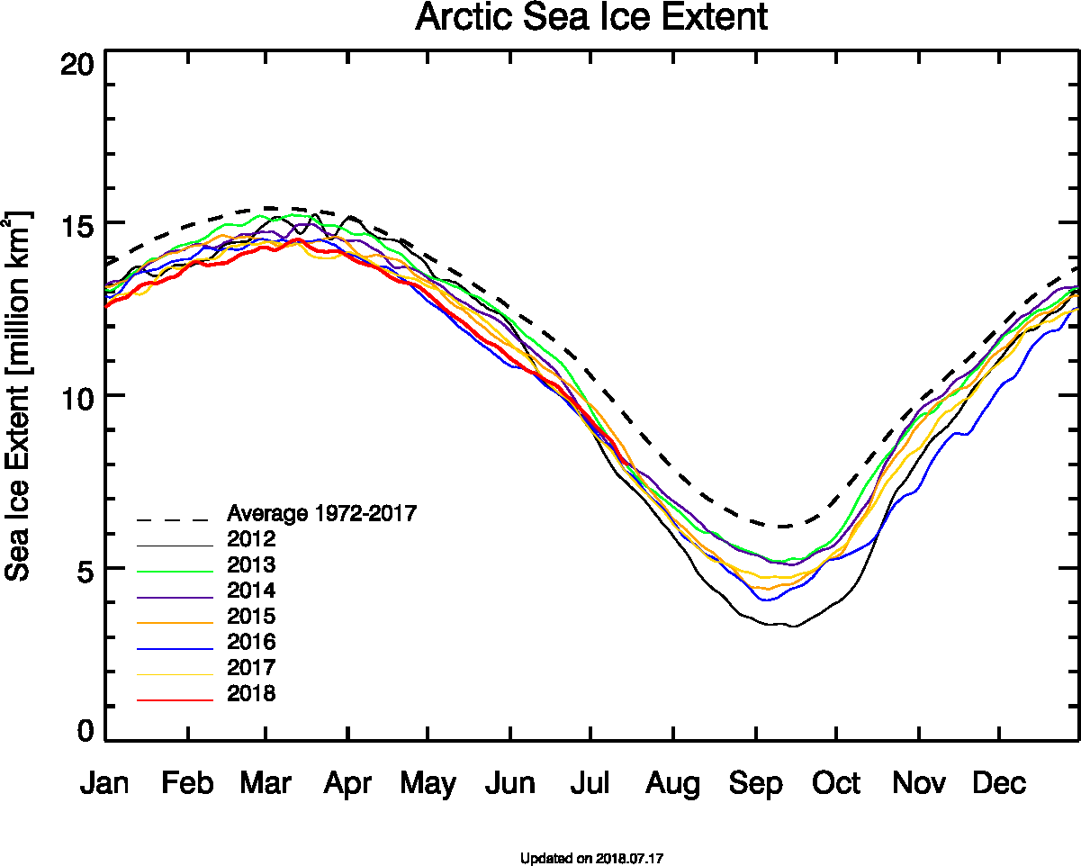
I still think it will be difficult. The ice is much higher concentration this year in the CAB/CAA, and 2012 had so much rotted ice on the Siberian side. This year, it's more just a straight line between ice/no ice.
-
July 2019 General Discussions & Observations Thread
nzucker replied to bluewave's topic in New York City Metro
I'm from Dobbs. I grew up on Luzern Rd and my parents still live there. Where in town is your dad? -
Also looks like significant improvement north of the CAA and Greenland.
-
What crash? You OK?
-
Boxing Day, you mean? Lol.
-
2010-11 got the good pattern back too late...we had a very cold end of March with snowfalls on 3/21 and 3/24 in Westchester, but it was too late to get more than a few more inches. I remember there were still patches of snow on 4/1 in Dobbs Ferry, and there was some snow/sleet that mixed into a rainstorm in mid-April. That winter did not want to go. Had 3 huge storms from 12/26-1/26...there was 25-30" on the ground after that and then again after the 2/2 ice storm. I think I measured 26" in my front lawn. It was a glacier too; I still remember the moon reflecting off the snowpack as I went to visit a friend.
-
Thank god your health is improving. Your recovery rate seems to be impressive.
-
Yes but the changes in solar output are much smaller in effect on radiative forcing than the cumulative influence of rapidly rising atmospheric CO2 concentrations.
-
UAH June: +0.21C July: +0.32C Notable warming in the Southern Hemisphere and Tropics, perhaps a result of the emerging El Nino conditions.
-
It's weakened somewhat but not NEARLY as much as the 7/27 map showed; that was almost certainly due to satellite error. That image had <75% concentration over a very large area. Seeing the new map, I doubt it melts completely in the East Siberian arm.
-
I may have been right...looks dramatically different today, more similar to before. These satellite maps are prone to short-term error due to clouds and other variables. Ice is much higher concentration now:
-
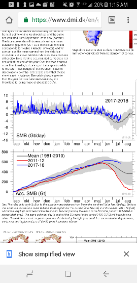
Greenland still seeing near record high surface mass balance for July, however. Very benign melt season there, so far.
-
Are we sure that isn't satellite error? It seems like an awfully big change from just a week or so ago, not sure if that's possible.
-
Looks above most recent years on Bremen extent:
-
Can you post the area numbers again, Will? Are we still close to 2009/2013/2014?
-
Doesn't the weather forecast look increasingly hostile though with a strong ridge over the Siberian side? Even if it's not a dipole, won't that degree of warmth (like +9C 850) promote melting?
-
It still looks like just a moderate melt pattern unless the PV over Baffin Island loses all influence. It's rare to get such a widespread high pressure extending from the Beaufort to Greenland, as we had in 2012. The usual response to ridging over Alaska is lower heights and associated PV in the Baffin region. The PV has been very stubborn in recent summers. With early indications that it is re-establishing in an environment of lower overall hemispheric heights, I remain skeptical of a 2012/2007 melt unless we see major changes.
-
It's hard to get a strong high pressure over Greenland with the near constant vortex near Hudson Bay. Some of the long range GFS runs have shown a ridge poking into Greenland from the east, however. Do you think the PV may finally drop further south and be forced out of the Baffin/Hudson Bay region?