GrandmasterB
-
Posts
634 -
Joined
-
Last visited
Content Type
Profiles
Blogs
Forums
American Weather
Media Demo
Store
Gallery
Everything posted by GrandmasterB
-
The 3K is colder than it’s 6Z run. I know it’s not a lot but a very small silver lining.
-
Check out the Canadian
-
Right before the precip starts my dewpoint on the 3K is 24. That would definitely work. A lot colder than the other models though.
-
Dayum! This is getting good
-
Yeah NAM was really trying late. Hard to believe we have another full day of tracking this thing!
-
Time to play the weenie game of give me the NAM thermals with the Euro QPF.
-
I think the snow amounts on the NAM were somewhat impacted by the overall QPF and QPF intensity. Which those two things are notoriously difficult to model. Overall progression on the NAM was great.
-
HH NAM is going to deliver!
-
Nope 54 still dumping
-
Thanks for posting those, Superstorm. Trend is clear for those of us on the bubble. Also, 12” for Allentown now??
-
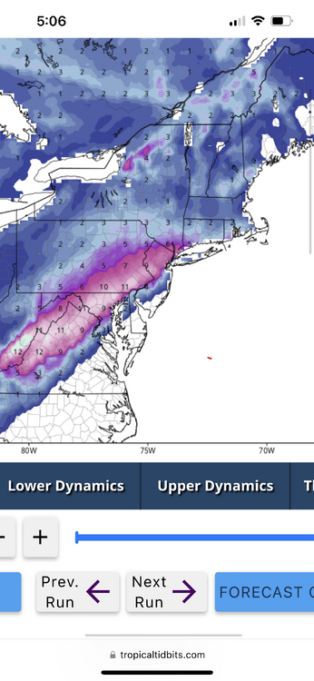
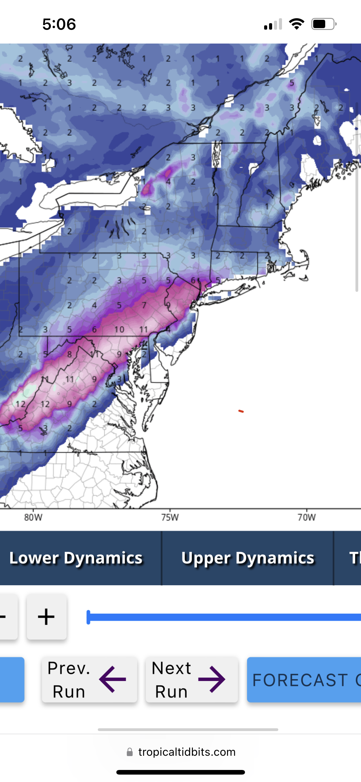
This gradient in Lancaster county tho
-
Also keeps the snow hanging around into Sunday morning, albeit light.
-
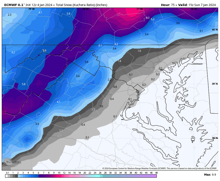
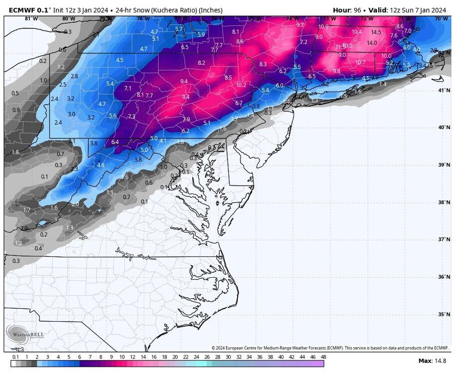
12Z Euro noticeably snowier than 0Z. I don’t have access to 6Z to compare to that run however. R/S line on 12Z struggles to move past Lebanon county this run.
-
An anomaly where? Doesn’t MDT average like 30”+ a year?
-
Really positive GFS run for those of us riding the line. Shifted some of the minor accumulations about 20 miles south and east of us which gives just a hair breathing room. I also thought it could have been better…when the main slug of precip arrived the GFS was a smidge colder but did something weird with the intensity. Gets the coastal organized more quickly just offshore which would help us with the BL issues.
-
MU posted the 10 day Euro and was about as weenie as it gets for the depiction. We’ll see if it translates to actual snow.
-
I hate this hobby
-
MU riding the Euro and calling for a change to rain for us south easterners. Probably reasonable stance at this point unfortunately.
-
GFS is colder at the surface vs its 12Z run. I like seeing that (obviously). Region wide 6-10.
-
Nice hit on the GFS. I would think that track would keep all of us mostly/all snow especially considering how heavy that precip is modeled on the GFS.
-
-
One thing I’ve noticed on models starting last night was a pretty significant increase in precip intensity along and to the northwest of the R/S line. So while the storm is moving along quickly it seems the intensity could be decent.
-
Quite a bit more snow than the 6Z
-
Not sure the doom and gloom is warranted based on the EPS. I think it’s a little deceiving having the OP end at 90. The heaviest precip wasn’t here yet.
-
Decent band of 6-10 across southeastern areas. State College fringed verbatim, but I think they’d do fine with this evolution.