GrandmasterB
-
Posts
634 -
Joined
-
Last visited
Content Type
Profiles
Blogs
Forums
American Weather
Media Demo
Store
Gallery
Everything posted by GrandmasterB
-
Warning!!
-
Overnight as Blizz just posted
-
GFS just went kinda crazy. Should be an interesting Kuchera map.
-
This is a precip breaking out overhead deal not a watching it come in from the southwest, JFYI
-
Latest forecast update from CTP saying warning may be needed for the southern folks: HREF data run with WPC forecast SLR between 15-20:1 shows some potential for warning level 5-6" fluffy totals in these locations which will need to be monitored for a short lead upgrade next shift
-
Thanks! I figured it would be fairly awesome…and it is.
-
GFS is a nice uptick. Anyone got the Kuchera clown map to share?
-
20:1!! I’m down for that
-
Yes, agreed. We’ve been getting bumped up on models statewide, but it’s getting up in the 4-6” range just to our south. History says that’s a great place to be!
-
Nice Canadian run as well. Let’s keep it going tomorrow!
-
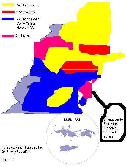
Most of the state gets 2-3” on the NAM. Small, but positive changes for this system on today’s model runs.
-
Still rather light totals but a definite uptick vs. the 12Z run. 18Z ICON was an increase as well.
-
More precip state wide on the 18Z GFS
-
Ripping now. Nearing an inch officially. Can’t believe these winds!
-
3K went total weenie
-
That’s on all the models
-
Where do I sign for this??
-
25/21 here. Wish the dew was lower.
-
And probably 10 miles from 7”
-
Haven't seen this one in a while. IYKYK. Ellinwood take notes!
-
Final Call

-
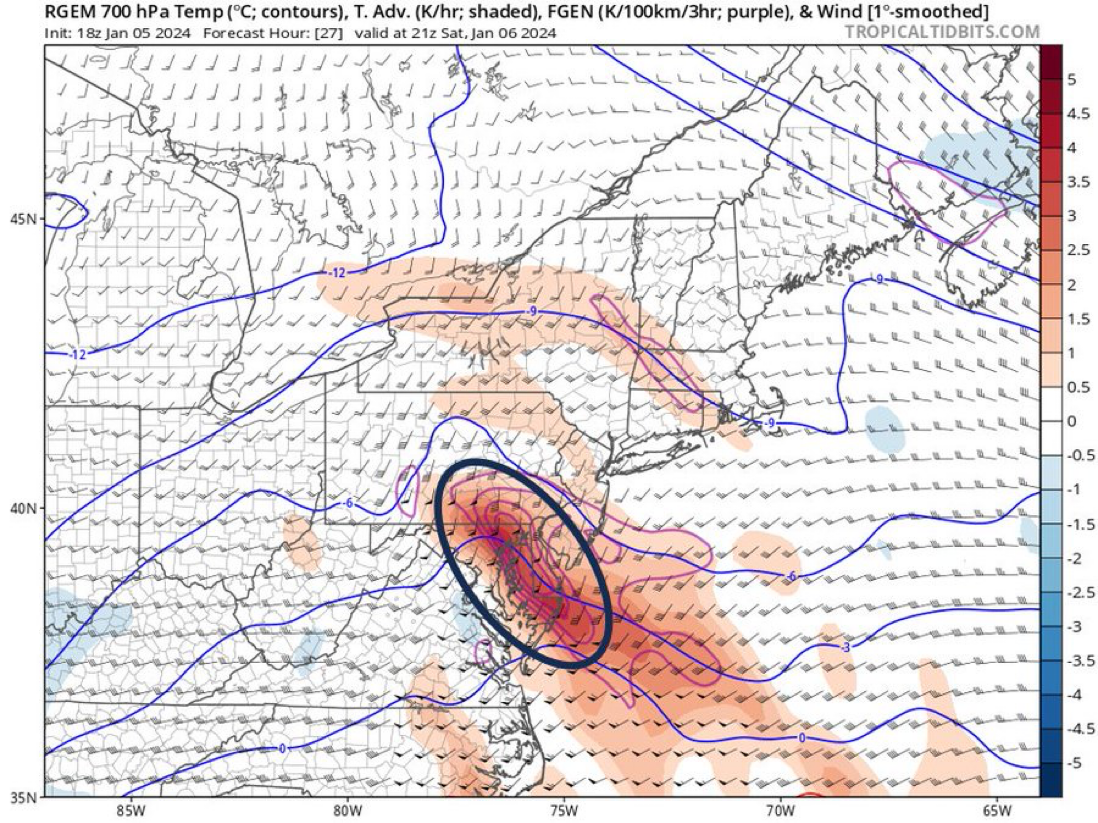
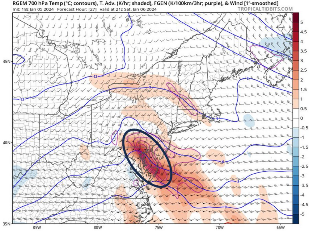
Also, RGEM gives me like 10” or something wild. Interesting to see how it does.
-
GFS intensity is pretty crazy. I’d bet places close to the RS line but depicted as rain on the hour 30 panel are probably ripping snow, but I’m a weenie so don’t take my word for it.
-
GFS colder for us ride the line folks. This has been a wild tracking week for the SE crew the last several days.
-
GFS is colder at 30 and a better thump. 36 is warmer but a decent amount before the changeover down here.