Jns2183
-
Posts
4,747 -
Joined
-
Last visited
Content Type
Profiles
Blogs
Forums
American Weather
Media Demo
Store
Gallery
Everything posted by Jns2183
-
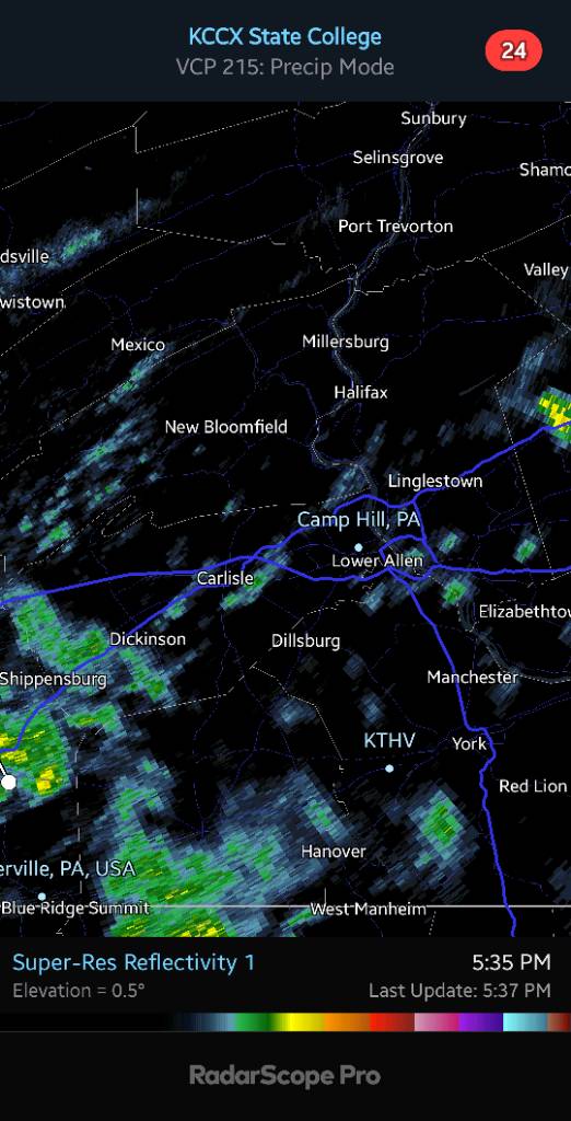
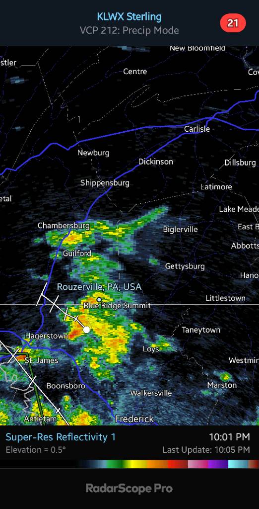
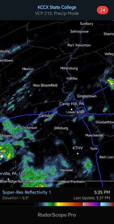
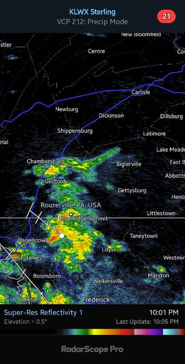
State College radar has some sprinkles, but remember the beam is at 7200 ft and Sterling's beam at Harrisburg is at 8500ft. Which is why everyone's been waiting for that dopplar radar in Lancaster to open. Speaking of which does anyone have any idea what's going on with it? Sent from my SM-G970U using Tapatalk
-
You have legit chance to get to 3.50"+ for week. I'm at 1.06" and hoping for 3" total for week. Sent from my SM-G970U using Tapatalk
-
Continued Sent from my SM-G970U using Tapatalk

-
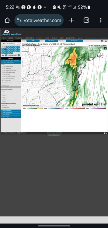
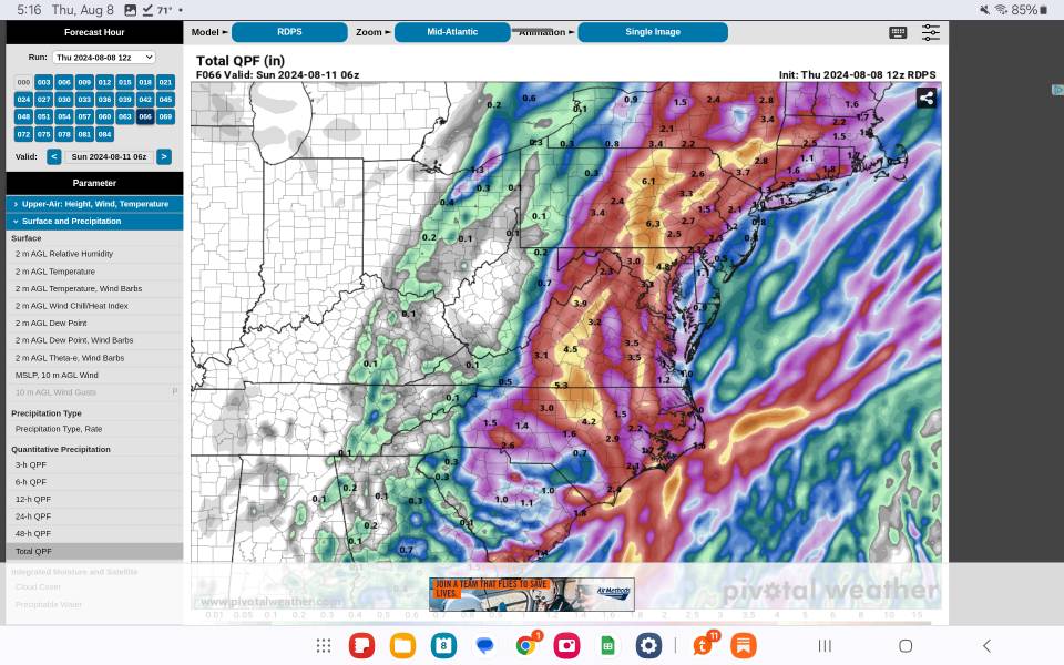
This is RDPS radar-like map Sent from my SM-G970U using Tapatalk


-
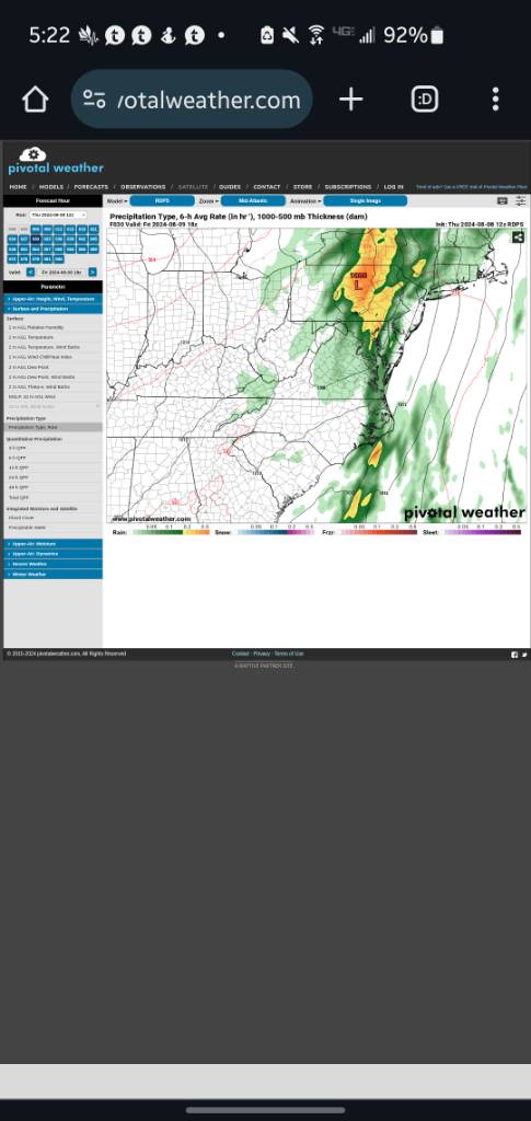
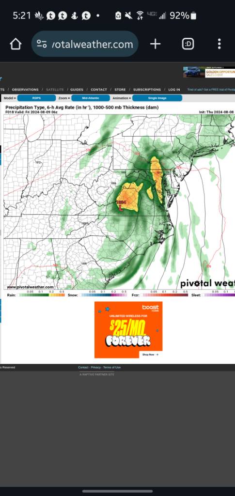
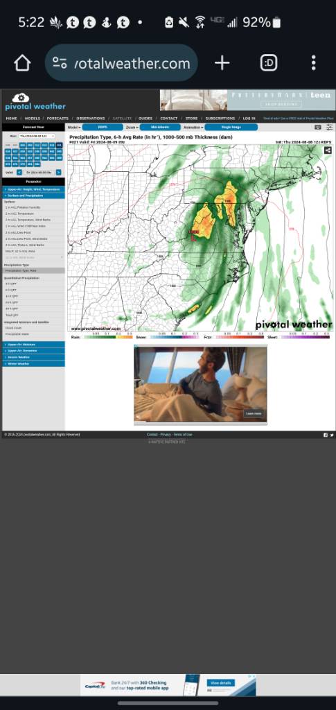
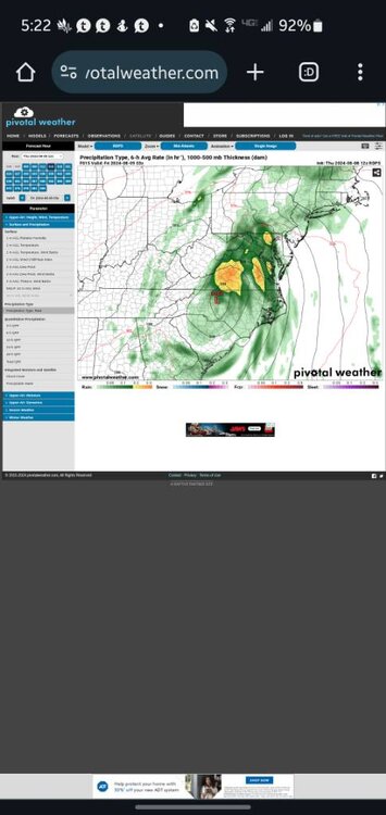
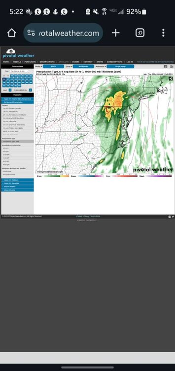
Here is the 18z RDPS which is just the regional Canadian. The second image is the 12z for comparison Sent from my SM-X210 using Tapatalk
-
Those bands if they continue and expand leads one to start taking the 12z RGEM more seriously. Do you know when the 18z comes out for it? Sent from my SM-G970U using Tapatalk
-
What were your totals for Tuesday, yesterday, and today so far? Sent from my SM-G970U using Tapatalk
-
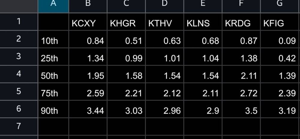
I went into the guts of the NBM and pulled out the qpf by percentiles for tomorrow for some airports around the region Capital City, Hagerstown, York, Lancaster, Reading, Clearfield Enjoy Sent from my SM-G970U using Tapatalk
-
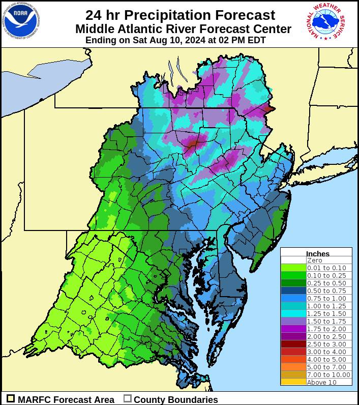
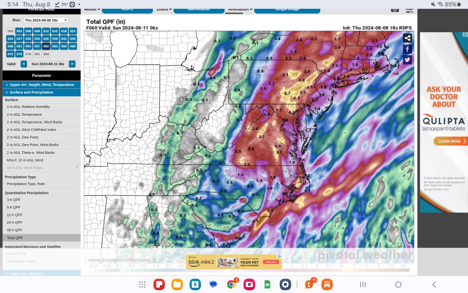
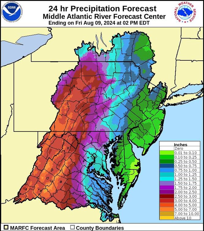
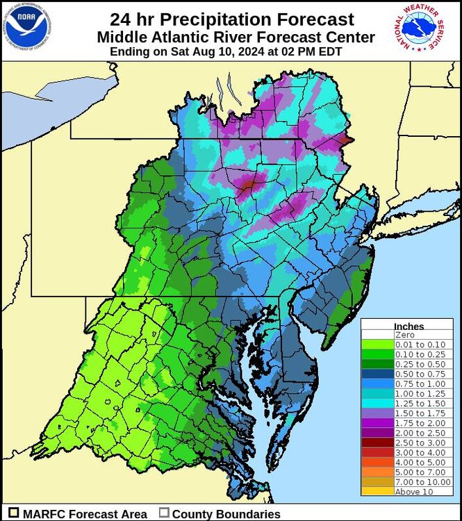
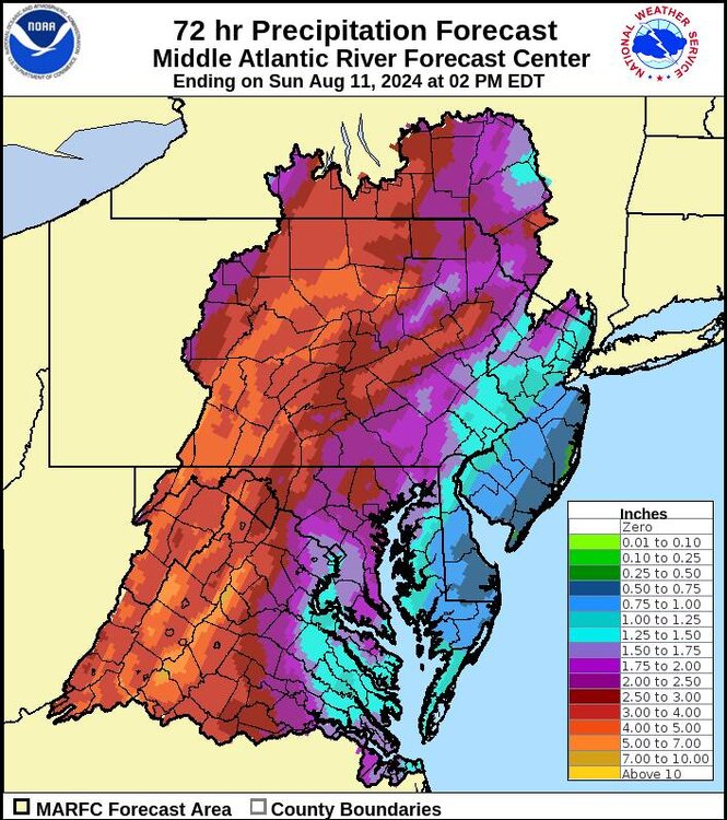
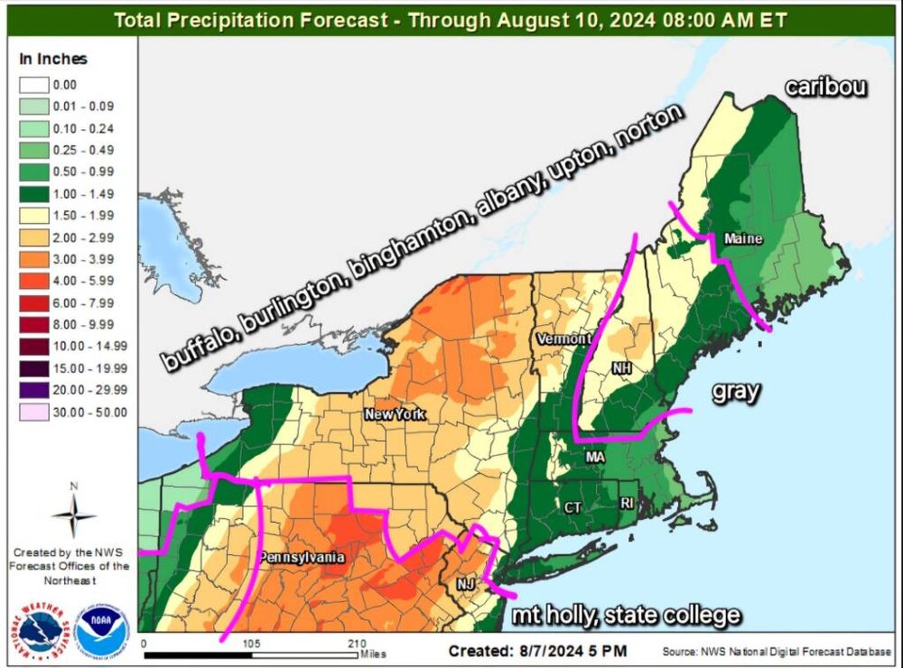
Here's the precipitation forecast as of 2:00 p.m. today. The first photo is the 24 hours ending Friday at 2:00 p.m. . The second photo is 24 hours ending Saturday at 2:00 p.m. . And the third photo is the 72-hour rainfall. I want to highlight the point that by Friday at 2:00 p.m. it's saying some parts of Lancaster county will only have 3/4 an inch of rain while some portions of Cumberland Perry county will have over 3 inches of rain. Sent from my SM-X210 using Tapatalk
-
Good Sent from my SM-G970U using Tapatalk
-
There will be firehouses tomorrow somewhere Sent from my SM-G970U using Tapatalk
-
The models that mail us have a southeast to northwest feeder band that wallops us. The squall lime you are talking about is also moving almost due north and has a slower east progression Sent from my SM-G970U using Tapatalk
-
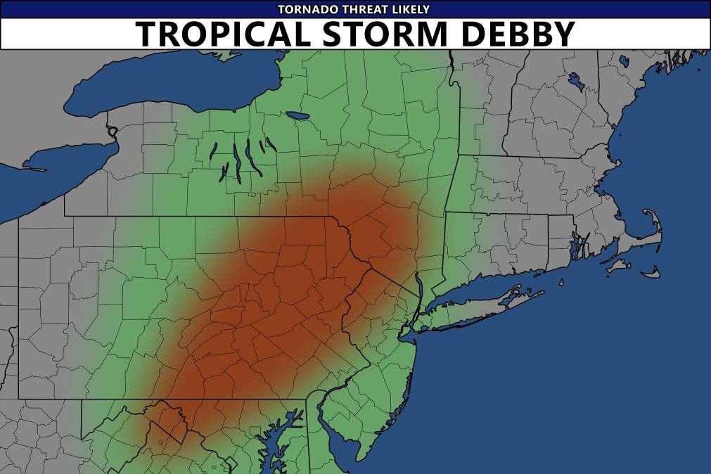
Front right quadrant of tropical systems always have a few Sent from my SM-G970U using Tapatalk
-
I think some photographer/storm chaser on Twitter took it from a nws briefing Sent from my SM-G970U using Tapatalk
-
That's beautiful Haha, I even manually added your town to radarscope since I root for you to get rain second only to myself Sent from my SM-G970U using Tapatalk
-
Of course you're getting rain look at the storm motion versus all the rest of summer Sent from my SM-G970U using Tapatalk
-
@Bubbler86 You're the best shot in the forum of the center going directly over your house Sent from my SM-G970U using Tapatalk
-
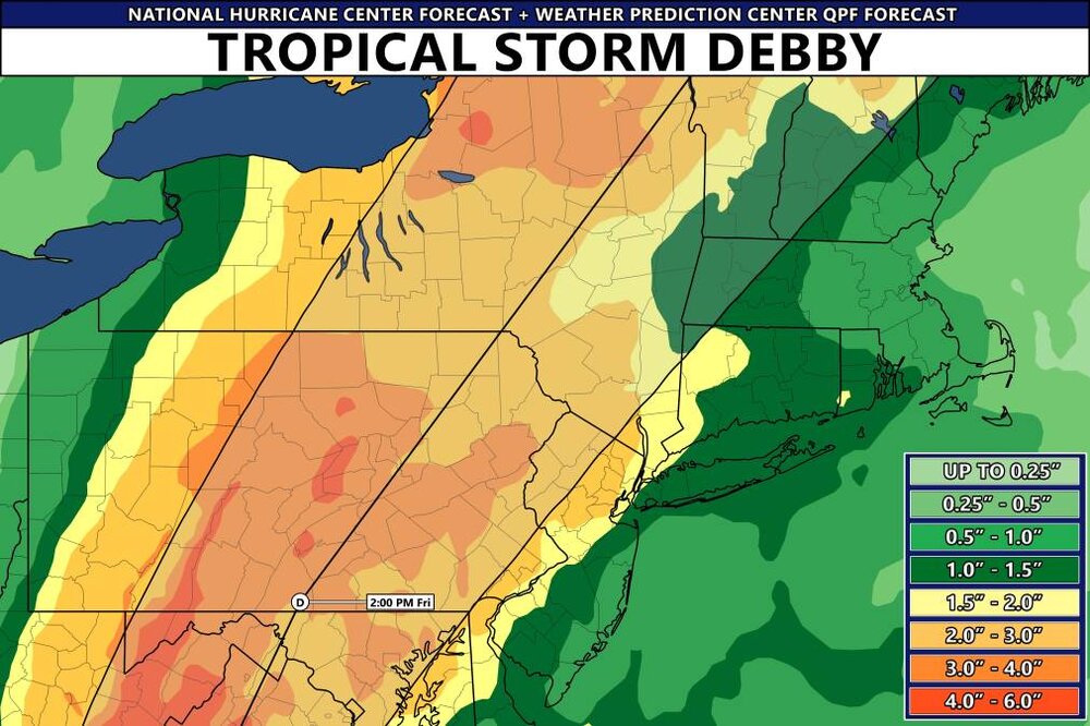
Qpf Sent from my SM-G970U using Tapatalk
-
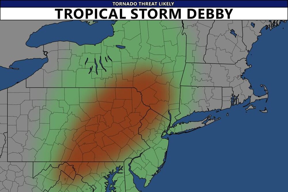
Haha, as long as I get my home rain gauge above normal that's what matters to me. Here is said nado threat Sent from my SM-G970U using Tapatalk
-
I apologize. I used it because atomix had used the word for himself many times and I was trying to make light hearted jest. I won't use it going further Sent from my SM-G970U using Tapatalk
-
Haha, I'd take a cold drought in a second over this summer Sent from my SM-G970U using Tapatalk
-
Haha, office politics Sent from my SM-G970U using Tapatalk
-
I just figured eventually my house has to score under one these bands. All the stations around me have a direct score this summer. I'm due Sent from my SM-G970U using Tapatalk
-
Eventually even the retards get one right Sent from my SM-G970U using Tapatalk
-
We should get under some great bands with lots of spin with the low going just to our west Sent from my SM-G970U using Tapatalk