Jns2183
-
Posts
5,868 -
Joined
-
Last visited
Content Type
Profiles
Blogs
Forums
American Weather
Media Demo
Store
Gallery
Everything posted by Jns2183
-
Central PA Winter 25/26 Discussion and Obs
Jns2183 replied to MAG5035's topic in Upstate New York/Pennsylvania
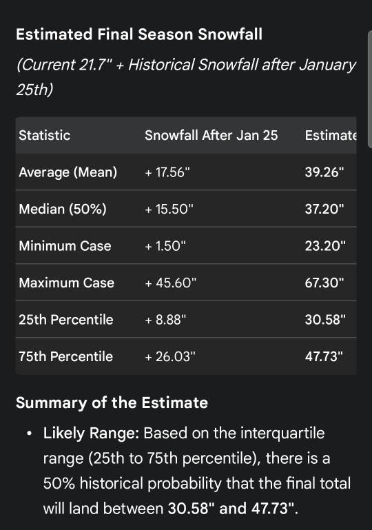
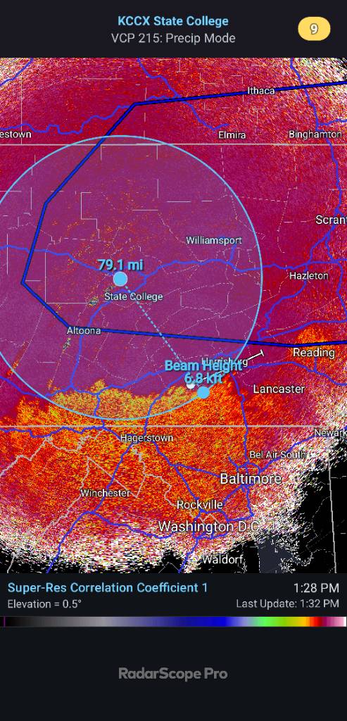
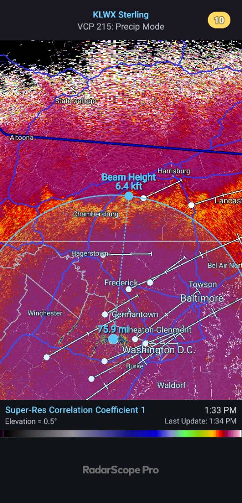
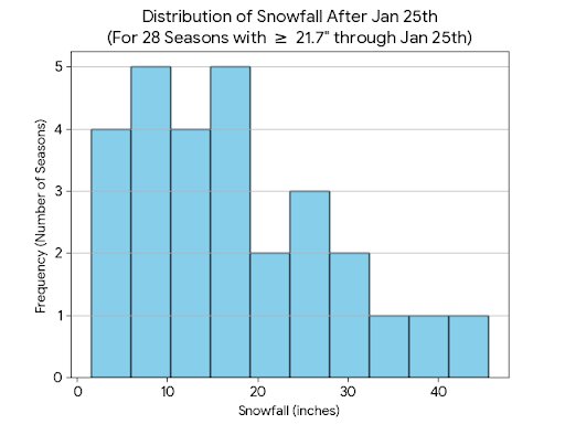
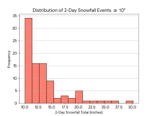
Where do we go from here? Analyzing 21.7" by Jan 25th (Harrisburg/Middletown) Hey eve With our current seasonal total sitting at 21.7" as of January 25th, I decided to dig into the historical archives for the Middletown-Harrisburg area to see how this stacks up and what "history" says about the rest of our winter. I looked at every season since 1899 to find years that met or exceeded our current 21.7" by today’s date. Here’s the breakdown: The Historical Analogues There are 28 seasons in our history that reached this mark by Jan 25th. * Average Final Total: 48.4" * Snowiest Year in this Group: 1960-1961 (Finished at 81.3") * Least Snowy Year in this Group: 1987-1988 (Finished at 26.7") What’s Left in the Tank? (Snow after Jan 25th) Looking only at what fell after today’s date in those 28 seasons: * Average remaining snow: 17.6" * Median remaining snow: 15.5" * The "Boom" Scenario: 1993-1994 added a massive 45.6" after Jan 25th! * The "Bust" Scenario: 1953-1954 only added 1.5" more. The "Confidence" Forecast Based strictly on these 28 historical matches, here is the probability for our final seasonal total: * 90% Certainty: We finish with at least 27.1" * 75% Certainty: We finish with at least 30.6" * 50% Certainty (The Coin Flip): We finish with at least 37.2" * 25% Certainty: We finish with at least 47.7" * 10% Certainty (The Longshot): We finish with at least 53.4" Context: The Big 2-Day Hitters For those wondering about the "big one," here are the top 2-day totals ever recorded in our data: * 30.2" (Jan 22-23, 2016) * 25.0" (Feb 11-12, 1983) * 22.2" (Jan 7-8, 1996) * 21.0" (Jan 15-16, 1945) * 20.4" (Mar 13-14, 1993) Summary: History suggests we are about 55-60% of the way through our seasonal snowfall. If we follow the "average" of our historical peers, we're looking at another 17" or so before spring. What do you guys think? Do we follow the 1994 path (+45") or the 1954 path (+1.5")? [emoji3587][emoji409] Sent from my SM-S731U using Tapatalk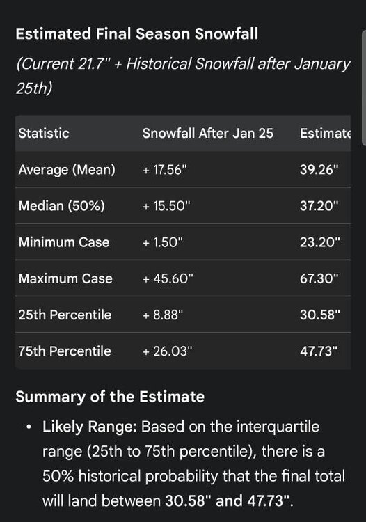
-
Central PA Winter 25/26 Discussion and Obs
Jns2183 replied to MAG5035's topic in Upstate New York/Pennsylvania
There were 17 seasons where the official Harrisburg station recorded 14" plus in a 2-day or less event since 1890. Here are the stats Statistics for these 17 Seasons: Count: 17 Mean: 49.91" Std Dev: 18.54" Median (50%): 47.20" Min: 23.90" Max: 81.30" 25th Percentile: 38.00" 75th Percentile: 57.70" For 12" plus Statistics for these 31 Seasons: Count: 31 Mean: 45.82" Std Dev: 16.39" Median (50%): 39.50" Min: 23.90" Max: 81.30" 25th Percentile: 34.95" 75th Percentile: 54.45 For 10" plus Statistics for these 48 Seasons: Count: 48 Mean: 42.90" Std Dev: 15.12" Median (50%): 39.30" Min: 18.40" Max: 81.30" 25th Percentile: 33.50" 75th Percentile: 50.85" Sent from my SM-S731U using Tapatalk -
Central PA Winter 25/26 Discussion and Obs
Jns2183 replied to MAG5035's topic in Upstate New York/Pennsylvania
Maybe we can do a reverse 1996 where we had the 22" storm and 5 days later a 11" Sent from my SM-S731U using Tapatalk -
Central PA Winter 25/26 Discussion and Obs
Jns2183 replied to MAG5035's topic in Upstate New York/Pennsylvania
What do you do for sleet? I had 8.5" at 11. This was also when rates were great. One of reasons I started taking them more frequently in this storm was because the breeze was starting to blow the supper dry snow around and I wasn't confident in the new location I placed the snow board. If you can point me too the correct protocol id appreciate it Sent from my SM-S731U using Tapatalk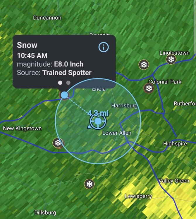
-
Central PA Winter 25/26 Discussion and Obs
Jns2183 replied to MAG5035's topic in Upstate New York/Pennsylvania
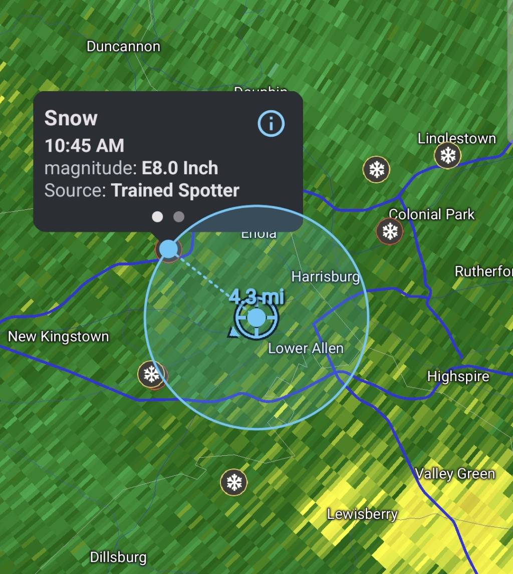
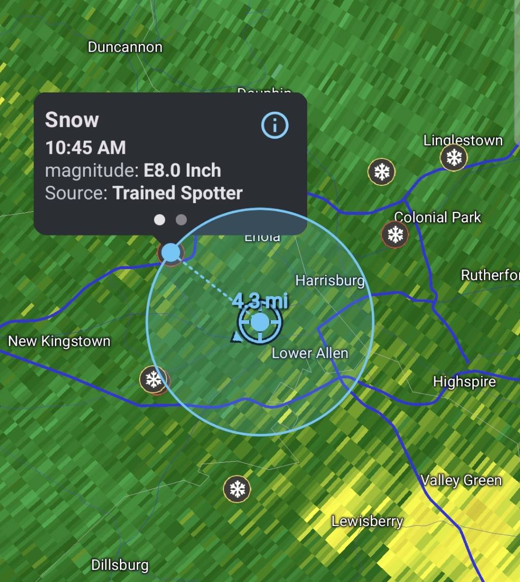
Truthfully it depends on how much I want to sleep and how much snow is blowing, and if it's different precipitation types. I truthfully try to shoot for 3 hours that are lined up exactly with the main model times because I'm a data junkie. But I did have almost exactly the same as that trained spotter 3 miles from my house when he did his report Sent from my SM-S731U using Tapatalk -
Central PA Winter 25/26 Discussion and Obs
Jns2183 replied to MAG5035's topic in Upstate New York/Pennsylvania
I'm laughing at the 7.3" in camp hill because if I measured after the storm was down in grass I would have gotten that much to. The snowboard got me 13.1" except I measured almost hourly. Still even with the sleet compaction I'm still getting 9.25" in yard this morning Sent from my SM-S731U using Tapatalk -
Central PA Winter 25/26 Discussion and Obs
Jns2183 replied to MAG5035's topic in Upstate New York/Pennsylvania
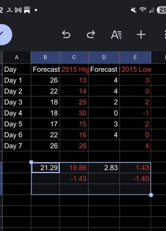
2/15/15 to 2/22/15 I remember driving to hershey hospital at 3am for my daughter to be born Sent from my SM-S731U using Tapatalk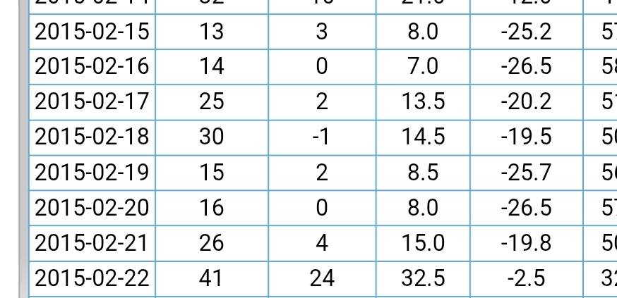
-
Central PA Winter 25/26 Discussion and Obs
Jns2183 replied to MAG5035's topic in Upstate New York/Pennsylvania
The nam somehow managed to nail the thermals but still finish close to the bottom if not totally at the bottom with storm totals with 7" predicted Sent from my SM-S731U using Tapatalk -
Central PA Winter 25/26 Discussion and Obs
Jns2183 replied to MAG5035's topic in Upstate New York/Pennsylvania
The dry slot fast approaching Sent from my SM-S731U using Tapatalk -
Central PA Winter 25/26 Discussion and Obs
Jns2183 replied to MAG5035's topic in Upstate New York/Pennsylvania
It was dynamic cooling from heavy returns and it running up against an 850 -700mb wall Sent from my SM-S731U using Tapatalk -
Central PA Winter 25/26 Discussion and Obs
Jns2183 replied to MAG5035's topic in Upstate New York/Pennsylvania
It also gave kmdt a storm total qpf of .80. It's currently at 1.32 and climbing. The only model that has chance of being right regarding qpf is euro at 1.4". Still the other 12 models all had over 1" at least. I remember back in the day the NAM used to always go crazy with qpf. What happened? It's gotten massacred this storm from Virginia through here Sent from my SM-S731U using Tapatalk -
Central PA Winter 25/26 Discussion and Obs
Jns2183 replied to MAG5035's topic in Upstate New York/Pennsylvania
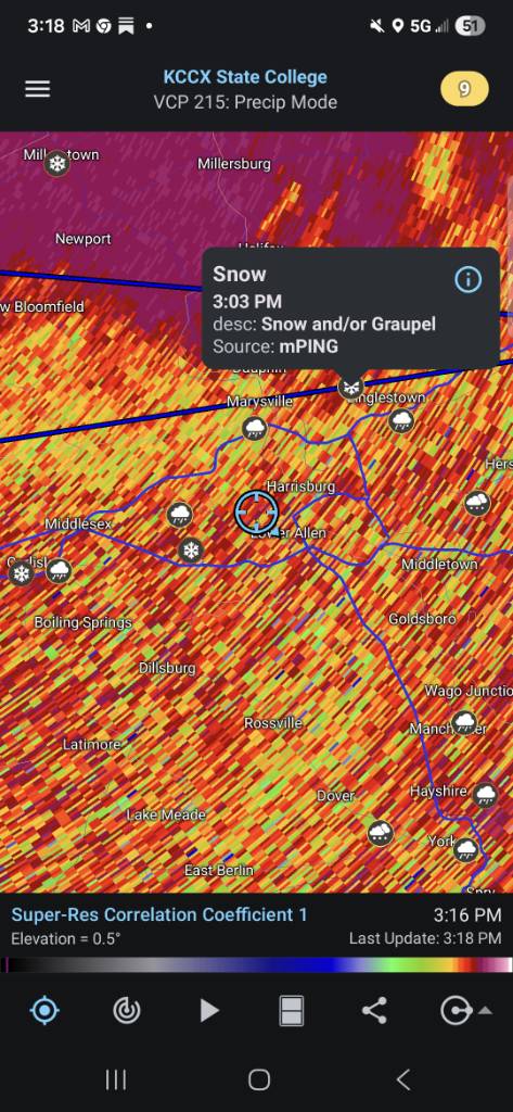
It's from mping reports Sent from my SM-S731U using Tapatalk -
Central PA Winter 25/26 Discussion and Obs
Jns2183 replied to MAG5035's topic in Upstate New York/Pennsylvania
Less than 10 miles away it is smow Sent from my SM-S731U using Tapatalk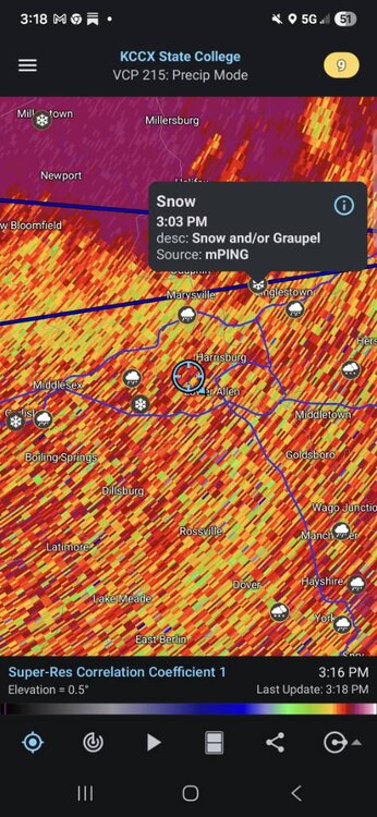
-
Central PA Winter 25/26 Discussion and Obs
Jns2183 replied to MAG5035's topic in Upstate New York/Pennsylvania
The snow this morning was just fluffy it was blowing a lot with just a slight breeze . If your board was exposed to wind you definitely suffered loss Sent from my SM-S731U using Tapatalk -
Central PA Winter 25/26 Discussion and Obs
Jns2183 replied to MAG5035's topic in Upstate New York/Pennsylvania
Camp hill. I got crushed this morning more than most. I had 8.5" by 11am and 10" by noon, the sleet hit for an hour but it mixed with snow enough I picked up another .5" by 1. That sleet line crashed and I was just north of it for an hour and it was heavy snow, with huge flakes that added 2" Sent from my SM-S731U using Tapatalk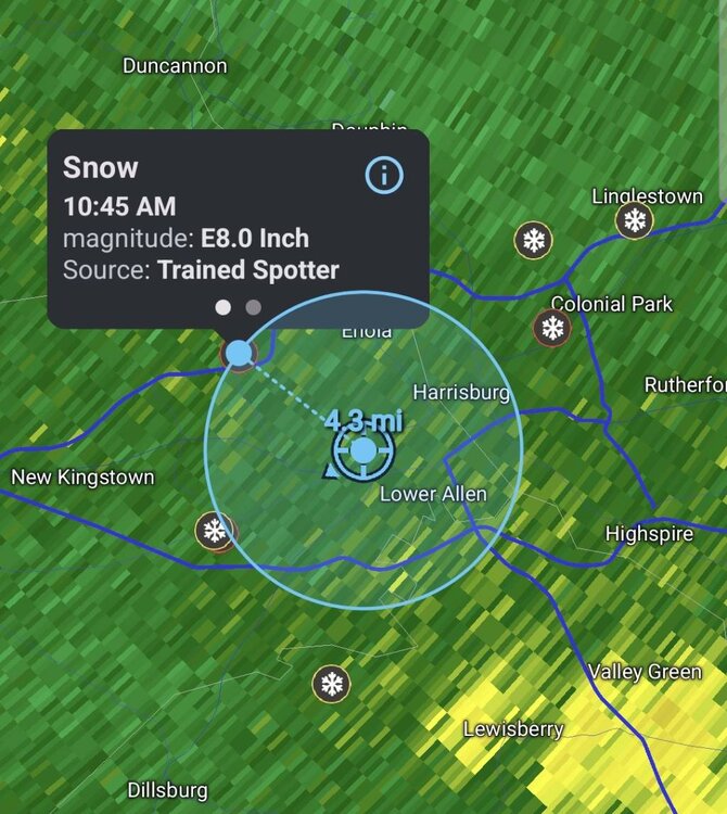
-
Central PA Winter 25/26 Discussion and Obs
Jns2183 replied to MAG5035's topic in Upstate New York/Pennsylvania
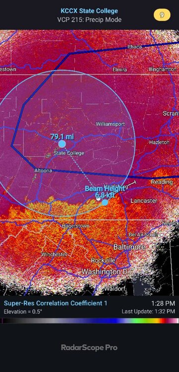
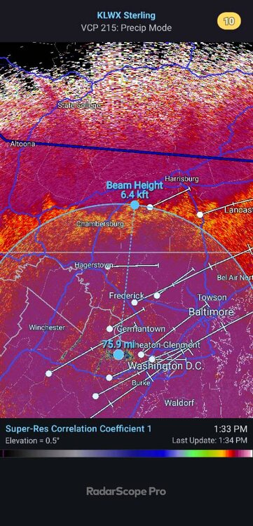
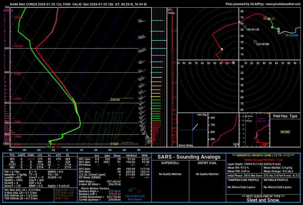
Looks like 700mb to 800mb warm layer Sent from my SM-S731U using Tapatalk -
Central PA Winter 25/26 Discussion and Obs
Jns2183 replied to MAG5035's topic in Upstate New York/Pennsylvania
MU launched a balloon at 18z, 1PM Sent from my SM-S731U using Tapatalk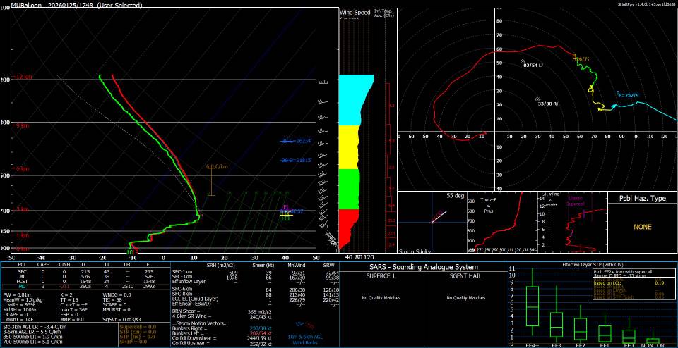
-
Central PA Winter 25/26 Discussion and Obs
Jns2183 replied to MAG5035's topic in Upstate New York/Pennsylvania
13". Mostly sleet again now. Very happy with this storm. That last hour surprise was amazing and nice to see. Definitely not a normal experience with miller B without the coastal bombing out Sent from my SM-S731U using Tapatalk -
Central PA Winter 25/26 Discussion and Obs
Jns2183 replied to MAG5035's topic in Upstate New York/Pennsylvania
This warm layer coming looks more thick. Wish we had a balloon launch right now Sent from my SM-S731U using Tapatalk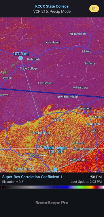
-
Central PA Winter 25/26 Discussion and Obs
Jns2183 replied to MAG5035's topic in Upstate New York/Pennsylvania
Sleet mixing in more now Sent from my SM-S731U using Tapatalk -
Central PA Winter 25/26 Discussion and Obs
Jns2183 replied to MAG5035's topic in Upstate New York/Pennsylvania
We won't know anything to super late tonight or tomorrow with them Sent from my SM-S731U using Tapatalk -
Central PA Winter 25/26 Discussion and Obs
Jns2183 replied to MAG5035's topic in Upstate New York/Pennsylvania
Wow, .75" in 15 mins. 3" hr rates. 12.75" to almost 13' Sent from my SM-S731U using Tapatalk -
Central PA Winter 25/26 Discussion and Obs
Jns2183 replied to MAG5035's topic in Upstate New York/Pennsylvania
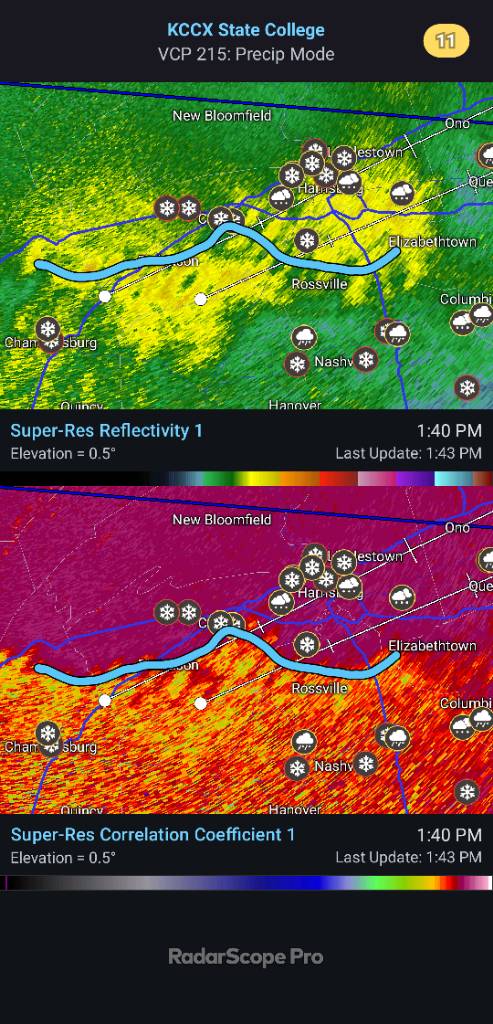
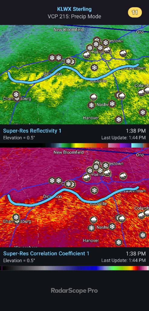
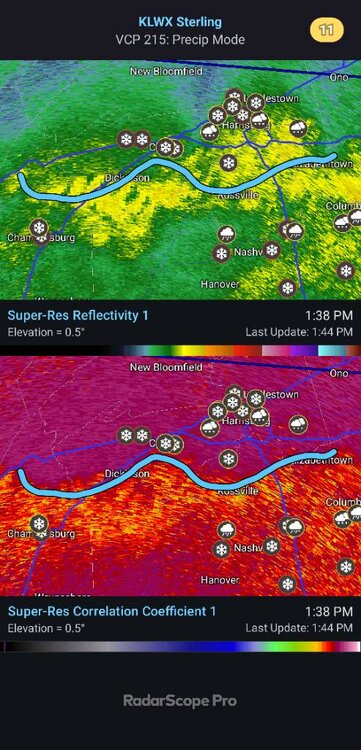
Basically at 800-825mb level. Heavy heavy snow with big flakes here mere miles north of sleet line Sent from my SM-S731U using Tapatalk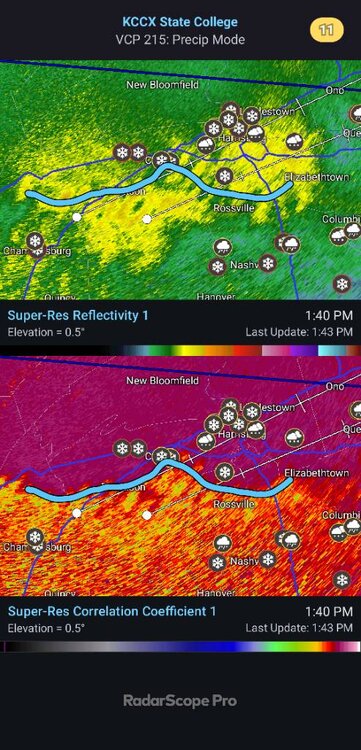
-
Central PA Winter 25/26 Discussion and Obs
Jns2183 replied to MAG5035's topic in Upstate New York/Pennsylvania
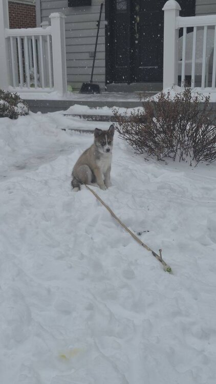
12" here Crazy lift right now. Threading that line here. Less than half mile visibility Sent from my SM-S731U using Tapatalk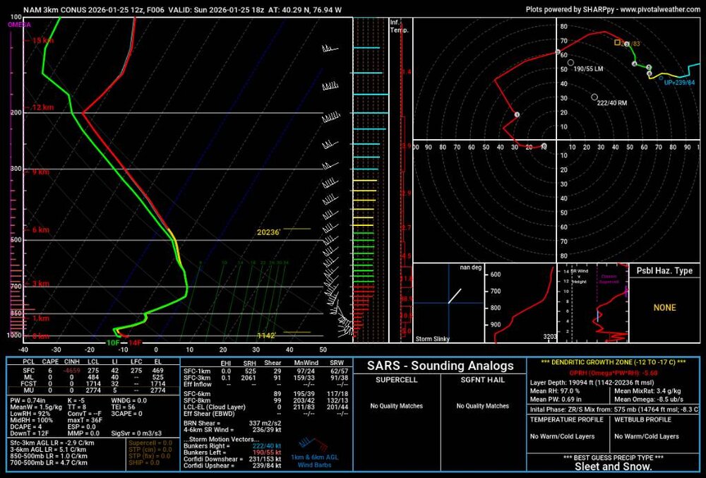
-
Central PA Winter 25/26 Discussion and Obs
Jns2183 replied to MAG5035's topic in Upstate New York/Pennsylvania
780 to 800mb. Heavy snow here with big huge flakes and a pink or two but accumulating fast Sent from my SM-S731U using Tapatalk