Jns2183
-
Posts
5,851 -
Joined
-
Last visited
Content Type
Profiles
Blogs
Forums
American Weather
Media Demo
Store
Gallery
Everything posted by Jns2183
-
How far is a train station from tit Sent from my SM-G970U using Tapatalk
-
It's been progressing north Sent from my SM-G970U using Tapatalk
-
We need some snow map porn Sent from my SM-G970U using Tapatalk
-
I can offer this for$89.99 a month. Save $10!!! Sent from my SM-G970U using Tapatalk
-
About same for 3K Sent from my SM-G970U using Tapatalk
-
Reg NAM is 2.3" for KMDT Sent from my SM-G970U using Tapatalk
-
We surpassed 10,000 posts for winter Sent from my SM-G970U using Tapatalk
-
I live in a skinny 3 story house with bedroom on top floor. A big wind I will feel my walls shaking Sent from my SM-G970U using Tapatalk
-
When does wind hit. It's been calm Sent from my SM-G970U using Tapatalk
-
Hot tub and bubbly weather Sent from my SM-G970U using Tapatalk
-
Start around 7-8pm Sent from my SM-G970U using Tapatalk
-
@canderson what was your shingle count last year? Sent from my SM-G970U using Tapatalk
-
HRRR looking good Sent from my SM-G970U using Tapatalk
-
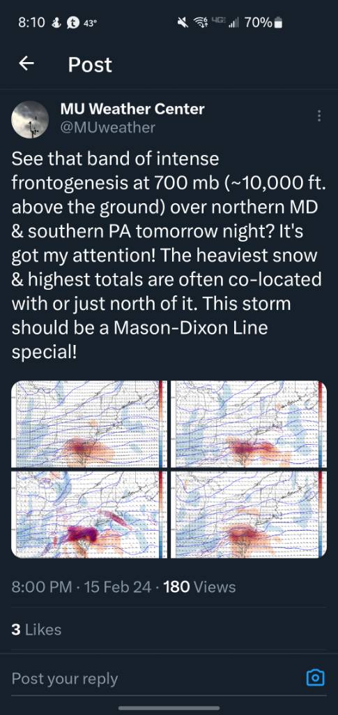
MU has spoken Sent from my SM-G970U using Tapatalk

-
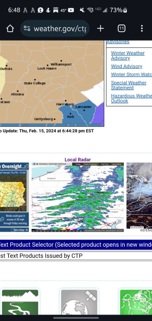
The AFD made it seem like they thought best snow would be between Richmond and DC Sent from my SM-G970U using Tapatalk
-
Are DC folks nervous they are on far south side of good snows now? Sent from my SM-G970U using Tapatalk
-
That tweet of theirs is quite passive aggressive Sent from my SM-G970U using Tapatalk
-
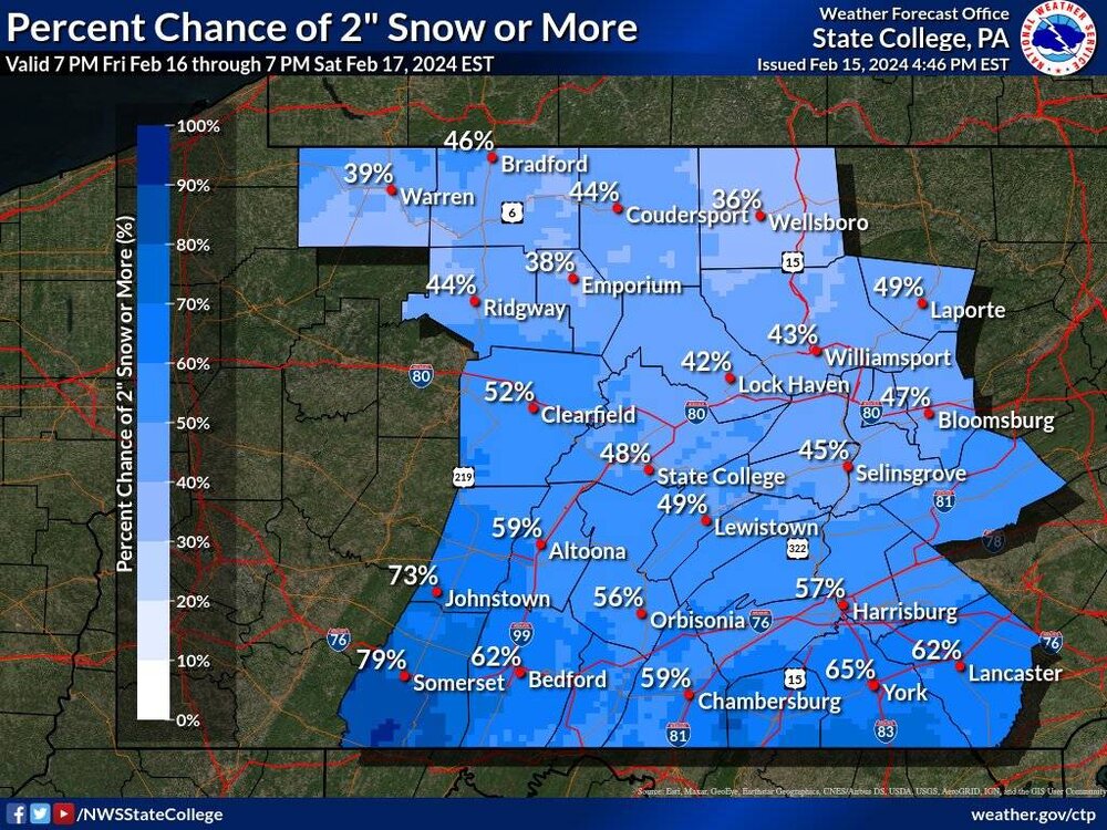
Chance of more than 2". Just tweeted out by CTP They seem like they got strong armed into watches Sent from my SM-G970U using Tapatalk
-
18Z? Sent from my SM-G970U using Tapatalk
-
About a mile to your west they are calling for 3"-6". I guess they plan on testing the river snow shield Sent from my SM-G970U using Tapatalk
-
You are correct. Sent from my SM-G970U using Tapatalk
-
They need to update graphics then Sent from my SM-G970U using Tapatalk

-
York and Lancaster only Sent from my SM-G970U using Tapatalk
-
We need @Blizzard of 93 in here Sent from my SM-G970U using Tapatalk
-
I think after Tuesdays debacle they are ready to throw all the models out the window and figure they can get away with waiting till 12-24 hours before this event to issue any headlines just so there is no chance they have to deal with a repeat of Tuesday. Sent from my SM-G970U using Tapatalk