Jns2183
-
Posts
4,747 -
Joined
-
Last visited
Content Type
Profiles
Blogs
Forums
American Weather
Media Demo
Store
Gallery
Everything posted by Jns2183
-
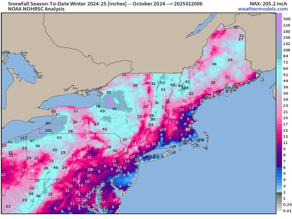
Season to date snow Sent from my SM-G970U1 using Tapatalk

-
We are going to have a nice little glacial snow pack by Saturday Sent from my SM-G970U1 using Tapatalk
-
I see my 10 day forecast is bone dry Sent from my SM-G970U1 using Tapatalk
-
KMDT made it down to 2 last night Sent from my SM-G970U1 using Tapatalk
-
It went below freezing around noon today. We should have roughly 132 straight hours of below freezing weather (noon Saturday) unless it sneaks above freezing on Friday Sent from my SM-G970U1 using Tapatalk
-
I just now discovered that kmdt had at least 1" of snow on the ground from 1/3/94 till 3/20/94. 76 consecutive days, the longest in station history. I moved to this area in 96. For anyone that was here for it id love to hear any recollections you have. I also find it amazing that in 1996 we had 50 straight days, number seven on the all-time list. It seems like epic winters here love coming in burts Sent from my SM-G970U1 using Tapatalk
-
I'd hope so. We had insane ratios for the 3 heaviest hours where I picked up 6" in those 3 hours Sent from my SM-G970U1 using Tapatalk
-
Looks like kmdt had 0.38" qpf Sent from my SM-G970U1 using Tapatalk
-
Looks like I'm going to finish in the 8.5"-9" range. A remarkable over preformer made even more remarkable with how it looked from 10am till 1pm. Sent from my SM-G970U1 using Tapatalk
-
Should we be debating why the globals humiliated the short term models this storm Sent from my SM-G970U1 using Tapatalk
-
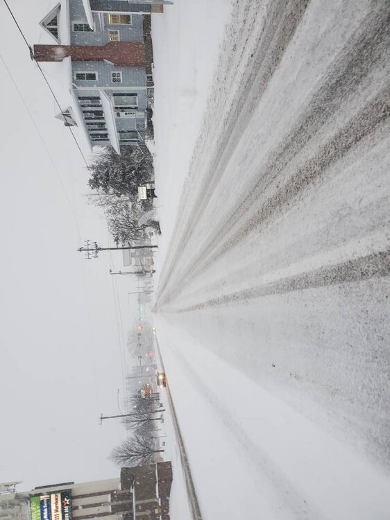
This is 11/15 in camp Hill. I have over 8 in on the grass and 6 in on roads Sent from my SM-G970U1 using Tapatalk
-
Not enough dendritic snow growth in the formative years? Sent from my SM-G970U1 using Tapatalk
-
Up to 6". 1" of snow last 20 mins. I have no idea how long it's been since there have been 3" an hour rates around here Sent from my SM-G970U1 using Tapatalk
-
Snow growth is maxed out right now. Wow Sent from my SM-G970U1 using Tapatalk
-
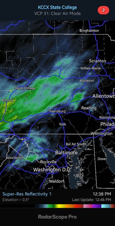
That image could easily be from January 2016 Sent from my SM-G970U1 using Tapatalk
-
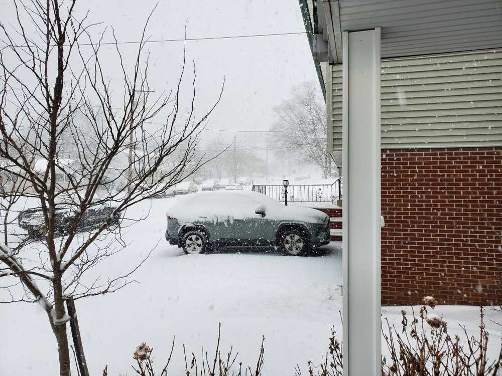
5" in camp Hill and heavy snow continuing This one is over preforming Sent from my SM-G970U1 using Tapatalk
-
The wind really has picked up Sent from my SM-G970U1 using Tapatalk
-
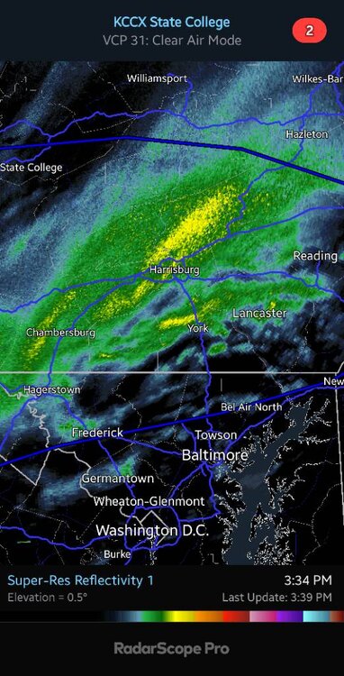
That Lancaster radar would have been great to have right now Sent from my SM-G970U1 using Tapatalk
-
5.5" .46 Sent from my SM-G970U1 using Tapatalk
-
6" on .49 Sent from my SM-G970U1 using Tapatalk
-
You would have to move mighty far away for that to make a real difference Sent from my SM-G970U1 using Tapatalk
-
It's far easier going from1-3" to 4-8" a few hours before the action starts than other way around. Far less anger so why wouldn't you do it. Sent from my SM-G970U1 using Tapatalk
-
I actually met someone who a decade ago went on the Rossiya train from Moscow to Vladivostok over a week. Besides getting an Amtrak month pass and traveling around the US, this would be my second dream trip. Sent from my SM-G970U1 using Tapatalk
-
Here comes your wind Sent from my SM-G970U1 using Tapatalk
-
I don't feel anything was that abnormal with the 700mb and 850mb FGEN except for we are more used to it occurring in a coastal and having a more sw-ne orientation. The HRRR coming so far north last night was definitely a sign since the 700mb FGEN seems to set up on the northern edge of the precipitation. The mesoanaylais from late last night definitely showed the forcing there setting up around I-80. It's all amplified by the precipitation moving parallel to the forcing. Lots of times in coastals the forcing at least swings through the entire area at some point even if it sets up and lingers over an area more. The models definitely struggle more than normal with the 700mb FGEN compared to the 850mb it seems. I have no idea why. Sent from my SM-G970U1 using Tapatalk