

moneypitmike
-
Posts
31,679 -
Joined
-
Last visited
Content Type
Profiles
Blogs
Forums
American Weather
Media Demo
Store
Gallery
Everything posted by moneypitmike
-

“Cory’s in LA! Let’s MECS!” Jan. 24-26 Disco
moneypitmike replied to TheSnowman's topic in New England
New Mattapoisett forecast calls for a change to sleet Sunday nigiht. Too bad we can move the mix line north but the qpf field isn't moving with it. Sunday Night Snow before 3am, then sleet. The snow could be heavy at times. Low around 21. East wind 10 to 14 mph, with gusts as high as 29 mph. Chance of precipitation is 100%. New snow and sleet accumulation of 4 to 8 inches possible. -
“Cory’s in LA! Let’s MECS!” Jan. 24-26 Disco
moneypitmike replied to TheSnowman's topic in New England
It's a Norfolk/Plymouth oounty kind of winter on the 06 GFS. -
“Cory’s in LA! Let’s MECS!” Jan. 24-26 Disco
moneypitmike replied to TheSnowman's topic in New England
Just saw it and laugh......that 5" is a killer! I'd typically be thrilled with what we're getting......but when there's so much opportunity a mere 50-75 miles south, it's disappointing. I'll give 12z or 18z to show a tease of moving north. I think it's pretty locked at this point though. -
“Cory’s in LA! Let’s MECS!” Jan. 24-26 Disco
moneypitmike replied to TheSnowman's topic in New England
I wasn't seeing those qpf amounts. I didn't see any posts regarding the AI models......AIGFS looks to be very good up here. If I'm reading it right..... -
“Cory’s in LA! Let’s MECS!” Jan. 24-26 Disco
moneypitmike replied to TheSnowman's topic in New England
I like your optimism. I'd really like to see few a more ticks north to get that level. I figure we have another 24-36 hours for some adjustments. -
“Cory’s in LA! Let’s MECS!” Jan. 24-26 Disco
moneypitmike replied to TheSnowman's topic in New England
I'm going to max out at 2/3 of what that shows. -
“Cory’s in LA! Let’s MECS!” Jan. 24-26 Disco
moneypitmike replied to TheSnowman's topic in New England
Man that really does suck up here. lol -
“Cory’s in LA! Let’s MECS!” Jan. 24-26 Disco
moneypitmike replied to TheSnowman's topic in New England
Based on that picture, .looks like a big suck for maine -
“Cory’s in LA! Let’s MECS!” Jan. 24-26 Disco
moneypitmike replied to TheSnowman's topic in New England
Lol. Ill be in bath—hence my hoping for northern tics of the precip. unlike the pope, i think were st the limit. -
“Cory’s in LA! Let’s MECS!” Jan. 24-26 Disco
moneypitmike replied to TheSnowman's topic in New England
Do you think we can manage double digits up here? I think out current ceiling is 10 with 6-8 being the modt likely. -
“Cory’s in LA! Let’s MECS!” Jan. 24-26 Disco
moneypitmike replied to TheSnowman's topic in New England
It appears that the northward trending has halted. At least for now. Probably any adjustments from now on will be minor. -
“Cory’s in LA! Let’s MECS!” Jan. 24-26 Disco
moneypitmike replied to TheSnowman's topic in New England
South of me too, FTL. -
“Cory’s in LA! Let’s MECS!” Jan. 24-26 Disco
moneypitmike replied to TheSnowman's topic in New England
Wrong franklin county -
“Cory’s in LA! Let’s MECS!” Jan. 24-26 Disco
moneypitmike replied to TheSnowman's topic in New England
I’ll be happy if i can even round up to double digits. -
“Cory’s in LA! Let’s MECS!” Jan. 24-26 Disco
moneypitmike replied to TheSnowman's topic in New England
Im thinking 5-8 for my hood at this point in time. Lighter qpf and lower ratio snow. -
“Cory’s in LA! Let’s MECS!” Jan. 24-26 Disco
moneypitmike replied to TheSnowman's topic in New England
Need that confluence set up north. -
“Cory’s in LA! Let’s MECS!” Jan. 24-26 Disco
moneypitmike replied to TheSnowman's topic in New England
Should have fired him after last season. -
“Cory’s in LA! Let’s MECS!” Jan. 24-26 Disco
moneypitmike replied to TheSnowman's topic in New England
Cut back up north. -
“Cory’s in LA! Let’s MECS!” Jan. 24-26 Disco
moneypitmike replied to TheSnowman's topic in New England
That's the future 12-hour dream run. -
“Cory’s in LA! Let’s MECS!” Jan. 24-26 Disco
moneypitmike replied to TheSnowman's topic in New England
I see down in northern VA, they've introduced sleet mix into the Sunday forecast (NWS). What are the current thoughts on where any ip/zr reaches? Still south of NYC? I *think* so, -
January 2026 regional war/obs/disco thread
moneypitmike replied to Baroclinic Zone's topic in New England
Looks like around 3" overnight. -
“Cory’s in LA! Let’s MECS!” Jan. 24-26 Disco
moneypitmike replied to TheSnowman's topic in New England
LOL. More exploding trees. And food will no longer be shipped to stores.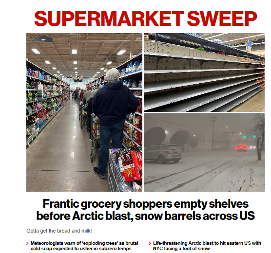
-
“Cory’s in LA! Let’s MECS!” Jan. 24-26 Disco
moneypitmike replied to TheSnowman's topic in New England
Only 72 hours to go.... -
“Cory’s in LA! Let’s MECS!” Jan. 24-26 Disco
moneypitmike replied to TheSnowman's topic in New England
Wow--what an event for down there. I wish I were still in retirement mode so I could spend the storm there rather than Pit2. Actually, that's just one of many reasons I wish I were still in retirement mode. ::) -
“Cory’s in LA! Let’s MECS!” Jan. 24-26 Disco
moneypitmike replied to TheSnowman's topic in New England
Congrats to NYS and SNE--looking great. Blows northeast of that.


