snowlover2
-
Posts
2,727 -
Joined
-
Last visited
Content Type
Profiles
Blogs
Forums
American Weather
Media Demo
Store
Gallery
Everything posted by snowlover2
-
-

May 13-19 Severe/Heavy Rain threats
snowlover2 replied to Tim from Springfield (IL)'s topic in Lakes/Ohio Valley
Eric Elwell on Spectrum1 said its law enforcement confirmed. -
May 13-19 Severe/Heavy Rain threats
snowlover2 replied to Tim from Springfield (IL)'s topic in Lakes/Ohio Valley
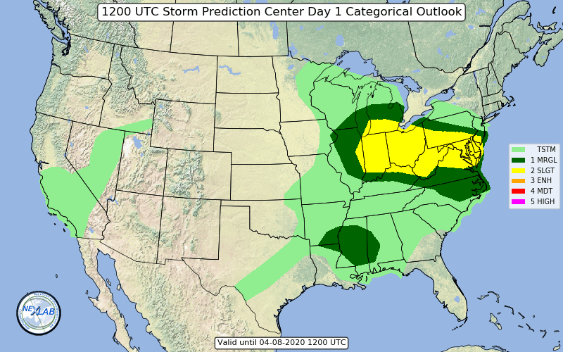
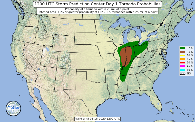
Slight risk for tornadoes just added for SW OH /N KY.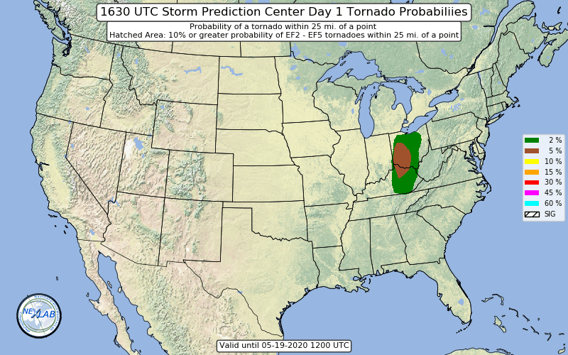
-
May 13-19 Severe/Heavy Rain threats
snowlover2 replied to Tim from Springfield (IL)'s topic in Lakes/Ohio Valley
End date should likely be changed to the 18th with the eastern sub seeing heavy rain and possible severe tomorrow.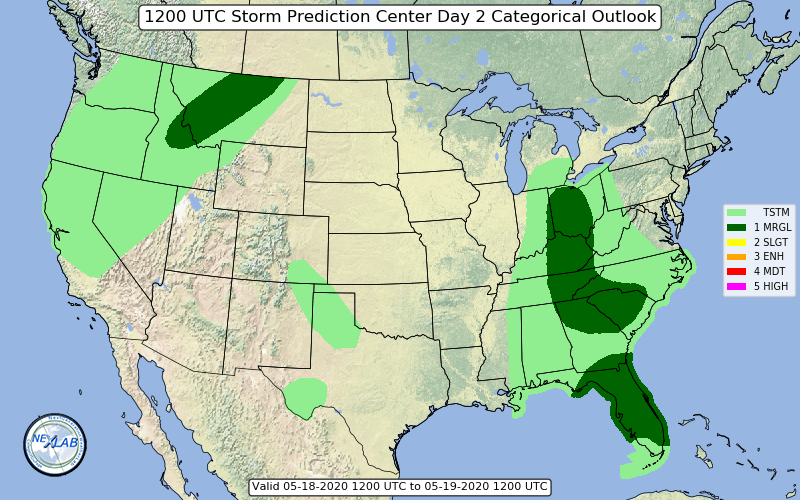
-
May 13-19 Severe/Heavy Rain threats
snowlover2 replied to Tim from Springfield (IL)'s topic in Lakes/Ohio Valley
New day 1 introduces a slight risk for tornadoes for E IL/W IN.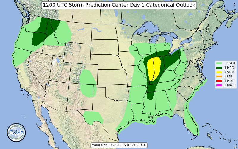
-
May 13-19 Severe/Heavy Rain threats
snowlover2 replied to Tim from Springfield (IL)'s topic in Lakes/Ohio Valley
Tornado warning NE of Peoria. -
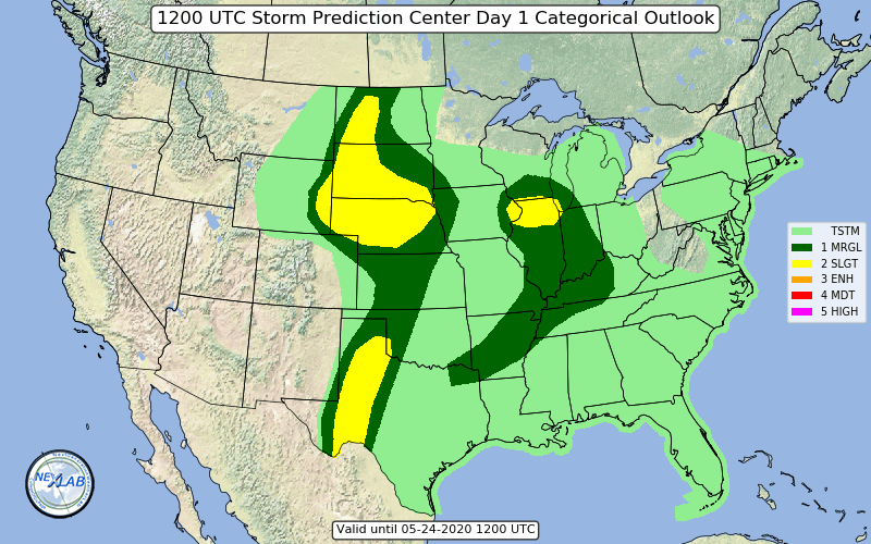
Maybe a little severe for IN/OH tomorrow. Mention of slight risk possibly being needed.
-
May 2020 cold snap; record cold, possible snow?
snowlover2 replied to michsnowfreak's topic in Lakes/Ohio Valley
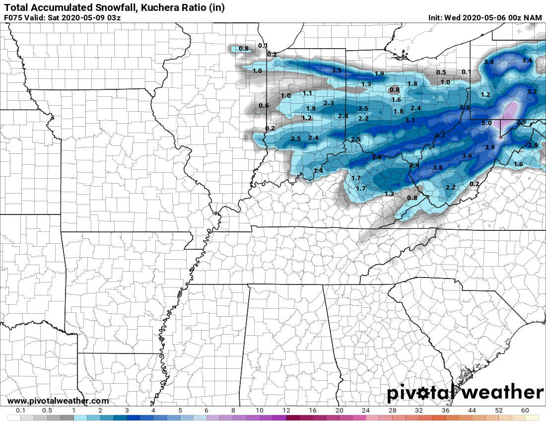
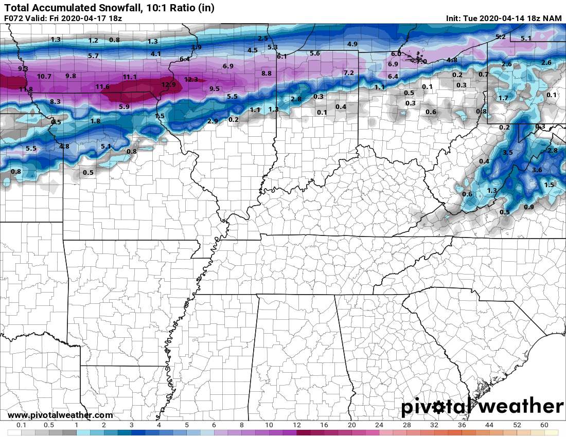
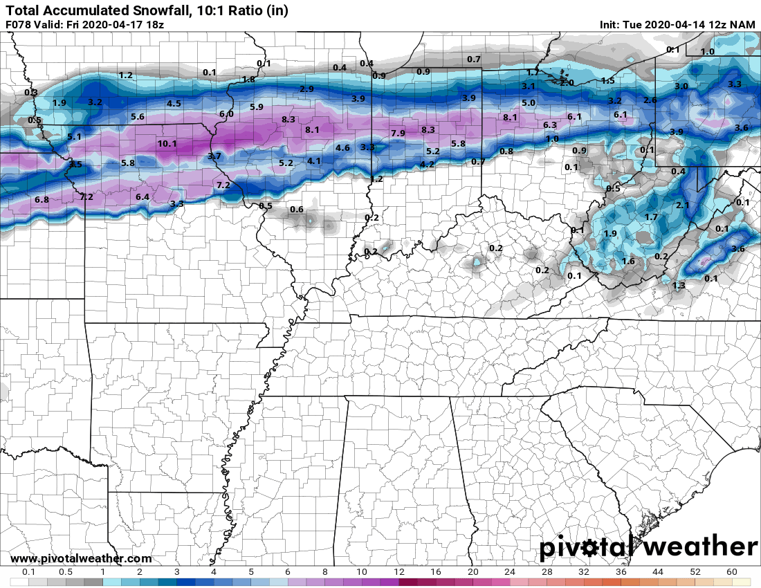
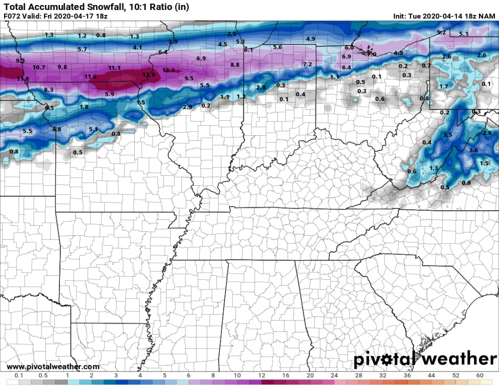
0z NAM holding on to the idea although amounts did lessen a little.
-
May 2020 cold snap; record cold, possible snow?
snowlover2 replied to michsnowfreak's topic in Lakes/Ohio Valley
FWIW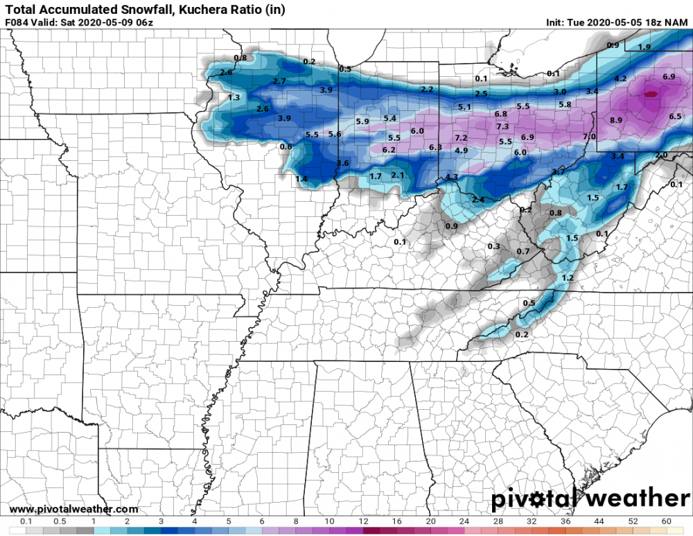
-
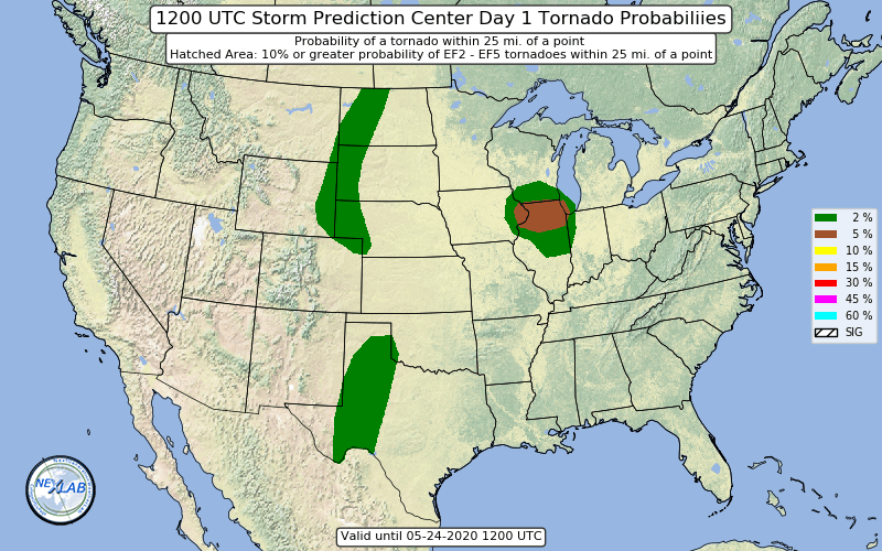
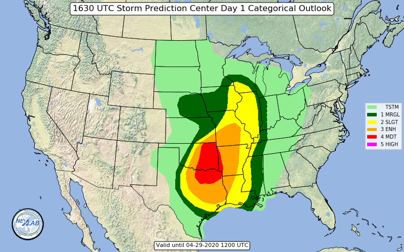
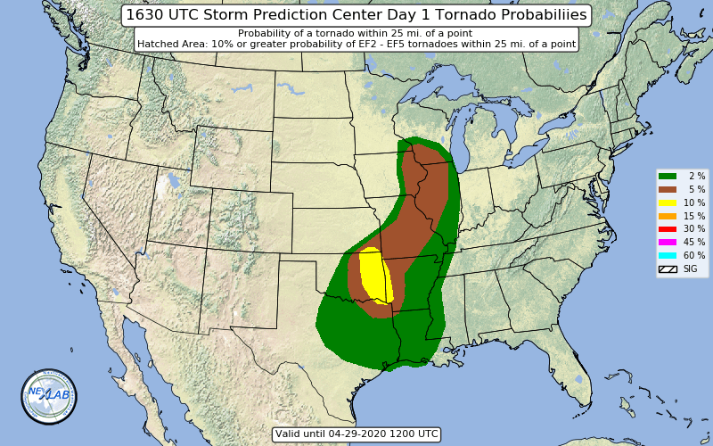
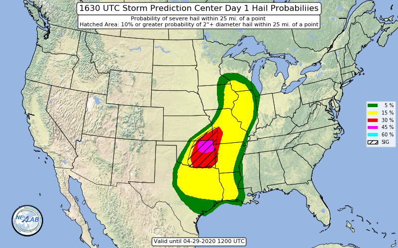
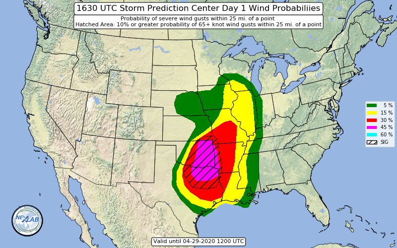
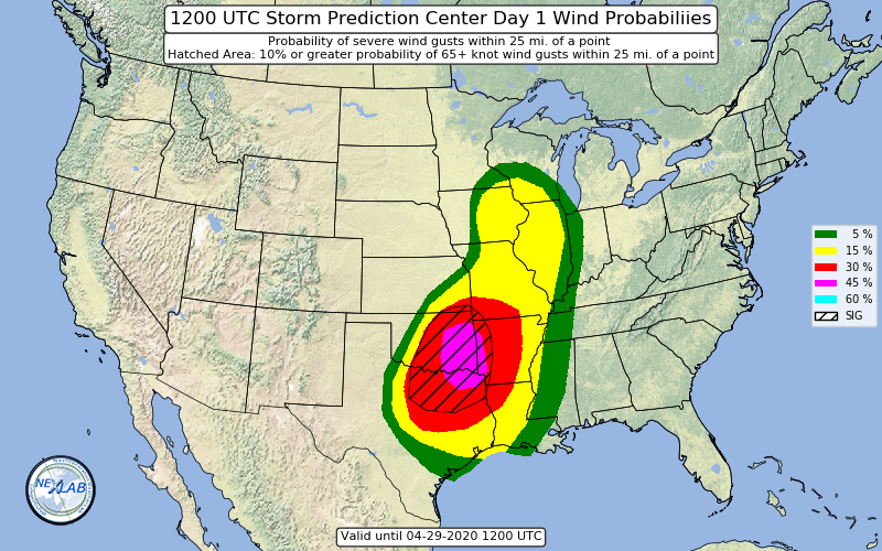
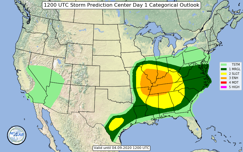
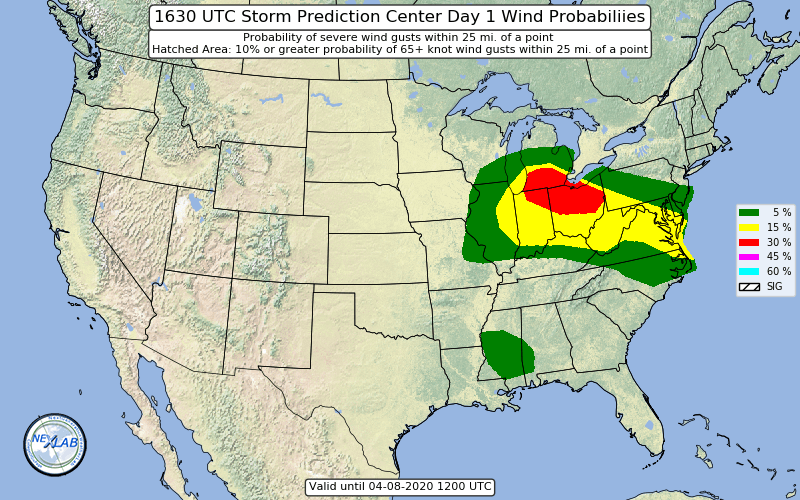
Moderate risk expanded both north and south, 10% tornado/45% wind expanded and 45% hail area added on new day 1.
-
Moderate risk for E OK.

-
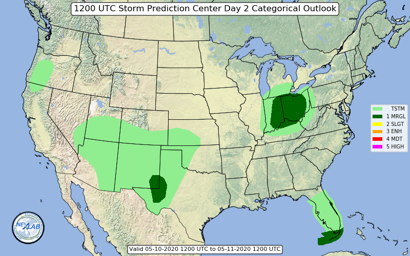
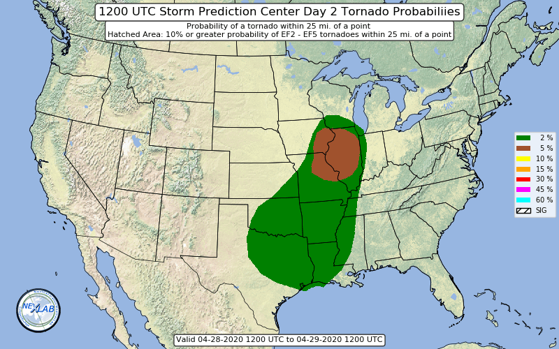
Only real change on new day 2 is an expansion south of the 5% tornado area through SW MO.
-
-
Kuchera isn't all that different well in IA anyway.

-
-
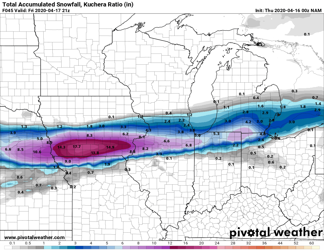
18z NAM took a healthy jump north.

-
3 different tornado warnings around the Cincy area now.
-
Just issued until 2am as far east as SW OH and KY.
-
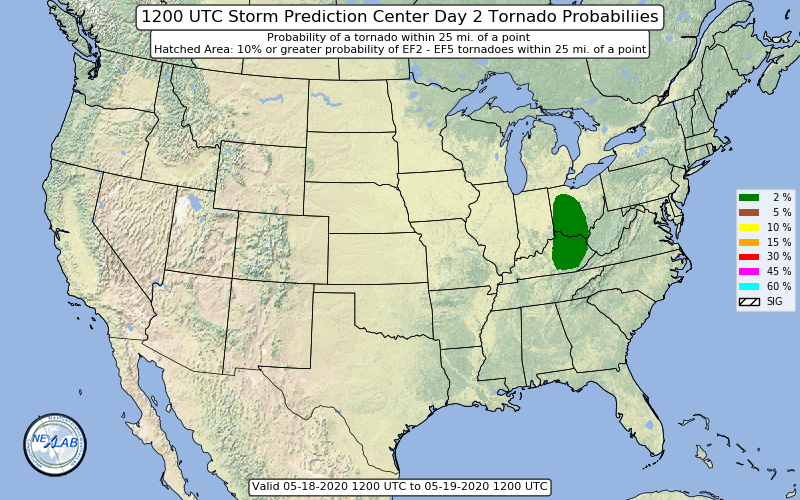
No real changes on the new day 1.
-
And a mention of possible moderate risk area in later updates next one being in around 45 minutes.
-
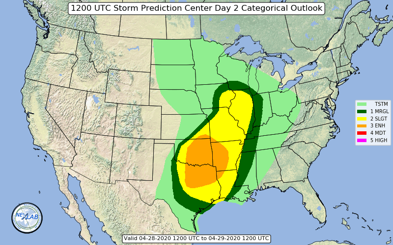
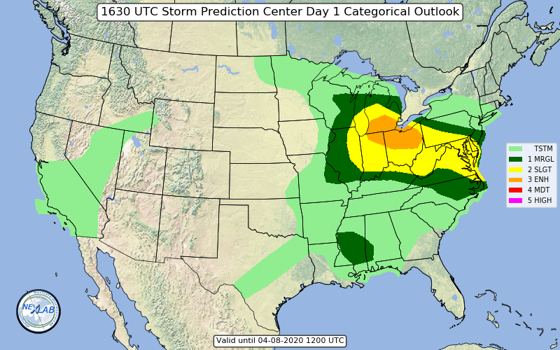
Large enhanced on new day 1.
-
I think by bust he means SPC should have had the enhanced area expanded west across N IL/S WI/E IA judging by all the hail/sig hail in that area.
-
-
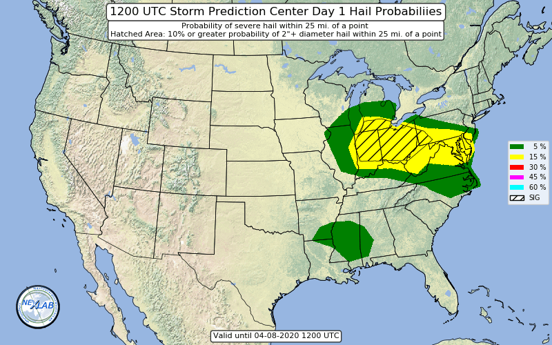
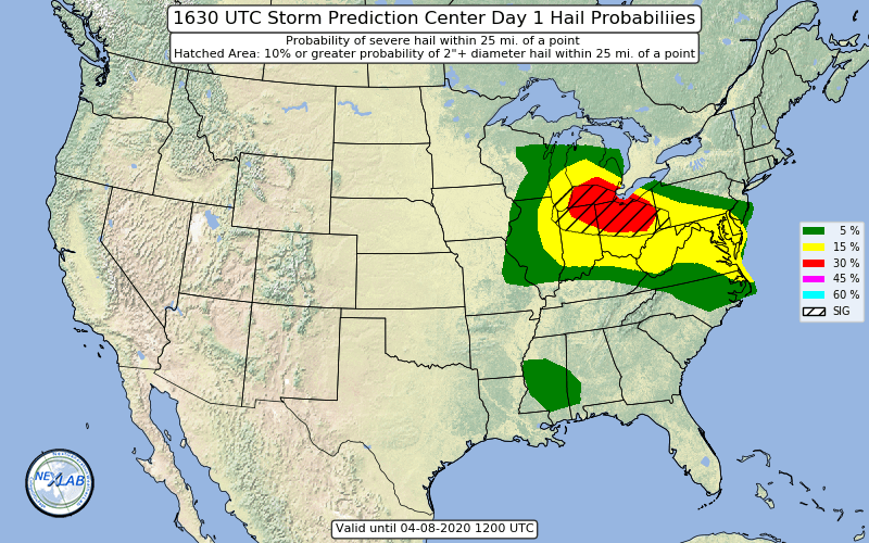
New day 1 adds hatched area for hail for IN/OH.