snowlover2
-
Posts
2,727 -
Joined
-
Last visited
Content Type
Profiles
Blogs
Forums
American Weather
Media Demo
Store
Gallery
Everything posted by snowlover2
-
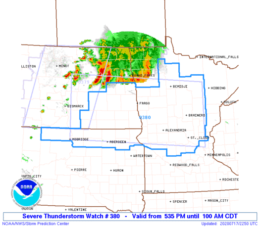
Got the very rare PDS T-storm watch for a good chunk of MN.
-
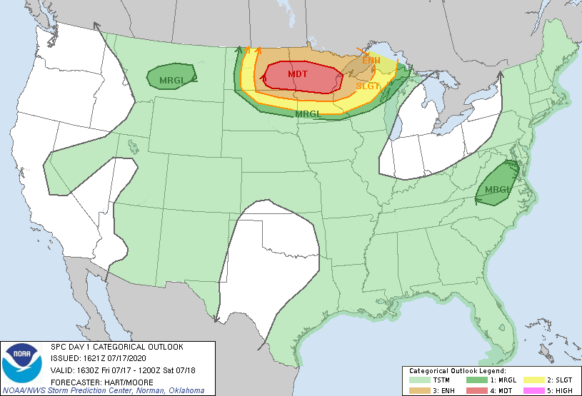
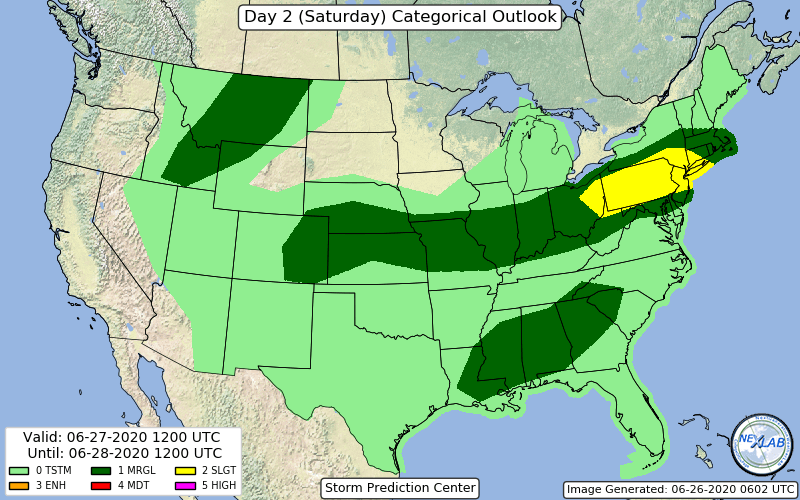
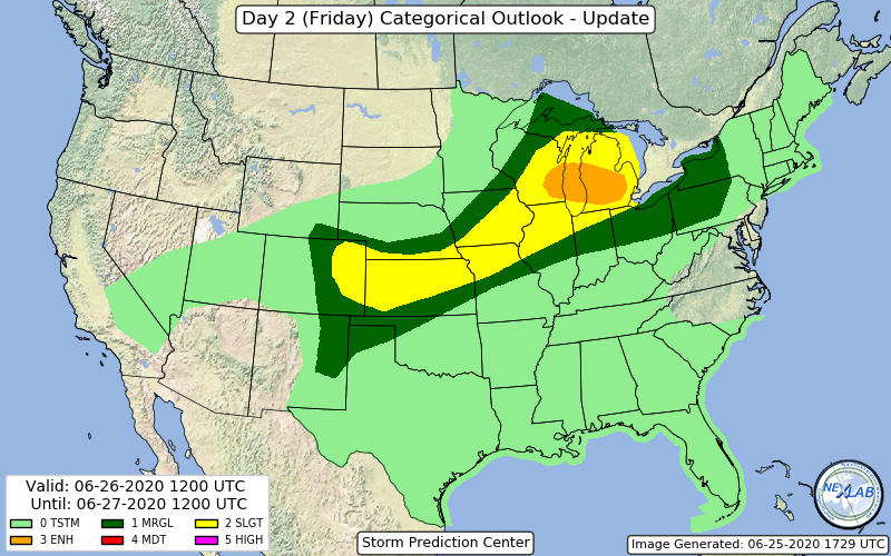
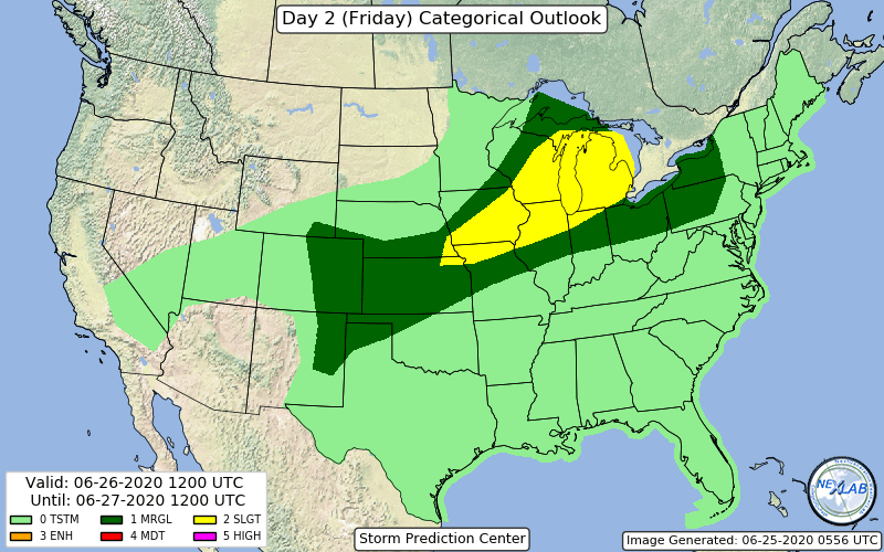
No real change on the updated day 2 but they do mention that an enhanced area will likely be needed.
-
SPC has expanded the moderate risk area into northwest WI and the enhanced across the rest of north WI into the UP of MI. They even say in the disco that a derecho appears possible.
-
It actually is backing off the extreme heat especially the farther east you go. It's been showing temps around 100 for all of Ohio but the 12z is now showing low/mid 90's for most except far northeast with temps in the upper 70's/low 80's. Wouldn't surprise me too much to see it back off a bit more.
-
Pretty big change in the 0z runs (GFS, GGEM) starting next weekend as far as heat goes. To this point they were showing the heat lasting to the 19th-20th area. Now both are showing the center of the ridge over the rockies instead of the plains with a trough over the lakes/ov. Now only showing highs in the 60's and 70's. This would be much welcomed relief.

-
92 in Dayton today. 4 days in a row of 90+ and counting. No clue what the longest streak of 90+ days is.
-
8 year Anniversary of the 2012 Derecho is today. One of those events you never forget.
-
That area of storms around Kankakee IL has been persistent. Looks like radar is estimating close to if not over 8" southeast of Kankakee.
-
Wasn't expecting a possible watch this far south.
-
Yikes! BULLETIN - EAS ACTIVATION REQUESTED Severe Thunderstorm Warning National Weather Service Grand Rapids MI 927 PM EDT Fri Jun 26 2020 The National Weather Service in Grand Rapids has issued a * Severe Thunderstorm Warning for... Kalamazoo County in southwestern Michigan... * Until 1015 PM EDT. * At 927 PM EDT, a severe thunderstorm was located near Paw Paw, moving east at 55 mph. This is a very dangerous storm. HAZARD...85 mph wind gusts. SOURCE...Radar indicated. IMPACT...You are in a life-threatening situation. Flying debris may be deadly to those caught without shelter. Mobile homes will be heavily damaged or destroyed. Homes and businesses will have substantial roof and window damage. Expect extensive tree damage and power outages. * Locations impacted include... Kalamazoo... Portage... Vicksburg... Galesburg... Mattawan... Schoolcraft... Climax... Richland... Comstock Northwest... Westwood... Gull Lake... Alamo... Fulton... Augusta... Oshtemo... Comstock... Scotts... Cooper... PRECAUTIONARY/PREPAREDNESS ACTIONS... This is an EXTREMELY DANGEROUS SITUATION with tornado like wind speeds expected. Mobile homes and high profile vehicles are especially susceptible to winds of this magnitude and may be overturned. For your protection move to an interior room on the lowest floor of a building. This storm has the potential to cause serious injury and significant property damage.
-
-
New tornado warning just west of Rockford.
-
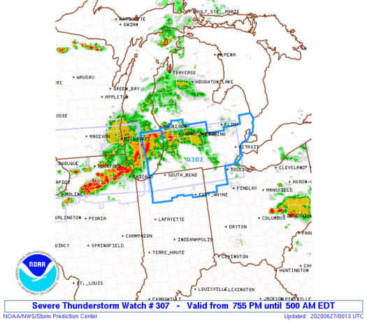
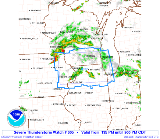
Watch is up.
-
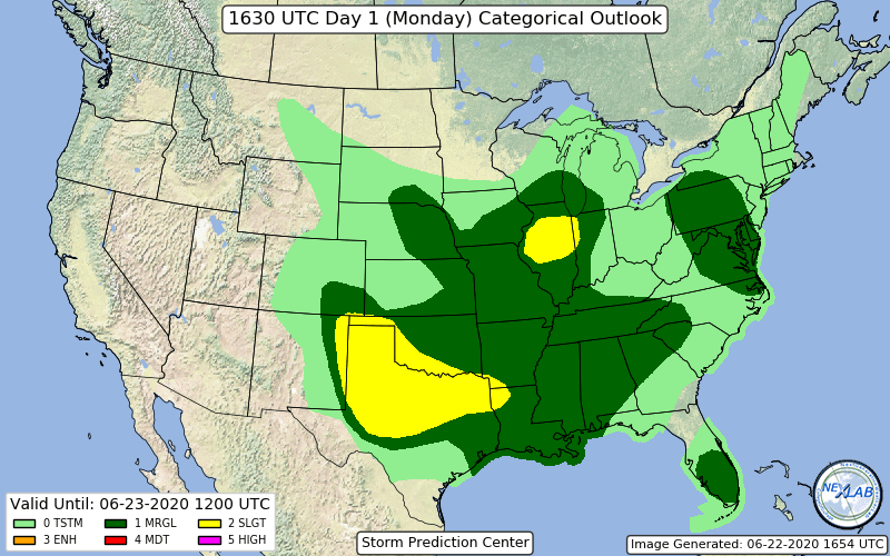
Marginal for most of the southern sub on new day 2.
-
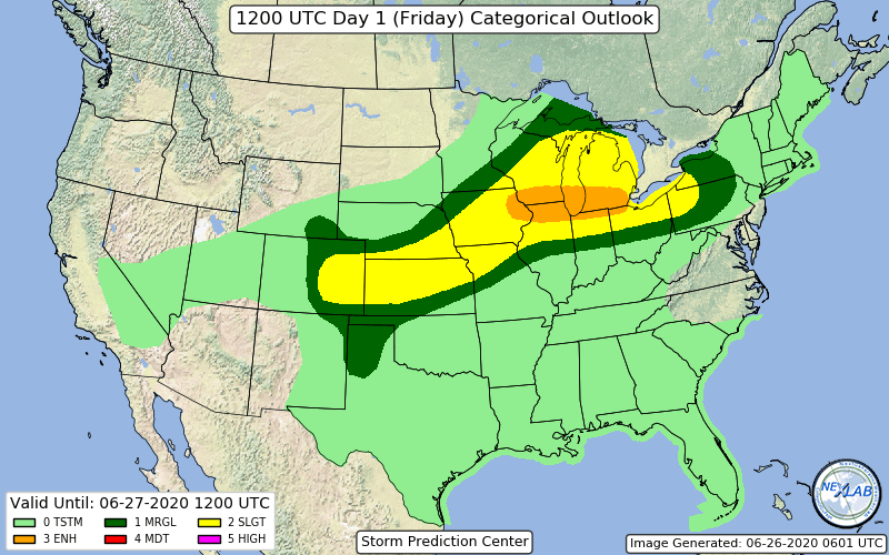
New day 1.
-
Enhanced area added on updated day 2.
-
New day 2 maintains a large slight risk from MI southwest to SE NE/NE KS. They mention that if enough destabilization can occur after morning activity, a more organized bowing type wind threat could evolve requiring an upgrade to wind and categorical risk.
-
Slight risk added to a good chunk of the northern half of IL.
-
-
Kinda surprised it won't be a tornado watch.
-
Here's the disco.
-
I could see the enhanced expanded south across the rest of west Ohio.
-
58mph winds at Dayton airport. PRELIMINARY LOCAL STORM REPORT NATIONAL WEATHER SERVICE WILMINGTON OH 453 PM EDT TUE JUN 9 2020 ..TIME... ...EVENT... ...CITY LOCATION... ...LAT.LON... ..DATE... ....MAG.... ..COUNTY LOCATION..ST.. ...SOURCE.... ..REMARKS.. 0443 PM TSTM WND GST KDAY DAYTON COX APT 39.90N 84.22W 06/09/2020 M58 MPH MONTGOMERY OH ASOS
-
ILN sounds really concerned about tornado potential tomorrow even mentioning being alert for strong tornado. .SHORT TERM /6 AM WEDNESDAY MORNING THROUGH WEDNESDAY NIGHT/... Main story Wednesday will be increasingly unstable airmass meeting up with a negatively tilted shortwave heading up the ridge axis currently in place over the East Coast. At the surface, a cold front/dry line will slice through the forecast area during the late afternoon hours. Timing of this line of convergence is still a bit uncertain with the guidance. Have bracketed the time of peak concern to be from 18Z through just after 00Z, with a quick end to the precipitation behind the main line along the front. Based on several emerging mesoscale factors, including SBCAPE values of 2000-3000 J/kg, 35-45kts of 0-6km bulk shear, and 20-30kts of 0-1km bulk shear, there is growing concern for severe storms with damaging wind, large hail, and tornadoes as well. In fact, STP values exceeding 3 in west central through central Ohio provide some alert for the potential for strong tornadoes during the late afternoon through early evening hours. Main question will be coverage for storms, as well as how long the storms remain discrete along the front.
-
T-storm warning just went up for Cincy area along that band.