El Kabong
-
Posts
104 -
Joined
-
Last visited
About El Kabong

-
Yes, Larry. We definitely had a couple of rounds of moderate to borderline heavy snow. Changeover happened just before 8 AM so we ended up with about a two hour window of snowfall. 3/4” appears to be the final total here in Perry. Still snowing lightly, but shouldn’t add much to the accumulations as the back edge is knocking on our door. Yesterday’s warm temperatures definitely created a challenge for accumulations. Our high yesterday was 62°!
-
Tony, thanks. We got into some moderate bands toward the end, but the heaviest stuff stayed south of us. The overall average for our area was around 4 to 5 inches but Cordele ended up getting between 8 and 9 inches! No complaints here! Biggest storm since I moved here 27 years ago, but far from the totals they got down this way in 1973. I’m sure hoping that you and the moles get your sleet storm soon! Sounds like Larry stole it from you!
-
Congratulations! Definitely a solid storm for most all of middle Georgia.
-
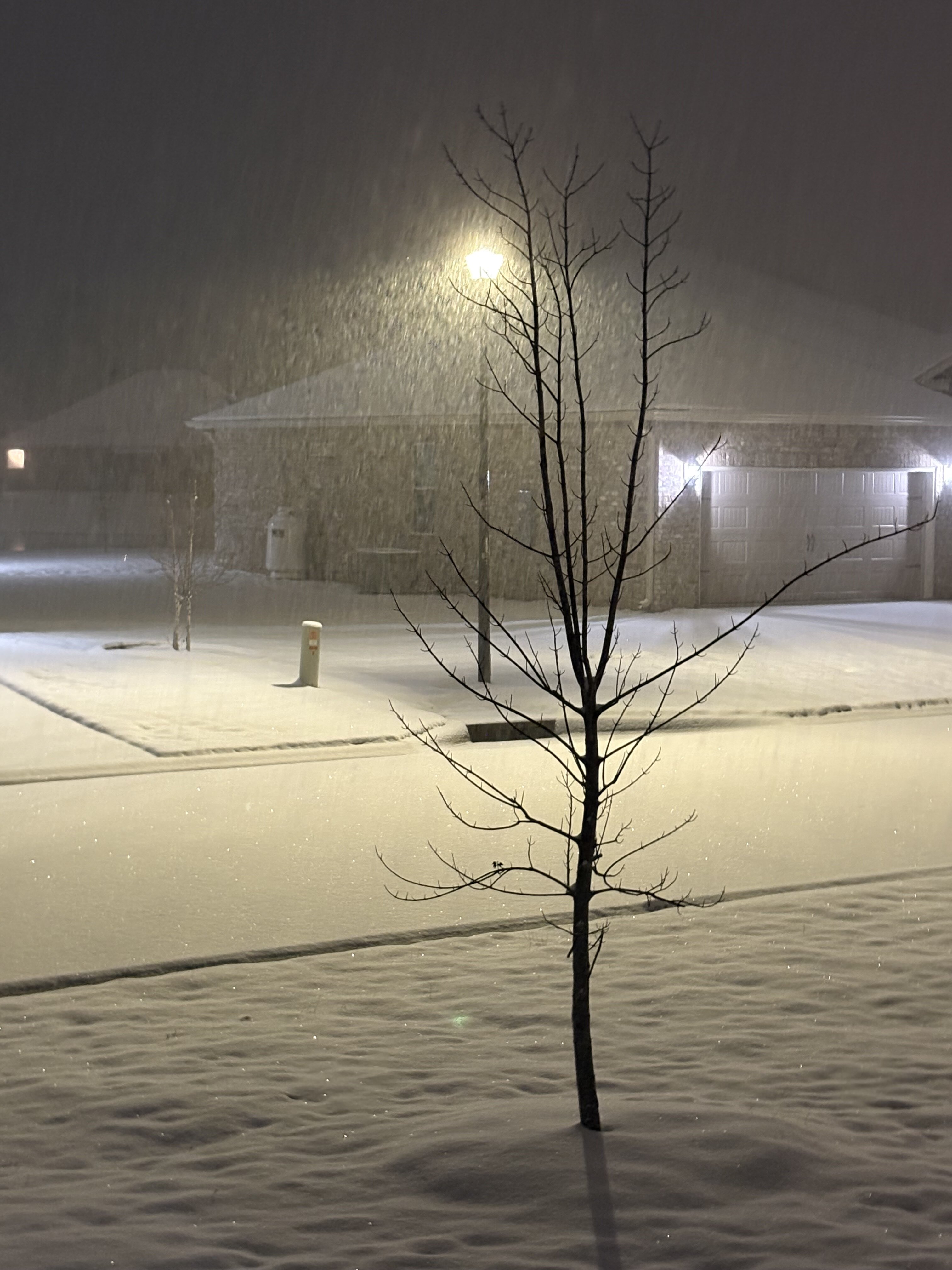
3.75" total. Biggest snow since I moved here in 1998! I believe some areas just to my south and east got closer to 5 inches. Currently 15.4 with the snowpack.
-
Final measurement TBD, but looking at several inches here in middle Georgia!
-
Light snow/flurries in Perry, GA. Current temp is 32.2.
-
Light snow/flurries in Perry, GA. Current temp is 32.2.
-
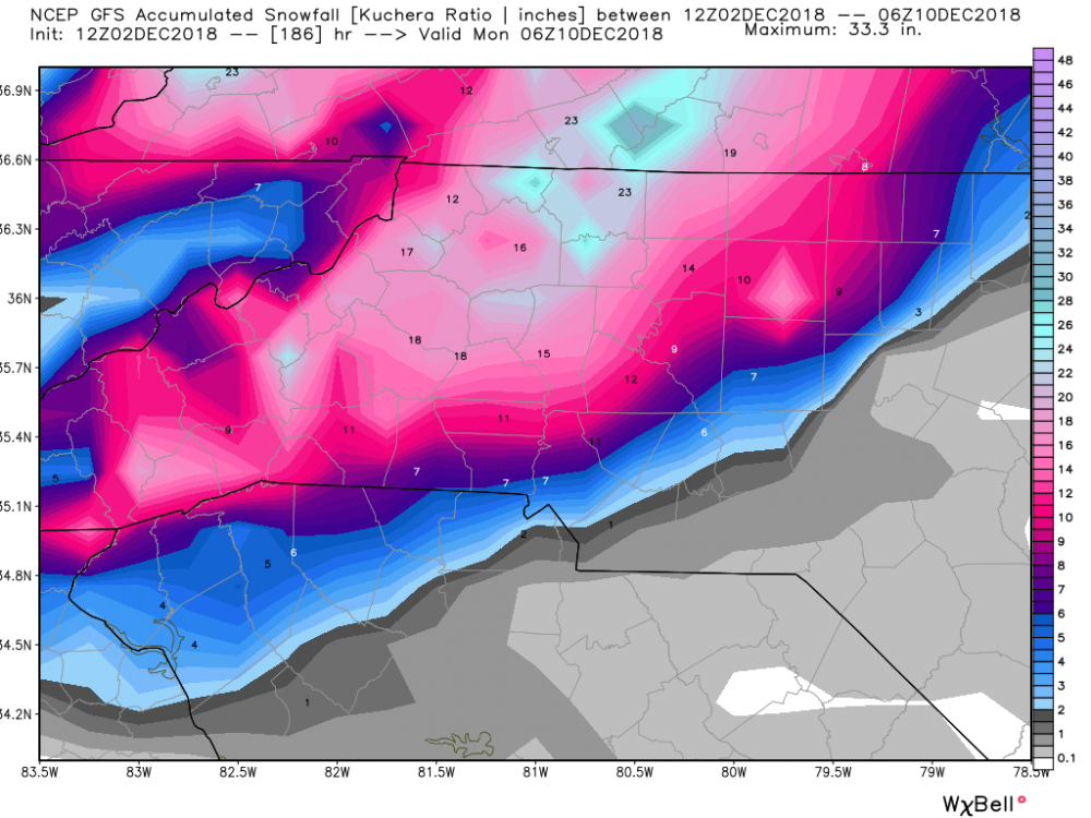
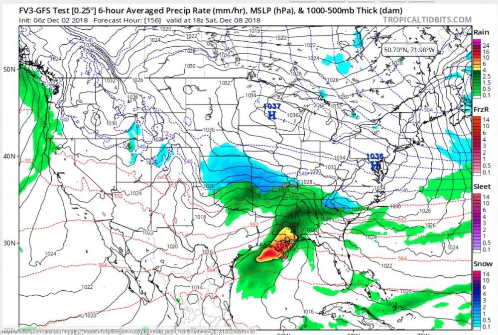
This may have already been posted, but quite an amazing job on the FV3 from 8 days out (at least for the deep south and southern apps portion of the map). This was the first forecast map that was posted in this thread back on 12/2. The 12Z GFS wasn't too far off either for its initial depiction for Sunday. The 12Z GFS snowfall map from that same day shows that the models were already zeroing in on on far NE Georgia, the upstate of SC, and central and western NC as the bullseye for winter weather. Those areas remained remarkably consistent as ground zero throughout the evolution of the storm. We'll see if the models show the same consistency when the next threat materializes, but it's encouraging to see the south's first winter storm of the season handled well by most of the major models. I'll leave it to the professional mets and seasoned amateurs to grade the overall performance of each model, but the "new" GFS appears to have received more than a passing grade (is a B+ too high?).
.png.d694ecd2054dd0eb05d5ec48e3d39dce.png)