weatherwiz
-
Posts
75,221 -
Joined
-
Last visited
Content Type
Profiles
Blogs
Forums
American Weather
Media Demo
Store
Gallery
Everything posted by weatherwiz
-
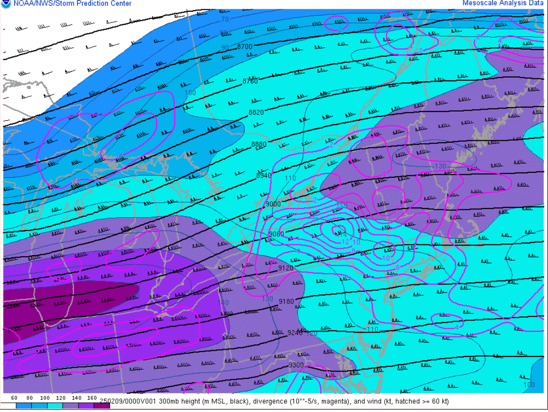
upper-level divergence is increasing and nose of strong mid-level jet streak punching in This should (hopefully aid in filling things in a bit more, especially south

-
Essentially, majority of the snow really falls in a 3 hour period (like 99.9%).
-
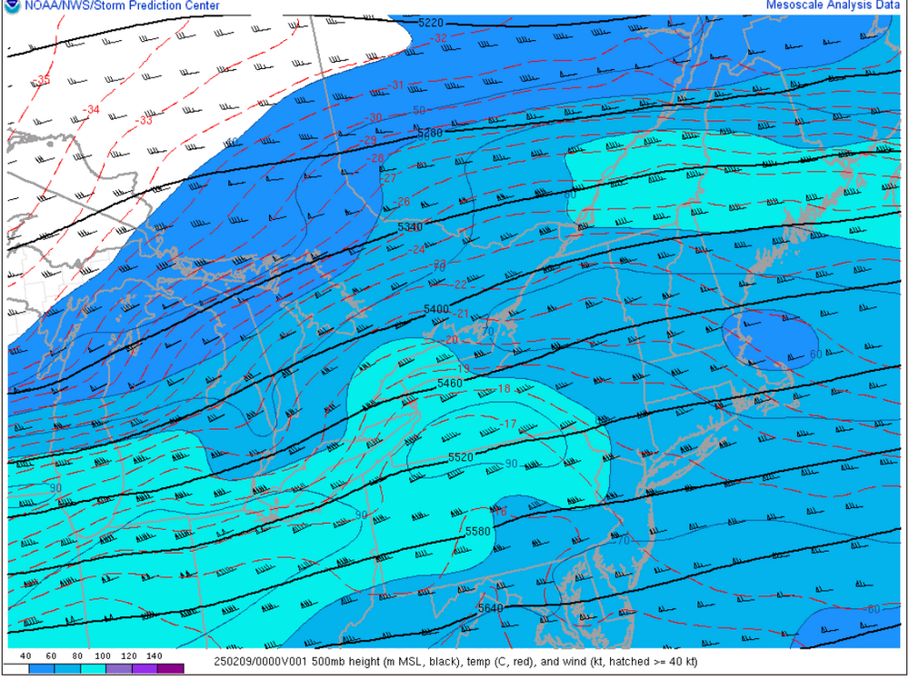
 It’s mesoanalysis time
 -
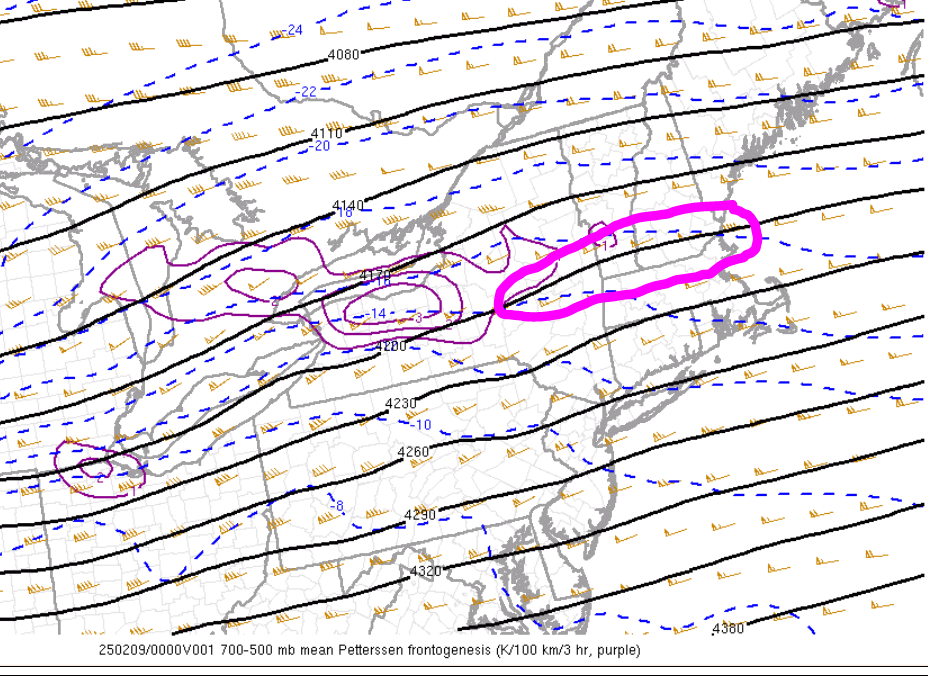
Looks like things could aligning great for the jackpot zone area. Be fun to watch that 700-500 area of fronto continue strengthening
-
I keep peeping out the window waiting to see flakes
-
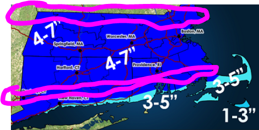
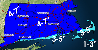
Seems on track to me QPF expectation wise (generally in the 0.50" range). This is hauling way too quickly for anything upwards of 0.75"-1.00", especially since the duration of enhanced lift is short. Still thinking most see 4-5" with 7-8" for those under the extra goodies longer.
-
HRRR looks good and on track. But we radar and mesoanalysis now
-
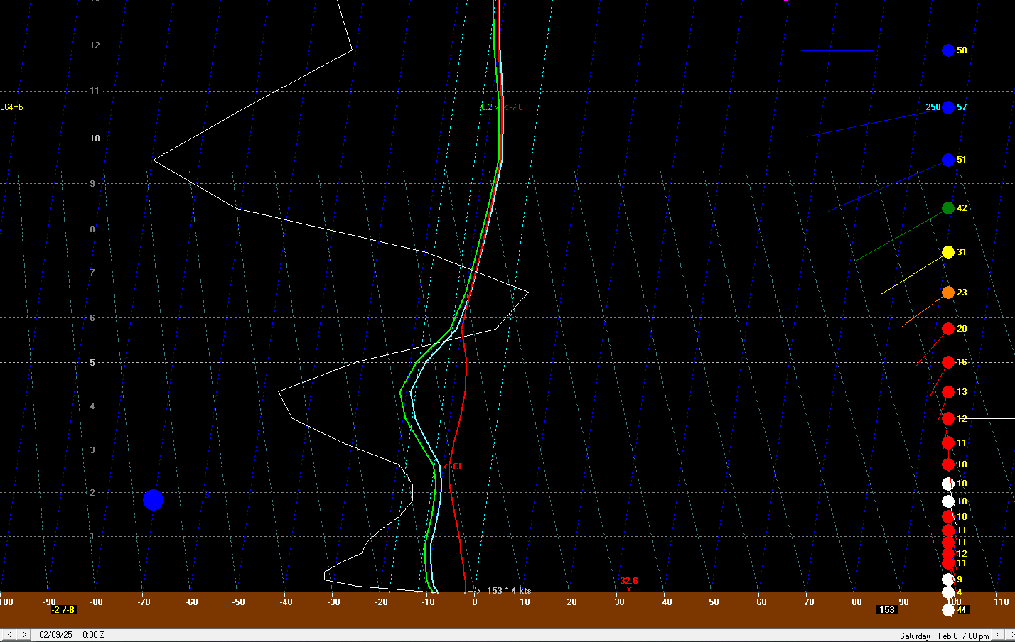
I don't think we'll see any lightning. Though I could be wrong...with bufkit soundings showing -40 ubar/sec into the DGZ that may be enough to net a few strikes.
-
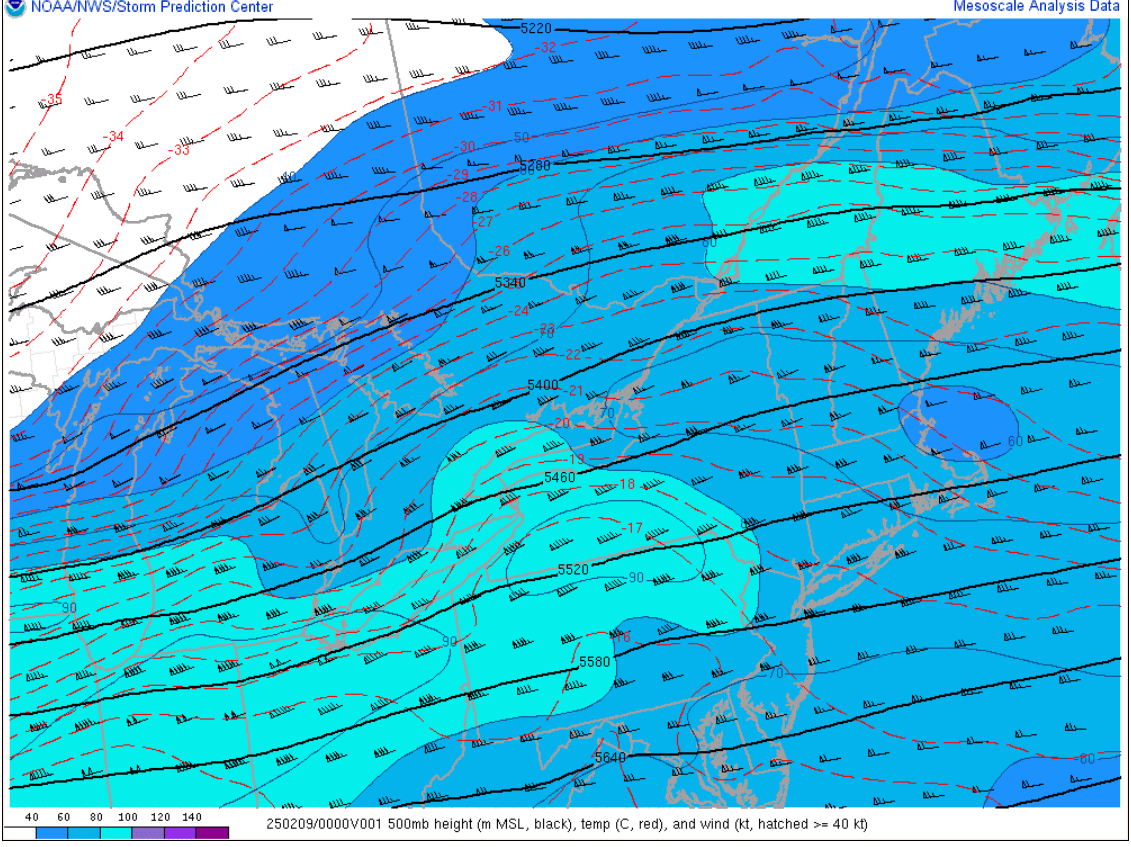
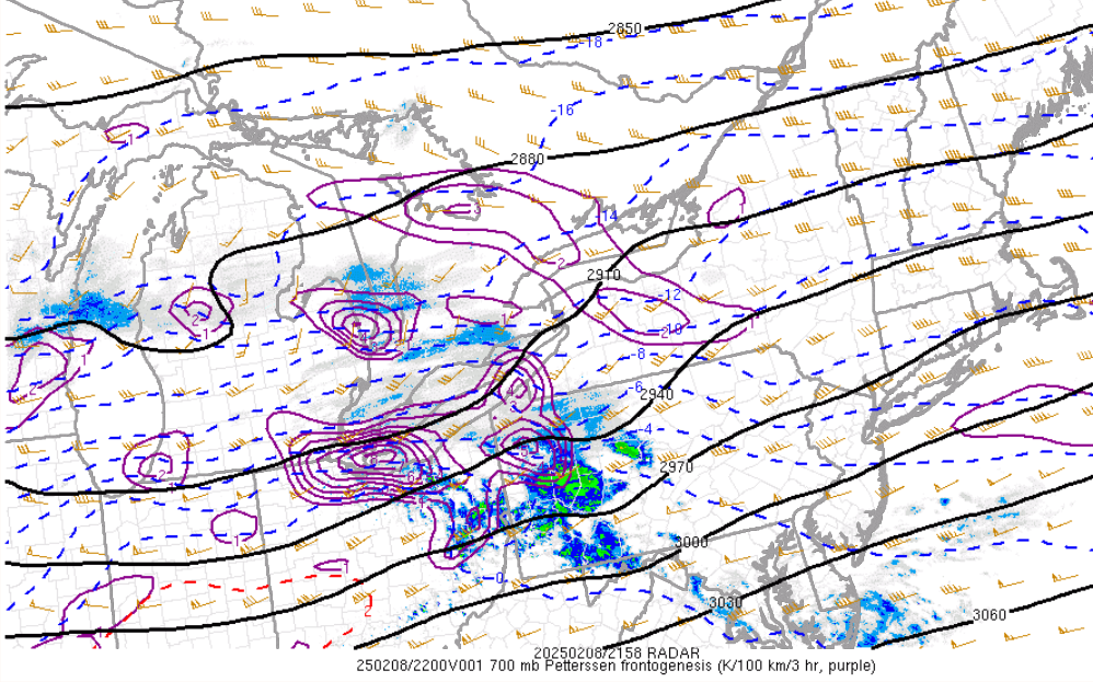
One of the most fun part of storms unfolding...the fronto maps. Our 700 fronto is starting to get cranking
-
Hangs back some H7 fronto a bit longer down there?
-
The GFS looks good but I don't think it's THAT amazing. It's also pretty damn close with that warm nose into southern CT. I was looking for some soundings showing some epic crosshair sigs like what the NAM had when Ryan showed...haven't been able to locate anything yet. GFS doesn't seen any more epic than other models to me.
-
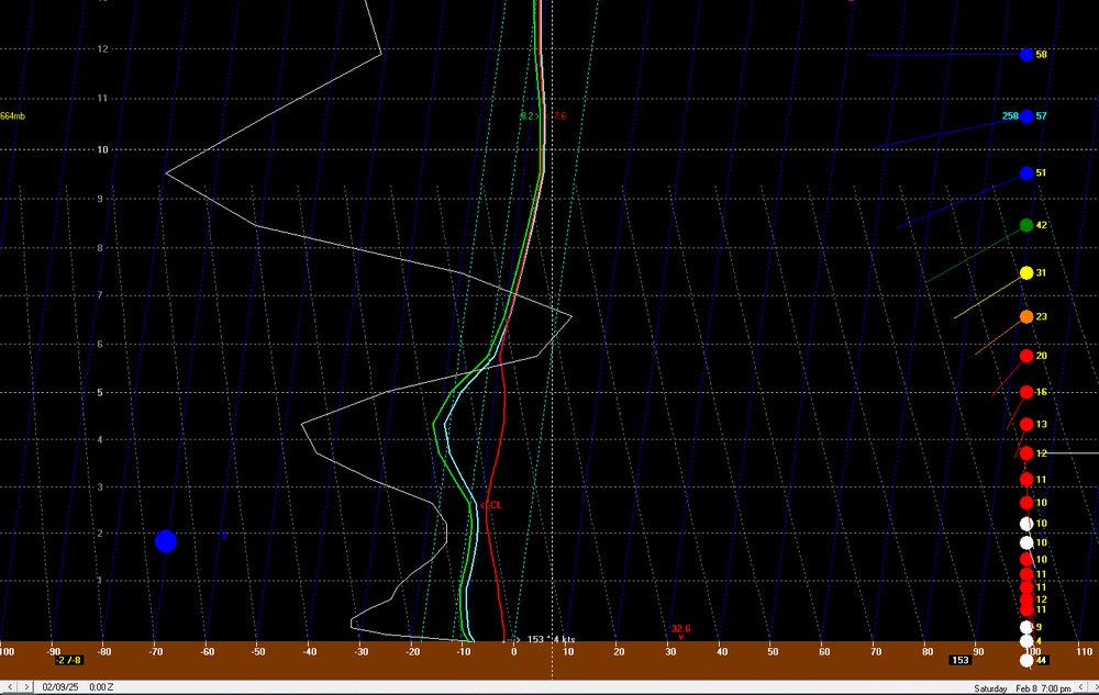
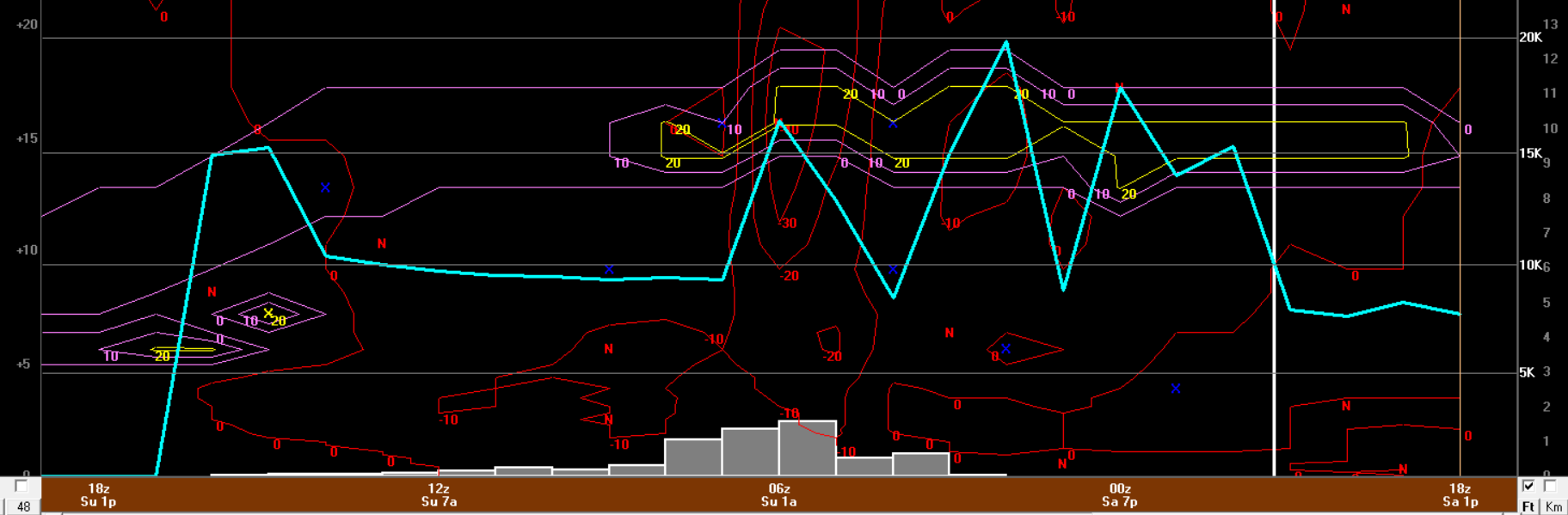
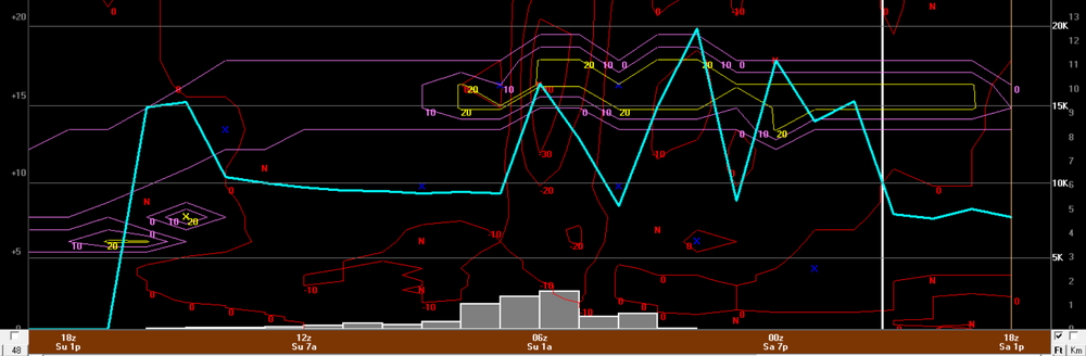
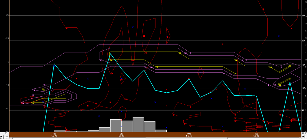
Hot off the presses 18z NAM bufkit for BDL. It will be RIPPING say 4-7z
-
Def most of the storm is certainly done by then. I think its just more of the fact of not losing sight of it. But yeah for most of us its getting slammed by the initial burst then a rapid decrease in intensity.
-
Yeah I was wondering if that dry slot would also be helping with enhanced forcing...that's a beast of a dry punch. The 12z NAM 800-600 fronto from fsu looked yummy
-
ha, we may have clicked on just about the same area lol...I saw that and was like, "woah". But damn...the NAM also wants to really drive in that drier here, if you forward that 3 hours...huge difference. I get the brunt of the snow falls before that happens but this could be critical when it comes to achieving the upper end of forecast ranges.
-
This is a terrible snipping tool job but hockey is about to come on so don't have time to illustrate this on a map but I would watch for two jack areas...one through south-central Connecticut and then up along MA/VT/NH border...these two zones may see totals push the 7-9" range. In between these two areas I wouldn't be surprised if 4-5" is more common. It's basically a quick hitting wall of snow then kind of poop....but it is going to be amazing under that wall.
-
Well making no changes to my forecast rom the other night after finally getting a chance to look at things closely today. Forecast soundings and bufkit look great for a good 2-3 hour period of heavy snow to get just about everyone. There is definitely room for some 7-10" totals north of the Pike but not adding an area for that.
-
Gotcha, I did have some worries that because the duration of those heavier rates looked relatively short whether the common totals would be more of 4-5” versus 6-7”. And Outside of the fronto bands I was a little worried we won’t accumulate efficiently.
-
What? I said same growth and rates would be great under the heaviest fronto bands (1” per hour rates) with ratios 12:1 to 15:1 and even out that in the discussion in the blog post I posted with my forecast. I said outside of this the rates and ratios could be poor or snow growth could struggle
-
Yeah I wish I was on my laptop so I could fire up bufkit soundings for the HRRR. I guess maybe H7 temps could be warm enough to where if lift and snow growth is awful we get crappy flakes and sleet like. Not sure I buy that though but something to watch for
-
That’s kind of what the hrrr looks like
-
18z NAM bufkit certainly rips at BDL for a good 3-4 hours. But it also really likes the ratios too under the stronger omega. That's some pretty hourly rates there
-
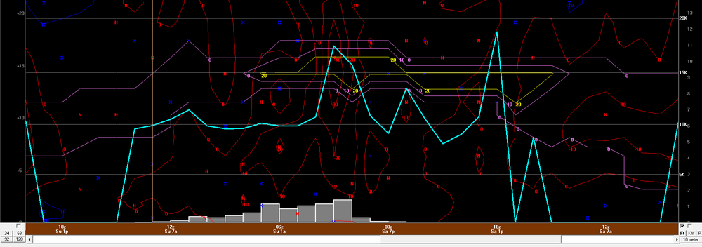
Much liking the structure of the precip shield too on the 3km. Very uniform distribution of dbz and not crappy dbz either
-
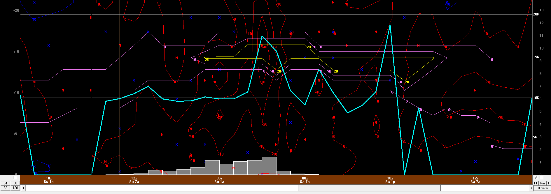
Even some kinking going on at 700. But that's a nice H7 fronto band that develops...probably a bit too late down in Connecticut but this would bode well probably Pike on north...that's where there is a good chance for some widespread 6-8" totals

-
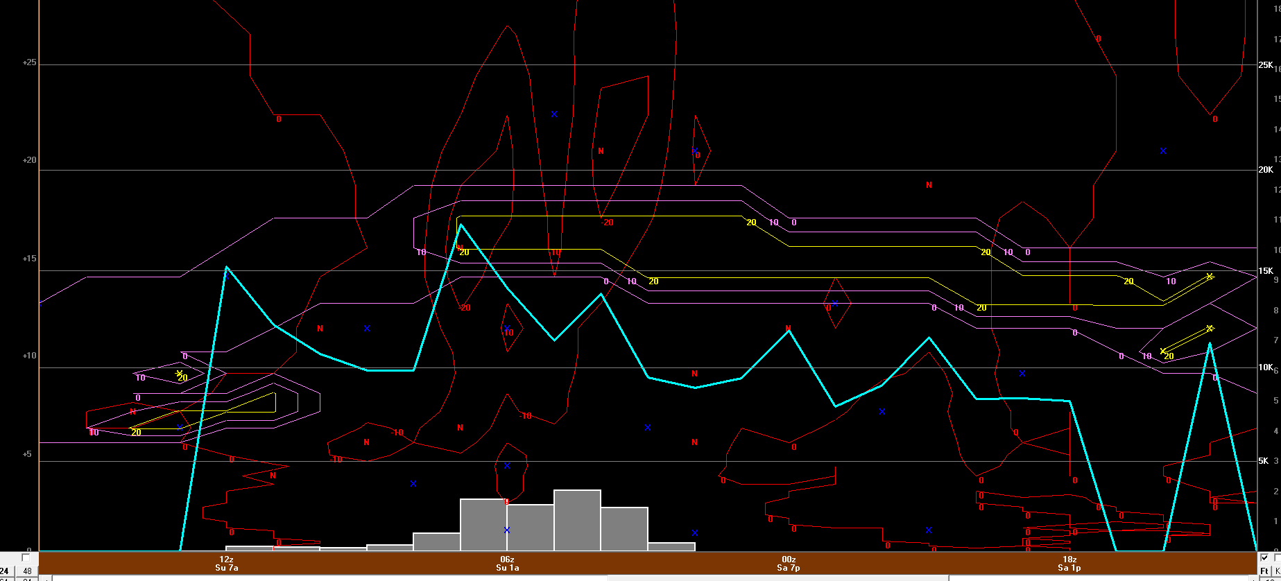
Well here is the 12z GF bufkit for BDL. I'll just stick with my 4-7" forecast though I think 4-5" amounts will be the more common across Connecticut with the best chance for 6-8" totals northwards (like where Scott mentioned). But you can see that the window for heavy snow/highest rates is confined to a very small window and and outside of the greatest lift there isn't a whole heck of a lot.