weatherwiz
-
Posts
75,223 -
Joined
-
Last visited
Content Type
Profiles
Blogs
Forums
American Weather
Media Demo
Store
Gallery
Everything posted by weatherwiz
-
 Well if the Euro was the only model showing a big hit and every other model was a strung out POS...everyone would be tossing those other models and siding with Euro...
 -
The GFS knows how to suck people in and once it has...there is no turning back. Once it shows a big hit, especially for multiple runs, it becomes a game of doing anything possible to justify why the GFS may be right. Been there and done that. No more
-
I hate when you see this because there is absolutely zero way to tell if it is correct. Sometimes guidance that shows this ends up being out to lunch and other times the guidance that had this ended up nailing it...but there is no way to know until basically now time. I was thinking that convection wasn't really impressive enough for that to happen but idk.
-
I don't know. I don't really have a good answer for that. But all I know is there have been many instances of being burned, even inside this range because of discounting models or solutions and for various reasons. Some of the reasons include; 1) Because the solutions aren't showing what we want, 2) the solutions go against original thoughts, 3) it is very difficult to separate emotions from a forecast I'm speaking from personal experience here but there have been way too many times I jump on the "big snow" train because the NAM and/or GFS + ensembles are coming in hot and heavy...the Euro isn't quite there but "I'm expecting it to come aboard". So I go big on the snow. Then as guidance starts to collapse, I let emotions get in the way of reality and I try and look for anything...something that justifies the snowier scenario, even though its clear and evident its not happening. Yesterday I thought this was going to be a pleasant surprise and even today I've made some posts saying I think a foot could be possible where the heaviest banding occurs. And I can sit here now and try to find anything...something to justify that and just run with it because it fits my motive...but the reality is that just isn't there. When it comes down to it we just have to ask ourselves, in this type of setup, what warrants a solution which is more amped versus less amped? Off all the pieces at play here, historically what is the outcome? IMO, how quickly that front drops south and east is going to be huge. The more amped solutions are slower with the south and east progression of the front but it is from my brief experience that guidance can often be too slow with this...this would leave me to believe that amped/northwest is not as likely. I am also very nervous with the indications of the stronger convection well off the mid-Atlantic and that playing some role. This is something which has been discounted in the past but often times becomes a bit player. Too many flags right now and if we expect there will be some last minute miracle...well that doesn't happen often
-
Well something will be caving at 0z. I'm sure we'll see some sort of compromise but its probably going to be mostly geared towards the Euro. Been burned way too many times on this before. I've had so many situations I get all amped up over crazy NAM/GFS runs at this stage, disregard the Euro, go aggressive on snow maps, only to be burned. The old me would be throwing out 6-10'' or 8-12'' today. Tired of making the same mistakes over and over. But this is depressing...time for a 3rd rum and coke soon.
-
Don't count your chickens before they shit. We've seen this game before. We think the euro is going to cave to other guidance and its the other guidance that ends up caving to euro.
-
ahhh yup! Didn't want to say everyone...was afraid I'd jinx and some weird shit would happen between 51-57 hr
-
crusher incoming for someone
-
No...but we are starting to get into the range where it may start to shed some insight on some of these more mesoscale components. At some point in the game the NAM will latch on and when it comes time to diagnosing banding and everything that comes with that the NAM will be very useful.
-
3km is ugly looking too in that regard...when storm is moving through what should be a favorable spot for CT it has a good size area of dbz in the teens. I guess just another factor to potentially consider when going full on assessment mode tomorrow. There are still many flags and concerns to address which we should be able to resolve over the next 24 hours...hopefully
-
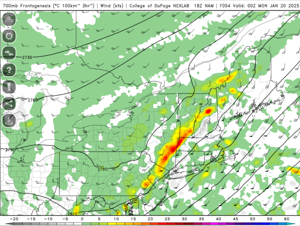
I'm just looking quickly but that QPF output by the NAM may be related to lift. Just looking at fronto/VV it may be signaling subsidence zones
-
I believe it's replaced the Wind Chill Watch/Warnings
-
NWS needs new color schemes for some of these advisories. Extreme cold watch and winter storm watch too close in shade. Could give someone whose had too many IPAs the wrong idea.
-
You know it's coming the board explodes and then when the 0z comes out we're all smacked with a hardcore dose of reality
-
Probably burn all NCEP computers
-
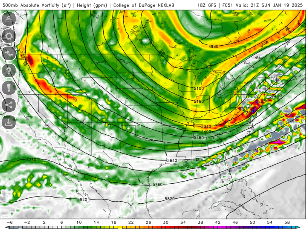
I wish the 700mb velocity products were working on weathermodels. At least 500mb vorticity is working but of course the parameters which matter most aren't.
-
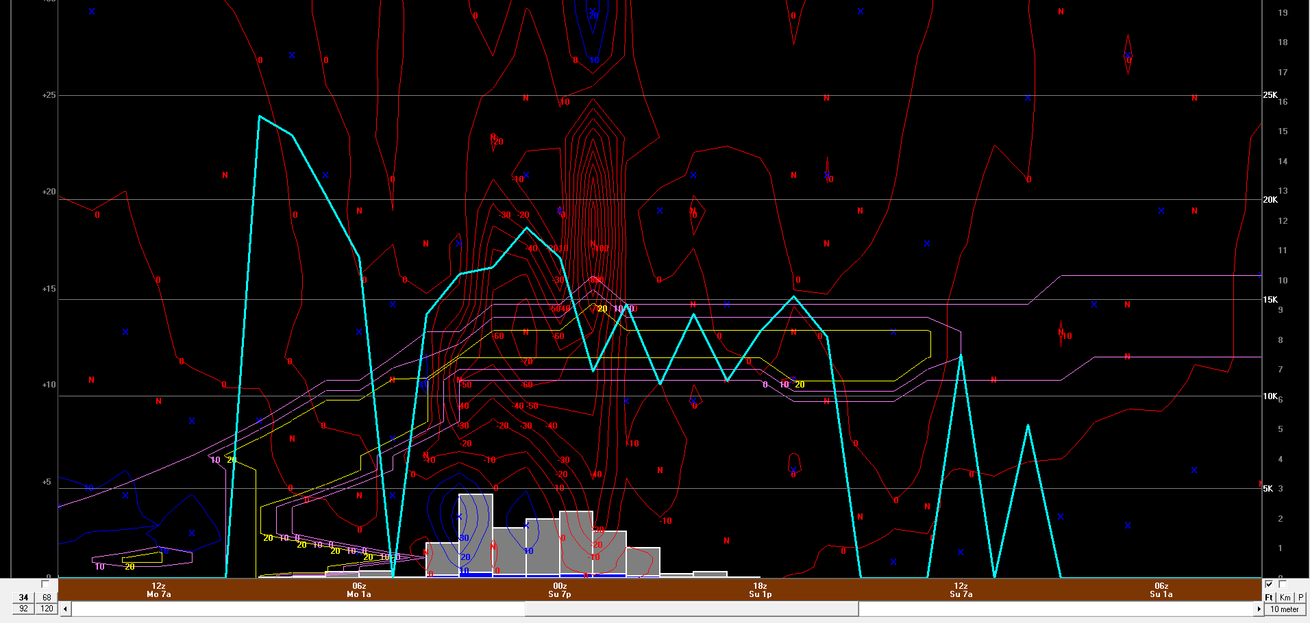
Not sure if we can expect that to verify but that would be some obscene snow rates for a time. I'm actually a bit shocked bufkit isn't spitting out greater hourly snowfall during that window. But there is also quite a difference in ratio/totals with cobb05 versus cobb11. cobb05 is pushing 25:1 for ratio lol
-
OHHH MY LORD. GFS Bufkit for ORH.....holy moly. BDL sucked but ORH....oh God this is gold.
-
fine by me...my expectation is that there will be a storm and its something that rides up along or just offshore.
-
Something to watch over the next 24-36 hours I think is the progression of the front south and east across the country. This is going to be huge in establishing the baroclinic zone and where that resides. I guess maybe we can compare real time and see which model may be handling this the best. Just an idea
-
When I load up bufkit at noon I am hoping to see some values as high as 25-30...that's what the clothes start flying off.
-
That makes sense. Ultimately the banding in this one will surely be farther north and west than projected, unless we really see the system crank as it is lifting northeast and we see it collapse towards the center. But with this I am starting to buy the idea of two banding signals which means there will be trouble in between. I also kind of use alot of hesitation with these point-and-click soundings. I've found you have to pay very close attention because sometimes the soundings generated are erroneous. Doesn't seem to happen alot but something I always note.