Yaz
-
Posts
71 -
Joined
-
Last visited
Content Type
Profiles
Blogs
Forums
American Weather
Media Demo
Store
Gallery
Everything posted by Yaz
-
Isnt’t the Fv3 supposed to replace the GFS, or am I getting my models confused?
-
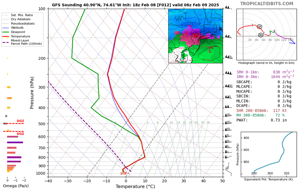
GFS 18z predicted warm nose never materialized ….0z initialization at two locations: so freezing rain never materialized

-
The GFS warm nose around 800 mb yielding the freezing rain….. let’s see if it will be correct or not for tonight.
-
Interesting. Thanks. 1. How strong is the correlation between MJO phase and temperature? 2. And how good are the projections of MJO progression. Back when I studied these types of things, the material was often a bit short in length and lacking a lot of detail. -Greg
-
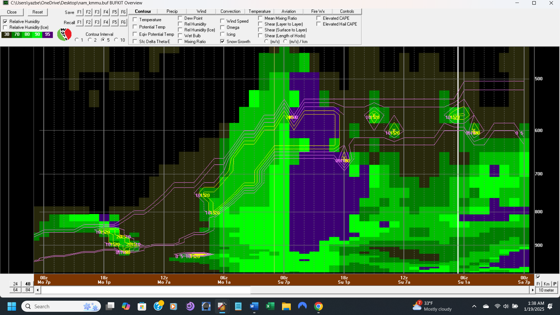
Let me know if anybody wants to learn how to use BUFKIT. It is a free software program that interprets American model output (i.e. GFS, NAM, et al) that is also freely available.
-
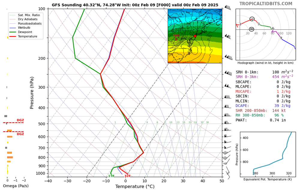
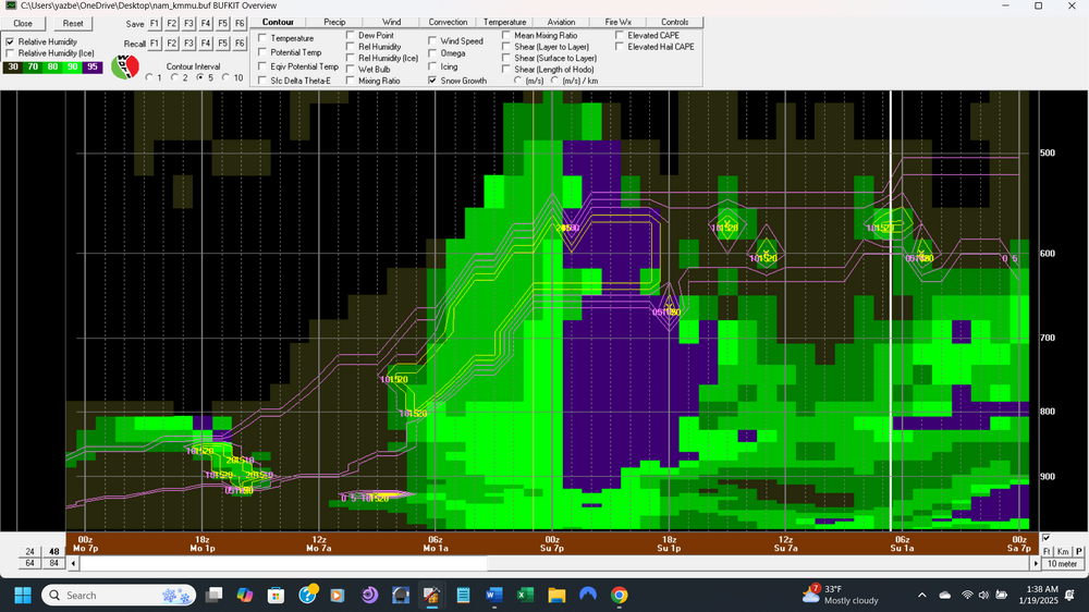
Below map shows Max snow growth region between purple lines where RH > 70% (temps between -12C and -18C).....which leads me to believe that snow rate should pickup around 7:00 pm in Morristown, assuming NAM is correct.(?)
-
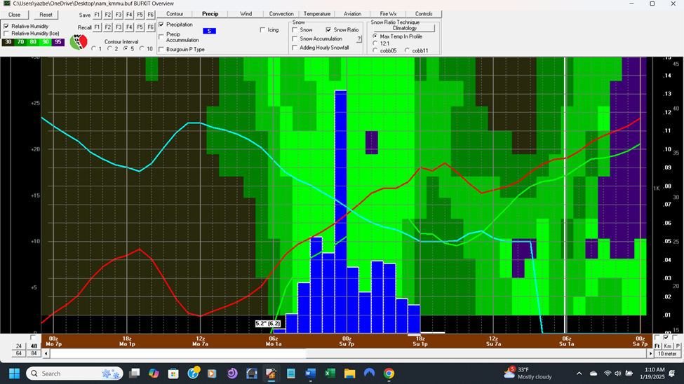
BufKIT for MMU 0z NAM (hourly from right to left...with blue as SNOW..total is 5.2"....snow ratio is the thin light blue line....2 meter temp (thin red line) and DP (thin green line); when green becomes bright green is when RH exceeds 90%.
-
GFS is all over the place

-
-
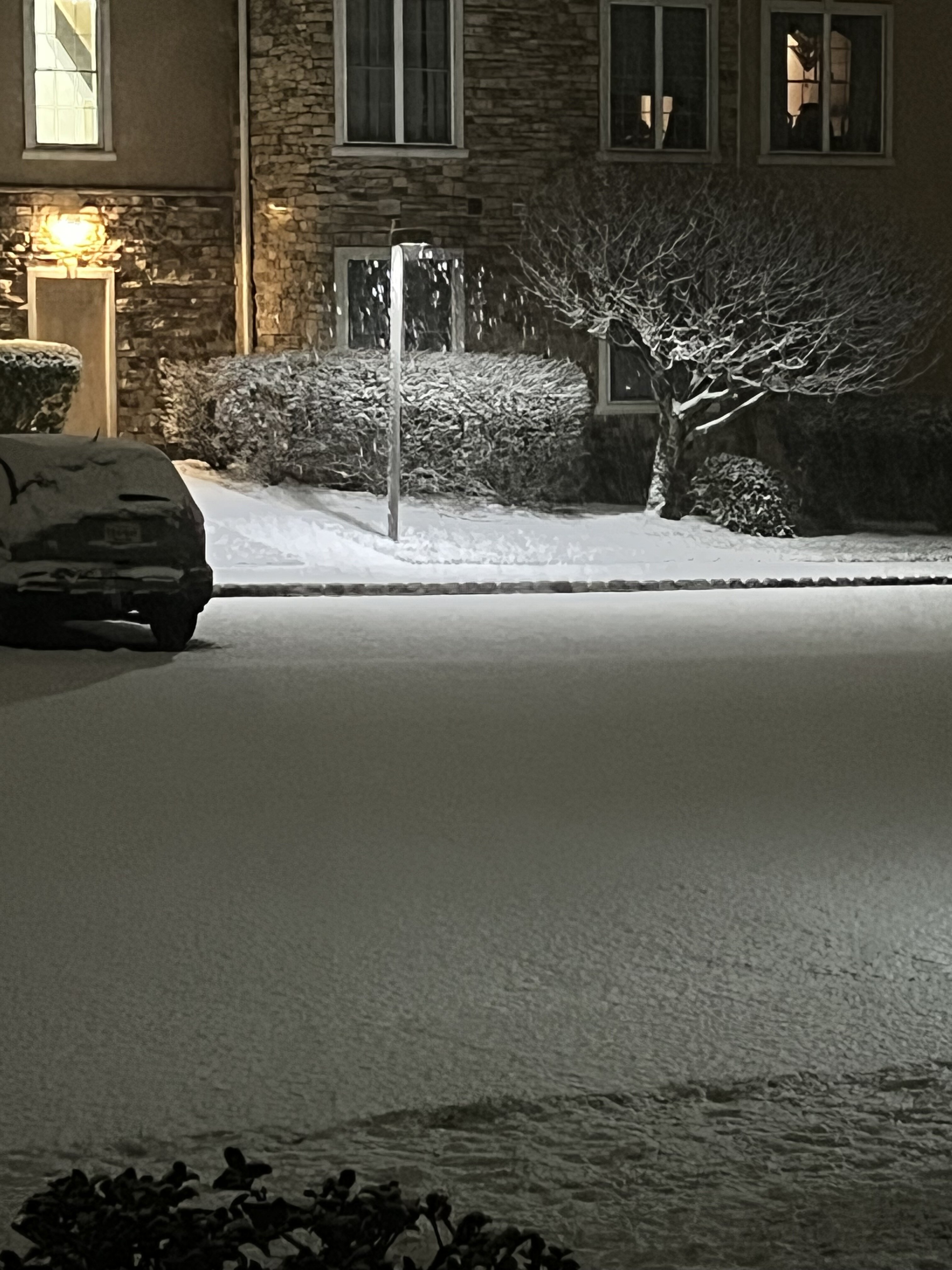
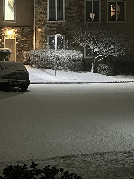
Rockaway NJ 2:50 am Morris County
-
This web site from COMET/Meted program
-
Refresher snow & obs between ~midnight and Noon Sat Feb 17 2024
Yaz replied to wdrag's topic in New York City Metro
Heavy snow Fords 31f -
The Dendrite growth should be very favorable but an above-freezing surface can spoil the ratio.
-
2/13 Significant/Major Winter Storm Discussion & Observations
Yaz replied to Northof78's topic in New York City Metro
-
2/13 Significant/Major Winter Storm Discussion & Observations
Yaz replied to Northof78's topic in New York City Metro
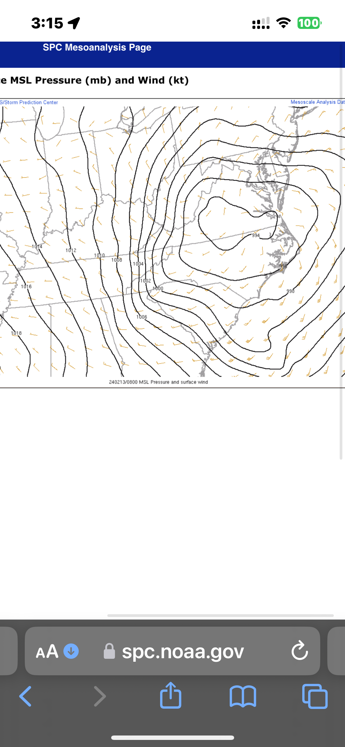
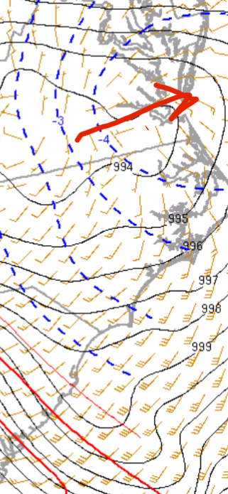
3 am. <994<994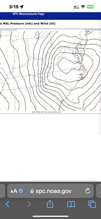
-
2/13 Significant/Major Winter Storm Discussion & Observations
Yaz replied to Northof78's topic in New York City Metro
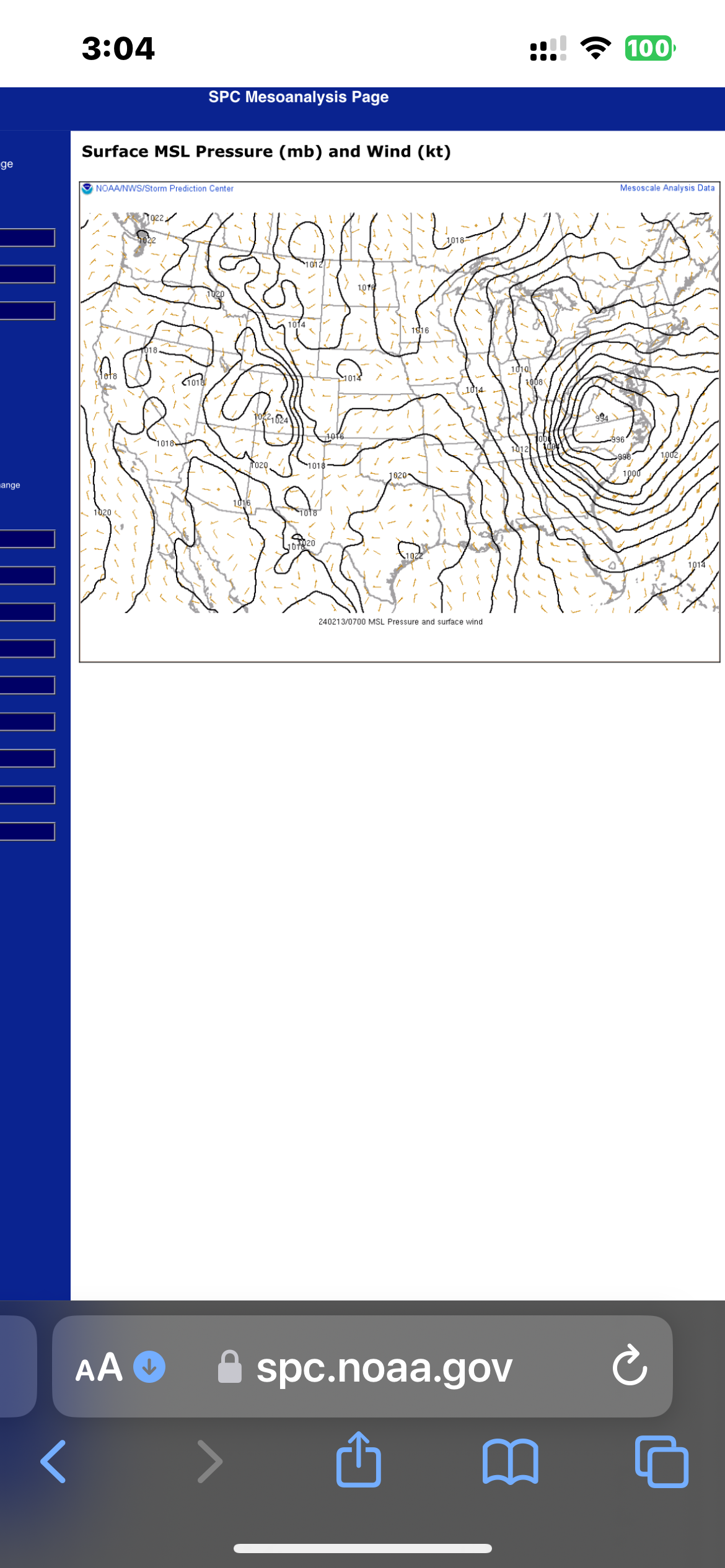
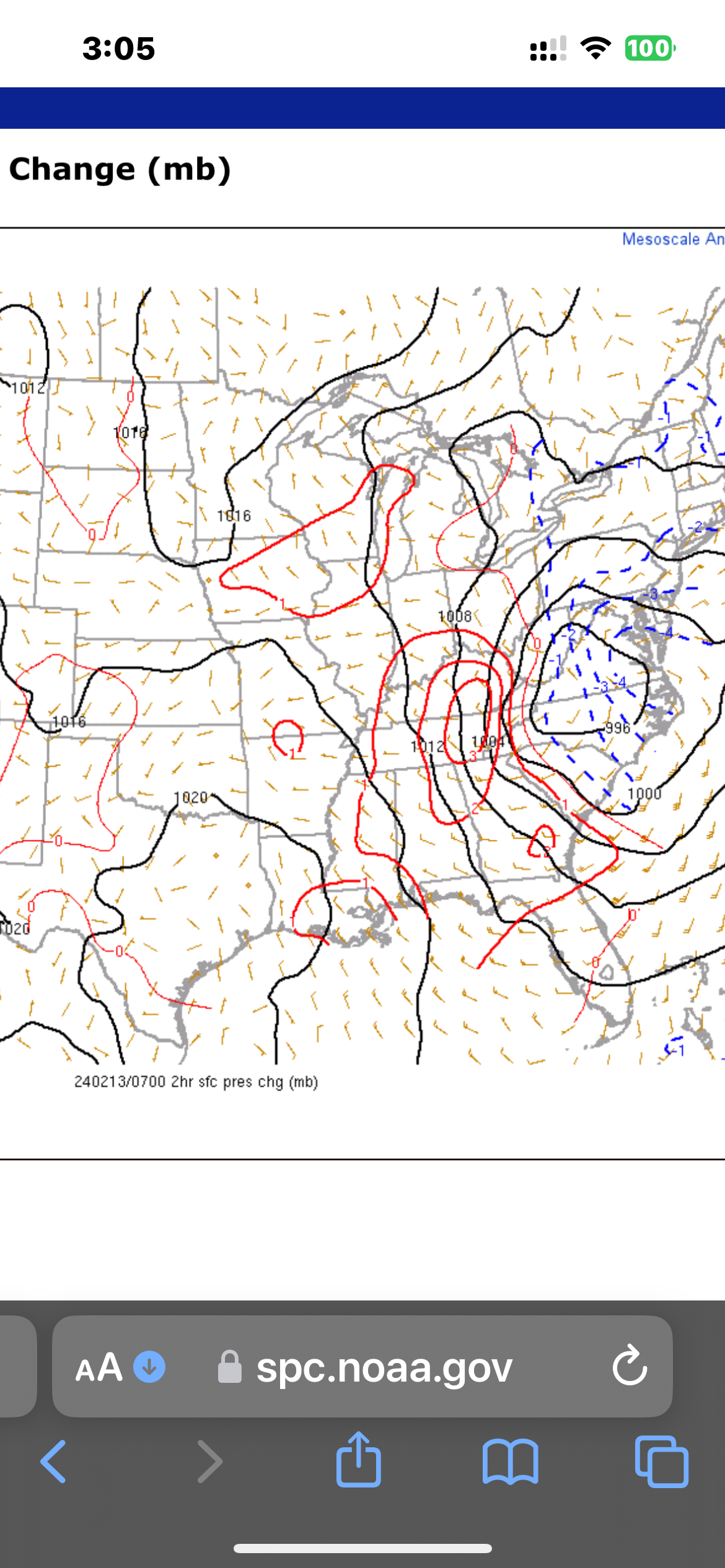
994. with 2 hr pressure tendency
-
2/13 Significant/Major Winter Storm Discussion & Observations
Yaz replied to Northof78's topic in New York City Metro
6z NAMers, bring it on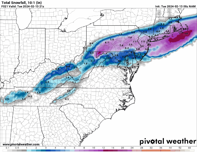
-
2/13 Significant/Major Winter Storm Discussion & Observations
Yaz replied to Northof78's topic in New York City Metro
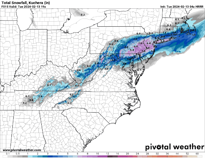
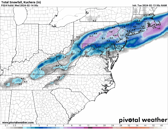
non Kuchie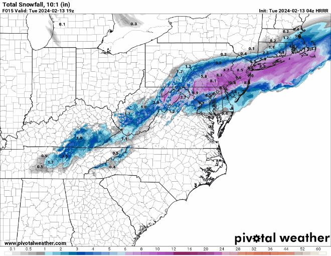
-
2/13 Significant/Major Winter Storm Discussion & Observations
Yaz replied to Northof78's topic in New York City Metro
HRRR 3 hr trend thru 19z indicating tick north and more qpf