Yaz
-
Posts
81 -
Joined
-
Last visited
About Yaz

Recent Profile Visitors
3,029 profile views


-
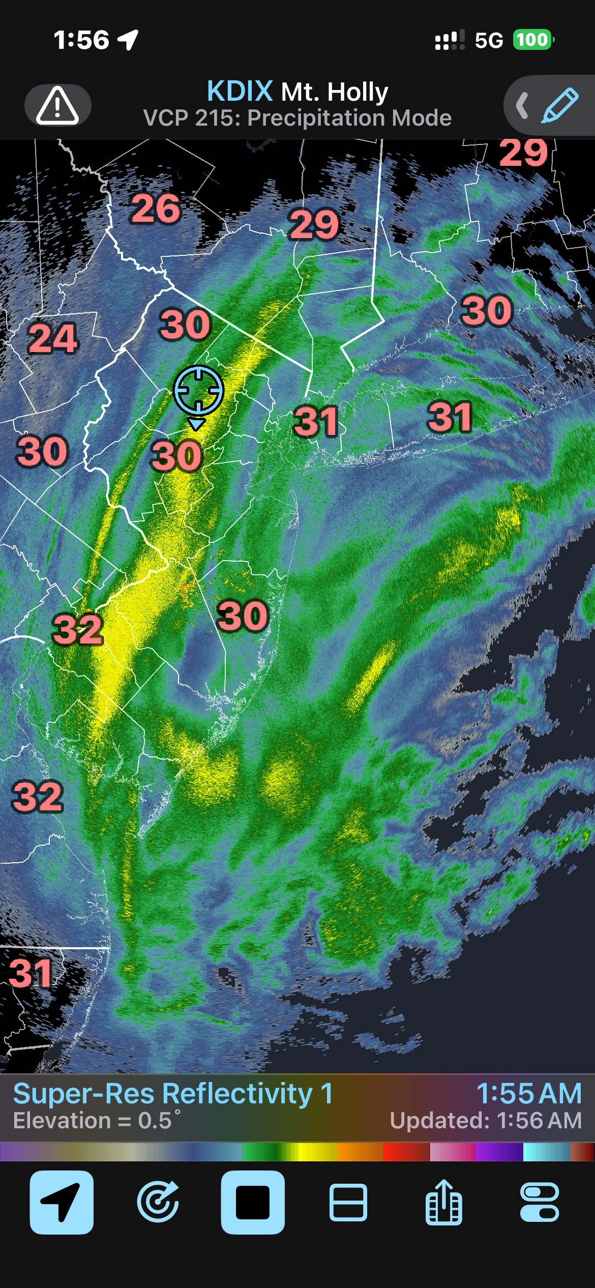
Near white out conditions in Rockaway NJ, in Morris County… heavy snow with blowing snow. I am under the yellow banding. Very , very cool!

-
Generally speaking, one major player increasing the snow to liquid ratio is to see high relative humidity (>80%) in the dendritic growth zone, which is the height range where temperatures are typically between -10C to -20C, combined with good lift (omega). However, the ratio can influenced by other factors (e.g. high surface wind can readily break apart the dendrites creating less more dense(more compact) surface accumulation).
-
Still monster snows for nyc
-
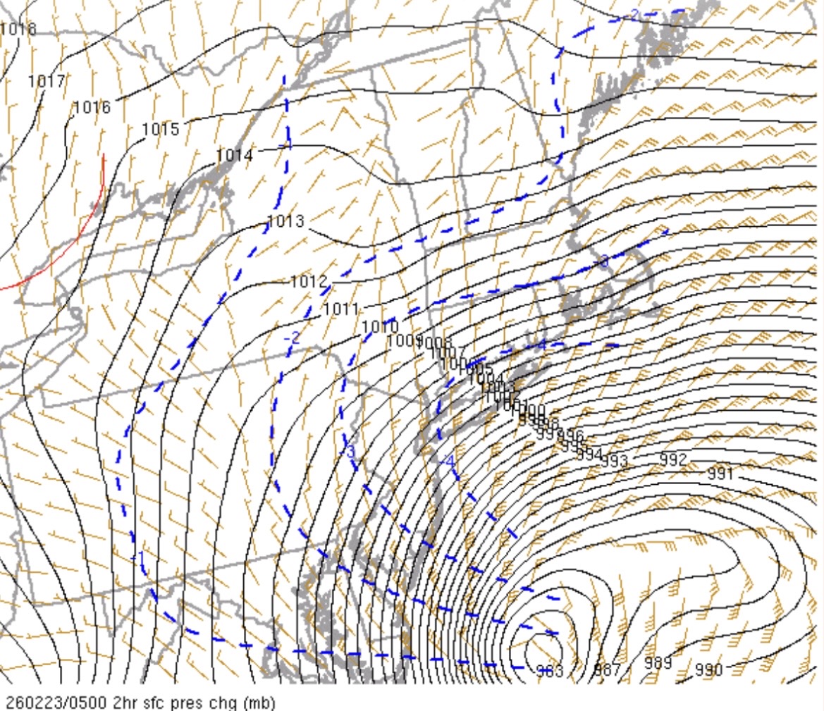
Yup…. just did not expect the primary to travel that far north.
-
Ukie inland?
-
can report a similar story in Rockaway- NJ.. the attached radar loop shows what almost looks like a thumb of echoes moving Northwest within the overall echoes (Norlan trof?) …this is on a 0.5 degree tilt 122725 3 am.mov
-
How far back does this go?
-
Isnt’t the Fv3 supposed to replace the GFS, or am I getting my models confused?
-
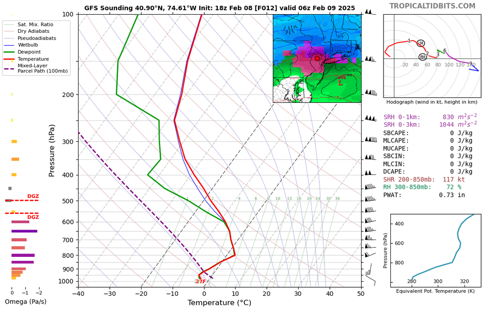
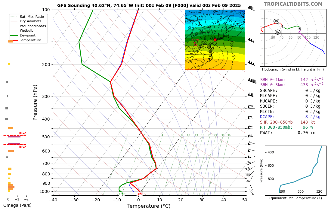
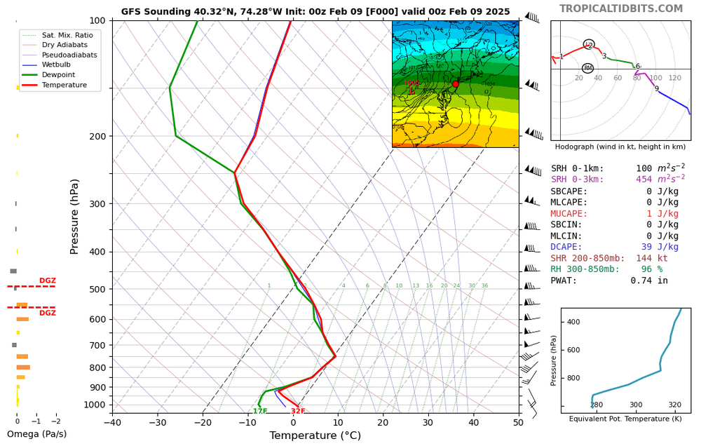
GFS 18z predicted warm nose never materialized ….0z initialization at two locations: so freezing rain never materialized

-
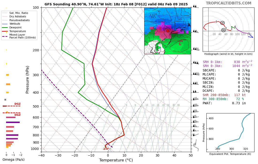
The GFS warm nose around 800 mb yielding the freezing rain….. let’s see if it will be correct or not for tonight.