
Alfoman
-
Posts
182 -
Joined
-
Last visited
Content Type
Profiles
Blogs
Forums
American Weather
Media Demo
Store
Gallery
Everything posted by Alfoman
-
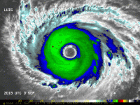
I think the rapid speed is one of the only real inhibiting factors at the moment. Looking at the profiles, dry air is still an issue ahead of the system, but generally Nana has created a fairly moist pocket around her with healthy expanding outflow to the east and west. Still some shear to the south of the system, but developing anticyclone in the upper levels will keep the environment favorable until landfall. Definitely could reach hurricane strength tonight into tomorrow
-
Jesus Christ. If you think this season is somehow inactive or "disappointing," you likely would have lost your mind tracking a season like 2014 or 2015 (just from recent memory). We just had one of the strongest landfalling hurricanes in US history before September.
-
For what it's worth, both the CMC and GFS have trended slightly weaker with the digging trough in the E US, which would reduce the southwesterly shear as 97L would theoretically make its way towards the GOM. The the large pocket of dry air above the moisture envelope for the wave plus the forward speed will slow down any progress until it passes 80W. Still think this could develop into a legitimate storm once it gets into the GOM.
-
This is typically what happens when you mix emotions into meteorology. Of course tracking long range hurricanes can be exciting for enthusiasts and professionals alike, but at the end of the day we are just observers. It can be difficult to separate the two when you enjoy the topic so much, and it can cloud your judgement to the point where you feel disappointed when death/destruction is not on the menu. It has happened to us all at some point. A weak storm that produces 2 ACE is still a designated tropical system that is worth observing, because at the end of the day it is a data point that will help improve future forecasting. But if his quote should bring anything to light, it is that you never know what a season will bring to the table until it is over. Two weeks can be the difference between a struggling tropical storm fighting off significant shear and multiple consecutive long-range MDR hurricanes. All we can do is watch.
-
Which paid model subscription do you think would provide me with the best graphics/access going into the hurricane season? I've probably held off on subscribing to a premium one for a decade, but I think it is finally the time, given I've finally graduated now.
-
I believe it gets that stigma because it models CAD events better than some of the other globals do when we're talking winter storms, but this overrunning setup is not usually what we are dealing with
-
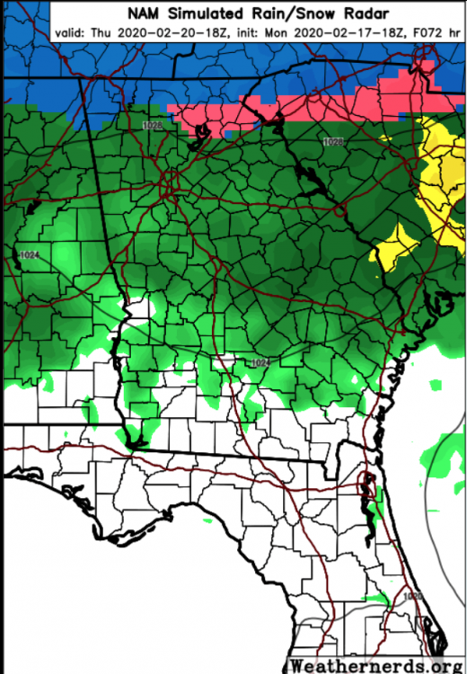
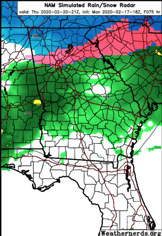
I do not think North Georgia is necessarily out of it at all. The discussion has been geared towards SC and NC because those are some of the most avid posters on the forum, however as the NAM 12k shows (obviously take this with a grain of salt), with crashing temperatures, we could see mixed precip in the second half of the event.
-
I feel like this will be the case with a lot of locations in central NC, NW SC, and NA GA. The rain/snow simulated radar mostly takes into account the modeled surface temperatures as being between 36-42, which translates to rain. But looking at the thermal profiles, you can clearly see an incredibly shallow warm layer at the surface that can easily be tweaked a few degrees between now and Thursday. This is a tricky setup and I do not think we get a real idea of what to expect temp wise until the hi-res models get into range. Right now we should be focusing on how the globals handle the energy transfer to our west and not expect the lower res sims to accurately depict surface conditions 84 hours out.
-
Go look at the 500h vort images to see where the true difference between the two lies. They seem all too similar at the surface, but the mechanisms behind the madness are far from the same
-
Damn this thread really did die after the last few model cycles, when it should absolutely not be. While looking at these could seem discouraging, the trends are subtle but where we want them to be in this time frame. This storm is five days away, and a suppressed look is not that bad of a thing to have at this point. From 6Z until 18Z on the GFS, we have seen the moisture slowly tick northward around 50 miles and in addition you can see the high in much better placement for cold transport from the NW compared to the last few runs. We do not get a thermal gradient threat very often for winter storms, but this is not time to give up. The players are still there and if we can get the energy to interact more with the northern stream like we see on the 18Z GFS then we still could be in business. Also I would air caution on just looking at snowfall outputs as the column above the surface is fairly cold (900 mb and above) and that would mix down with the right moisture levels.


