Alfoman
-
Posts
182 -
Joined
-
Last visited
Content Type
Profiles
Blogs
Forums
American Weather
Media Demo
Store
Gallery
Everything posted by Alfoman
-

2024 Valentines Day Who the Hell Knows - Comeback Thread
Alfoman replied to DDweatherman's topic in Mid Atlantic
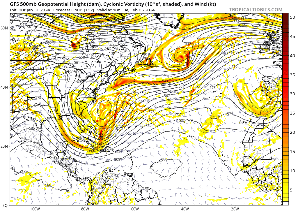
Almost identical low placement to 12Z, just more amped and axis of precip moves north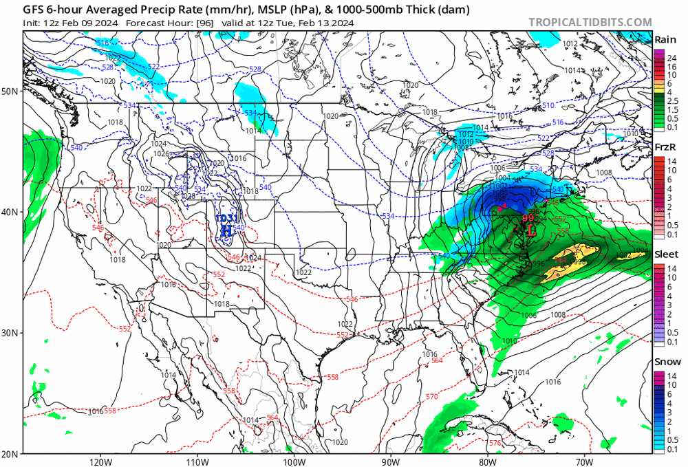
-
2024 Valentines Day Who the Hell Knows - Comeback Thread
Alfoman replied to DDweatherman's topic in Mid Atlantic
Surface low slightly more north and more amped through 72 hours Edit: We need this to slow down or our cold press continues to get worse moving into the window, GFS progressively speeding this up slightly each run -
2024 Valentines Day Rain/Snow/Who The Hell Knows Thread
Alfoman replied to WinterWxLuvr's topic in Mid Atlantic
This one seems out of reach yet we haven't played our ultimate trap card just yet.... Open a new thread -
2024 Valentines Day Rain/Snow/Who The Hell Knows Thread
Alfoman replied to WinterWxLuvr's topic in Mid Atlantic
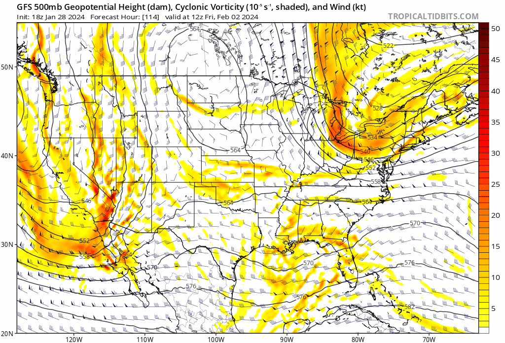
Surface low just behind WV at Hour 108, definitely a tad bit faster than 12Z -
2024 Valentines Day Rain/Snow/Who The Hell Knows Thread
Alfoman replied to WinterWxLuvr's topic in Mid Atlantic
Tad bit quicker so far and thevort closes off 6 hours sooner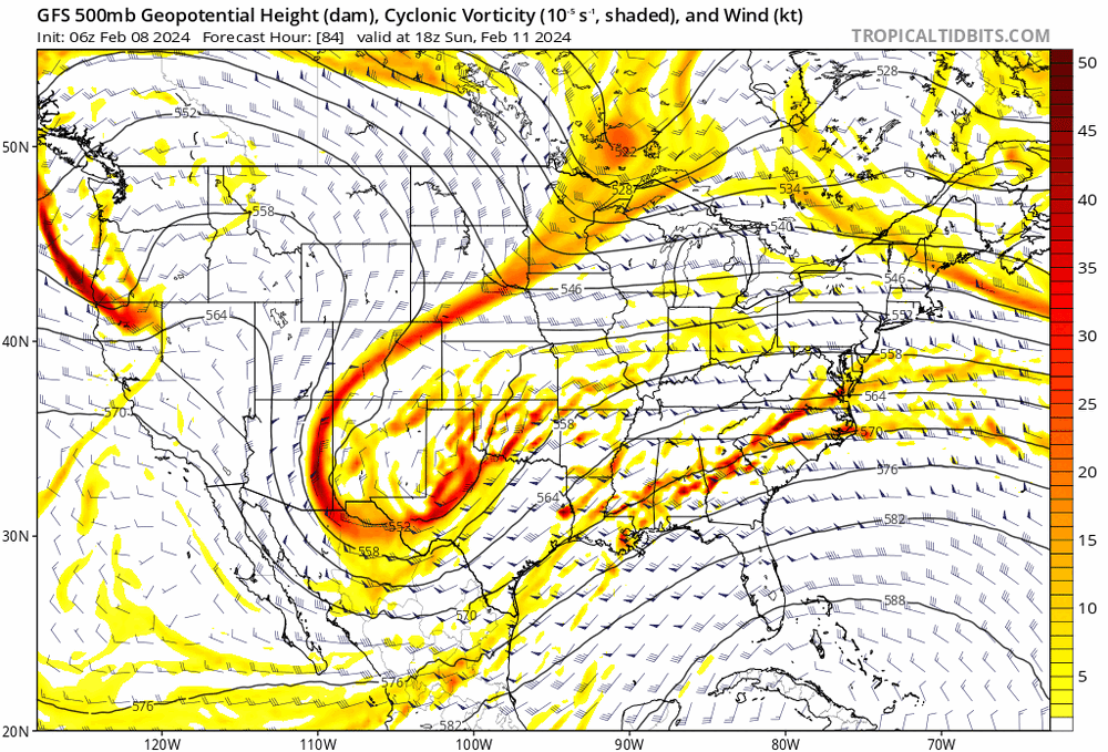
-
2024 Valentines Day Rain/Snow/Who The Hell Knows Thread
Alfoman replied to WinterWxLuvr's topic in Mid Atlantic
Last several storms we've looked at this winter, the GFS has trended towards increased wave separation in the medium range (3-5 days) and has lead the others in that regard - including the initial Jan storm (rain here) and I believe both of our small snowstorms mid-month. While not an ideal setup for us, I won't say its dead until we're inside 3 days -
Can't wait for us to track the end of February period and get a big storm on the models...only for most of us to miss it to the south or north after all the anticipation FRINGEEEEEEEEEDDDDD
-
If the last two weeks of February into the beginning of March verify as they are modeled at the moment - you couldn't say that the seasonals were completely off base. They're used as a guide to the longwave pattern progression, no one is using them to pinpoint exact week-by-week shifts. Being off by two weeks and then getting it right would be a crazy good win for the seasonals.
-
Wall to wall cold and snow for a chosen two week period during the winter is just absolutely never a guarantee when you live in and around the MA region. Mod El-Nino or not, breaks and warm ups happen even in our greatest of years.
-
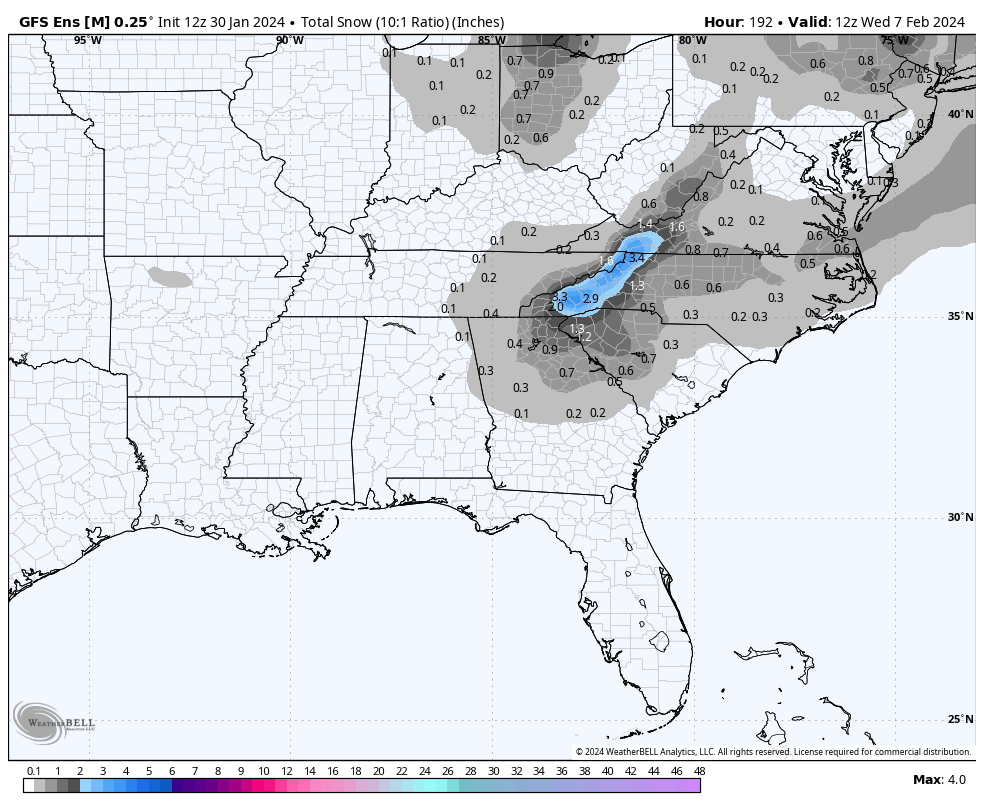
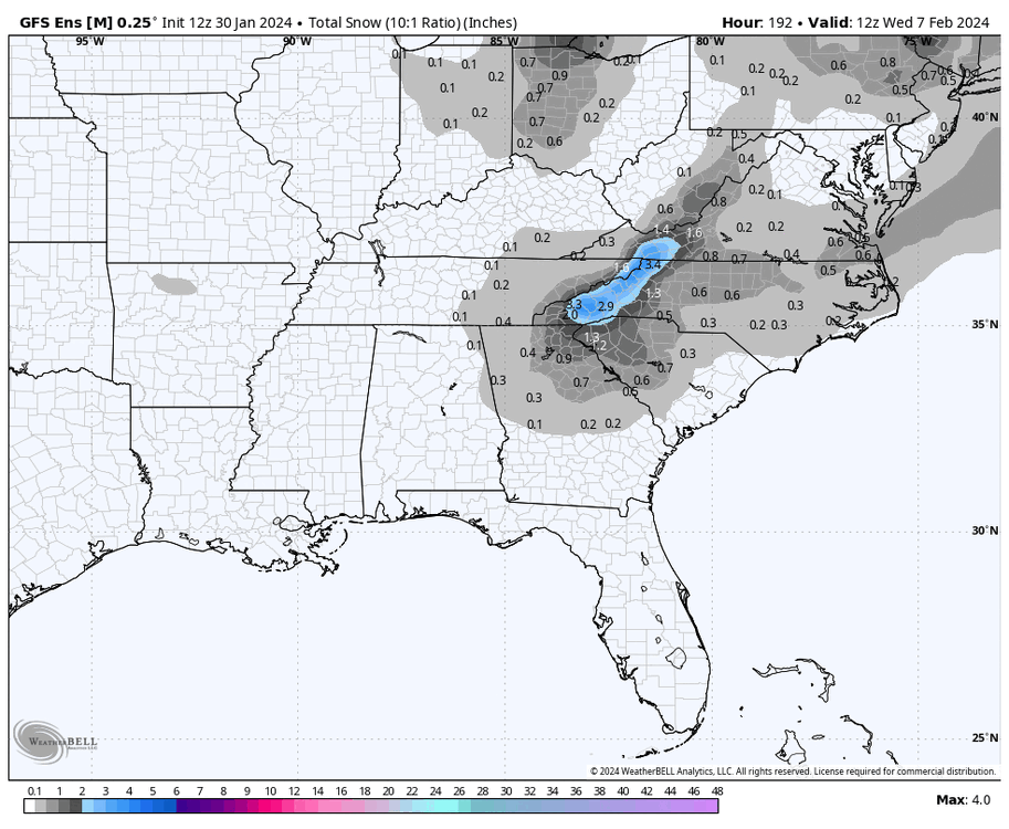
On this note - interesting progression of the snow outputs on the GFS Ens the past few runs. While it is likely skewed by a few members that bomb out, nice to see a strengthening of the output along the MA coast
- 2,509 replies
-
- 1
-

-
- weenie fest or weenie roast?
- weenies got roasted
- (and 2 more)
-
While I understand this storm is holding on by its fingernails at this point in time, I find the model trends interesting the last 24 Hours. It seems as if there is a phase to be had but it happens well off-shore. How much more would the NS SW need to come westward for the interaction/phase to happen in time for us to benefit?
-
Jan/Early Feb Medium/Long Range Discussion Part 3
Alfoman replied to WinterWxLuvr's topic in Mid Atlantic
18Z GFS rolling now...crazy east trend continues for that shortwave to our NE past 5 runs
-
Jan/Early Feb Medium/Long Range Discussion Part 3
Alfoman replied to WinterWxLuvr's topic in Mid Atlantic
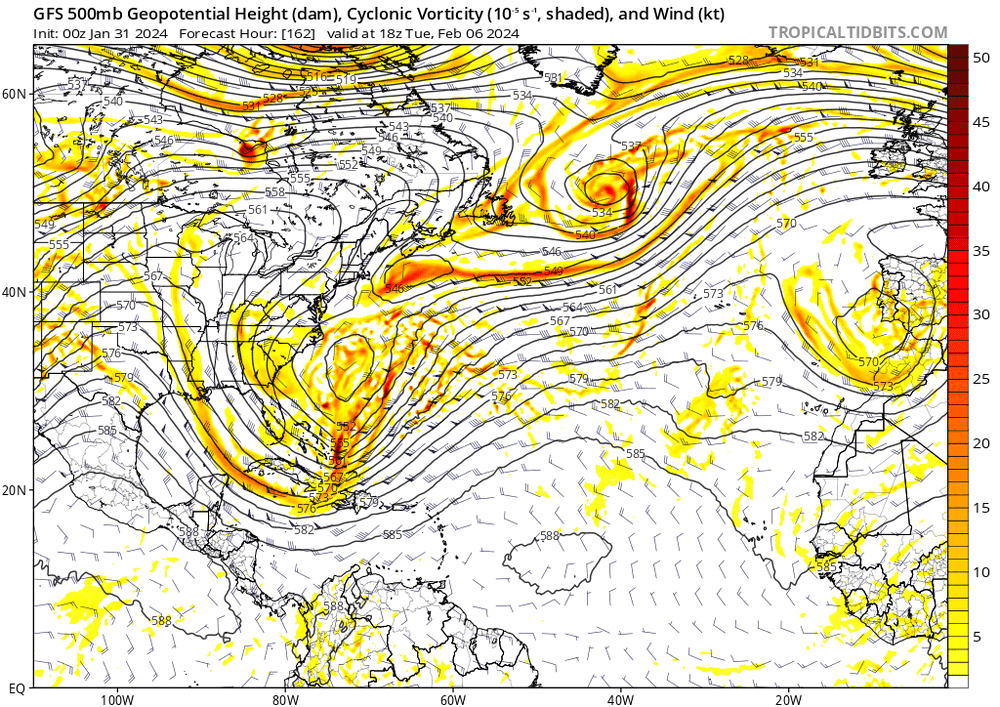
This scenario is such a delicate balance. The separation with the lobe over NE Canada is what allows the ULL to strengthen and pull northward in the first place, however that also can serve as our cold air source if we can get the surface High over Quebec to stay in position and provide CAA towards CAD regions. Current evolution on the GFS is cold enough here as you can see the negative 850 mb temps being pulled into the DMV area as the low bombs off-shore but the lack of precip means there is no cooling at the surface which explains the surface temps in the mid/upper 30s. If the NS energy moves too far offshore, the cold air source is now gone and we are left with marginal temps at best. A phase would allow a bomb off the coast and the colder temps to be pulled in, but that scenario needs perfect timing for the phase... The players are all on the table though. -
Jan/Early Feb Medium/Long Range Discussion Part 3
Alfoman replied to WinterWxLuvr's topic in Mid Atlantic
You saw this with the beginning of January when the pattern began changing - the models had a 4-5 stretch with much lower verification scores as they tried to adjust and figure out the synoptic evolution progressing. -
That doesn't matter if you get under some decent rates even with terrible ratios. NAM has surface temps around 34-35, a little cooler than 18Z, that could easily accumulate on grass. Could be fun to watch fall if we got lucky here at the least!
-
Jan/Early Feb Medium/Long Range Discussion Part 3
Alfoman replied to WinterWxLuvr's topic in Mid Atlantic
You need a reliable mechanism to get sustainable cold air into the region that doesn't get pushed out by every cutter. Only way to beat that is an incredibly timed system that threads the needle coupled with a well placed 50/50 on its way out. Going to be difficult to escape our glorious cutters the next 10 days or so as we wait for that Pac Jet to clam down moving into early Feb. If you want snow in the area though, look out your window tonight -
Jan 19th Snow on Snow: the this always works until it doesn't thread
Alfoman replied to psuhoffman's topic in Mid Atlantic
See the difference of the vort trending south and the LP north on the NAM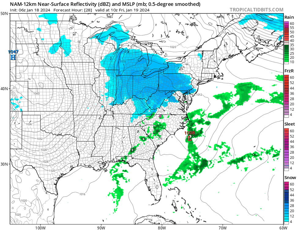
-
Jan 19th Snow on Snow: the this always works until it doesn't thread
Alfoman replied to psuhoffman's topic in Mid Atlantic
Looks like the heaviest snow producer could be the overnight 5 AM band as the LP shifts towards the coast. The path towards success is a stronger more organized LP off the NC coast. This would make temps slightly more marginal but I think it would be a worth it trade off for I-95 -
Jan 15-16 Storm Threat Thread: Do we finally win or get Saltburned?
Alfoman replied to H2O's topic in Mid Atlantic
Never doubt Papa Euro- 425 replies
-
- 2
-

-

-
- jinx
- kiss of death
- (and 3 more)
-
Jan Medium/Long Range Disco 2: Total Obliteration is Coming
Alfoman replied to Jebman's topic in Mid Atlantic
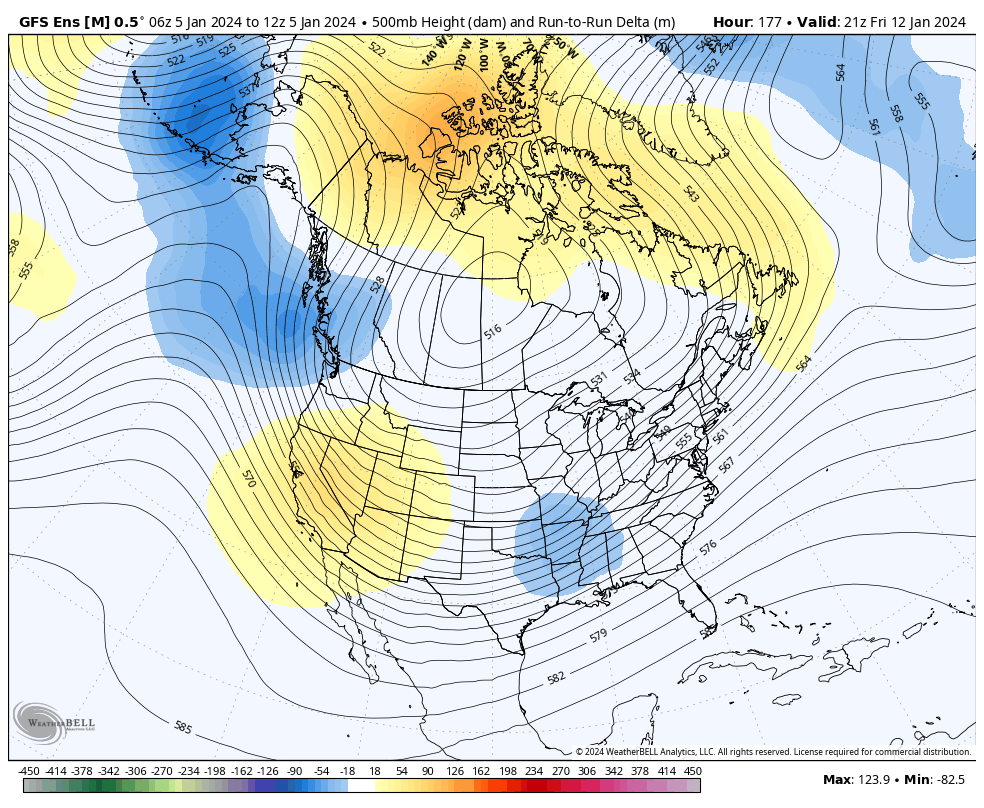
I believe this is what Heisy was mentioning on a previous page, but increased separation between these NS SWs is evident on the GFS the past few runs - this leads to a flatter evolution of our southern stream interaction for the 16th. While it is not a significant amount, the 12Z Euro moved towards more separation here as well (like it had yesterday at 12Z actually). I've been noticing this so far with the GFS this winter, it seems to be the first to sniff out how far energy will pull back in general. It lead the charge for a flatter and weaker 500 mb vort evolution for our last storm in the Day 3-5 range which ended up being the correct forecast compared to more progressive CMC and Euro solutions. Something to keep in mind.
-
Jan Medium/Long Range Disco: Winter is coming
Alfoman replied to stormtracker's topic in Mid Atlantic
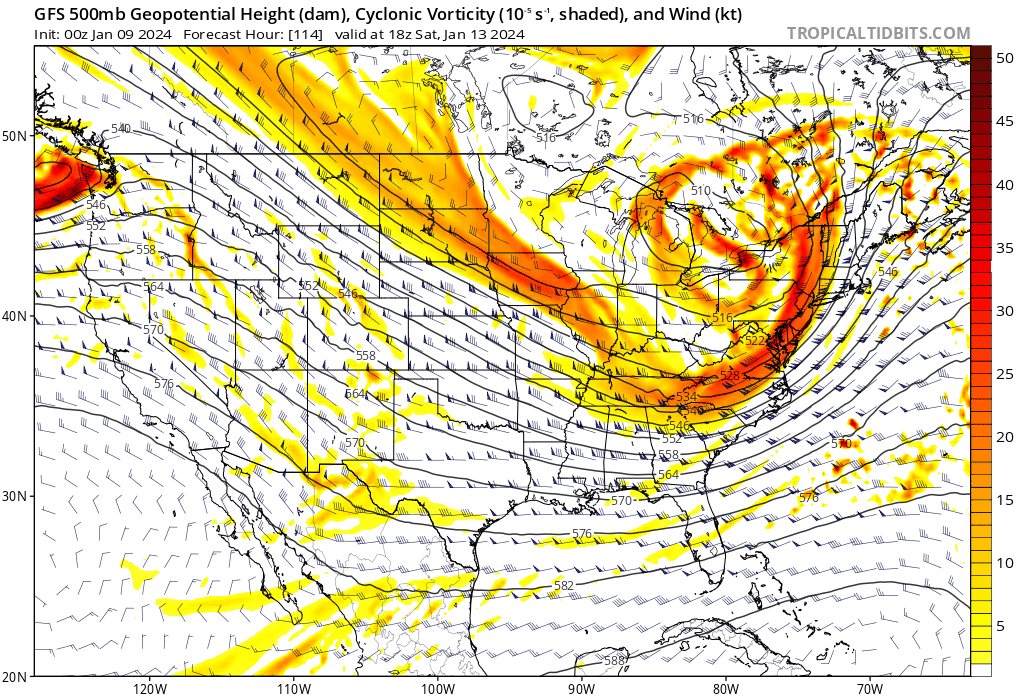
My god that cold push at hour 168 is insane - 0's and below down to Arkansas -
Jan Medium/Long Range Disco: Winter is coming
Alfoman replied to stormtracker's topic in Mid Atlantic
Still new to what's favorable for the MA region but should have known better than the B-word. -
Jan Medium/Long Range Disco: Winter is coming
Alfoman replied to stormtracker's topic in Mid Atlantic
What would it take to bring this south and maybe turn it into a Miller B transfer in a favorable spot for the MA for next weekend?
-
Jan Medium/Long Range Disco: Winter is coming
Alfoman replied to stormtracker's topic in Mid Atlantic
Interesting to watch the evolution of the blocking pattern on the last few runs of the CMC Ens - can't say I don't enjoy it -
Won't ever take Hours 60+ on the NAM with any sort of seriousness - but on that note, there was better confluence and slightly lower surface temps this run.