weatherbook
-
Posts
62 -
Joined
-
Last visited
Content Type
Profiles
Blogs
Forums
American Weather
Media Demo
Store
Gallery
Everything posted by weatherbook
-
I think it's fairly unique to our region because we have the potential to have big snows, and have a rich history of big snowstorms, but it rarely happens. Only a handful of HECS in most of our lifetimes. But people in Buffalo, who receive a lot of lake-effect snow, would be similar to us in D.C. tracking thunderstorms in the spring. It happens a lot, and if it misses, no big drama. Most of us don't track rainstorms that underperform or miss us. On the flip side, my coworker in Ottawa, Canada, just got buried yesterday in snow and he hates snows. If we had multiple two-foot snowstorms a winter, it would not be as fun for many.
-
For those of us who enjoy radar hallucinations, it's looking good so far: https://weather.cod.edu/satrad/?parms=regional-southcentral-comp_radar-24-1-100-1&checked=map&colorbar=undefined
-
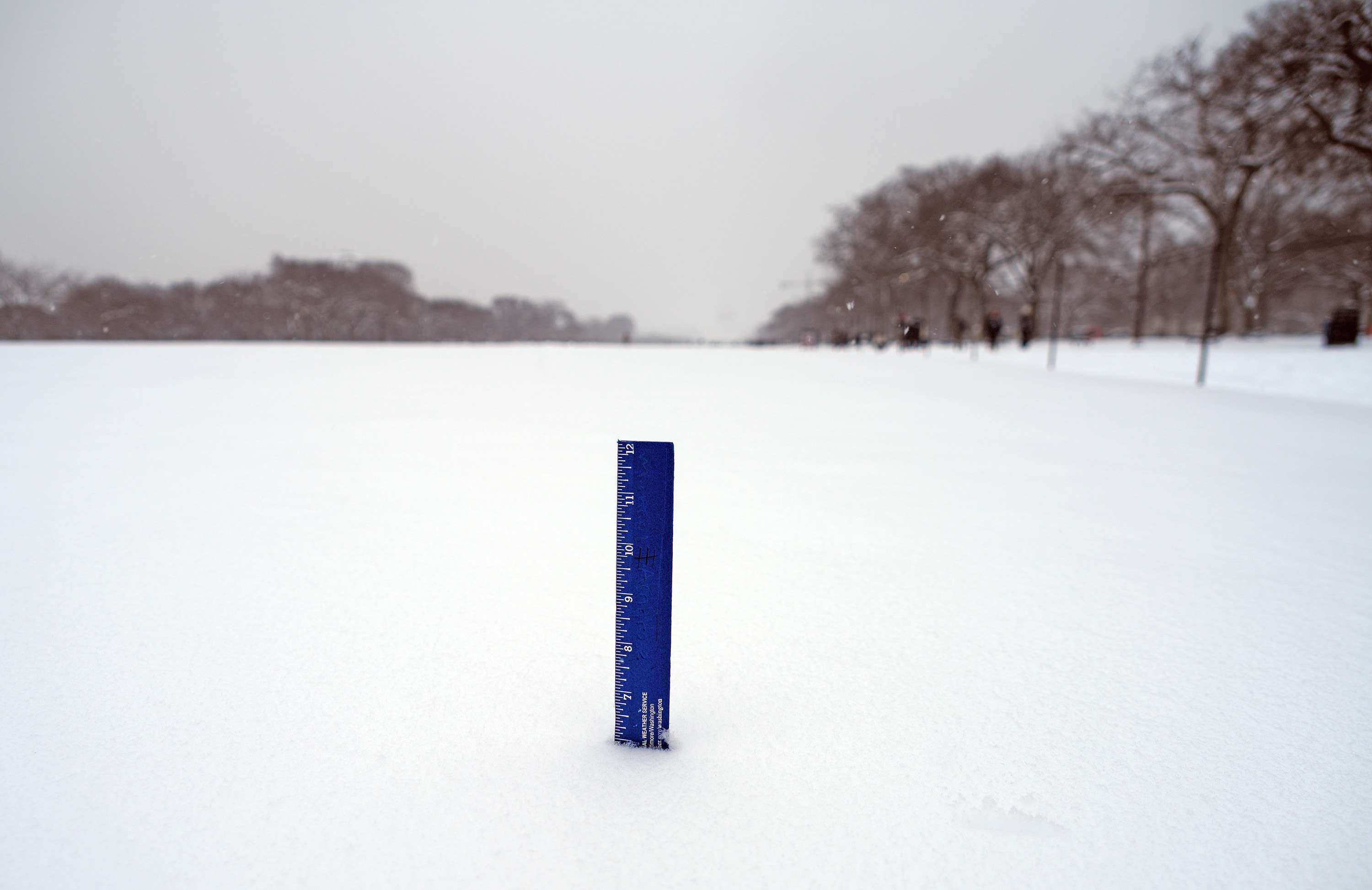
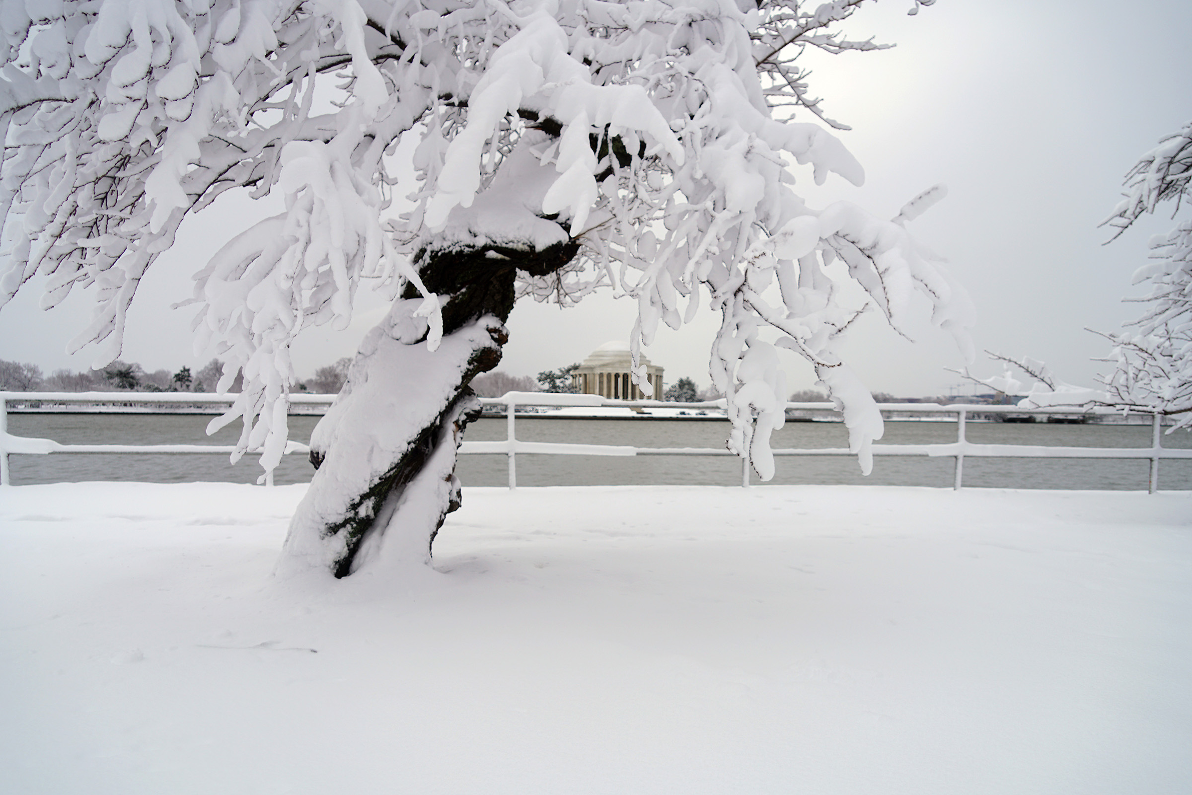
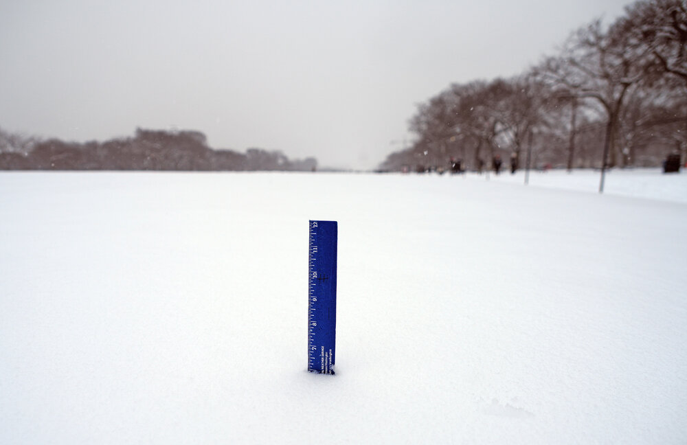
The snow depth on the National Mall this afternoon was six inches.
-
The band extends west through Fairfax County and has produced some of the best snowfall rates in Oakton that I've seen with this storm.
-
Heavy snow now in the band that bisects Fairfax County.
-
LOL. I stay home during the big storms. Maybe Tuesday or Wednesday I'll venture to the Mall.
-
Light snow finally started in Oakton, Va.
-
2024 Valentines Day Who the Hell Knows - Comeback Thread
weatherbook replied to DDweatherman's topic in Mid Atlantic
About .5" near Oakton, Virginia. The roads were briefly slush covered. 
-
Jan/Early Feb Medium/Long Range Discussion Part 3
weatherbook replied to WinterWxLuvr's topic in Mid Atlantic
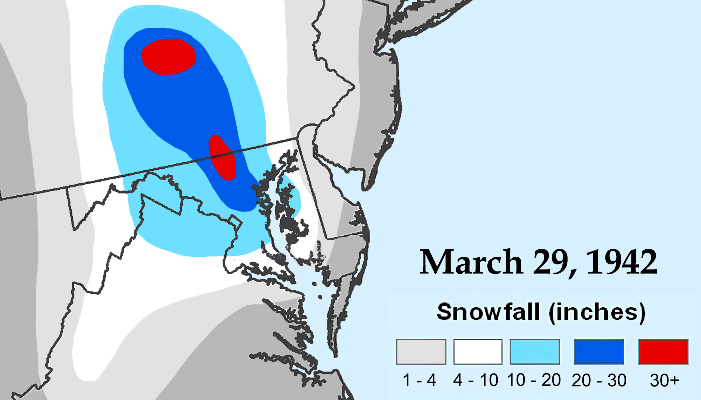
March 1993 was way bigger and covered a very large area, but for Baltimore, the snow was not as deep as 1942. Here's a comparison for Baltimore: 1942 produced 22" of snow with 2.05" liquid content, and 1993 produced 11.5" of snow with 2.45" liquid content. -
Jan/Early Feb Medium/Long Range Discussion Part 3
weatherbook replied to WinterWxLuvr's topic in Mid Atlantic
1942 was big. Even bigger than 1958 for the greater DC area.
-
Jan/Early Feb Medium/Long Range Discussion Part 3
weatherbook replied to WinterWxLuvr's topic in Mid Atlantic
1977 was impressive because snow was on the ground at DCA for 24 consecutive days from three back-to-back snowstorms in early January that only dropped a total of 8.7" of snow. The snow didn't melt for weeks. However, in 1961, there were 30 consecutive days of snow cover at DCA in late January and early February from six snowstorms that dropped 31.6" of snow throughout that period. The winter of 1960-61 also had 16 consecutive days of snow cover at DCA in mid-to-late December which included a white Christmas. What a great winter! -
I'm under the green and yellow radar returns northwest of Fairfax. Heaviest snow of the day by far.
-
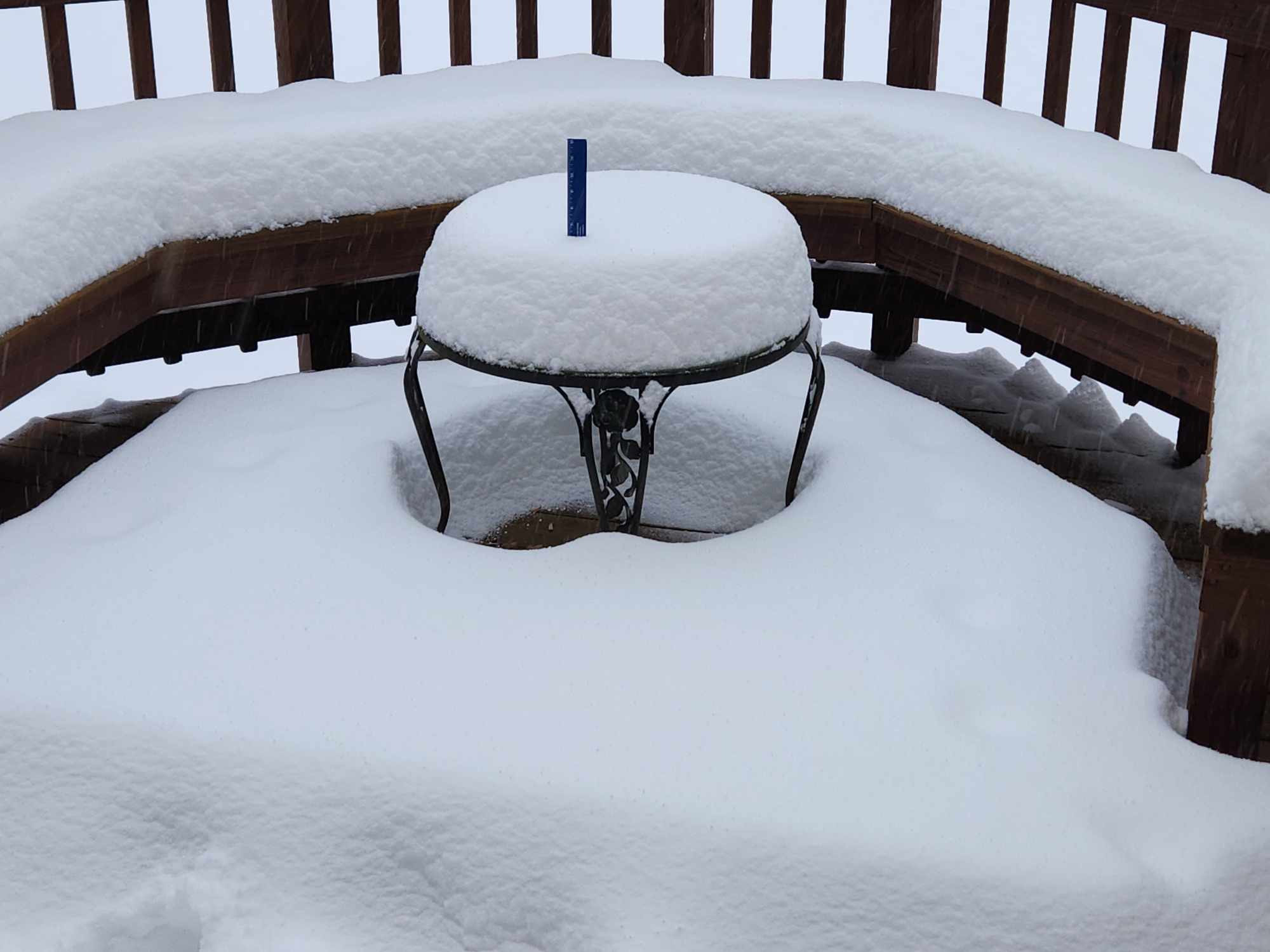
2.75" so far today in Oakton, VA and over 6" snowpack on the deck.

-
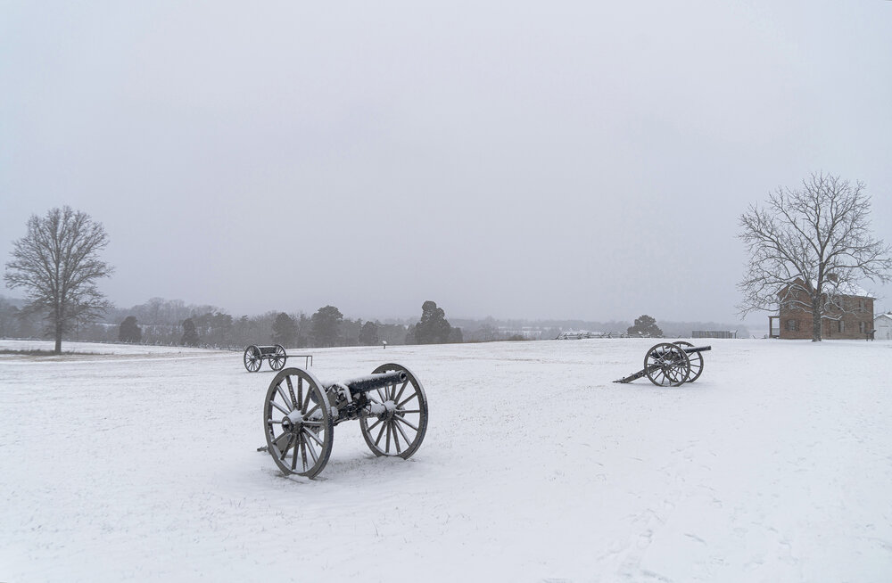
The Manassas Battlefield Park did well with the morning snow bands. There was about two inches of snow on the ground by 3:30 this afternoon.
-
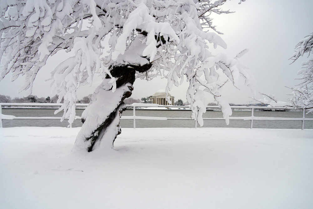
D.C. had a winter storm warning on Jan 3, 2022. I measured about 8" at the Tidal Basin. It was a classic D.C. snowstorm.
-
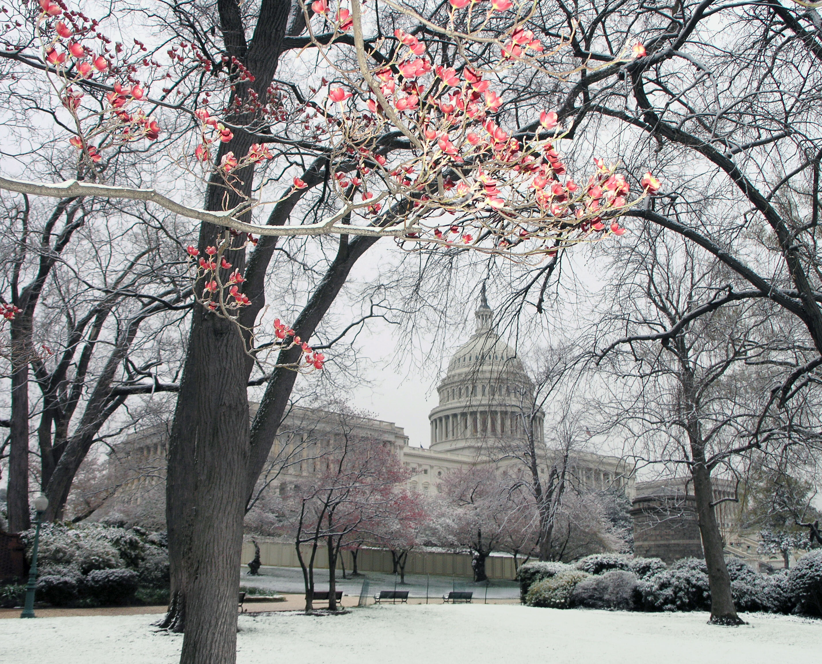
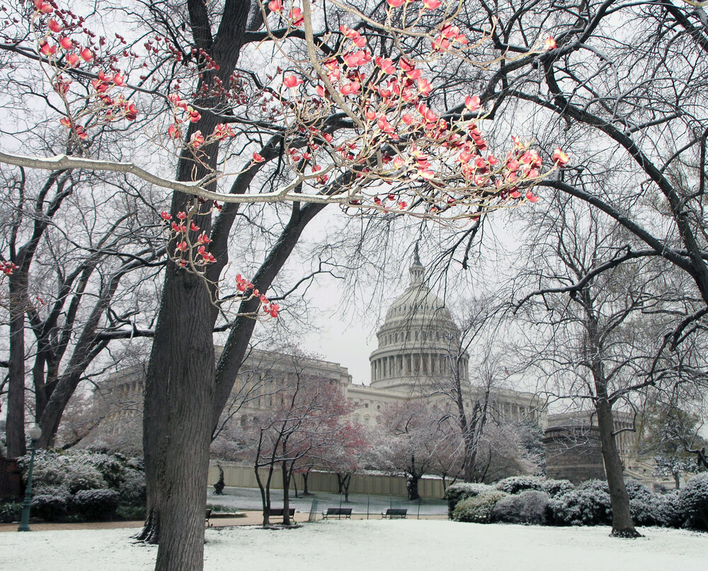
As recently as April 7, 2007, it snowed about an inch in D.C., but 0.4" was the official measurement at DCA. Here's a shot I took that day at the Capitol.
-
3/12 Event: Winters Last Hurrah at Least East of Mountains
weatherbook replied to Weather Will's topic in Mid Atlantic
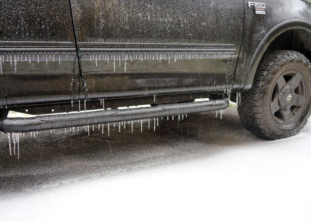
A bumper of a F-150 is not a great snowboard, but it provided the deepest snow measurement. The average measurement was 3.2" near Oakton, Va. That last snow burst was impressive.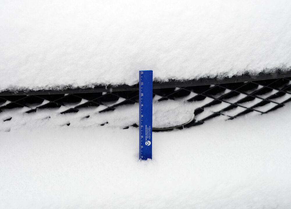
-
3/12 Event: Winters Last Hurrah at Least East of Mountains
weatherbook replied to Weather Will's topic in Mid Atlantic
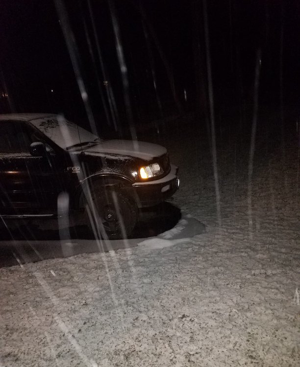
2.4" near Oakton, Va.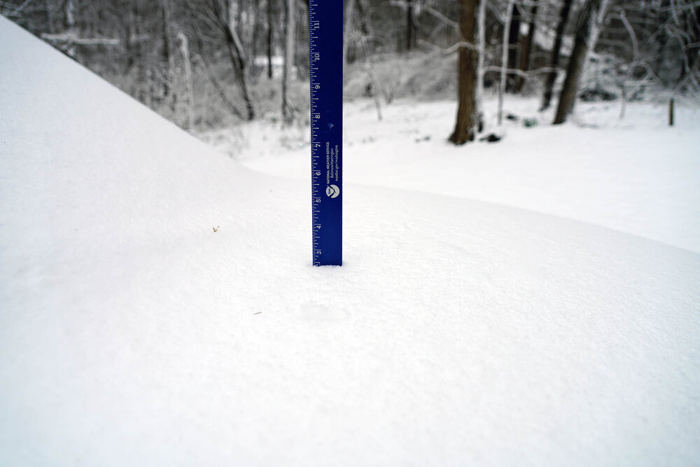
-
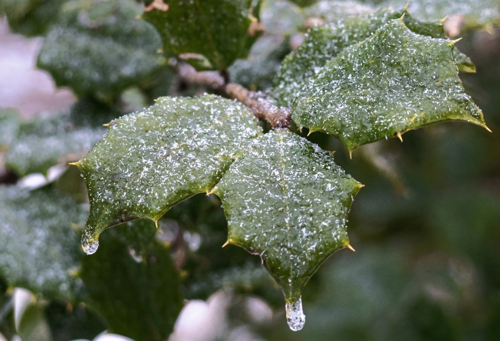
Here's a close-up of the needle-shaped snow crystals that fell this afternoon with the sleet.
-
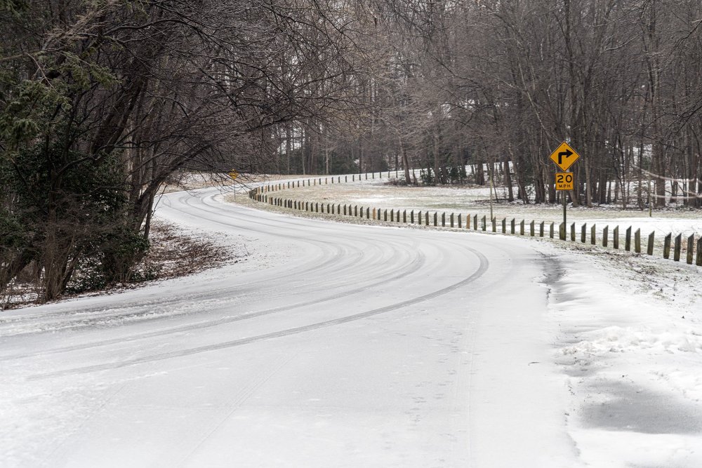
Sleet-coated road in Oakton, VA this afternoon.
- 891 replies
-
- 11
-

-
Between Oakton and Chantilly, the sleet has mixed with small, needle-shaped snow crystals. My driveway is encrusted with a thick layer of sleet.
-
0.3" in Oakton, VA>
-
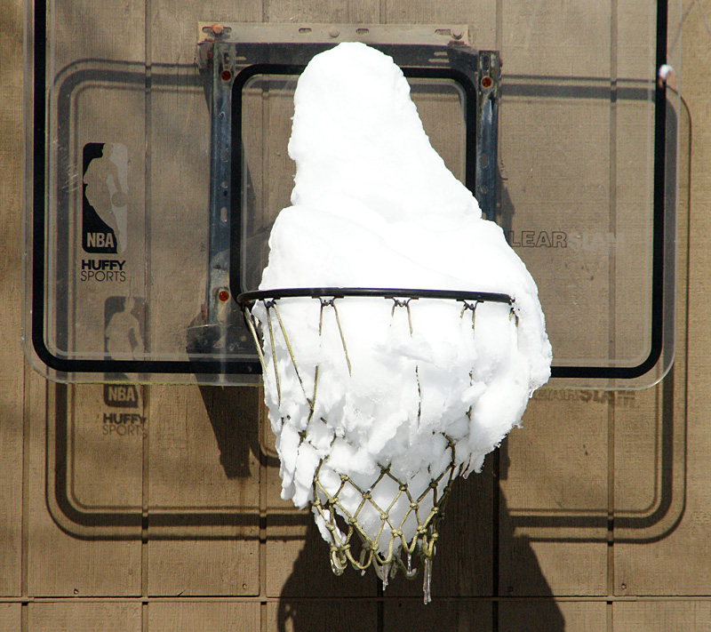
This has become one of my favorite photos of Snowmageddon. It shows the depth and density of the snow. You'll never see this kind of photo with lake-effect snow.