

RCNYILWX
-
Posts
3,225 -
Joined
-
Last visited
3 Followers
About RCNYILWX

- Birthday 05/27/1984
-

2025 Short Range Severe Weather Discussion
RCNYILWX replied to Chicago Storm's topic in Lakes/Ohio Valley
The potential is def there for a very favorable low topped supercell sig tor environment, particularly if the more aggressively moist HRRR/RAP depictions pan out. Glad SPC bumped up the tornado threat. Other than being a little surprised Bentley went right to the 10% hatched (vs. unhatched 10% or perhaps a smaller 5% tor) given questions on the specifics with the moisture and the resulting 0-3km CAPE, nice outlook and well written discussion. I'm liking near/south of the IL and Kankakee River in LOT CWA, which gives more wiggle room south of the warm front given the ~40 kt SSW Bunkers right mover vector, and low hodographs have generally looked a little better with southward extent in the warm sector within the CWA. Might see about chasing (for the first time since 2016) since I won't be called into work after working 7 shifts in a row.- 50 replies
-
- 10
-

-
Spring 2025 Medium/Long Range Discussion
RCNYILWX replied to Chicago Storm's topic in Lakes/Ohio Valley
Timing currently looks unfavorably late locally (LOT/Chicago metro) on Friday regarding any substantial severe threat. Since these deep negatively tilted troughs/closed ULLs often trend slower, the system slowing more into Sat may be the best path to getting some severe into the CWA. Sent from my Pixel 9 Pro using Tapatalk -
Fall/Winter '24 Banter and Complaints Go Here
RCNYILWX replied to IWXwx's topic in Lakes/Ohio Valley
And now, they froze our GSA credit cards. I will say, the commitment to the bit of hurting fellow Americans at all costs by any means is quite something. The level of brainwashedness to be able to hate a group of actually hard working people in the federal govt that don't apply politics to the jobs we do has to be unprecedented in modern history. Edit: Sorry, not frozen, a $1 limit [emoji51] -
Fall/Winter '24 Banter and Complaints Go Here
RCNYILWX replied to IWXwx's topic in Lakes/Ohio Valley
Thank you for the words of support. It's comforting to know that there's a lot of people who are angered about this nightmare and have our backs. I agree that there's outright fear among non hardcore MAGAs in the GOP. I think that's a big driver in the rubber stamping of unqualified nominees to Cabinet positions and the silence on the monstrosity of DOGE. But they're gonna be getting more and more anger from constituents considering the high approval ratings of NOAA/NWS and other agencies. Ultimately, all we need is a few to be unexpectedly brave given the small margins, and it gives me a small sliver of hope. That said, you're absolutely right the people in this administration could care less - they're carrying out the Project 2025 playbook that Trump laughably disavowed. So if we don't get a few GOP reps to flip, things will continue to get worse and even those of us in the agency for 10+ years are probably in jeopardy of being laid off. -
Fall/Winter '24 Banter and Complaints Go Here
RCNYILWX replied to IWXwx's topic in Lakes/Ohio Valley
Horrible day and the worst is still yet to come. For those of us in the thick of it, we need the support of everyone who appreciates what we do. Contact your Congressional representatives. The staffing shortages caused by the fork and now the probationary employee firings have us on defcon 2 level in terms of how bad it is. The goals of the people staffing this admin will get us to defcon one and beyond. I've been in the NWS since 2009 and I fear for my job at this point. They're demanding RIFs (reductions in force plans) by March 13th. This stuff technically is illegal and could be stopped by Congress if GOP Senators and Reps muster up the will to stand up to this for once. Not very optimistic about it, but maybe understanding that offices in their states or districts would have to close and services degraded, and the flood of complaints from constituents can make a difference. Sent from my Pixel 9 Pro using Tapatalk -
Maybe someone more intricately involved in NWP can chime in, but my perception from my NWS career (started in Feb 09 at OKX) and my hobbyist phase going back years before that, is that modeling has grown less stable at closer in lead times on the most important details for system evolution. I think that global modeling systems are better than they've ever been at nailing the large scale pattern at long leads, but these large swings inside D5 feel more common to me than back in the 2000s and 2010s. My theory is that it's partially related to faster flow due to CC and partially related to ever increasing resolution (high resolution garbage in still = high resolution garbage out; ie. errors in those high res details, such as convective parameterizations, reach many of the members which all have the same physics and then amplify). I have no idea if I'm right on this, but I'm def interested in hearing from others better versed than me. Sent from my Pixel 9 Pro using Tapatalk
-
Heh, revisit my 2nd post about a 4-7"/5-8" type event for the Chicago metro going to 1-5" in 2 days. Sent from my Pixel 9 Pro using Tapatalk
-
We've definitely been on the cusp of something better but had too much predominantly dry NW flow in January after missing the big early January event not too far to our south. And then this past week looked good synoptically but again didn't come together for a widespread significant to major event (places in IA, NW IL, WI did do very well on Wednesday with mid-level frontogenensis and high ratios). Regarding the 98-99 winter, it's a good example of how getting a major storm or multiple to significant events (solid advisory to warning type amounts) makes a winter. This winter will end up much colder than that one, but getting almost 22" in one storm, an occurrence that's actually much more rare in our area than the northeast coast, went a huge way to ORD getting about 50" in 98-99. Even though this has been a weak La Niña winter, it reminds me somewhat of 2014-15, in that we had plenty of cold, dry NW flow (tied for coldest Feb on record that winter), but we cashed in with the Superbowl snowstorm in early Feb, with 19.3" at ORD the 5th largest snowstorm for Chicago. We're literally pennying up our snow totals out here this winter, haha. Makes it less fun to deal with the ~20 below wind chills we're getting tonight and tomorrow night. At least we do have about 5" otg in my neighborhood though, better than brutal cold with bare ground.
-
You're welcome! Honestly as someone who grew up in Queens with snowstorms my number one drive to getting into this field, I understand the frustration. We're somehow on track to end up with a solidly below normal temperature AND well below normal snowfall winter out here in the Chicago area lol. We just had a system back on Wednesday go from being in a winter storm watch two days out to a 1-5" event for most of the area. And then there was some potential for the current messy system hitting the northeast to become a solid storm out here and especially just east of here, and that missed as well (we did get a nice 2-4 hour burst of moderate to heavy snow Friday night). Sent from my Pixel 9 Pro using Tapatalk
-
While ensembles are the way to go days out from a threat, the important thing to keep in mind is that ensemble systems (some more/less than others) tend to be underdispersive, meaning that more members will in general come out in the general direction of the operational. When you look at members showing various scenarios, the probabilities are not absolute probabilities - they're called experimental probabilities. While it's fair to say that taking all systems and other op solutions into account allows you to lean a certain way in your thinking (such as there probably being a higher chance of the system missing much of the NYC with heavy snow as of this current lead time), at point X lead time, all member solutions are still equally plausible. When there's still guidance members showing the outcome snow lovers want, it's still a plausible solution and can't be ruled out yet. Definitely understand not being optimistic when the 84 hour NAM is the lifeline, (and I personally wouldn't be right now if I still lived in and forecasted for the NY area), but there really is plenty of time for changes. Past misses this winter aren't necessarily prologue, while it's 4+ days out. This post may end up meaning nothing, but I think it's some good context when tracking winter threats.
-
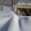
Heaviest snow here since the second mid January event last winter (the Friday morning 2-3"/hour thump followed by 40-50 mph wind gusts). Edit: Probably 1/4 mile or less visibility
-
From everything I looked at today, rates should be good for during the meat of the event, the main burst from the late morning through the afternoon. Felt confident enough to go with temporary 1/2 mile visibility in the 18z TAFs (in collab with the CWSU), which is not super common for us to do near or over 24 hours out. Forecast soundings are supportive of 1"/hour rates at times, so maybe the beefier looking sim ref output from some of the CAMs are onto something. We did account for the possibility of some lake enhancement of the totals into NE IL, though soundings don't look particularly impressive to generate notably higher totals (and impacts). Feeling pretty good overall about the 3-6" range for the metro mentioned in the advisory. Sent from my Pixel 9 Pro using Tapatalk
- 605 replies
-
- 13
-
-

-
Some hindsight involved here, but I think the average of the ensemble 10:1 mean, probability and percentile stuff told a pretty consistent story. From the NWS perspective, I haven't been directly involved in the forecast process this time, but the inter-office collab and collab with WPC aspect is way more challenging than many realize. Internally, we felt that the QPF and ratios were too aggressive but there's only so much we can do when trying to form a consistent picture across large regions. To me this looked like a advisory to perhaps low end warning event, particularly on the non-GFS/GEFS data. It's easy to get caught up in the Kuchera ratio output when assessing the snowfall forecast, that method is too simplistic though. 10:1 gets bashed, and it should in marginal temp situations and more clear cut high ratio setups, but I think it's a good first guess plenty of the time for synoptic systems. Use the 10:1 and then adjust up where you're confident better banding is going to set up, through using model diagnostics like f-gen and cross sections, and utilizing the Cobb output. Sent from my Pixel 9 Pro using Tapatalk
- 605 replies
-
- 11
-
-
-
Winter 2024-25 Medium/Long Range Discussion
RCNYILWX replied to michsnowfreak's topic in Lakes/Ohio Valley
Good voice of reason today Sent from my Pixel 9 Pro using Tapatalk -
Noise level changes on the GEFS all in all if you look at the past 4 runs. Sent from my Pixel 9 Pro using Tapatalk

