DeltaPilot
-
Posts
145 -
Joined
-
Last visited
Content Type
Profiles
Blogs
Forums
American Weather
Media Demo
Store
Gallery
Everything posted by DeltaPilot
-
The runways probably finally dried out enough or they treated them. My guess is it will be good to go in the am tomorrow.
-
I know I looked at a LOT of models last week, who didnt!!! But what I recall is most of the models got quite a few runs which looked very much like what we actually got. All of the models at one point or another had several ensemble runs which kind of nailed it. Im curious for you guys who look way closer at this stuff than most of us do which ones got the overall system "mostly" correct for the gulf states and into the Carolinas, I.E the southeast?
-
Suzook. 6784808918 feel free to text me I do a 2 day trip and get back Sat afternoon. Figure out when works for my winnings!
-
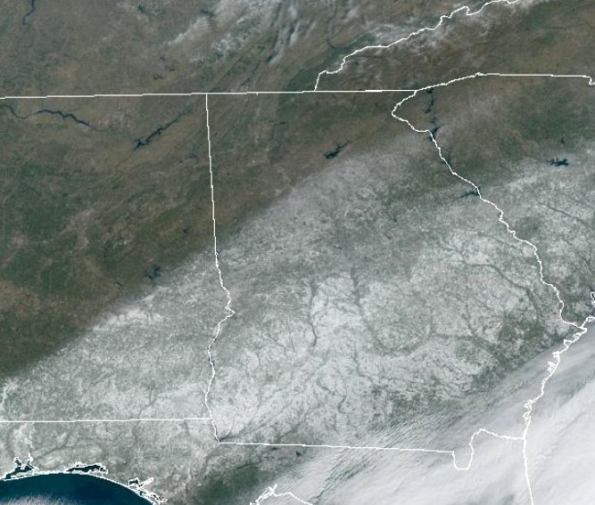
The snow line literally hugs I-85.
-
I finished up with just shy of 1.5" Im calling it 1.3" here. Pretty morning but the roads last night and into this am were and still are a shitshow. Should get melting on all sun exposed surfaces cranking up any time now and improve the situation. Im hearing the ATL airport and Delta Operations are a full on complex IROP causing massive delays and cancellations. Im sure every early go today needed de-icing and thats just fuel added to the fire. Word on the street is over 500 ground/ramp personnel either called in sick or could not make it in. Will take a few days to smooth out, but its pretty bad.
-
I just measured, 3 places, right at 1" as of about 5 minutes ago. Couple miles SE of KFFC. Snowing pretty good still here. ATM I'd call it light to occasional moderate. Im guessing we could get close to 2 here if this keeps up for another couple more hours. KFFC Metar is 1/2 M SN FZFG. Interestingly, it did not stick to the roads for quite a while.
-
Measured 1" here about 25 minutes ago in Senoia, GA. Snowing light to occasionally moderate now. Temps going back down, 25 here. Im going to guess we might get near 2" if it keeps up like this for another few hours, but Im pretty happy. Two measurable events in one month. For being "on the line" in a bunch of the models over the last three or four days, I'd say this is going to over perform here. NWS had lowered totals to T-1/2 inch 48 hours ago.
-
Solid light snow now, roof picking up a coating. 28 degrees
-
As a pilot ive seen some pretty crazy stuff with regards to snowfall and coverage. From higher altitudes its hard to fathom how the line can be extremely abrupt. Like someone painted the earth with a brush.
-
We keep getting little bouts of flurries here. Very light and usually lasts about 5-10 minutes. Happening since about 930 or so this am. Its trying, but the column is still too dry.
-
We have had flakes off and on now for about 45 minutes. Good sign.
-
Bench, I think she will be fine. Still gonna be a bit before the column gets saturated. Think things will run fine, but once it starts sticking the deice operation will begin and that will likely cause delays in the range of an hour or so, then it will get ugly into the evening later on. Right now would more depend on where her plane is coming from since there are a lot of impacts along the gulf coast states.
-
Son in LaGrange reporting light snow at surface @ 7:50am
-
Prob should move to OBS thread for those of us about to be in it.
-
Son in LaGrange says light snow started about 20 minutes ago, 750ish am.
-
I really find it hard to believe ATL proper is going to get anything more than a dusting. Gonna take a while for the precip to saturate the column. I dont think we will get heavy enough for long enough to really get anything over a light coat by the time this goes by. Looking at the tilt though and where the snow is firing up farther north in TX right now sure seems promising. We just need a bit stronger storm than whats progged and some of us might be pretty happy tomorrow night.
-
Well, I think you said we get some "mood flakes". I win if its over 1/2" and you win if its less???? Sounds good on the Beer. Maybe take the average of NWS and our locations?? And I DO know how to measure.
-
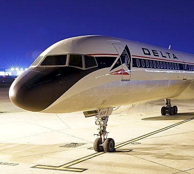
IM a 757/767 Captain in ATL. Also own a forked tail Dr killer (V-tail Beechcraft Bonanza for the non aviation types) based at KFFC
-
Ill take one more north tick here. Whatever falls is going to immediately accumulate here for once.
-
Ill bet ya we get 1/4-1/2 inch suzook. What would you like to wager? Im just NE of downtown Senoia off Rockaway
-
Looks like the snow line is going to taper off right around ATL proper. I think north of that its a dusting to non accumulating flakes. South of the airport Looks like we have a chance at some accumulations right now, but its gonna be close. As I said earlier, Ill be happy with half an inch of white stuff, but hoping for 1". Still some time, and predicting where the "line" is right now, and even during the event, is pretty much impossible. I do think we will see widespread snow, but real accumulations will be south of KATL and where Im at in Senoia and more into Central and Southern GA. Earlier everything was trending south and Im still worried we just get some flakes here and no real accumulation, but most of the ensembles and the better models have held on to us south of ATL getting "something" accumulating. Fingers crossed. I think it only needs to be off by 30 miles or so for real differences to be seen.
-
Im not cliff diving yet. Im in the 1.5-2ish zone on the Euro. Ill even take a half an inch for the win. As some have said, if this verifies and the folks along the coast score more than a few inches that will be EPIC!!! I was in Jacksonville, FL for the Winter 89 event and it was crazy! I'll be happy for them. Remember that it aint over until the Fat Lady sings and I havent heard her warming up quite yet.
-
Just need the models to tick north a few miles and I’ll be happy. Most model runs/ensembles have seen us getting some measurable snow for the last 4-5 days. Would be awesome to see two events in one month. We got about 1.5 here last one(20nm S of KATL). Its pretty darn rare that S of ATL we might be on the NORTH side of a snow event!
-
 Looking at just over an inch. Im in Senoia just immediately S of KFFC. Sleet snow mix and just started light rain off and on and getting glaze. Im pretty happy!
 -
Im wishcasting about an .5-1 inch of pretty white stuff with some sleet and then little or no Ice. Anything at this point. Looks like down here in Peachtree City we are going to be right on the edge. Been a while here.


