yoda
-
Posts
61,397 -
Joined
Content Type
Profiles
Blogs
Forums
American Weather
Media Demo
Store
Gallery
Everything posted by yoda
-
For our DCA snow report watchers: DCA reported 1.9" at 12:00am per the latest PNS
-
Nice. What was your call for DC again? I believe you called for around 6? Or am I wrong?
-
04z HRRR does look nice at the end of its run...
-
3 inches in West Springfield... anyone still up confirm that or around that? Sending it in as a spotter report to LWX... so want some conformity
-
FWIW, 00z UKIE also has it snowing until 6z MON
-
3km NAM has an intense band in S MD at 05z MON
-
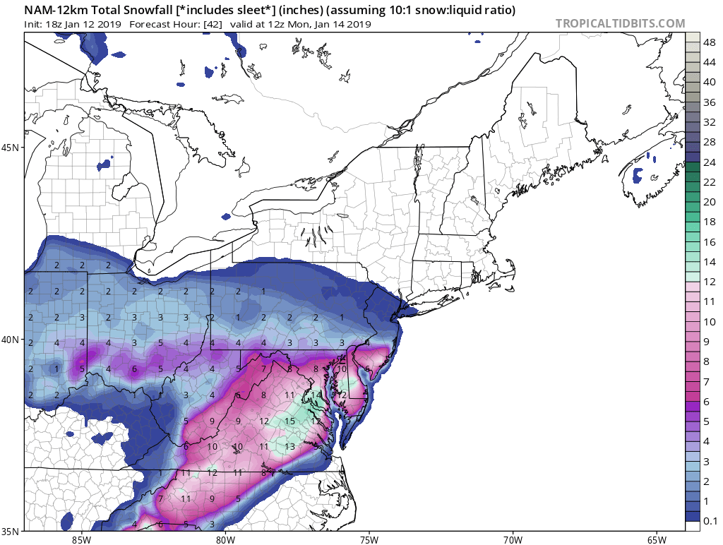
00z NAM finishes 1.4" QPF at DCA
-
1.25" QPF DCA at hour 27 on 00z NAM and still snowing
-
00z NAM mod snow along i95 corridor at 05z MON lol
-
You mean the massive lull
-
00z NAM looks really nice around midnight and after looking at the radar forecast
-
-
Just measured around an inch here in West Springfield... I'm gathering that conforms to other obs in the area near me?
-
Does this signify better ratios or just that the column is very good?
-
Area of precip moving west in WV? Uh oh
-
-
Looks better for everyone on 18z GFS as well... good luck to you
-
18z GFS suggests 2-3 inches across region by 06z SUN
-
Right down towards me and DC as well as you so its 100 percent right lol
-
18z NAM being the NAM... but looks nice

-
Its still snowing at 2am Monday morning... light to mod band along i95 lol
-
Still snowing nicely across the region at 00z MON (7pm SUN) per 18z NAM
-
FWIW, DCA approaching 0.5" QPF by 12z SUN per 18z NAM
-
I know... just surprised that it came up. I guess there is a warm nose somewhere
-
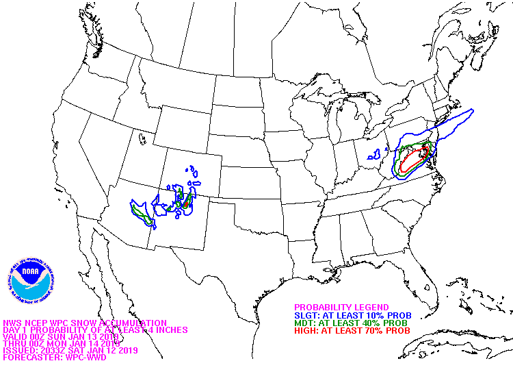
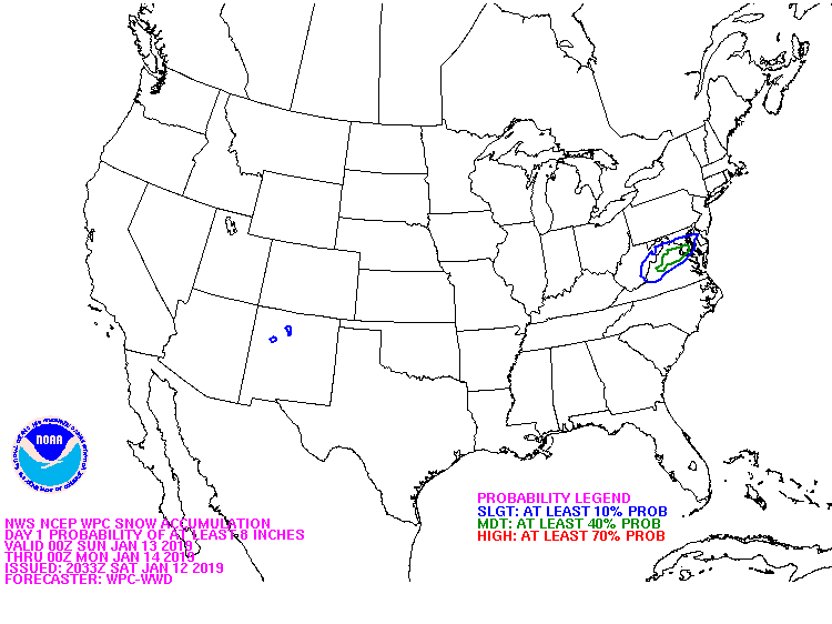
Hmmm URGENT - WINTER WEATHER MESSAGE National Weather Service Baltimore MD/Washington DC 222 PM EST Sat Jan 12 2019 MDZ016-VAZ036>038-050-055>057-130330- /O.CON.KLWX.WS.W.0002.190112T2100Z-190113T2300Z/ Charles-Nelson-Albemarle-Greene-Orange-Stafford-Spotsylvania- King George- 222 PM EST Sat Jan 12 2019 ...WINTER STORM WARNING REMAINS IN EFFECT UNTIL 6 PM EST SUNDAY... * WHAT...Heavy snow and some ice. Total snow accumulations of 4 to 8 inches and up to one tenth of an inch of glaze ice expected. * WHERE...Portions of southern Maryland and central and northern Virginia. * WHEN...Until 6 PM EST Sunday.