yoda
-
Posts
61,397 -
Joined
Content Type
Profiles
Blogs
Forums
American Weather
Media Demo
Store
Gallery
Everything posted by yoda
-
Looks like SLP is in S AL at 72 on IWM
-
Pretty nice hit at that too
-
No go for the NAM tonight... rain for all as SLP crosses through our region
-
84 near or right over ORF at 1002mb
-
Hmmm IWM at 81 has SLP in NC...
-
12z FV3 looks close to what the GFS says
-
Cold rain for most... perhaps snow for W MD into parts of C MD and for those along M/D line per 12z GFS
-
Looks slightly more amped than 6z
-
I'm guessing that this is the story http://www.mininggazette.com/news/2019/02/rescuers-win-race-against-time-in-storm/
-
Opal is in Fauquier county for those who don't know reading the AFD posted above
-
LWX morning AFD as of 3:50am:
-
Yet he says he is in Chevy Chase MD
-
And of course... if you wish to hug and accept the UKMET snow weenie map
-
850 0c line doesn't cross our region till around 20z... doesn't go above 32 till 22z/23z 18z WED 6hr radar shot -- notice the QPF
-
FWIW, UKMET is a pounding
-
It's even better than 18z lol
-
Sounding at 18z at DCA looks isothermal up at 700mb... so just barely hanging on to snow if its pounding IMO
-
If we can keep the heavy rates, I think we can hold off the flip until 18z
-
Updated AFD from LWX as of 8:57pm:
-
What does that mean?
-
Ripping snow at 16z WED in DCA at the very end of the 22z HRRR
-
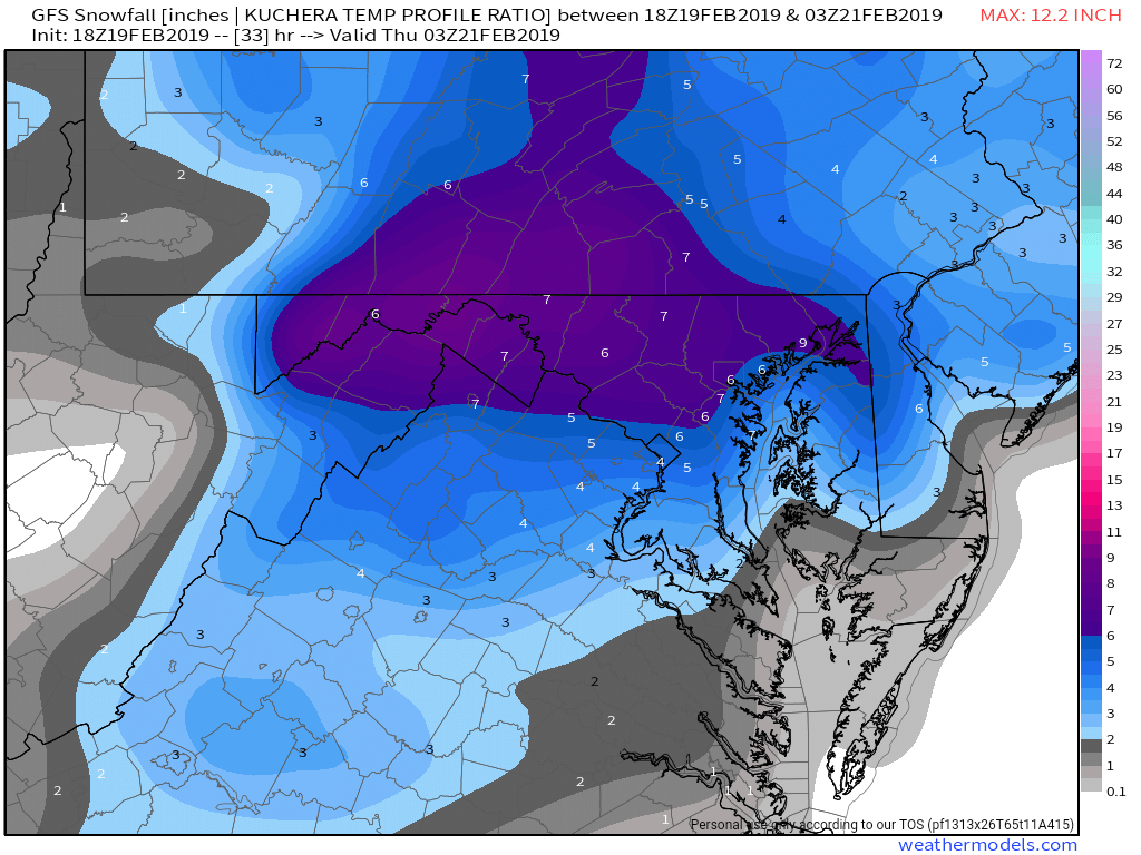
18z GFS Kuchera is 4" from EZF north

-
Tornado warning for DeKalb, Rutherford, Wilson and Cannon counties until 3:15pm
-
If true, that's just... wow
-
Drip drip drip is what's going on outside right now for him