

yoda
-
Posts
61,397 -
Joined
Content Type
Profiles
Blogs
Forums
American Weather
Media Demo
Store
Gallery
Everything posted by yoda
-
But its snow
-
Hr 54 Ji... ending as light rain. 48 is snowing hard
-
Sounding at DCA at 48 and 54 on TT are entirely below zero except for last 50m or so... so I would assume it's likely going to be snow
-
1004mb SLP E NC at 51 1000mb SLP just offshore VA/NC border at 54 996mb SLP about 150 miles east of Ocean City at 57
-
1008mb SLP near ATL at 45
-
-
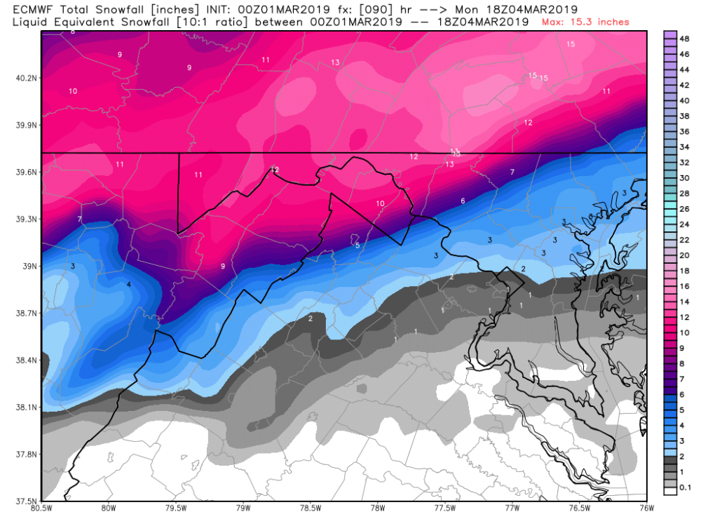
5" at DCA at 48 on the 10:1 maps on pivotal and still snowing
-
DCA sneaks barely into all snow on 00z ICON
-
Ya that ain't sticking Um okay... why not?
-
Starts snowing in DCA at around 16z SUN on 00z RGEM Mod snow (perhaps heavy) starts in DCA at 20z SUN and continues until the end of the run at 00z MON
-
Back to so much whining and complaining in here
-
Zoom in to like super extreme NW Loudoun and there is like a speck of blue lol
-
-
Western MD to about HGR is crushed though this run
-
Not sure it will be enough looking at SLP placement at 72 on IWM this run
-
Ukie is cold rain for most at 78 unfortunately... 850 0c line is out west by i81 corridor at that time even though 2mT are hovering around 32 degrees
-
The mean is flatter or the ensembles themselves then?
-
It's only out to 36 on WB... where you seeing it that fast?
-
Extrapolate goodness?
-
12z run at 84 had it in around the same place 00z at 72 has it... so well see what the precip and 850 maps show ahortly
-
00z UKMET at 72 has SLP in NW GA
-
Meh, 72 and 78 need work on the fv3. 850 0c line are out towards i81 corridor tbh
-
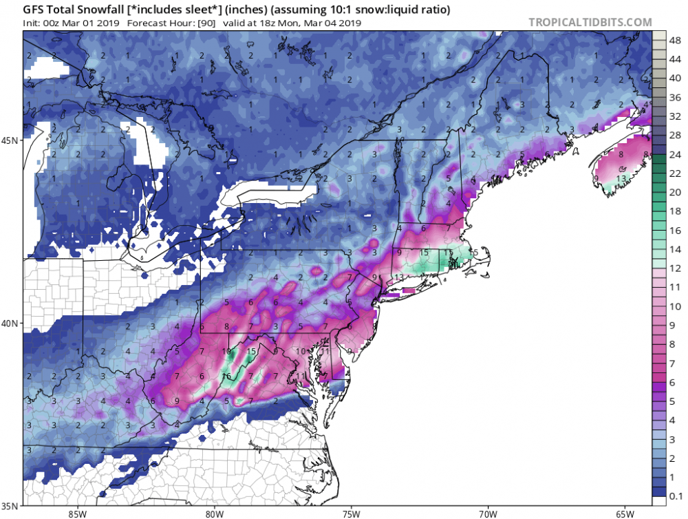
Through 90 hours
-
Still snow at DCA at 78... and looks like snow at EZF too
-
Lol the SLP is so far south that everyone gets hit


