Chrisrotary12
-
Posts
6,163 -
Joined
-
Last visited
Content Type
Profiles
Blogs
Forums
American Weather
Media Demo
Store
Gallery
Everything posted by Chrisrotary12
-
Big time heat focused in sne Sunday-Tuesday to close out July
Chrisrotary12 replied to weathafella's topic in New England
Makes the heat index a nice round 100 F -
Tuesday, July 28, 2020 Convective Potential
Chrisrotary12 replied to weatherwiz's topic in New England
Narrator: It did not. dry beget dry. droughtsteined. (what am I missing) -
My lawn was green.........
-
SNE "Tropical" Season Discussion 2020
Chrisrotary12 replied to Bostonseminole's topic in New England
Assuming this system forms, overall there is pretty good agreement in the overnight ensembles of a TC moving up the east coast and passing southeast of ACK. Hopefully a large transitioning cyclone that can throw some rain back our way. -
Big time heat focused in sne Sunday-Tuesday to close out July
Chrisrotary12 replied to weathafella's topic in New England
Ugh. Didn't think of those b@$+@rds. Yeah. But they're torch has to be less than this. Right? Right? -
Tuesday, July 28, 2020 Convective Potential
Chrisrotary12 replied to weatherwiz's topic in New England
Please hold together
-
Big time heat focused in sne Sunday-Tuesday to close out July
Chrisrotary12 replied to weathafella's topic in New England
Nunavut sounds lovely in the summer. -
Big time heat focused in sne Sunday-Tuesday to close out July
Chrisrotary12 replied to weathafella's topic in New England
Last night was miserable. My basement feels like 80 degrees. Remind me to either move further north or to install central AC. This blows. -
Summer 2020 Banter and random observations
Chrisrotary12 replied to Baroclinic Zone's topic in New England
I don't think I've ever had a summer where I have looked forward to fall weather more than this one. Corona essentially stole spring and summer from a social sense. Then this summer I feel like has been nothing but hot to me. Which I am not a fan of. -
Summer 2020 Banter and random observations
Chrisrotary12 replied to Baroclinic Zone's topic in New England
And you crazies want a repeat of 1938 and double the winds. Sad for him. But he is the reason I do not listen to 98.5 in the morning. Everyone else at the station is ok by me. -
Tuesday, July 28, 2020 Convective Potential
Chrisrotary12 replied to weatherwiz's topic in New England
If Wiz can start a convective thread 7 days in advance, can we start a tropical threat thread 10-14 days in advance. Asking for a friend? -
New convective thread imminent then? lol EDIT: THERE ALREADY IS ONE!
-
SNE "Tropical" Season Discussion 2020
Chrisrotary12 replied to Bostonseminole's topic in New England
Hanna & Gonzalo......zzzzz. Bring me Isaias. -
Just a passing thundershower if we're being honest.
-
SNE "Tropical" Season Discussion 2020
Chrisrotary12 replied to Bostonseminole's topic in New England
What's the record for number of tropical storms in a season? (i.e. systems that maxed out as a TS) -
Somebody save this.
-
My oak trees are dropping half matured acorns in bunches. Adjust your winter outlooks accordingly.
-
My oak trees are dropping half mature acorns in bunches
-
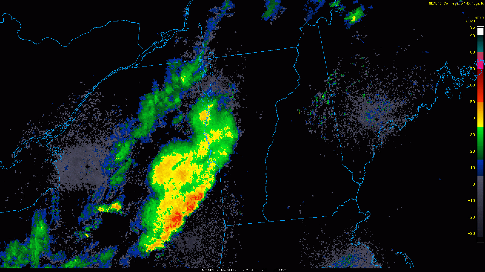
Unrelated but......nice boundary from Framingham to Brockton on radar.
-
77.5 F here. Refreshing.
-
The ground is wet. I think it came from above. What is this voodoo?
-
SNE "Tropical" Season Discussion 2020
Chrisrotary12 replied to Bostonseminole's topic in New England
Why not both? -
Anyone ever play the south course of Stow Acres? Playing it this Saturday. What am I in for?
-
Truth. Fall is the best for any outdoor activity lol
-
Not full size. But found a few on ground and heard a few hit house other day (no wind). Maybe just the squirrels fooling around up there, who knows.