Chrisrotary12
-
Posts
6,167 -
Joined
-
Last visited
Content Type
Profiles
Blogs
Forums
American Weather
Media Demo
Store
Gallery
Everything posted by Chrisrotary12
-
But what about the 06z GFS?!?!
-
Looks like we flurry or snizzle anytime Sunday through to the actually storm Tuesday morning.
-
But were there flurries dancing across I-90?
-
17th and 19th continue to look interesting in this mornings GEFS. We watch.
-
I think our best hope for Sunday is a repeat of last Sunday
-
Have we not had a SWFE or a coastal front set up along 495?
-
Interesting to see that the two operational models (GFS & ECMWF) are targeting different systems for the "biggie" over the next week or so. GFS likes the 14th while ECMWF prefers the 17th. (ICON looks good for both lol)
-
As expected, nearly a non-event here (I was expecting to get 2"). Flakes in air all day with very little to show for it.
-
Finally getting some good flakes. Solid coating now.
-
Miller B city on the 12z GFS. One after another after another.
-
After today's light snow....next two threats to keep eye on are 14th and 17th. Both have operational and ensemble support right now.
-
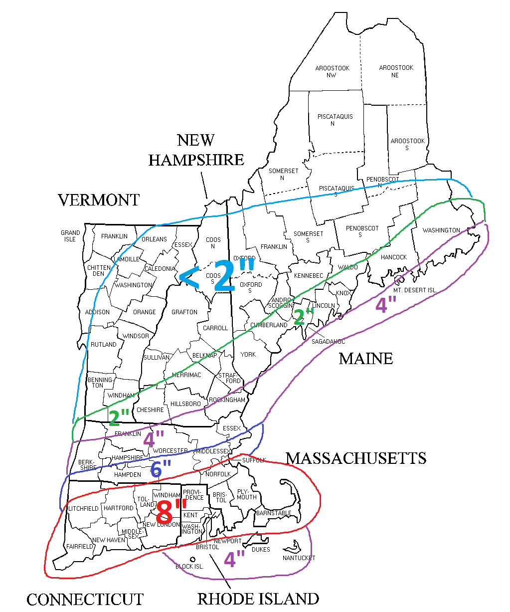
GYX currently forecasting 3-4" here. 500 yards to the south, BOX forecast 6-8".
-
Wait....what did I miss today? Am I really getting 6-8"? NWS still has me for 2".
-
Quick Hitter Coastal Threat, Feb 7-8th
Chrisrotary12 replied to The 4 Seasons's topic in New England
Definitely think I need to tighten the NW gradient.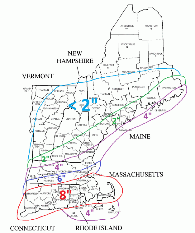
-
Quick Hitter Coastal Threat, Feb 7-8th
Chrisrotary12 replied to The 4 Seasons's topic in New England
Highlights the 2020-2021 southern New Hampshire Merrimack Valley snow hole well. -
Quick Hitter Coastal Threat, Feb 7-8th
Chrisrotary12 replied to The 4 Seasons's topic in New England
First call......thinking I need to tighten up the gradient on the northwest side.
-
Quick Hitter Coastal Threat, Feb 7-8th
Chrisrotary12 replied to The 4 Seasons's topic in New England
Remember this storm. Went to bed expecting 6-9" I think and woke up to 15". -
Quick Hitter Coastal Threat, Feb 7-8th
Chrisrotary12 replied to The 4 Seasons's topic in New England
Some people count snow falling out of the trees as additional accumulation. -
Was just puking dendrites. Everything covered. Still snowing, but flakes not as great.
-
Definitely.....I imagine you stay all snow during nearly all SWFEs?
-
I'll take my chances with the Euro for Tuesday PM. Standard SWFE for my area 6-10" then drizzle. Euro absolutely croaks the chicken coups though.
-
Quick Hitter Coastal Threat, Feb 7-8th
Chrisrotary12 replied to The 4 Seasons's topic in New England
Congrats Jimmy......guy deserves it. I will gladly pass on this one and await my 6-10" from Tuesday PM SWFE that the Euro is advertising. -
Quick Hitter Coastal Threat, Feb 7-8th
Chrisrotary12 replied to The 4 Seasons's topic in New England
Yeah we get the northern stream to lift out and the southern vort is actually a beast.....wagons west. Wonder if we see the southern vort trend stronger in guidance? The trend this season has been to under model the strength of vorts as they approach the east coast; even shredding them at times.. -
Quick Hitter Coastal Threat, Feb 7-8th
Chrisrotary12 replied to The 4 Seasons's topic in New England
What's the NAM & RPM rule again?!?! (joking) But admittedly it could probably be "Never trust either" -
Quick Hitter Coastal Threat, Feb 7-8th
Chrisrotary12 replied to The 4 Seasons's topic in New England
Yep. Few more of these and we'll be fine.