Chrisrotary12
-
Posts
7,420 -
Joined
-
Last visited
Content Type
Profiles
Blogs
Forums
American Weather
Media Demo
Store
Gallery
Everything posted by Chrisrotary12
-
You don’t say
-
WTF is with the GFS perfect blizzard track LP on Thursday?
-
You get your revenge 9 out of 10 winters.
-
Garden variety thunderstorm. Also good for the soul.
-
Thunder from line to west. Let’s see how we screw this up.
-
Do you track things like month-to-date and year-to-date?
-
Do you know what we got for rain?
-
After all that bitching you got over 2”? LOL
-
Gentle stratiform rain. Very soothing
-
Southeast Mass special

-
Yes
-
Couple sprinkles from round 1 earlier. Wait to see if anything survives to here in round 2.
-
Looking like a 7-10 split here. #stein
-
I honestly can’t recall the last time I called that body of water anything other than “the Gulf”.
-
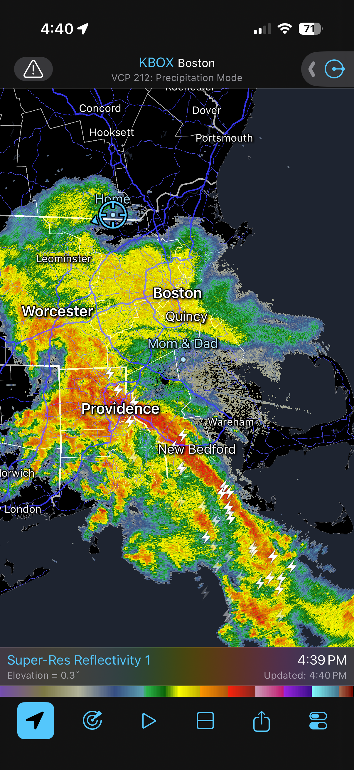
It would be different in here if something exciting happened occasionally but it just doesn’t anymore. Straight up boredom around these parts for the last decade. I agree with you that the vast majority of people want yesterday’s weather, but the people in here at least want excitement. It’s been so boring that we have been left to post about rain and smoke. Occasionally a blizzard impacts southeast Mass but that’s about it.
-
Yes. The smoke after the rain was very noticable.
-
Saturday, July 18, 2026 Thunderstorm/Severe Weather Potential
Chrisrotary12 replied to weatherwiz's topic in New England
Yes it appear so. -
Saturday, July 18, 2026 Thunderstorm/Severe Weather Potential
Chrisrotary12 replied to weatherwiz's topic in New England
Was that gentle stratiform rain we just got the severe threat? Haven’t been paying attention. -
Saturday, July 18, 2026 Thunderstorm/Severe Weather Potential
Chrisrotary12 replied to weatherwiz's topic in New England
Holy smoke ahead of this rain, -
A++ morning
-
Damn Canada. Why can’t you rake your forests!
-
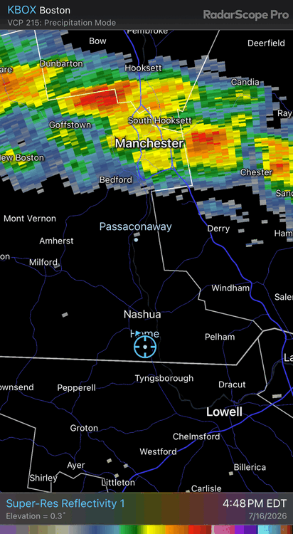
Shows up good on BOX radar
-
Fine by me. I got tee times Saturday and Sunday.
-
Not even enough to wet under the trees. Buddy to my south in Chelmsford reports the gust front is pretty intense. Branches down in his neighborhood.
-
Can see the outflow boundary drop south. Basically along rte 3 and east. Then as storm approaches, it collapses. Gentlest of rains.