Dunkman
-
Posts
2,099 -
Joined
-
Last visited
Content Type
Profiles
Blogs
Forums
American Weather
Media Demo
Store
Gallery
Everything posted by Dunkman
-
With snow our WFOs seem to decide how they feel about an event a few days in advance and try to stick with it, at least until the night before. It makes sense you don't want the forecast bouncing around with every model run. I'm fine with the expected forecasts, we've certainly had white rain events in the past. That said, the 1 in 10 forecasts and probability of x" of snow products aren't great.
-
For sure I hope no one is expecting 12"+ now. But if we could squeeze a 4-6" event out of this miserable excuse for a winter I'd be thrilled.
-
I mean of course a good Euro would bring me back but after what I've seen so far today I'm out. The NAM and the GFS with no ensemble support against the world isn't really where I want to be 2 days out. Definitely the most exciting and important suite of model runs this winter for NC, it's a shame it's mostly flopped.
-
I mean big picture the Euro is the most skilled model at every time frame. To say it's not important would be silly. It's true though it hasn't done particularly well forecasting sensible weather in our region with this pattern lately.
-
I'm pretty excited about getting NAMed at least once this year. It's a big step forward!
-
Fun fact about February 1990, it was right in the middle of the longest snow drought on record here in the Triad. They may be onto something with this Arctic Oscillation thingy.
-
Even the high end forecast from GSP looks pretty meager. We must really be wishcasting this one or something.
-
I'm happy to see the 60s will be back for the start of Fab Feb!
-
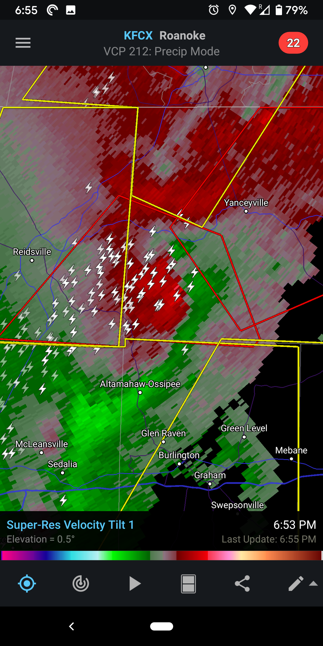
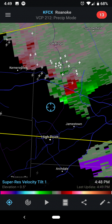
That warned storm north of Greensboro has really gotten it's act together

-
Tornado warning in Guilford County. That part of the line went over my house less than 10 minutes before it was warned. Pretty wild few minutes.
-
Yeah the graphic they have for the watch is all wrong here's the text: The tornado watch area is approximately along and 85 statute miles east and west of a line from 20 miles west southwest of Columbia SC to 30 miles northeast of Greensboro NC. For a complete depiction of the watch see the associated watch outline update (WOUS64 KWNS WOU8).
-
How long do you think it'll be before we keep reliving Sandy in painstaking detail every time there's a hurricane? I'm setting the o/u at 2050.
-
With every post I've seen saying a model is going west the last 2 days it should be hitting Texas by now.
-
Yeah and honestly it seems like the NHC was maybe a little late with the hurricane watches. I really think the wind radii expanding out relatively rapidly is a pretty big concern. I know they didn't go with the actual reading but I can't say I ever remember a dropsonde measuring 200+ at the surface before. Anyone else?
-
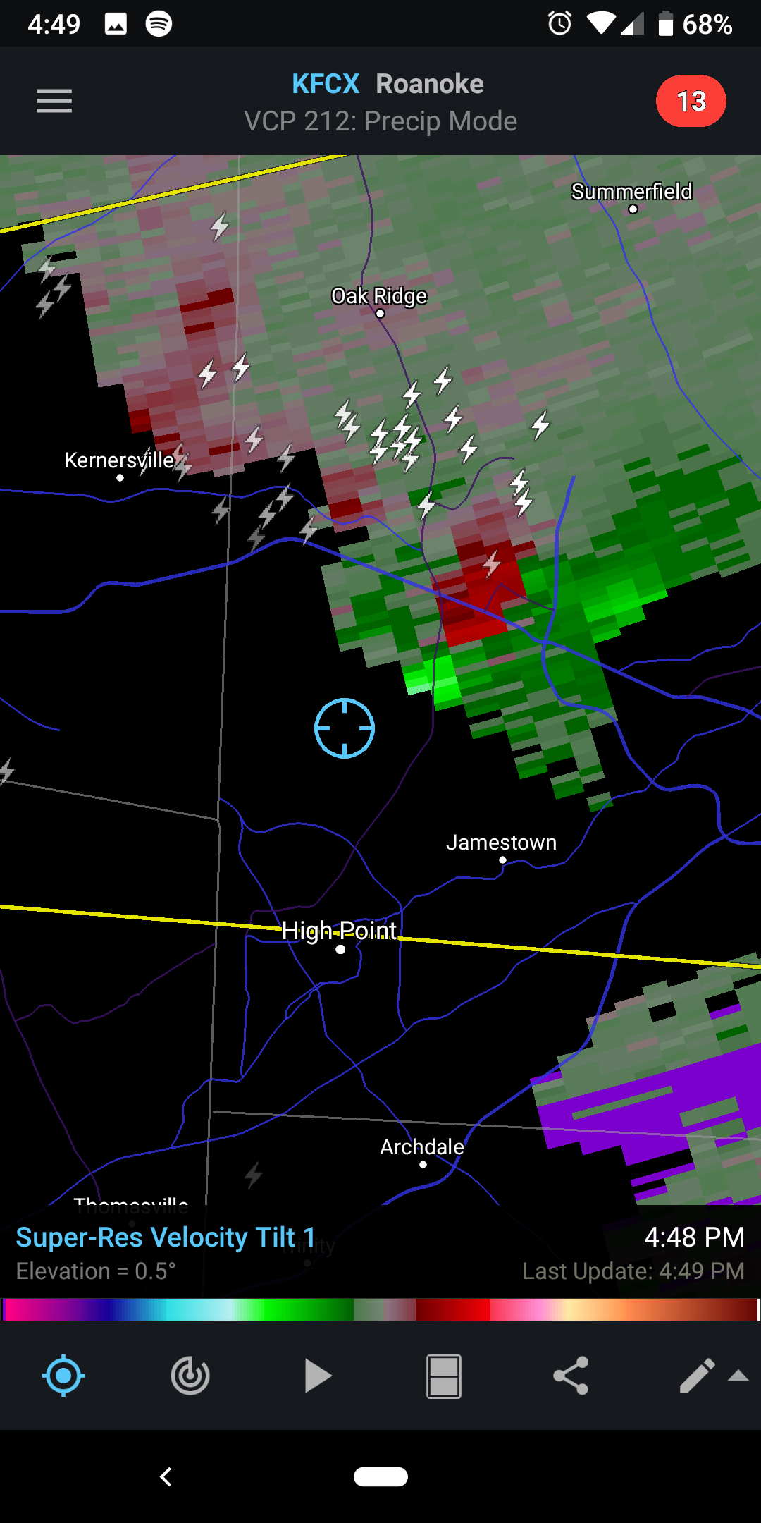
Odd timing on that the storm is much weaker than it was 20-30 minutes ago. Another warning now for the storm near Concord.
-
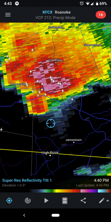
For sure. The hail marker is up to 2.25" for that storm as well. That storm is like 75 dBZ just WNW of Greensboro. I'd imagine there will be a lot of storm reports rolling in soon.
-
Yeah I have a pretty good view from here. It's definitely rotating.
-
Storm that just moved through Winston probably needs a TOR soon
-
Nice little notch on that storm
-
Nothing even remotely interesting materialized here in the center of the Triad but hey look it's more rain...
-
I don't know we're pretty good at getting cold rain to verify in March and April.
-
This only being warm enough to rain for the 12 hours it's actually precipitating thing is some bs
-
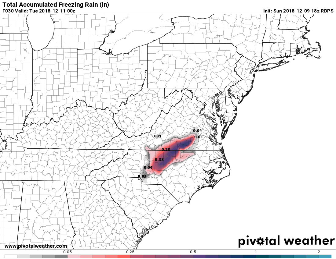
It's all zr right now I don't think you're missing out
-
Lol thanks. I need to sleep probably.
-
Sure