eaglesin2011
-
Posts
989 -
Joined
-
Last visited
Content Type
Profiles
Blogs
Forums
American Weather
Media Demo
Store
Gallery
Everything posted by eaglesin2011
-
Richmond Metro/Hampton Roads Area Discussion
eaglesin2011 replied to RIC Airport's topic in Mid Atlantic
-
Richmond Metro/Hampton Roads Area Discussion
eaglesin2011 replied to RIC Airport's topic in Mid Atlantic
This or that?

-
Richmond Metro/Hampton Roads Area Discussion
eaglesin2011 replied to RIC Airport's topic in Mid Atlantic
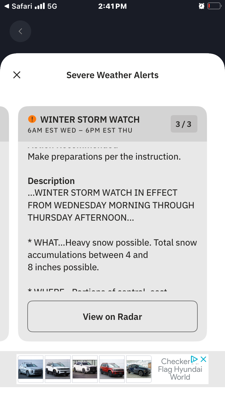
FWIW the NWS is still calling for 3-5 in the Richmond/Glen Allen area.. If we end up with that it’s still better then 90% of the storms around here.. Also, will be an all snow event that rarely happens here.. I’m just hoping it’s enough to make my work office close early tomorrow lol… -
Richmond Metro/Hampton Roads Area Discussion
eaglesin2011 replied to RIC Airport's topic in Mid Atlantic
Definitely looks like that will be right around the bullseye. In my area of Glen Allen…I’m starting to think this area may get more accumulating snow from the wrap around upper low, especially if nothing expands back from the coast from the main system …At least it’s still close enough to keep watching up until game-time & should be all snow (whatever ends up here.) -
Actually, it was a slight improvement… Another bump up before game-time could really make it a decent event for that area…
-
Richmond Metro/Hampton Roads Area Discussion
eaglesin2011 replied to RIC Airport's topic in Mid Atlantic
-
Richmond Metro/Hampton Roads Area Discussion
eaglesin2011 replied to RIC Airport's topic in Mid Atlantic
Aggressive early call up this way…
-
Richmond Metro/Hampton Roads Area Discussion
eaglesin2011 replied to RIC Airport's topic in Mid Atlantic
I will happily take 1 to 3 inches in my part of Glen Allen.. At least we won’t have to worry about it getting washed right away this time..… It just shows how hard it is to get a big accumulating snow in this area… Who knows….Maybe the storm will juice up & expand just enough to throw a few more inches up this way… -
Richmond Metro/Hampton Roads Area Discussion
eaglesin2011 replied to RIC Airport's topic in Mid Atlantic
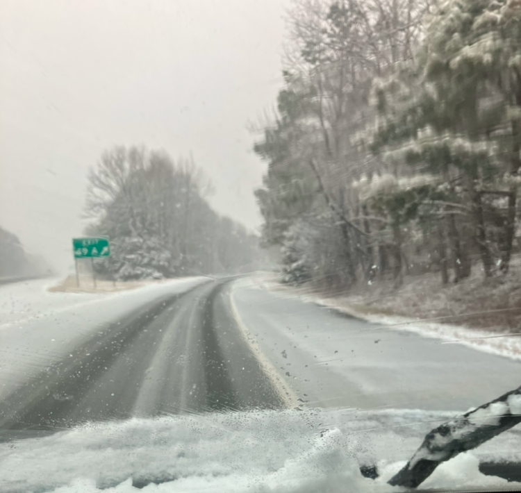
Roads starting to be sprayed 288 / short pump.. hopefully it’s a sign of better things to come -
Richmond Metro/Hampton Roads Area Discussion
eaglesin2011 replied to RIC Airport's topic in Mid Atlantic
-
Richmond Metro/Hampton Roads Area Discussion
eaglesin2011 replied to RIC Airport's topic in Mid Atlantic
Looks like it’s getting ready to change over to more of a freezing rain /rain here in my part of Glen Allen.. I’d say just under 3inches.. Now we wait for the 2 inches of rain lol -
Richmond Metro/Hampton Roads Area Discussion
eaglesin2011 replied to RIC Airport's topic in Mid Atlantic
Decent band going through here as well best rates maybe all day .. still mixing but mostly snow -
Richmond Metro/Hampton Roads Area Discussion
eaglesin2011 replied to RIC Airport's topic in Mid Atlantic
I’m doubting we get much more measurable snow in this area, with temps rising aloft .. Roads are gonna be pretty treacherous for the next few hours especially back roads and the father north u are -
Richmond Metro/Hampton Roads Area Discussion
eaglesin2011 replied to RIC Airport's topic in Mid Atlantic
Flipping back and forth from a sleetly light snow to a moderate snow/sleet seem to be just south of the better banding
-
Richmond Metro/Hampton Roads Area Discussion
eaglesin2011 replied to RIC Airport's topic in Mid Atlantic
Nice burst here just south of short pump getting close to 2 inches -
Richmond Metro/Hampton Roads Area Discussion
eaglesin2011 replied to RIC Airport's topic in Mid Atlantic
lol the sleet mix helped it accumulate on the roads hopefully we stay in the heavy band and stay this way for a few hours but it’s basically coming straight down now so we will see -
Richmond Metro/Hampton Roads Area Discussion
eaglesin2011 replied to RIC Airport's topic in Mid Atlantic
Brook rd to staples mill exit mod sleet and snow now making all roads here starting to be covered -
Richmond Metro/Hampton Roads Area Discussion
eaglesin2011 replied to RIC Airport's topic in Mid Atlantic
-
Richmond Metro/Hampton Roads Area Discussion
eaglesin2011 replied to RIC Airport's topic in Mid Atlantic
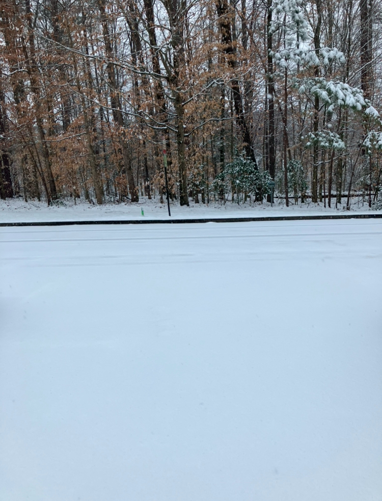
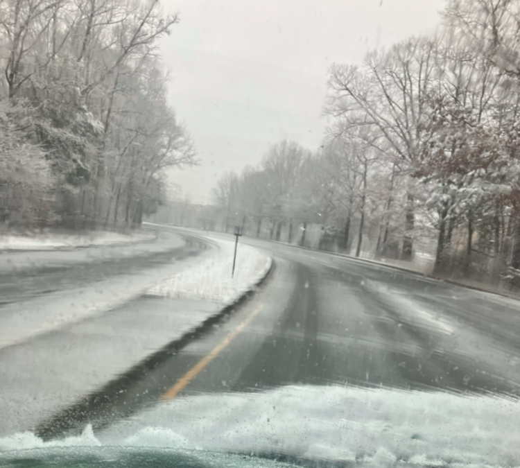
starting to finally accumulate on the road area here in Short pump area... -
Richmond Metro/Hampton Roads Area Discussion
eaglesin2011 replied to RIC Airport's topic in Mid Atlantic
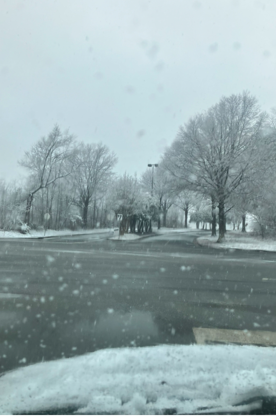
Not the best photo but bigger flakes still melting on contact here in VA commons area… big difference from here to Powhatan just because of temps /elevation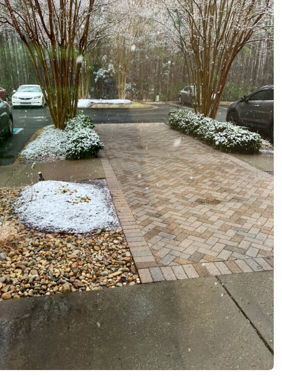
-
Richmond Metro/Hampton Roads Area Discussion
eaglesin2011 replied to RIC Airport's topic in Mid Atlantic
looks like a decent/heavier band should move back in within the next hour for most of the Northern side of the Richmond area... -
Richmond Metro/Hampton Roads Area Discussion
eaglesin2011 replied to RIC Airport's topic in Mid Atlantic
dusting in short pump area so far.. nothing on roads yet -
Richmond Metro/Hampton Roads Area Discussion
eaglesin2011 replied to RIC Airport's topic in Mid Atlantic
Been snowing in Powhatan for about 30 mins -
Richmond Metro/Hampton Roads Area Discussion
eaglesin2011 replied to RIC Airport's topic in Mid Atlantic
About an inch or less most likely in most places, but again depending how & where the banding comes through there could be a couple inches added in isolated areas… -
Richmond Metro/Hampton Roads Area Discussion
eaglesin2011 replied to RIC Airport's topic in Mid Atlantic
Yep, it’s why that break & the temperature getting over freezing for a few hours is going to be huge for avoiding any major ice damage… We will see how fast the cold air works in & re freezes everything… Hopefully we can hit another good band right before the storm pulls away… After 5 to 6pm