.JPG.9198b1c204cb49070076f929685eaf35.JPG)
katabatic
-
Posts
498 -
Joined
-
Last visited
Content Type
Profiles
Blogs
Forums
American Weather
Media Demo
Store
Gallery
Everything posted by katabatic
-
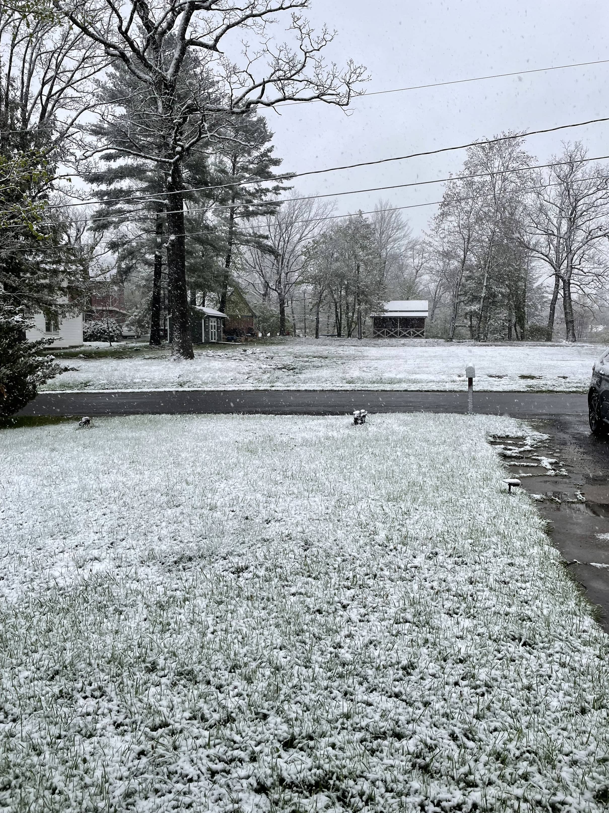
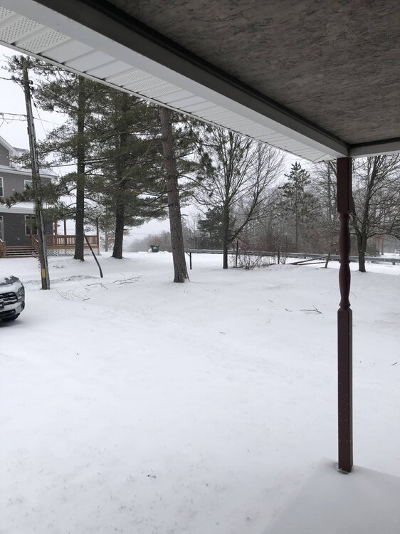
While this doesn’t compare to Davis/Snowshoe, nevertheless a beautiful scene in Mountain Lake Park this morning.

- 528 replies
-
- 12
-

-
We have had snow flurries off and on all morning (no accumulation) with up to 3 inches in GC tonight (WWA hoisted about an hour ago). Pretty neat honestly.
-
Front has passed through SW Garrett County. Will be interesting to see if a fraction of those (seemingly outlandish) modeled upslope snow totals come close to verifying outside of Snowshoe/Canaan.
-
What a difference a few miles makes. Had some flakes earlier but absolutely zero on the ground and 34.
-
54 mph gust and 0.26” rain in ~8 minutes with small hail and a single rumble of thunder just now. You know, typical Garrett County February weather.
-
They’re just as excited to finally have something to write about as we are to track.
-
A very hopeful 3-4 week disco from CPC along with their revised maps showing well BN temps throughout most of the country supports this.
-
Almost made it. 1.9.
-
For those coming to Garrett County, best winter day thus far. Intermittent snow falling now with winds IMBY gusting to 43 mph. Temp is 29.4 and has been slowly falling all night. Impossible to measure but eyeballing between 1/2 to 1 inch thus far. Rates look to pick up through the day with NWS forecasting 7” in Oakland. @Terpeastyou picked a good weekend!
-
Your bit of elevation helps. It’s 33.6 in MLP although we got 2.2 inches over the course of Friday thru early Saturday AM but a disgusting light rain and 33-34 all afternoon today. LWX is calling for 4” beginning with tonight’s passage and interested to see what the end of the week brings. “Prolonged” doesn’t mean significant.
-
After a week of spring, hoping that’s the end of it for a while. May get some flakes here tonight. Down to 31.4.
-
Another option is Wisp. Quick glance shows availability on the 14h of January. My husband is a lift operator there and even today the area was manageable. By the 14th we will have had some colder weather and while Mother Nature looks stingy AF re: natural snow, it’ll be cold enough to make it.
-
Where are you?
-
Temp at 5:38 was 35.4 Temp at 6:42 was 21.9 Heavy snow currently (I’m at 2,438’)
-
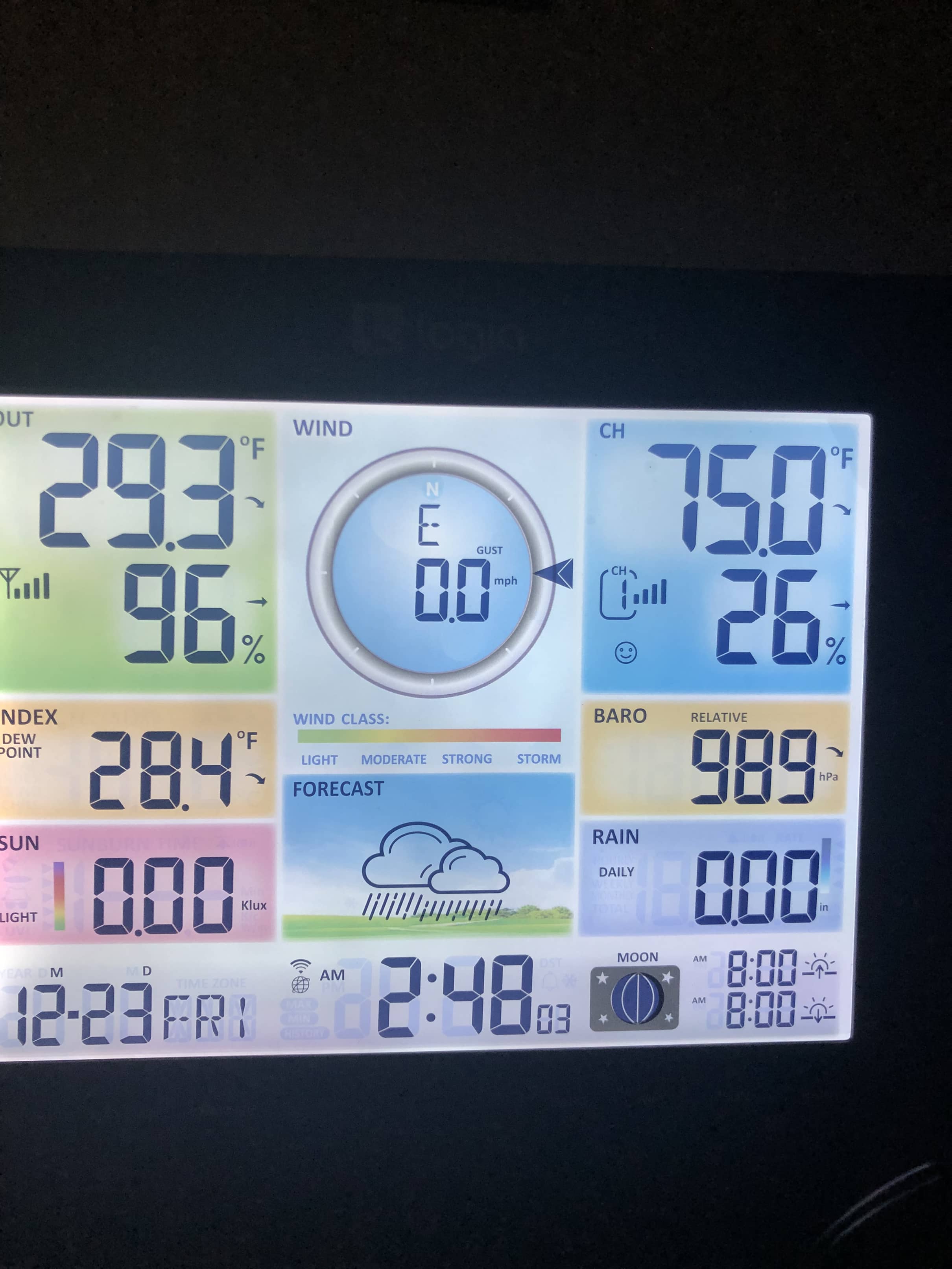
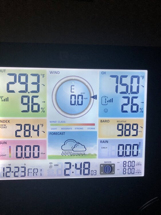
Front has passed, as expected an abrupt wind shift. Switched to snow immediately. Temps quickly rose from 29.3 to 35.4 immediately before fropa and are now 30.5 (dropping 0.2 degrees every 30 seconds or so).
-
Baro down to 989 in southwest Garrett County. Never got above freezing with a ton of ice still on the trees.
-
THIS TIMES A MILLION.
-
Now ZR in MLP. I hope we rise above freezing long enough this evening to melt what accretes with the wind coming. Fairly light returns downwind (good accretion) and already small icicles on the trees.
-
28.5/26.4 in Mountain Lake Park. Had some decent snow (after starting out as ZR and temps right at 32) but is now almost all sleet. About an inch of slop, maybe a tad more.
-
Interesting inversion last night. 7.3 for a low here and in McHenry (about 350’ higher and ~12 miles north), 14.6.
-
It really is. Steady snow, gusts to around 20 mph and temps in the low 20s. Spectacular morning.
-
22.1 and steady snow this morning. Beautiful, light upslope event. 1.9” since last night on top of last weeks glacier.
-
I live in Garrett County and can confirm the roads are dicey, but passable. The heaviest precip has ended and the road crews out here are phenomenal. It has been mostly sleet for the last 4 or so hours, which has limited the ZR accretion. If he hits the road, you know the drill...just take your time. It won't do anyone any good to call from a ditch.
-
Mostly sleet in southern Garrett County after overnight ZR (thank god). 29.8. Roads are slushy but the awesome highway crews are doing a fantastic job.
-
ZR has begun in MLP. 30.9/23.3.
.thumb.JPG.418e8a9a2902ae687ec35ff4bc0e038e.JPG)