

Topher
-
Posts
83 -
Joined
-
Last visited
Content Type
Profiles
Blogs
Forums
American Weather
Media Demo
Store
Gallery
Everything posted by Topher
-
Started flurrying 5 mins ago.
-
Yeah, I was up in Calvert, md for last storm so got my fill of snow for a bit. It anyways has changed over to just snow here and coming down heavy.
-
Near ft Eutis with this heavy band, snow main precip type but also sleet and freezing rain.
-
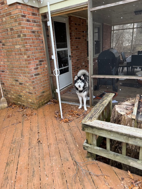
Dogs first snow since 2021, was in Charleston for a bit, now husband is stationed here for another couple years.

-
Very light snow in northern Newport News. Now big flakes and sleet
-
6z euro slightly improved. 500mb heights in front of the vort slightly more amped. .29 precip dca(0z had .19) more to the south and slightly less to the north but mostly everyone above .2.
-
Rain/snow mix in navy yard.
-
Hey, I’m also chasing this storm(from dc area). Very familiar with the selinsgrove, Williamsport area so hoping those two will be in the max area. Would just be happy with 12-15”+.
-
Southern MD / Lower Eastern Shore weather discussion
Topher replied to PrinceFrederickWx's topic in Mid Atlantic
Looking like 2-3 inches already. Just keeps pouring snow. Will measure later. -
Southern MD / Lower Eastern Shore weather discussion
Topher replied to PrinceFrederickWx's topic in Mid Atlantic
I’m a mile or so west of the China king, oceanic gas station -
Southern MD / Lower Eastern Shore weather discussion
Topher replied to PrinceFrederickWx's topic in Mid Atlantic
All snow now and coming down heavy. I think 5-6 is a good call for all of us. -
Southern MD / Lower Eastern Shore weather discussion
Topher replied to PrinceFrederickWx's topic in Mid Atlantic
Was just about to say it looked like snow mixing in outsides a couple minutes ago. Now it’s 50/50 snow/sleet and at Prince frederick that does seem off, even Chesapeake beach is 32-33. I look on weather underground for stations close to me. I’m fine with 4-6. I think that is doable. -
Southern MD / Lower Eastern Shore weather discussion
Topher replied to PrinceFrederickWx's topic in Mid Atlantic
Sleeting here too, nice ice accretion from all the drizzle last night. 31.8F right now. Hoping we turn to snow within the next hour or two. Location just north of the 2&4 split in huntingtown. -
Southern MD / Lower Eastern Shore weather discussion
Topher replied to PrinceFrederickWx's topic in Mid Atlantic
Snow starting to pick up. Around an inch so far. -
Southern MD / Lower Eastern Shore weather discussion
Topher replied to PrinceFrederickWx's topic in Mid Atlantic
Had a little snow on the car this morning. The 6z runs the gfs was more amped and was a little stronger with the low, however precip was basically the same, the nam came in a little less amped causing precip to move farther southeast by 20-30 miles. Ecmwf was pretty awesome .4 all the way to northern Calvert and .8 at the beaches on the eastern shore. It's probably the wettest model currently. -
Southern MD / Lower Eastern Shore weather discussion
Topher replied to PrinceFrederickWx's topic in Mid Atlantic
Heavy snow, currently 34.7F. Sticking to everything. Edit: 33.4F now -
Southern MD / Lower Eastern Shore weather discussion
Topher replied to PrinceFrederickWx's topic in Mid Atlantic
Hopefully we can get snow tomorrow night. GFS has 2-3 inches across southern Maryland and 1-5" across the Delmarva, 1" for SBY and 4-5" for DOV. -
Southern MD / Lower Eastern Shore weather discussion
Topher replied to PrinceFrederickWx's topic in Mid Atlantic
Euro is 2"+ -
Southern MD / Lower Eastern Shore weather discussion
Topher replied to PrinceFrederickWx's topic in Mid Atlantic
I love it, they have really good margaritas and i usually get the nacho fajitas for an appetizer, if i'm drinking. It feeds two or more people, unless you are extremely hungry. Also their regular fajita options are really good. My friends like basically every entree there so I don't think there is a wrong choice. Also, 30.4F on and off light freezing rain showers/drizzle. Probably have around 1/8 of a inch of ice accretion on cars and over previous snow pack. -
Southern MD / Lower Eastern Shore weather discussion
Topher replied to PrinceFrederickWx's topic in Mid Atlantic
Route 4 down to southern part of Huntingtown is pretty icy(went to Mexico). Currently 30.1F and freezing drizzle. -
Southern MD / Lower Eastern Shore weather discussion
Topher replied to PrinceFrederickWx's topic in Mid Atlantic
29.8F and some light freezing rain, wonder how long I can stay below 32. -
Southern MD / Lower Eastern Shore weather discussion
Topher replied to PrinceFrederickWx's topic in Mid Atlantic
HRRR did pretty good last night highlights st marys as the bullseye, showing 5" by 7 am this morning. HRRR is now showing us switching over to sleet and then freezing rain, at 1pm in st marys and 2pm in calvert, but not after another 2-3 inches of snow. HRRR also shows around .15-.25 inch of ice in southern maryland through 3-10pm. 10 pm rain in st marys and then around 11pm in calvert. -
Southern MD / Lower Eastern Shore weather discussion
Topher replied to PrinceFrederickWx's topic in Mid Atlantic
Has been between light and heavy snow, besides the break in the squalls. About to be sunny again. Probably .5". Hoping we can get another band in here. -
Southern MD / Lower Eastern Shore weather discussion
Topher replied to PrinceFrederickWx's topic in Mid Atlantic
They were just issued a couple minutes after you posted that, and for 1-3 inches. -
Southern MD / Lower Eastern Shore weather discussion
Topher replied to PrinceFrederickWx's topic in Mid Atlantic
Hopefully we can all party in the snow, if it doesn't trend back out to sea!
