OSUmetstud
-
Posts
16,521 -
Joined
-
Last visited
Content Type
Profiles
Blogs
Forums
American Weather
Media Demo
Store
Gallery
Everything posted by OSUmetstud
-
Solid hit on the euro for my area.
-
Thats not Elinor. Its Zach...he was a bit of teen genius from the old board that has seemed to go the way of weirdness ala Chuck. Elinor is Turtle not Turtle Hurricane.
-
A bit of a rant re: NHC overcautiousness.
OSUmetstud replied to Cheeznado's topic in Weather Forecasting and Discussion
Also, they use the word "Hurricane Conditions" which is more encompassing than the strict wind definition. It includes thing like storm surge and large battering waves. -
A bit of a rant re: NHC overcautiousness.
OSUmetstud replied to Cheeznado's topic in Weather Forecasting and Discussion
Hurricane Warnings only verify a small percentage of the time. They warn larger stretches of the coast line to have sufficient lead time for preparations and account for track deviations. I think theyre verification stats are similar to tornado warnings compared to other warning products. Im guessing there is some sort of peristence bias with warnings in the sense that there not lifted until conditions markedly improve even though they would know they arent verifying. -
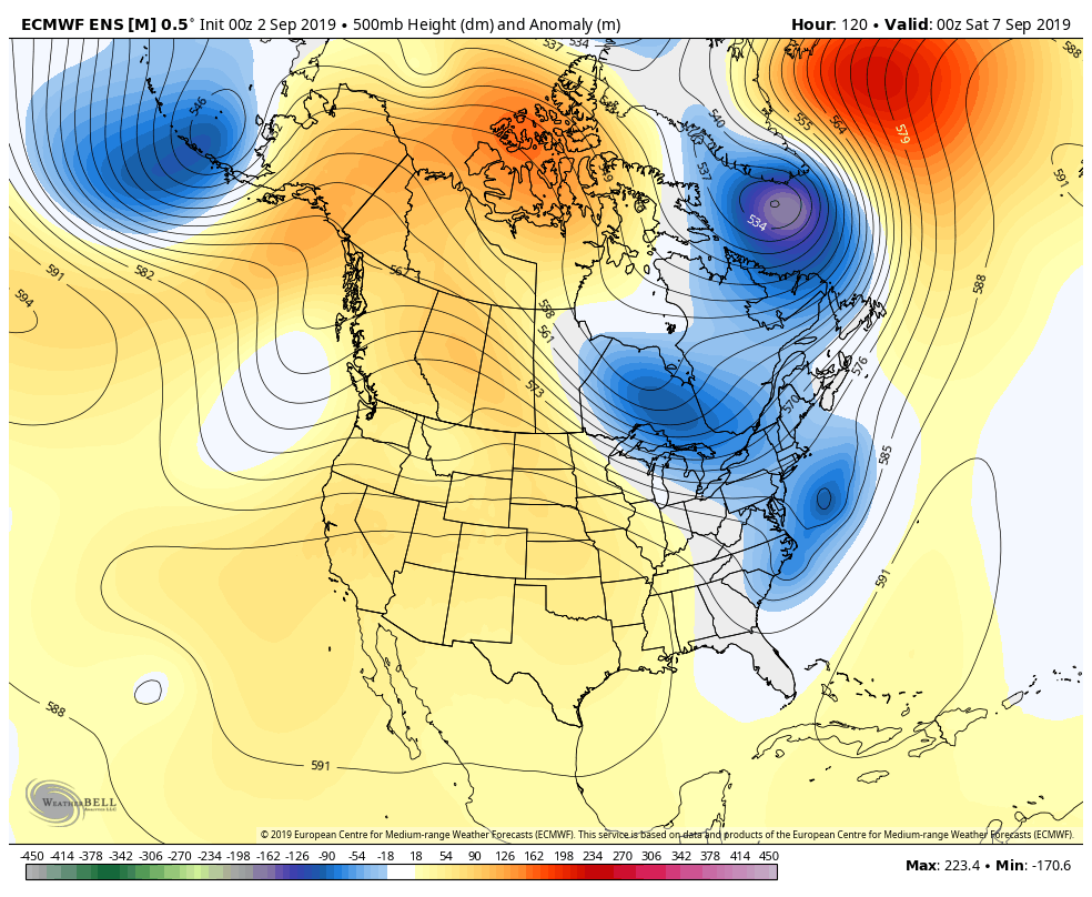
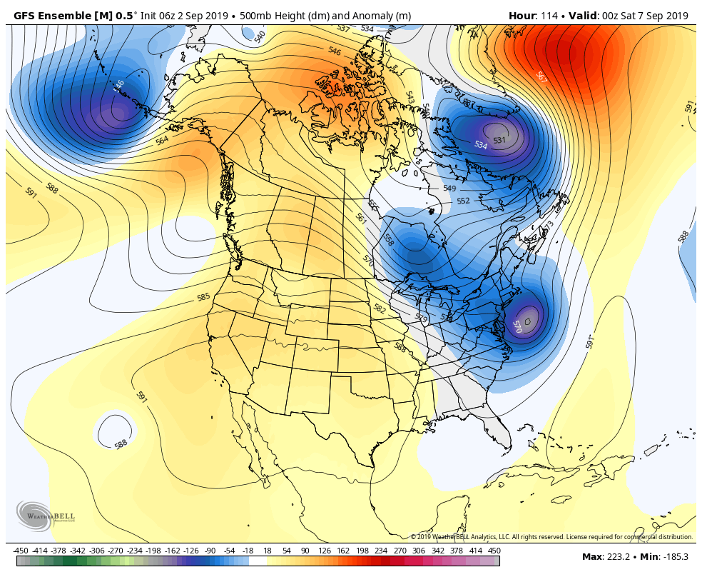
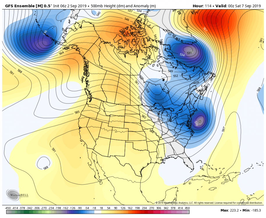
The lack of blocking over Atlantic Canada with this one makes it tough to get west definitely fun and important to monitor run to run changes though
-
Should be decent here. Id like another nudge east to get into the lightly better winds. The winds wont be higher than any of our major winter storms but with leafed trees and unfrozen ground there will be more opportunity for damage and power outages.
-
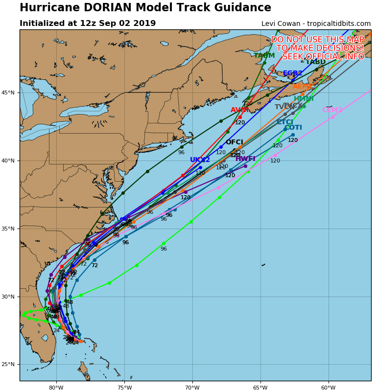
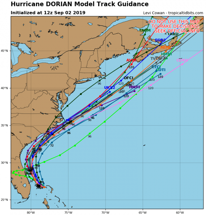
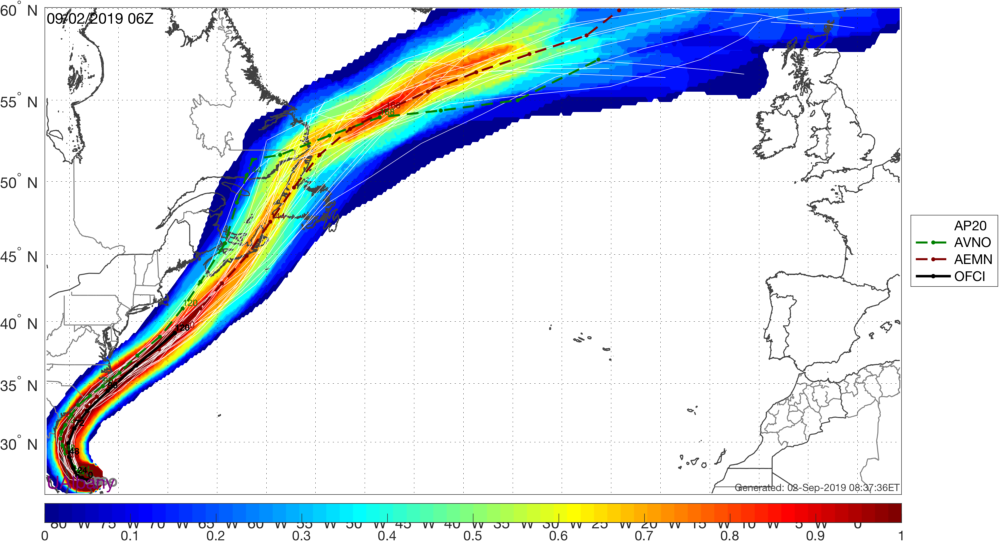
The COTI ensemble track blend followed by the UKMET have been the best verifying pieces of guidance for Dorian at 120 hours so far.
-
Id probably go 45/35/20 for landfall probs in NL, NS, and out to sea. Theres still a lot of lowering of heights in Atlantic Canada ahead of Dorian that make me hesitant to believe in the further west tracks like the gfs and the ukmet even with the partial phase from the clipper out of eastern Canada.

.png.6913a567daa343edb56cf36bff27efef.png)
-
Where is the post?
-
Looks pretty solid for an Atlantic Canada landfall.
-
The Icon is so good at tropical forecasting that the NHC doesn't even run statistics on it.
-
This is the third leading story on fox. Much more responsible. Canadian ex-PM 'rooting' for Hurricane Dorian to slam Mar-a-Lago
-
Hwrf has better scores than the hmon for track...and hwrf is the best model of all for intensity.
-
Its the old gfdl.
-
indeed
-
I'm grateful for those who know how to embed tweets, otherwise I wouldn't be able to see any of Ryan Maue's. He blocked me a few months back.
-
This sounds a lot like the seinfeld episode where George takes food into bed.
-
Are we forgetting about 1995-1996 and 2004-2005?
-
82/69 steamy for these parts.
-

-
Yeah i agree. Theres a good amount of cape around there and obviously convective clouds over the alps on eurosat. 700 temps are like plus 5c.
-
For some applications youll need the $ symbol. For example if im verifying multiple forecast values against a single observation in A1, I need to maintain the reference to A1 in the formulas since excel will automatically change your formula to A2, A3, A4....when copied.
-
Yeah. If you want to change it up and not have it change the formula to different cells as you copy it you use the $ symbol before the cell reference.
-
-
May was our coldest since 1974. This -NAO thermohaline slowdown thing means business. I was on a boat tour yesterday with temps in the mid 40s yesterday. Frigid.