OSUmetstud
-
Posts
16,521 -
Joined
-
Last visited
Content Type
Profiles
Blogs
Forums
American Weather
Media Demo
Store
Gallery
Everything posted by OSUmetstud
-
Upstate/Eastern New York
OSUmetstud replied to BuffaloWeather's topic in Upstate New York/Pennsylvania
https://montrealgazette.com/news/local-news/high-winds-leave-thousands-of-montrealers-in-the-dark/amp?__twitter_impression=true Wow -
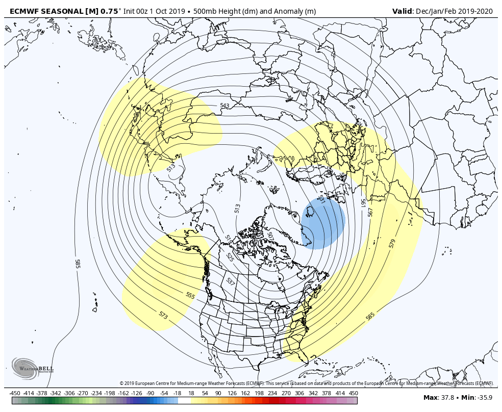
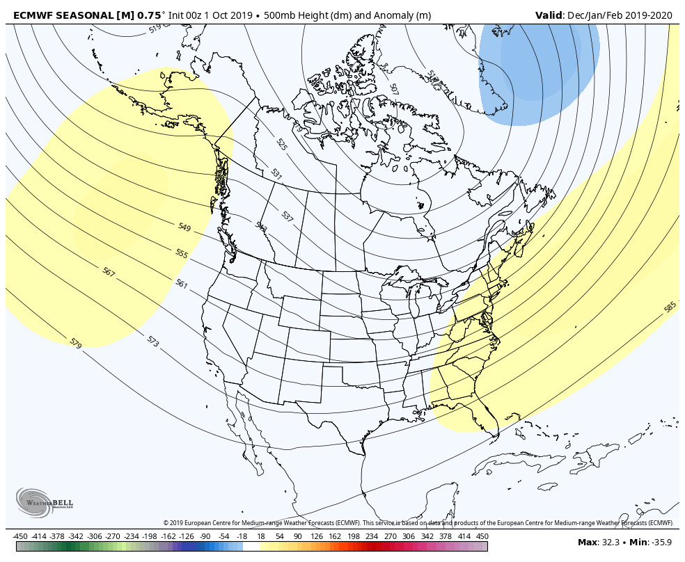
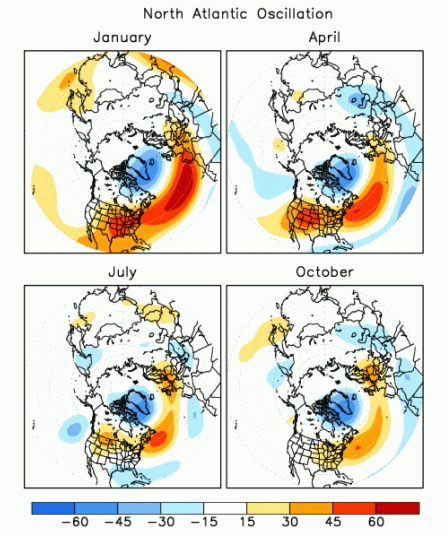
The positive anomalies over the eastern namer and west and central atlantic are factored into the nao calculation from cpc anyway.
-
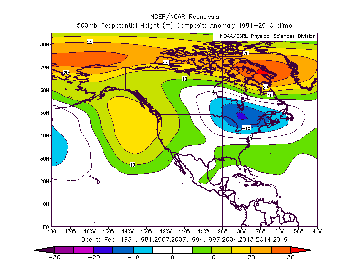
I dont agree. The strong ridging further south shows that theres no effective blocking response. It looks more like the -epo +nao winters weve seen of late as opposed to the 2000s classic -NAOs.
-
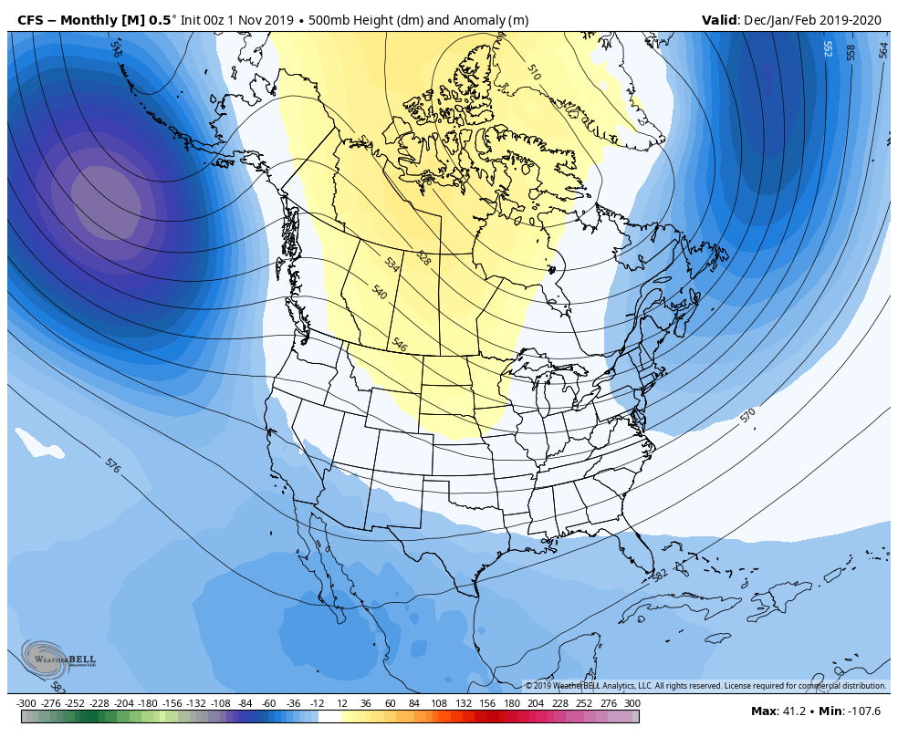
The cfs is definitely -nao. The cansips is debatable. It doesnt look like the positive anomalies in northern greenland are affecting the upstream pattern.
-
Upstate/Eastern New York
OSUmetstud replied to BuffaloWeather's topic in Upstate New York/Pennsylvania
Strongest winds were on the canadian side as the low took a while to get going. Kingston to 107 km/h (66 mph) and Montreal to 105 km/h (65 mph) is not too shabby. Im still a bit suspicious of port colburne obs. I know its on the pier but the ob of 102g130 km/h is super intense and seemingly out of whack compared to other sites and the synoptics. -
Upstate/Eastern New York
OSUmetstud replied to BuffaloWeather's topic in Upstate New York/Pennsylvania
The wind was a medium type high wind event. Nothing particularly special. It was early in the year with leaves still on trees and saturated unfrozen ground That makes a big difference with re: damage and outages. The sieche was solid and i believe highest in a while (10 ft 6") but some of that is due to the very high antecedent lake levels (running 4 ft over low water datum). -
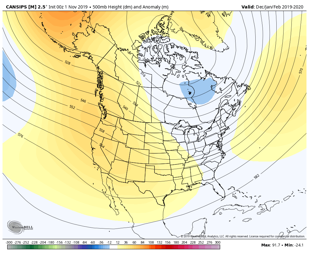
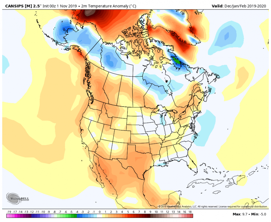
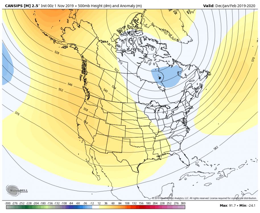
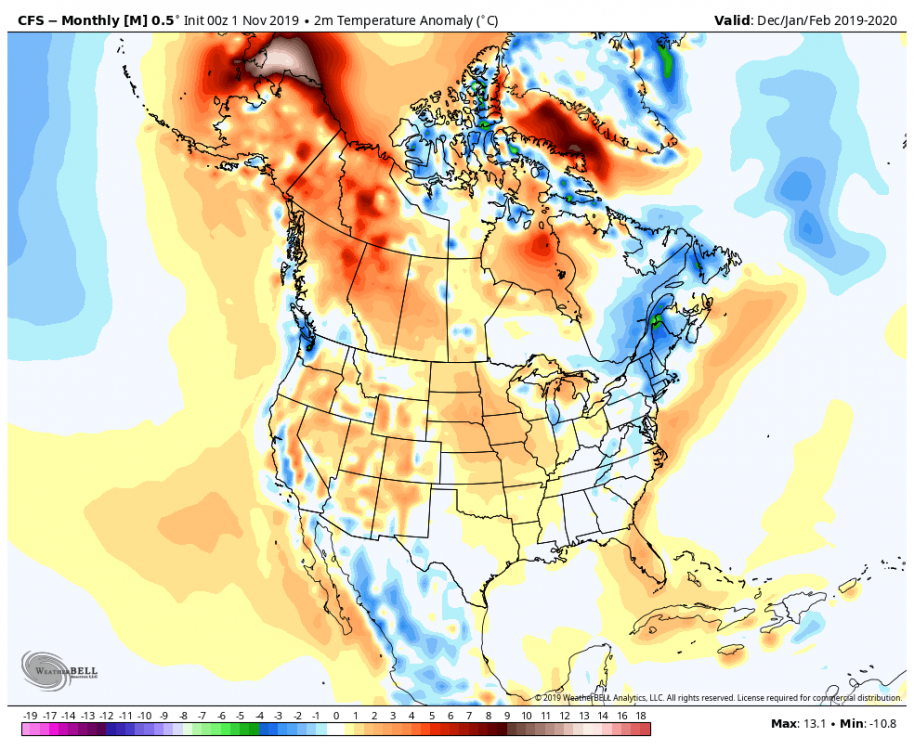
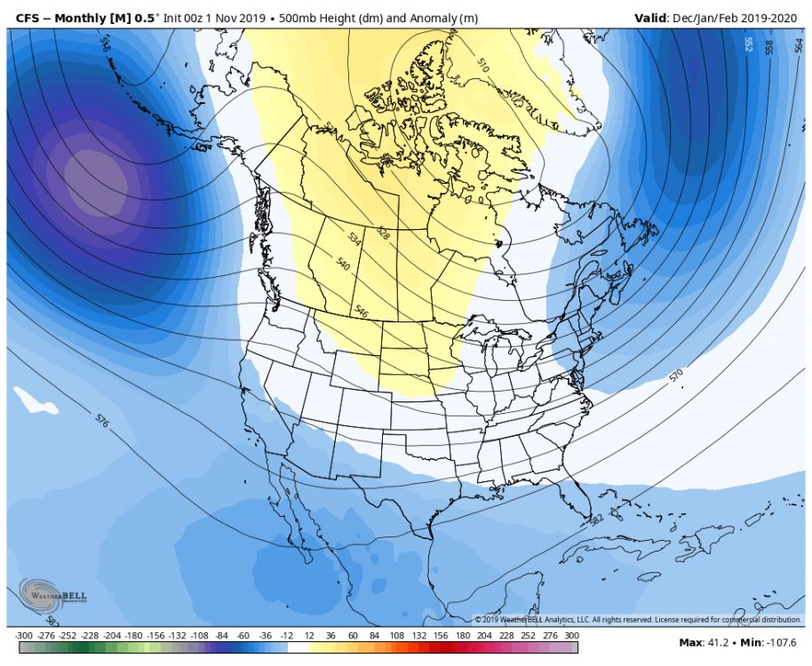
Yeah that cansips look is pretty similar to last few winters. The cfs look is different more of a classic -nao pattern
-
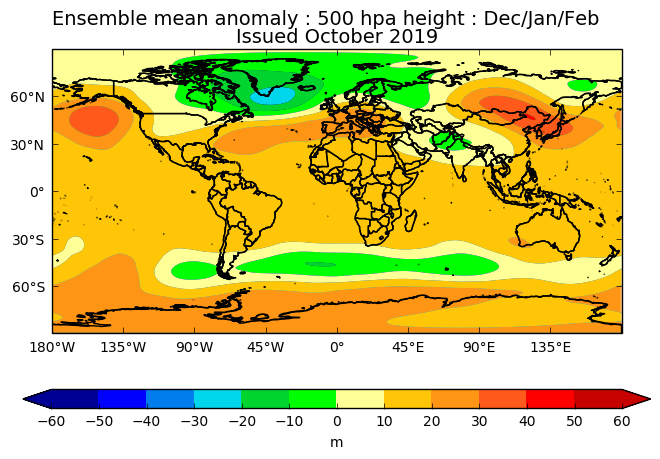
Newest Cansips and CFS. No obvious red flags.
-
Upstate/Eastern New York
OSUmetstud replied to BuffaloWeather's topic in Upstate New York/Pennsylvania
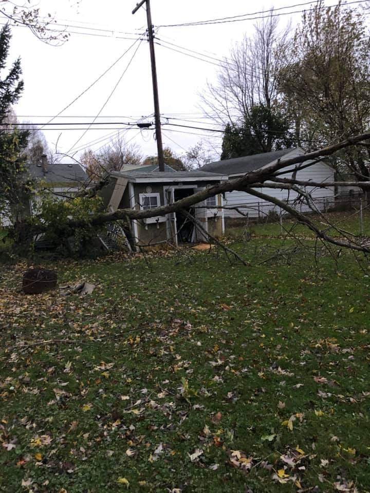
My mom had a tree fall on the shed last night (West Seneca).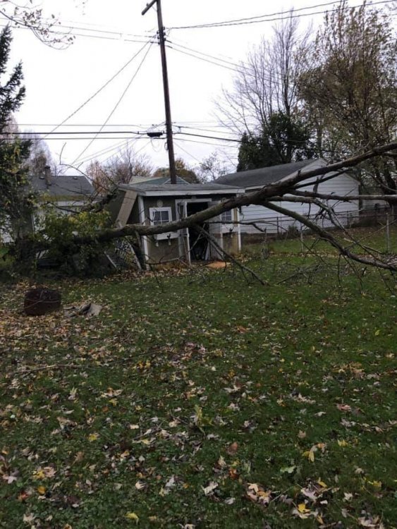
-
Yes, I remember that study. I don't believe the new FV3 has changed much, the GFS and GEM have been running toe to toe and considerably behind the ECMWF and UKMET for some time.
-
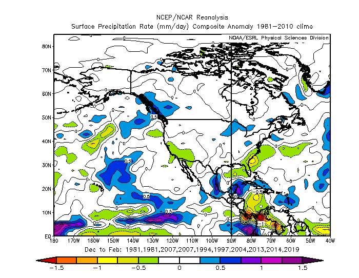
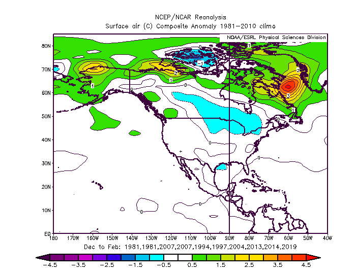
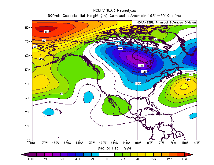
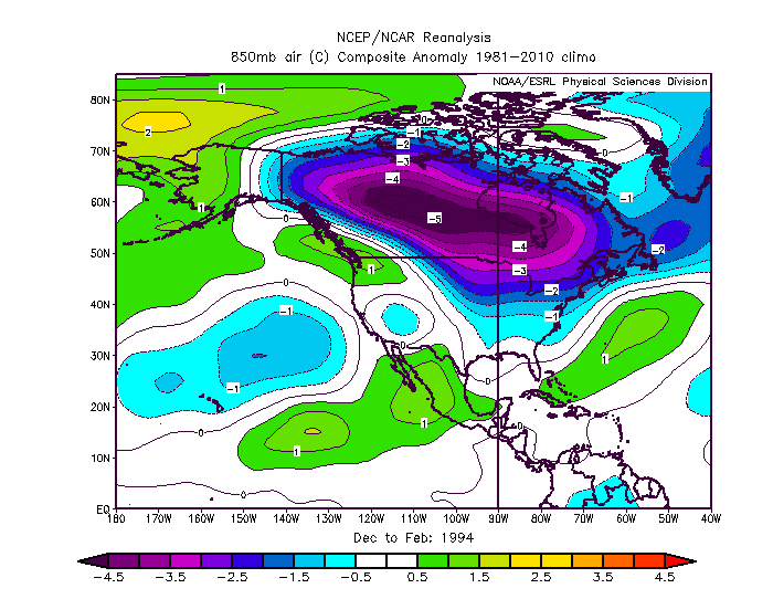
These were chosen based on best matches re: summer into fall for ENSO, TNI, PDO, AMO, QBO, NAO and solar. I haven't checked on the snowfall result in those years for the northeast.
-
I didn't post them, just give me a minute.
-
Alright, I grabbed a couple very weak El Ninos in my analog set. too, but most of mine are ENSO neutral just given the available guidance.
-
Dynamical guidance is in solid agreement on ENSO neutral conditions. Are you assuming its wrong? Or do you think the very warm nino 4 will keep it acting like a weak El Nino?
-
Ahh thanks. I was trying to come up a with a whitty interpretation of NBM but failed.
-
We will only have fv3 mos?
-
You should be thankful model guidance isnt always perfect. Otherwise we wouldnt have jobs.
-
System5_guide.pdf
-

-
Only in the sense that is "gradient" or compressed flow pattern. Youll never see those rediculous anomalies on a seasonal model but theres large enough differences in the epo region to keep the cold air from invading Canada.

-
Yeah im not super keen on that look, but maybe it works out. Looks like last feb out here. Cold and dry.
-
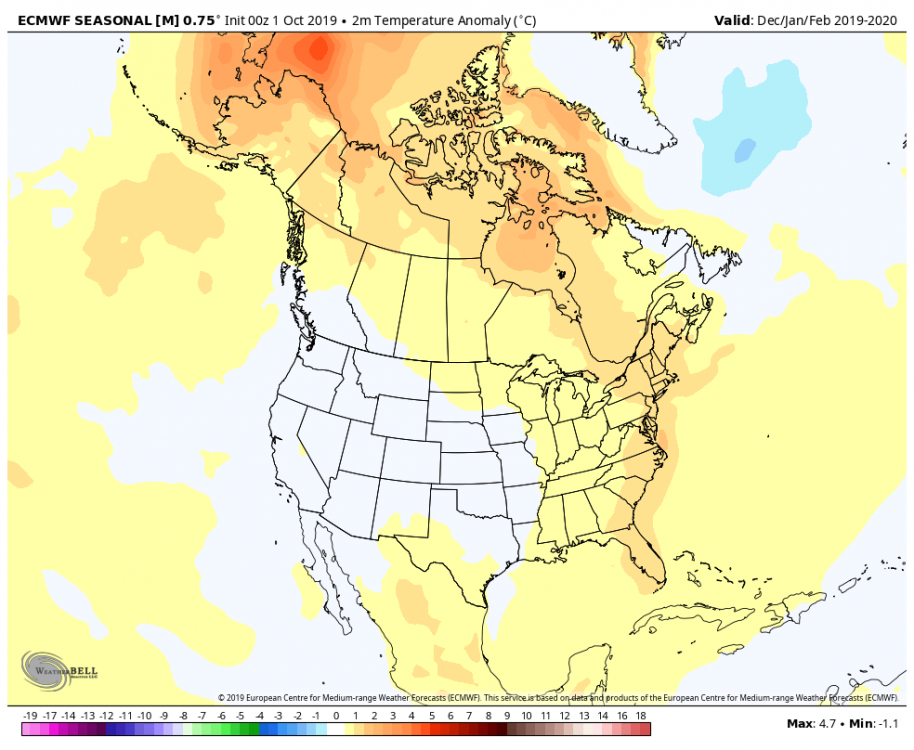
New UKMET Glosea5 is out today. Looks a bit nina-ish. Weak -EPO, -PNA, +NAO se ridge.
-
Hes intellectually dishonest. "Every cold front in the GOM" just stop.
-
I hope cranky is satisfied.
-