OSUmetstud
-
Posts
16,521 -
Joined
-
Last visited
Content Type
Profiles
Blogs
Forums
American Weather
Media Demo
Store
Gallery
Everything posted by OSUmetstud
-
As do I. But seasonal forecasting is still a budding field with low confidence so I'm not sure if there's much difference in skill between a forecaster's forecast and a model forecast.
-
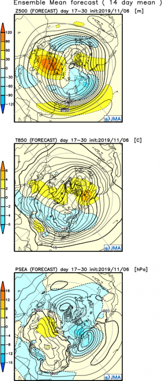
Jma looks okay to start December too for what it's worth.
-
The seasonal didn't show a torchy December.
-
It probably wasn't there lol. There has been problems this morning.
-
Yeah we got 45" that month. I think there 2 other decent events beyond the big storm on November 20th. Must have just been cold and dry there, interesting.
-
Interesting, thanks. I figured bigger storms are harder to come by, but maybe a smattering of minor to moderate events could be done? How about something like November 2000?
-
Growing up in the lakes November can be very kind, even epic, but I wouldn't think a wintry November in New England is too unusual.
-
fake news!
-
I'd go for suppression and sheared mess to the southeast over cutter. The cold air dump from the -epo block and fast flow and mean trough position are decidely against a great lakes track.
-
The UKMET Glosea5 last fall forecasted a fairly strong -NAO for the winter. It didn't verify. But I mean if were just looking for the post-2013 era, the NAO has nearly constantly positive through winter.
-
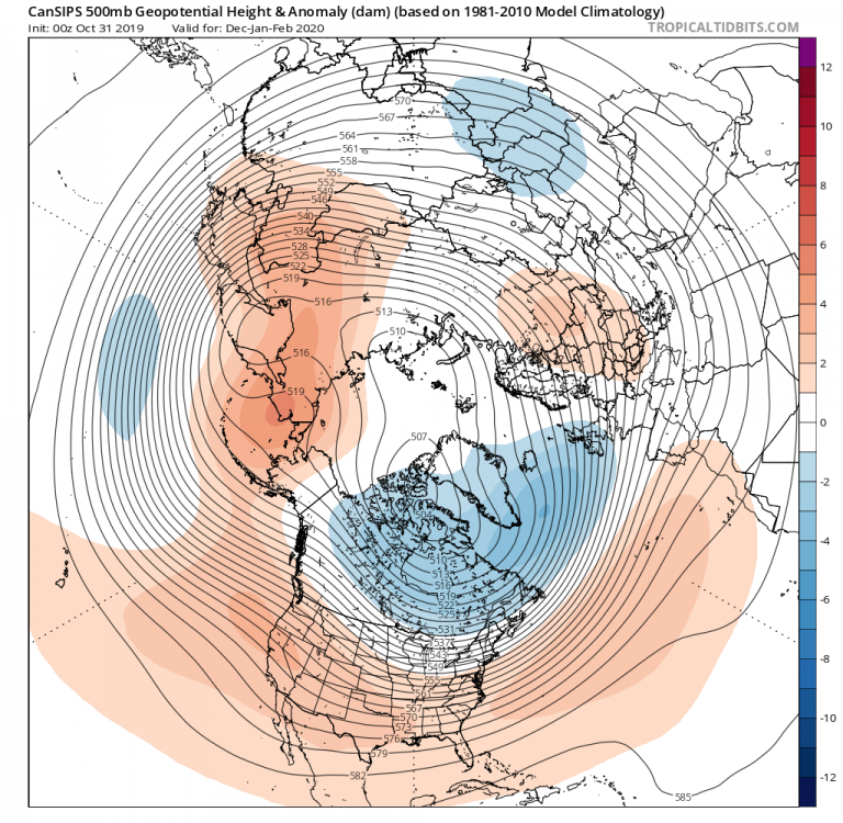
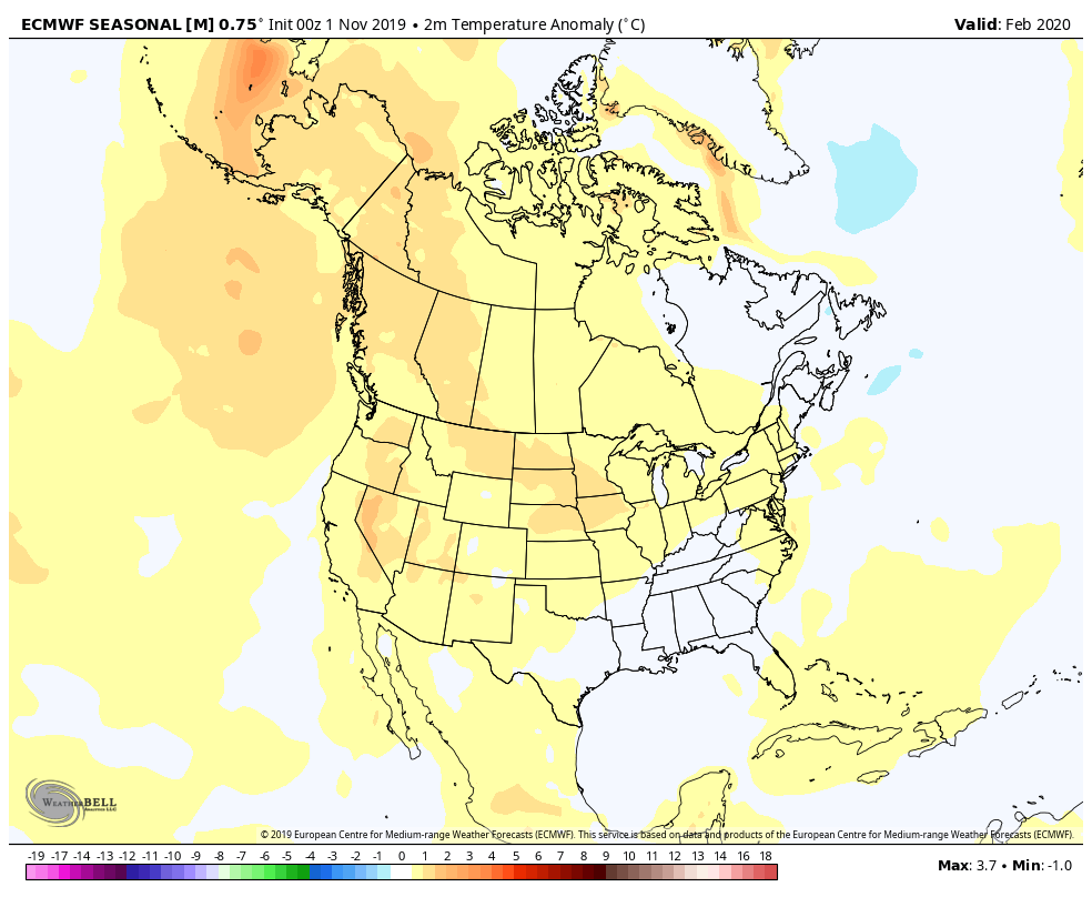
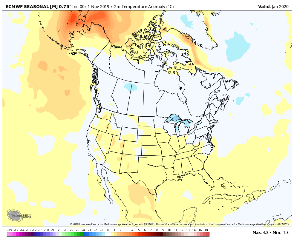
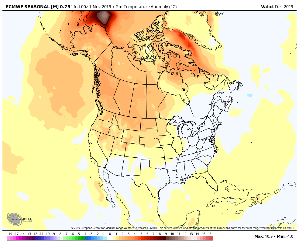
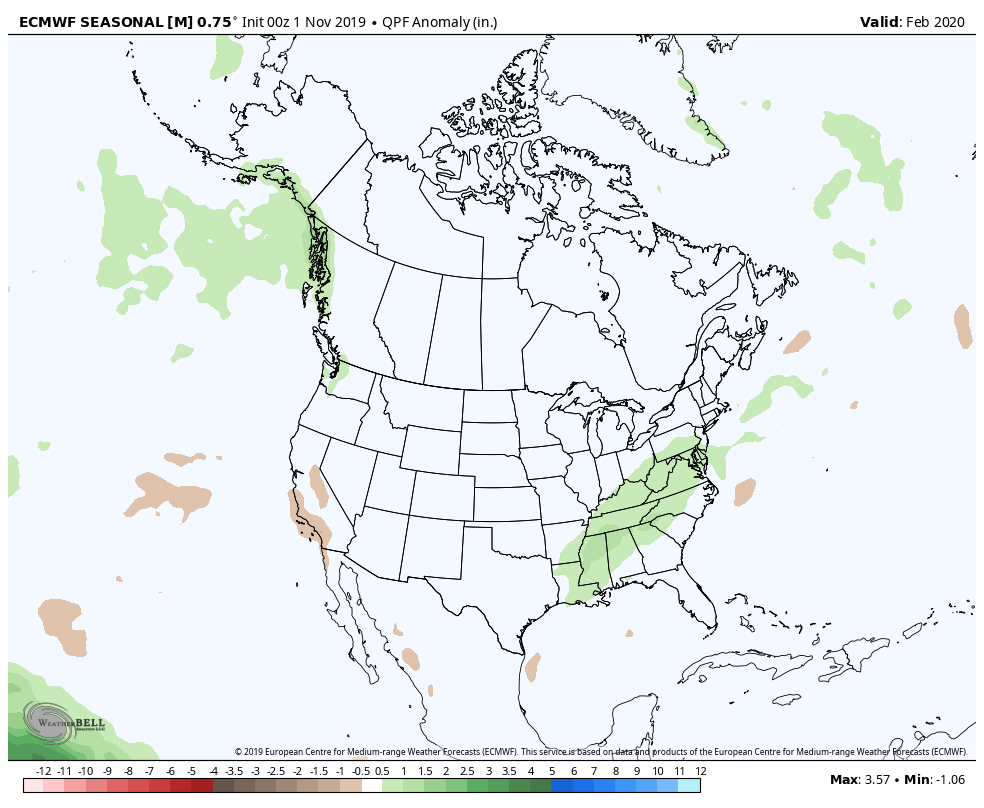
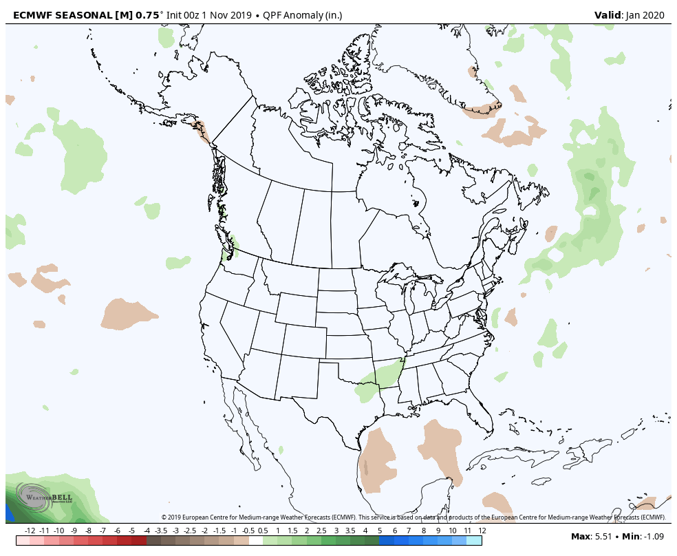
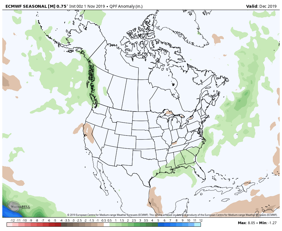
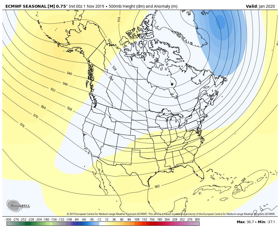
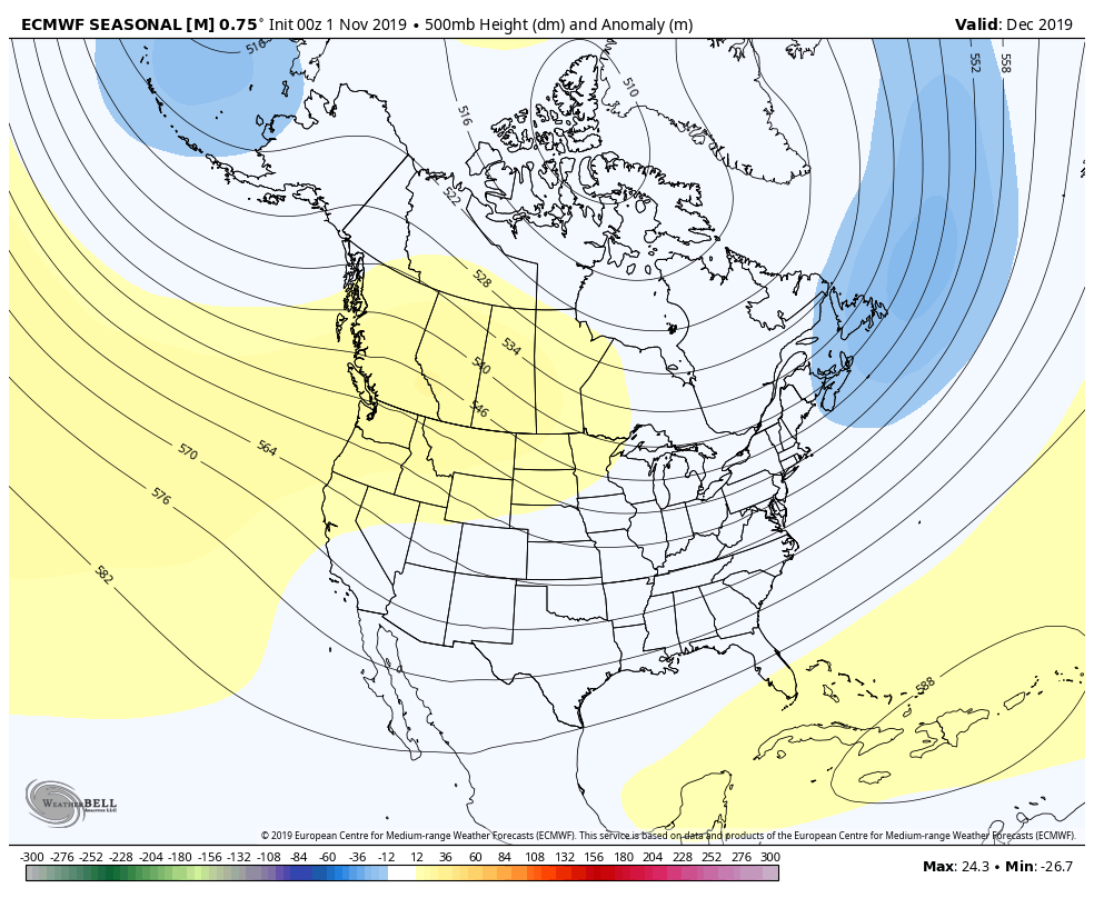
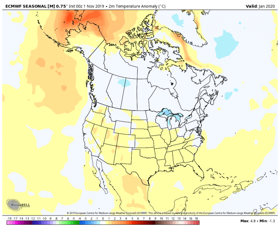
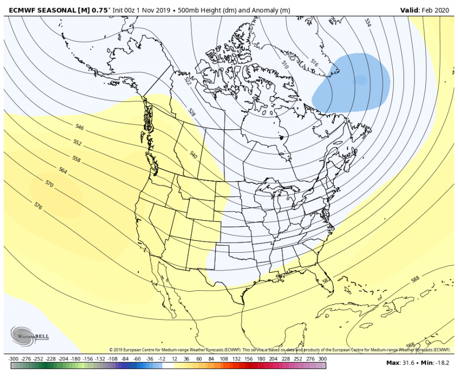
November ECMWF Seasonal is out. +PNA/+NAO pattern. Big difference for December from October forecast with a beatdown of the WAR and lower heights and pressure over eastern North America extending into the central Atlantic.


-
A little pre-season thread: Can Nov. 8 pull off an early win?
OSUmetstud replied to moneypitmike's topic in New England
That's happen with off-hour runs the past two days from what I saw. Kinda weird. -
A little pre-season thread: Can Nov. 8 pull off an early win?
OSUmetstud replied to moneypitmike's topic in New England
Pope ftw -
A little pre-season thread: Can Nov. 8 pull off an early win?
OSUmetstud replied to moneypitmike's topic in New England
Nazis, dude -
A little pre-season thread: Can Nov. 8 pull off an early win?
OSUmetstud replied to moneypitmike's topic in New England
Light a candle for the archbishop -
A little pre-season thread: Can Nov. 8 pull off an early win?
OSUmetstud replied to moneypitmike's topic in New England
Weirdly I find the navgem and ecmwf often agree even with the very different verification scores. -
A little pre-season thread: Can Nov. 8 pull off an early win?
OSUmetstud replied to moneypitmike's topic in New England
Look another stj warm sector. These last few winters have killed me. -
A little pre-season thread: Can Nov. 8 pull off an early win?
OSUmetstud replied to moneypitmike's topic in New England
Kuch does okay in marginal airmasses (it will shower lower than (10:1) and mid level magic areas but otherwise isn't super helpful. -
A little pre-season thread: Can Nov. 8 pull off an early win?
OSUmetstud replied to moneypitmike's topic in New England
It's on the emc page. It throws mid level warmth too far north of a sfc low so it over mixes but if anything it has a cold bias at the surface. That snow map from the gdps showed southern areas suffering from a torched bl not from too much ip/zr. -
A little pre-season thread: Can Nov. 8 pull off an early win?
OSUmetstud replied to moneypitmike's topic in New England
The ggem has a cold bias at the surface. Its warm bias is centered in the 850-700 layer. -
The gdps has the same sfc cold bias but it more properly diagnoses warm noses in the 850 to 700mb layer.
-
The thing with the gfs that bothers me is its inability to see the warm nose. It's useless for mixed precip but that was a thing before and after the fv3 upgrade. It's cold bias is through the whole lower atmosphere.
-
If a winter storm warm sectors St. John's, lock it in.
-
True, at least Tidbits puts where they are getting their baseline, wxbell just posts "anomaly."
-
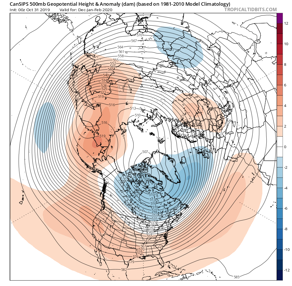
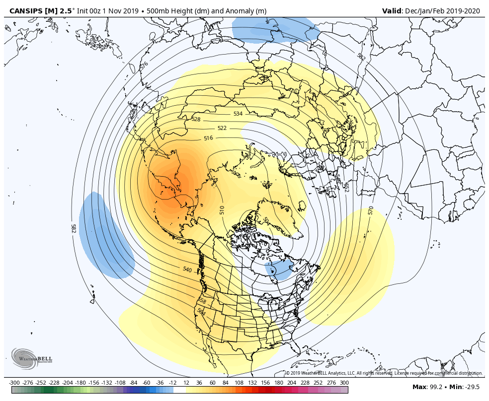
Mike V's maps looked more like Tropical Tidbits for the CanSIPS. It does look like the Weatherbell maps have erroneous ridging over central and northern Greenland. Weird.