OSUmetstud
-
Posts
16,521 -
Joined
-
Last visited
Content Type
Profiles
Blogs
Forums
American Weather
Media Demo
Store
Gallery
Everything posted by OSUmetstud
-
Its not a miller b. You are dishonest.

-
It's a clipper moving into the ne. The gfs has a southern steam system coming out of the sw. How does that "verify" what the gfs shows?
-
The ecwmf doesn't have the day 10 snowstorm. What are you talking about?
-
Because it SNE and you guys are on like a 15 to 20 year heater?
-
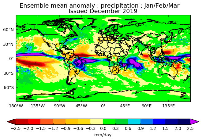
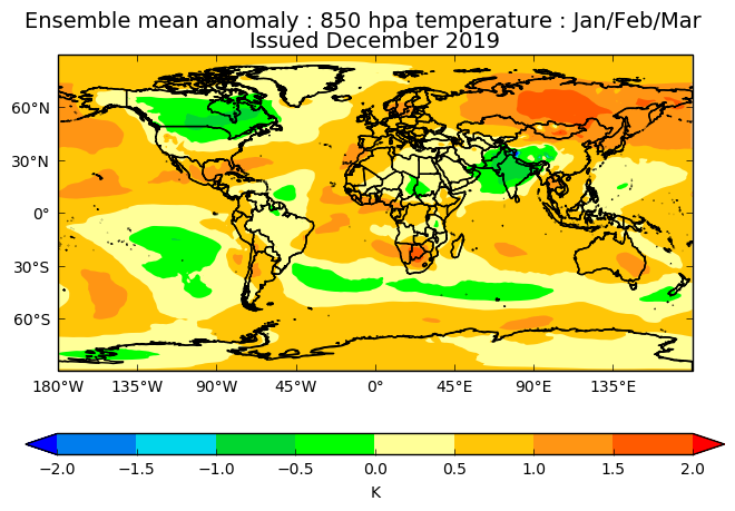
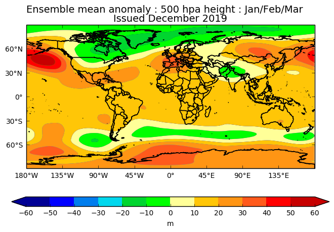
Newest ukmet seasonal is out. Looks like a (potentially) favorable gradient pattern.
-
We've had 3.6" in stj if it's any consolation. Just a brutal start..though I think we might be turning the corner.
-
I feel like he was probably joking there but there seems to be may more knowledgeable people to follow if you're into the strat warm events.
-
I mean...
-
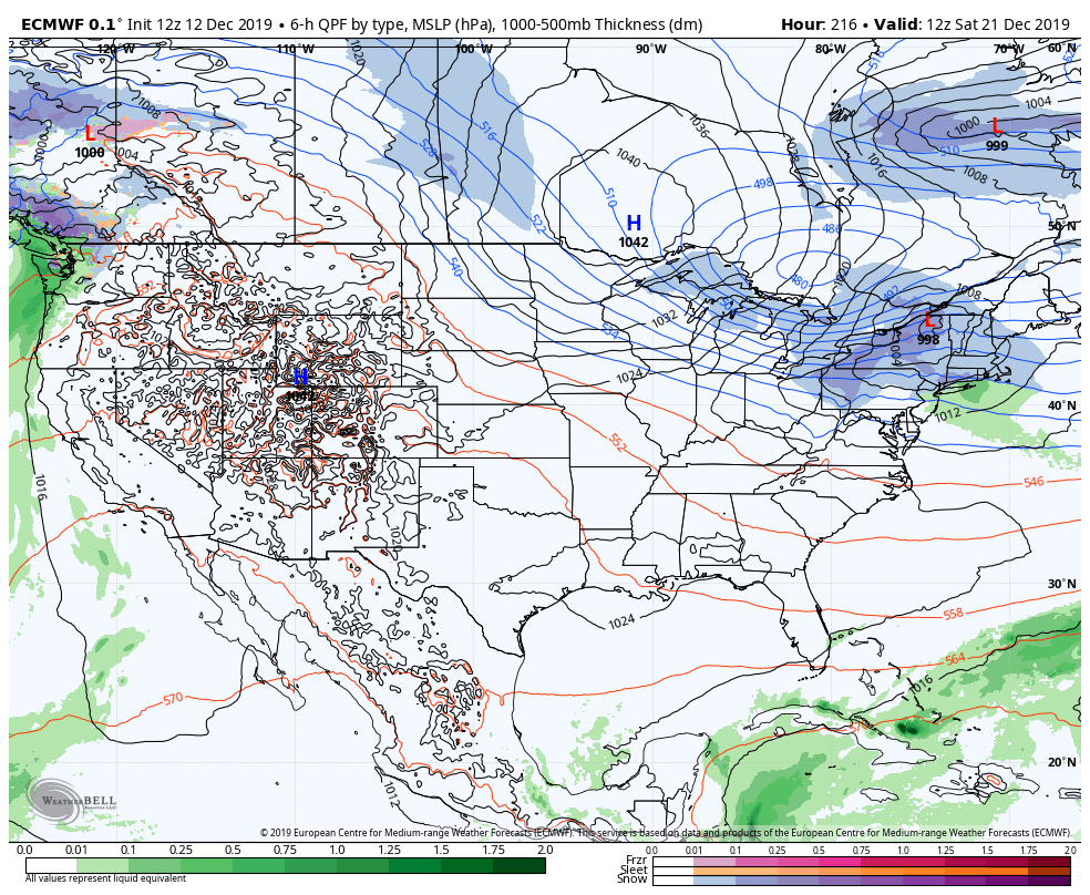
GFS delivering a Christmas miracle.
-
Do you guys know an easier to way found out what PWS have subsurface temperatures? I was looking at wunderground and can't seem to figure that out.
-
Happy Thanksgiving! Will, do you have your average seasonal snowfall map around?
-
Yeah, Tidbits has had some issues with uploading the rdps and the icon the past day or two.
-
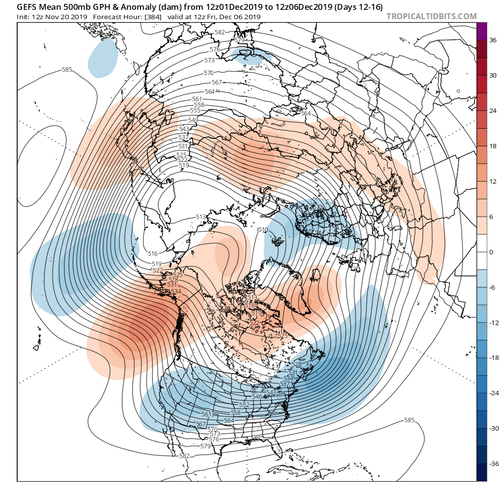
Man that late week low could be fun out here. What a monster for late November...looks more like a late winter low.
-
Yeah, I'm sure it will be a challenge. I'll have to dig out some good coastal front papers/training for the other forecasters.
-
My company just came to an agreement with Sudbury and Franklin for road forecasting. So I'll be regularly forecasting in Massachusetts going forward. Pretty cool.
-
The king of weenie maps
-
Upstate/Eastern New York
OSUmetstud replied to BuffaloWeather's topic in Upstate New York/Pennsylvania
Some models nowadays are coupled which is important in a hurricane upwelling situation. -
Upstate/Eastern New York
OSUmetstud replied to BuffaloWeather's topic in Upstate New York/Pennsylvania
Well yeah I mean this was 2007...but the wrf model did have the observed lake temperature with all its differences from Toledo to Buffalo. I would assume the model just has the surface temperature. It's not coupled and it's not mixing through the thermocline. -
Upstate/Eastern New York
OSUmetstud replied to BuffaloWeather's topic in Upstate New York/Pennsylvania
That event was my senior thesis. Some of the wrf simulation actually did an excellent job in mainly showing snow. Wrf simulations maximized precip over BUF at the observed lake temperature. Lake temperature decreased modeled precip overall. Lake temperature increased resulted in the band concentrating more precip over the lake but less at BUF The extremely deep mixed layer (lake induced equilibrium level in excess of 500mb) allowed the sensible heat of the lake to only heat up the surface temperature by 1 to 1.5 degree Celsius as the sensible heat gets mixed upward through the mixed layer. A more shallow cold air mass would have been more modified by the sensible lake heat. The land breeze circulation aided in drawing low level cooler and drier air from northern pa/ne ohio/sw ny underneath the band. This air wasn't as modified by the lakes and wet bulb and ice bulb temperature were fairly close to freezing. -
Upstate/Eastern New York
OSUmetstud replied to BuffaloWeather's topic in Upstate New York/Pennsylvania
I don't remember but the nws issued a warning the morning of Oct 12th for 2 to 6 inches. The lake effect event itself was well-modeled in advance and discussed for at least a few days before the storm. The ptype and accumulation was the difficult part of the forecast. -
Upstate/Eastern New York
OSUmetstud replied to BuffaloWeather's topic in Upstate New York/Pennsylvania
That's only the past 10 years, too. It could be that the past 10 have been more synoptic heavy at BUF than overall or a standard 30-year climb. -
Upstate/Eastern New York
OSUmetstud replied to BuffaloWeather's topic in Upstate New York/Pennsylvania
I too would be interested to see the logic but it doesn't seem too unreasonable. She graduated from Penn State, I'd guess she's pretty smart. -
Theres a lot of toughing in sw. Thered probably be a mixture of both
-
It think you'd expect an active pattern with frequent but not super intense lows.
-
I'd hit the gefs look.