OSUmetstud
-
Posts
16,521 -
Joined
-
Last visited
Content Type
Profiles
Blogs
Forums
American Weather
Media Demo
Store
Gallery
Everything posted by OSUmetstud
-
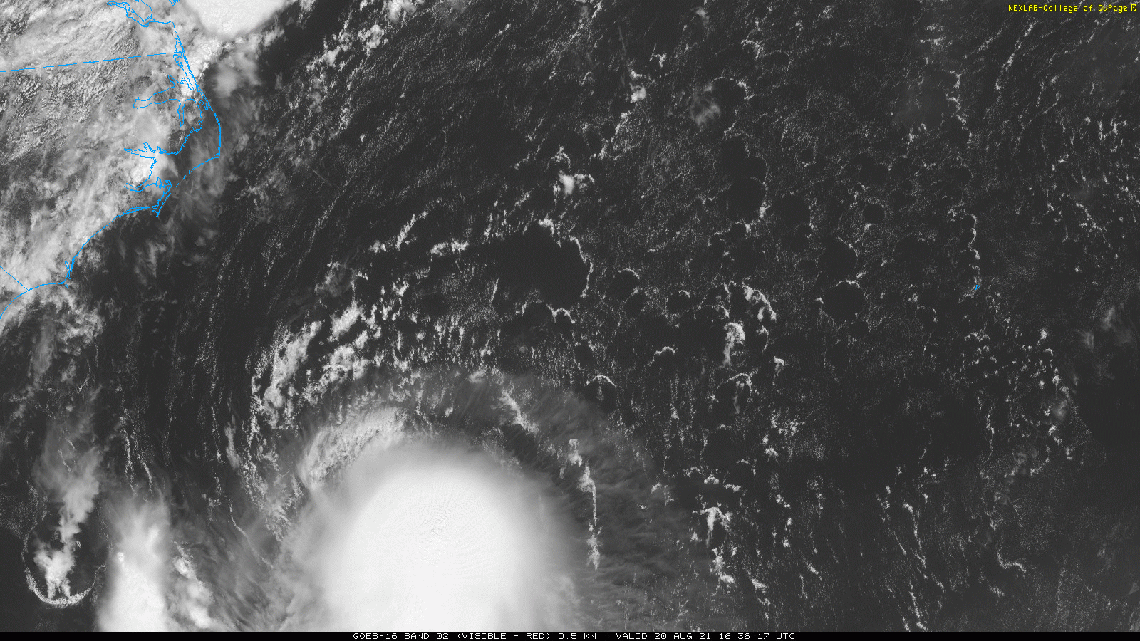
You can use your eyeballs on the vis there lol. But microwave would show it also.
-

-
Yeah Irene was very impressive. Lost trees and got several inches of rain in Blackstone. It looks very tilted right now albeit organized.
-
It really needs to take off between now and tomorrow to become a real wind event. If it made to a 3 before weakening it would make a huge difference.
-
UKMET hooks into Long Island and is near Newburg at 72 h.
-
Thanks. I didn't realize that it was that cold there at the moment. The upwelling part makes sense. It doesn't show up very well on the broader SST charts.
-
Yeah i know that spot is generally cold, but 11C? The Grand Banks is 16 right now lol.
-
What's with the dark blue east of Cape Cod and Nantucket? Doesn't seem realistic to me?
-
Yeah I guess I was just saying that it's independent. It's based on average track error at the lead time. it's not model spread or confidence dependent.
-
Definitely has a good chance to take off tomorrow, but the shear has titled the vortex and the outflow is restricted to the north for now. Objective guidance has been running around T3.5, which supports strong TS, not hurricane.
-
Cone is always the same size at the various lead times.
-
I believe SSD is done at least somewhat manually while Wisconsin is computer generated.
-
https://www.ssd.noaa.gov/PS/TROP/tdpositions.html http://tropic.ssec.wisc.edu/real-time/adt/odt08L.html Yeah, it's near a t4.0 65 knots (minimal hurricane)
-
Yes thanks. I actually ment WAR to the east but the general idea is there...
-
So it looks like to me that a stronger storm initially through the next day or so pushes the storm southwest (shear vector is out of the northeast). The after, a stronger storm should help build the WAR to the west of it. If you have a weak pos those two things don't happen.
-
Yeah euro is borderline tossable. It's basically not showing a TC.
-
It's almost an open wave the whole time though lol. That's something else entirely.
-
At initialization it's fine I think but given it doesn't spin up into much the whole run you might not put as much weight on it as normal. Intensity matters to track here I think.
-
ATCF IDENTIFIER : AL082021 LEAD CENTRAL MAXIMUM WIND VERIFYING TIME TIME POSITION PRESSURE (MB) SPEED (KNOTS) -------------- ---- -------- ------------- ------------- 1200UTC 18.08.2021 0 29.9N 66.1W 1004 40 0000UTC 19.08.2021 12 29.7N 68.4W 999 51 1200UTC 19.08.2021 24 29.5N 70.6W 987 61 0000UTC 20.08.2021 36 29.5N 72.5W 983 63 1200UTC 20.08.2021 48 30.0N 73.9W 981 65 0000UTC 21.08.2021 60 31.3N 74.3W 976 68 1200UTC 21.08.2021 72 33.7N 73.2W 961 85 0000UTC 22.08.2021 84 37.4N 71.3W 960 81 1200UTC 22.08.2021 96 41.1N 70.2W 962 79 0000UTC 23.08.2021 108 42.4N 69.9W 986 46 1200UTC 23.08.2021 120 43.0N 68.0W 996 35 0000UTC 24.08.2021 132 43.4N 65.5W 1003 27 1200UTC 24.08.2021 144 44.2N 62.5W 1005 25 Doesn't copy well but this is the last UKMET TC guidance. I think it goes over the cape as it weakens?
-
The loop thing seems actually more supported in some respect. Henri gets absorbed into that weak MA trough and just sits underneath the eastern Canadian ridge. There's not much push for a proper landfall.
-
I meant to post this here lol. Eric seems pretty convinced. Idk. The pattern is not crazy anomalous and the storm is so far east initially.
-
Eric seems pretty convinced. Idk. The pattern is not crazy anomalous and the storm is so far east initially.
-
You seem like a really nice person dude.
-
I think some empathy is in order given the awful circumstances.
-
blatant trolling? Delete half the tread then. Good lord lol. PhineasC has double the post of anyone here and does that all the time. it seems that some accept only the "right kind" of trolling.