

Tatamy
-
Posts
2,323 -
Joined
-
Last visited
Content Type
Profiles
Blogs
Forums
American Weather
Media Demo
Store
Gallery
Everything posted by Tatamy
-

August 2019 General Discussions & Observations Thread
Tatamy replied to bluewave's topic in New York City Metro
A gust to 65 mph was measured in the vicinity of the Sayville Ferry dock (Weather Underground). -
August 2019 General Discussions & Observations Thread
Tatamy replied to bluewave's topic in New York City Metro
Have some wind reports to share from Fire Island from tonight’s event: Fire Island Light 46 mph Fair Harbor 46 mph Atlantique 40 mph Point of Woods 40 mph Cherry Grove 40 mph Fire Island Pines 35 mph These gusts all occurred around 10 pm. It is amazing that these stations are still up and reporting after this event. -
August 2019 General Discussions & Observations Thread
Tatamy replied to bluewave's topic in New York City Metro
The cell that popped near Allentown a short while ago dropped a quick 0.96” here. No strong winds or CTG lightning with it however. -
July 2019 General Discussions & Observations Thread
Tatamy replied to bluewave's topic in New York City Metro
I have a station mounted at my brother’s house at Cherry Grove. It gusted to 26 mph at 8pm. It’s mounted slightly below the roof line so it does not get the full exposure to the wind. Based upon how it is set up I would estimate actual winds gusted to 40 mph there at that time. -
July 2019 General Discussions & Observations Thread
Tatamy replied to bluewave's topic in New York City Metro
Shelf cloud from earlier with the second round of storms.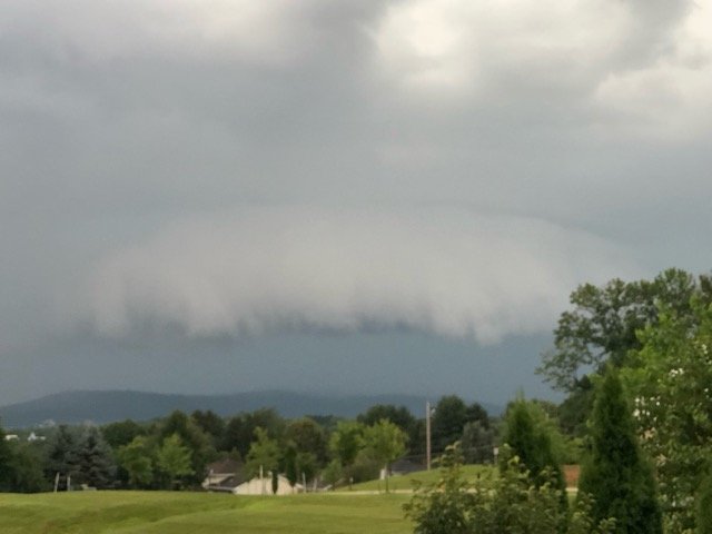
-
July 2019 General Discussions & Observations Thread
Tatamy replied to bluewave's topic in New York City Metro
Lots of lightning just to my SW as the next batch of storms approaches.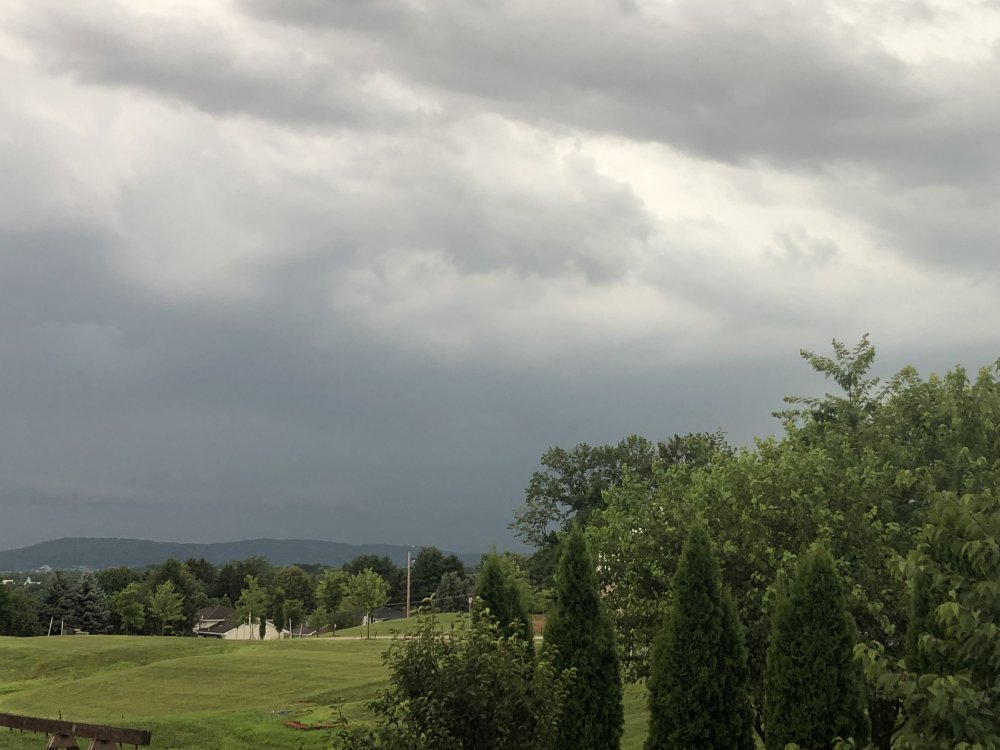
-
July 2019 General Discussions & Observations Thread
Tatamy replied to bluewave's topic in New York City Metro
I think the storms over Allentown will head to the city First round of storms were good rain producers - rec'd 0.67" with that round which is reforming in western and NW NJ. Lightning was minimal here but saw a nice shelf cloud as it arrived with a wind gust to 20 mph. Skies darkening here as the second round gets going near Allentown and heads our way. -
July 2019 General Discussions & Observations Thread
Tatamy replied to bluewave's topic in New York City Metro
I think it weakens. But that is a ton of rain over PA. Hopefully we don't get into that because it would be flash flooding. It's only moving around 20 mph. Plenty of rain out here today with on and off convection. Nice shelf cloud with the latest feature that moved through about 7:15pm. 1.10” on the day. NWS has a FFW for my area. -
I would go with 2/78 and 1/16. 2/78 was especially dramatic with high winds and low near zero visibility’s for hours on end along with 30” of snow. 1/16 also brought 30” of snow with very high rates. As dramatic as Boxing Day was its most significant impacts were felt in eastern NJ and places to the north and east of there in the region. We only had a couple of inches from that one here.
-
I live in the Lehigh Valley of Pennsylvania. We had a snowstorm on 11/15. Similar to this situation the models were showing heavy amounts for my area. The FV3 consistently showed 10”+ for me for 2 - 3 days prior. The Mets blew them off. The model outputs were contaminated by sleet they said. We were forecasted to get 1-3” by the NWS office. On the 15th as the storm was getting underway at 12pm and I was out on my back deck photographing the arrival of a wall of snow we were upgraded to a WSW. By 6pm we were at 8 1/2” of snow before we changed over to sleet. We picked up another 1 1/2” by the next morning to bring the storm total up to 10”. The bottom line is those who are blowing off these model outputs do so at their own risk. The FV3 proved to be correct. Many many people spent the night out on the highway because they could not get home.
-
The August 21, 2017 Great American Eclipse
Tatamy replied to ice1972's topic in Weather Forecasting and Discussion
Looked at the traffic map this evening and there is a lot of heavy traffic going south down through VA on I-95 and I-81. I am guessing that this is in part related to the eclipse. Hotels all over SC are booked in anticipation of this event.


