

Tatamy
-
Posts
2,570 -
Joined
-
Last visited
Content Type
Profiles
Blogs
Forums
American Weather
Media Demo
Store
Gallery
Everything posted by Tatamy
-

Obs and nowcast Friday afternoon-night 18z NY Day 2021- 12z/2
Tatamy replied to wdrag's topic in New York City Metro
32 with light rain here. -
Cold front has just passed through. Temperature has dropped to 44F
- 242 replies
-
- 1
-

-
- damaging wind
- flooding rains
- (and 1 more)
-
HIGH IMPACT Stormy Christmas (EVE and morning) 12/24-25/20 6P-10A
Tatamy replied to wdrag's topic in New York City Metro
Total rainfall so far this event - 1.20". Highest wind gust - 33 mph.- 227 replies
-
- 2
-
-
- heavy rain
- flooding potential
- (and 2 more)
-
HIGH IMPACT Stormy Christmas (EVE and morning) 12/24-25/20 6P-10A
Tatamy replied to wdrag's topic in New York City Metro
0z NAM output for highest wind gusts- 227 replies
-
- 2
-

-

-
- heavy rain
- flooding potential
- (and 2 more)
-
HIGH IMPACT Stormy Christmas (EVE and morning) 12/24-25/20 6P-10A
Tatamy replied to wdrag's topic in New York City Metro
12z Euro maximum projected wind gusts- 227 replies
-
- 1
-
-
- heavy rain
- flooding potential
- (and 2 more)
-
It's been quite an evening here. We now have sleet pellets mixed in and according to Dual Pol Doppler we will be transitioning soon. We have had 8" so far. 19F / DP 18F. Blizzard conditions reported at ABE.
-
It is still snowing in southern PA right near the DE line. blob:https://www.511pa.com/53ece02f-f11f-4747-bc4e-c081fede4295
- 3,762 replies
-
- 1
-
-
- heavy snow
- heavy rain
- (and 3 more)
-
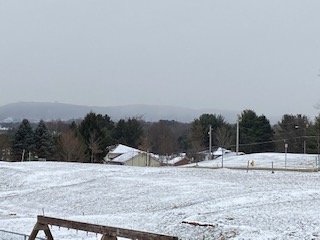
This is the wall of snow approaching from my south.
-
I am seeing very light snow begin here. There is steady light snow falling to my west between Allentown and Harrisburg. Visibilities that I am seeing in those areas look to be about 1 - 2 miles along I-78. Along I-81 to the south and west of Harrisburg visibilities drop off steadily. I am seeing 1/4 mile visibilities as you go down towards MD.
-
December 16-17, 2020 Storm Observations and Nowcast
Tatamy replied to wdrag's topic in New York City Metro
Watching snow spread rapidly to the east from Harrisburg towards the Allentown/Bethlehem area. I am expecting snow to reach me by 1 PM or so based upon what I am seeing unfold to my west.- 1,011 replies
-
- 1
-
-
- heavy snow
- sleet
- (and 4 more)
-
December 16-17, 2020 Storm Observations and Nowcast
Tatamy replied to wdrag's topic in New York City Metro
Watching snow break out rapidly across south central PA. Visibility has dropped significantly in the Harrisburg area.- 1,011 replies
-
- 1
-
-
- heavy snow
- sleet
- (and 4 more)
-
Just checked some Penndot cameras in south central PA. Snow is moving into the Harrisburg area and is coming down steadily along I-81 in south central PA. https://www.511pa.com/CameraListing.aspx?OpenPage
- 3,762 replies
-
- 1
-
-
- heavy snow
- heavy rain
- (and 3 more)
-
Enjoy. I have had mine for a few months. It's a nice station.
- 3,762 replies
-
- 1
-
-
- heavy snow
- heavy rain
- (and 3 more)
-
Exact same conditions here. Now all steady wet snow - coating on the ground - Visibility 1 mile 33.0F
-
Mixed snow sleet and rain here. 34.3F
-
0z NAM
-
0z HRRR
-
In my view the 12z Ukie can definitely be disregarded however I would be cautious about tossing the GFS / GEFS. If the GFS suite were to verify this would not be the first time where confluence over New England forced a winter storm off to the south of us. I would incorporate a blend of these models.
-
18z GEFS
-
I've been liking mine in the Lehigh Valley in Bethlehem Twp. PA.
- 3,762 replies
-
- 1
-
-
- heavy snow
- heavy rain
- (and 3 more)
-
18z NAM - still snowing across the region at 84 hours. The run total would include the Monday event.