

Tatamy
-
Posts
2,571 -
Joined
-
Last visited
Content Type
Profiles
Blogs
Forums
American Weather
Media Demo
Store
Gallery
Everything posted by Tatamy
-

January 28/29 Blizzard Observations/Discussion/Nowcasting
Tatamy replied to Northof78's topic in New York City Metro
The back edge of the snow has been nearly steady across eastern PA and eastern MD for the last two hours at least so you will definitely be in this for a number of hours to come. -
January 28/29 Blizzard Observations/Discussion/Nowcasting
Tatamy replied to Northof78's topic in New York City Metro
It looks like an IVT has set up along the Delaware River going NW from Trenton towards my area. This storm does not lack for surprises. My visibility has dropped from 5 miles back down to 1. -
January 28/29 Blizzard Observations/Discussion/Nowcasting
Tatamy replied to Northof78's topic in New York City Metro
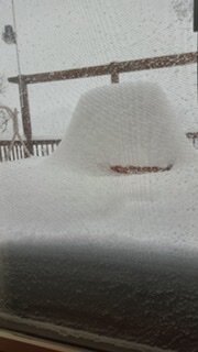
1 1/2” new today. -
The recon data that is gathered later will go into the 0z runs tonight. Interesting how the GFS jumped last night at 0z after the data from yesterday’s flights were ingested.
-
I have 1” new this morning and was forecast to get 1/2” for the entire day. Big time fluff factor here.
-
January 28/29 Blizzard Observations/Discussion/Nowcasting
Tatamy replied to Northof78's topic in New York City Metro
Steady light snow continues. 27* with 1 mile visibility. 1” new OTG. Big time fluff factor with this snow. -
Mesos showed me getting an inch or so today. Already 1/2” OTG.
-
January 28/29 Blizzard Observations/Discussion/Nowcasting
Tatamy replied to Northof78's topic in New York City Metro
Steady light snow- 1 mile visibility. -
I am in the screw zone and expect to be on the west side of the gradient. In any case this is what it looks like out here at the current time.
-
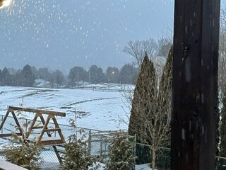
Snowing here with 1 mile visibility.
-
Snow is rapidly breaking out across south central PA with the overrunning. Are we going to get an Obs thread set up for this?
-
This is what 30” looks like (from 1/2016)
-
Are you ready to shovel 24”? I had that a year ago this weekend. I will pass on that.
-
Check out the mesos (HRRR/RAP) for tomorrow for northern NJ. If this overrunning happens you will be pushing snow from your driveway.
-
That is the flight that will be sampling the western Atlantic for the 0z runs. There are two flights scheduled to go out over the PAC as well. Again the intention is for this data to make it into the 0z model suite. The update for tomorrow is for two flights over the western Atlantic and two over the PAC.
-
I am out in Bethlehem, PA - not really expecting anything. What is crazy are some of those EPS members. By my count 10 of those 50 members would give me 12” +. Brings new definition to the term “Go big or go home.”
-
06z Euro has 3-6” across the area with 6”+ across eastern LI and down closer to ACY in S NJ. Lesser amounts to the N&W.
-
06z Euro shifts east
-
No the Euro output cannot be discounted at this time.
-
The wild card in all this is what will come from the data collected on the recon flight today and the 3 additional flights tomorrow. The data from today’s flight is expected to reflect in the 0z model suite.
-
Yes it is
-
This would come from 20:1 ratios. Do you really think the ratios go that high?
-
Wait to tomorrow when they send out 3 planes. 1 out to the Atlantic and 2 out to the PAC. Another day of model gyrations coming up.
-
18z Euro is 6-12” from the city S and E and 3-6” to the N and W. What is not to like about that?
-
The Euro was the model that went nuts with this one in recent runs. The other models were further east or going that direction. The NAM went big on this this morning for that one run.


