Tatamy
-
Posts
2,570 -
Joined
-
Last visited
Content Type
Profiles
Blogs
Forums
American Weather
Media Demo
Store
Gallery
Everything posted by Tatamy
-

Extreme Cold, Snow & Sleet: SECS 1/24 - 1/26
Tatamy replied to TriPol's topic in New York City Metro
Feel better- that’s nasty. -
Extreme Cold, Snow & Sleet: SECS 1/24 - 1/26
Tatamy replied to TriPol's topic in New York City Metro
Stores out here have been out of deicing pellets for days now. -
Extreme Cold, Snow & Sleet: SECS 1/24 - 1/26
Tatamy replied to TriPol's topic in New York City Metro
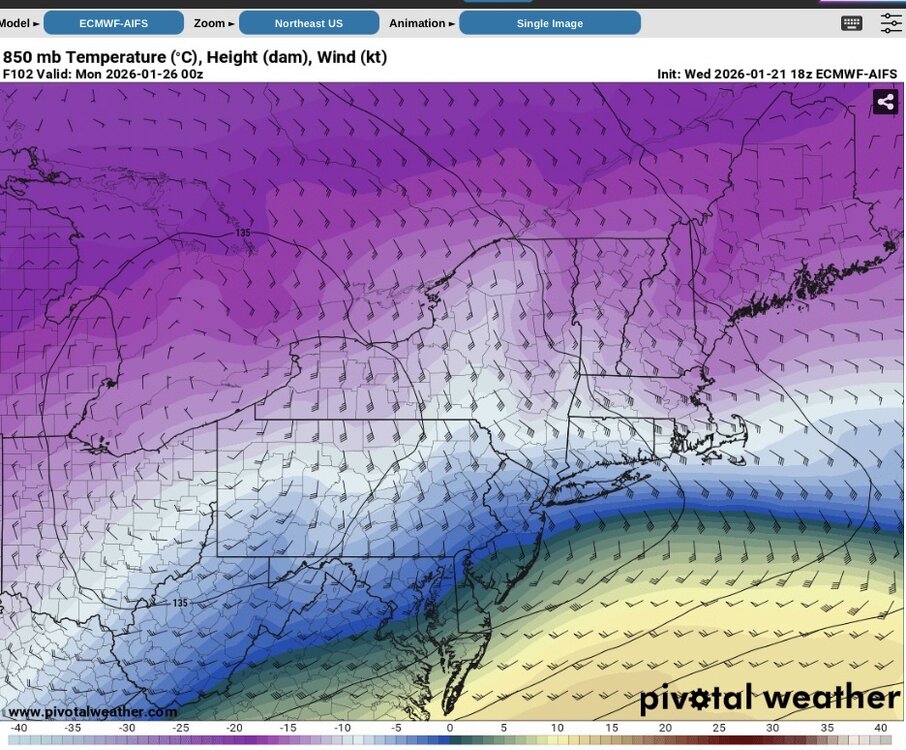
The NAM has a big time warm nose at 750 mb at 84 hours at 12z just to the south and west of the city. -
Extreme Cold, Snow & Sleet: SECS 1/24 - 1/26
Tatamy replied to TriPol's topic in New York City Metro
Look at the temps at 700mb and 850mb. It gives a different picture of the event precip wise. Be sure to look at 96 and 102 hours. -
Extreme Cold, Snow & Sleet: SECS 1/24 - 1/26
Tatamy replied to TriPol's topic in New York City Metro
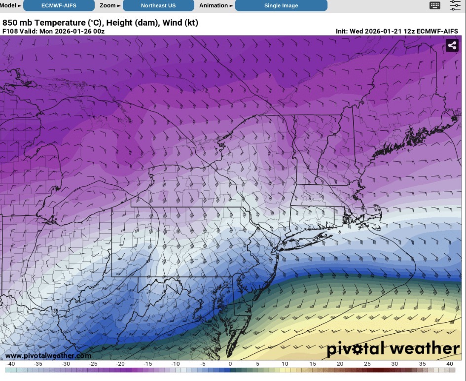
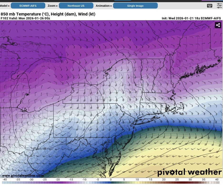
We do need to watch the position of the 850 mb low on the Euro AI. These screenshots are from 12z and 18z. It’s getting further north and that will act to promote mid level warming.
-
Extreme Cold, Snow & Sleet: SECS 1/24 - 1/26
Tatamy replied to TriPol's topic in New York City Metro
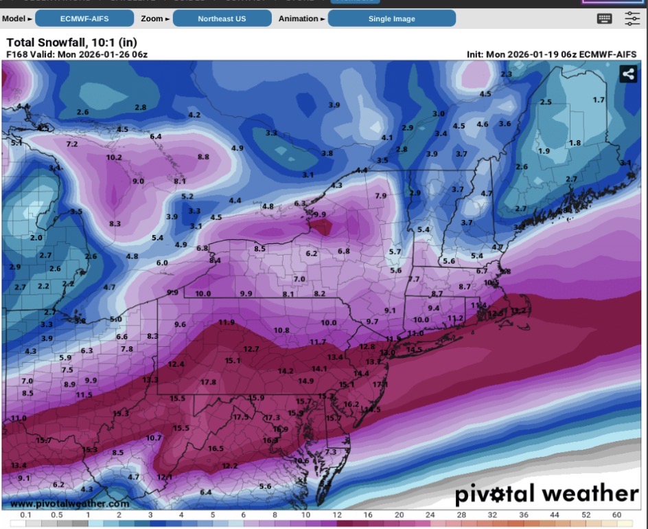
18z Euro has a front end thump of 7-10” for coastal areas before going to a lighter wintry mix. Inland areas get 10-15”+. The main feature is SLP that is tucked into the Delmarva and southern NJ coast. This is still a significant storm for the area. -
Extreme Cold, Snow & Sleet: SECS 1/24 - 1/26
Tatamy replied to TriPol's topic in New York City Metro
No mixing issues shown on this model in the NY Metro area. -
Extreme Cold, Snow & Sleet: SECS 1/24 - 1/26
Tatamy replied to TriPol's topic in New York City Metro
That’s nuts. I don’t want five feet of snow in my neighborhood. -
Extreme Cold, Snow & Sleet: SECS 1/24 - 1/26
Tatamy replied to TriPol's topic in New York City Metro
There’s actually a burst of snow at the end. -
Extreme Cold, Snow & Sleet: SECS 1/24 - 1/26
Tatamy replied to TriPol's topic in New York City Metro
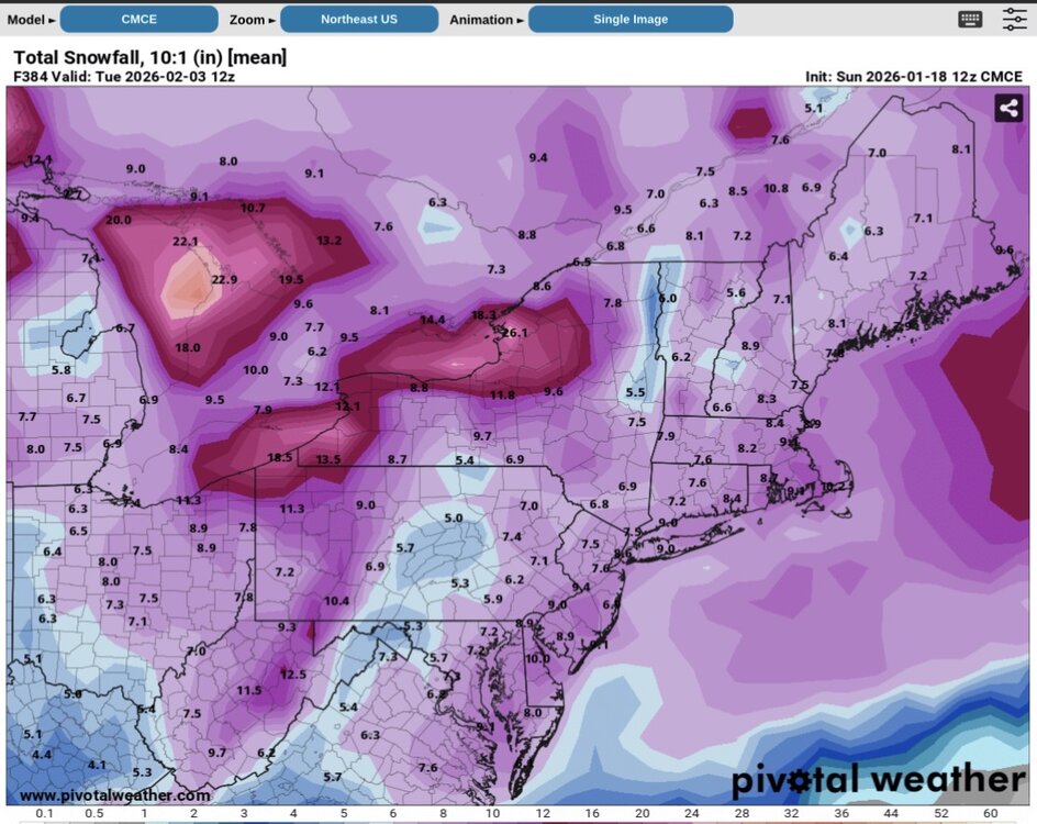
FWIW the CMC has a history of being on the north side of the guidance at this stage. -
Extreme Cold, Snow & Sleet: SECS 1/24 - 1/26
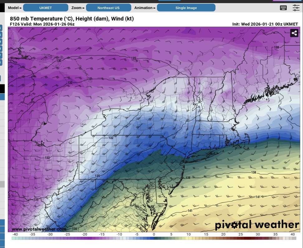
Tatamy replied to TriPol's topic in New York City Metro
Ukie is a much different evolution as compared to 0Z. It does mix with a little sleet but is still a big hit. -
Extreme Cold, Snow & Sleet: SECS 1/24 - 1/26
Tatamy replied to TriPol's topic in New York City Metro
The NAM can probably barely contain its excitement over being able to work that warm nose in another day or so. -
Extreme Cold, Snow & Sleet: SECS 1/24 - 1/26
Tatamy replied to TriPol's topic in New York City Metro
Huge run on the 06z EPS mean as well. -
Extreme Cold, Snow & Sleet: SECS 1/24 - 1/26
Tatamy replied to TriPol's topic in New York City Metro
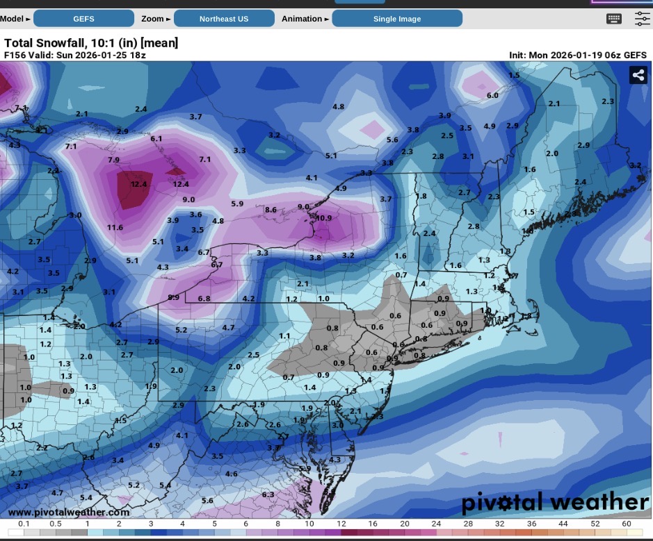
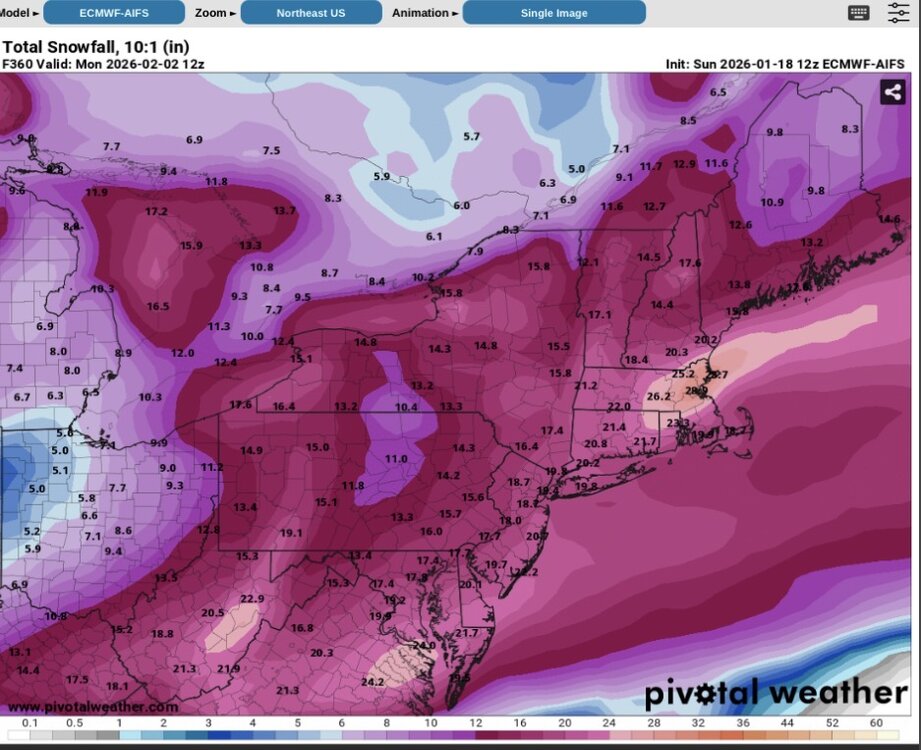
Euro AI is a big hit across the area. -
Extreme Cold, Snow & Sleet: SECS 1/24 - 1/26
Tatamy replied to TriPol's topic in New York City Metro
Definitely precip issues with the Ukie for at least part of the area.
-
Extreme Cold, Snow & Sleet: SECS 1/24 - 1/26
Tatamy replied to TriPol's topic in New York City Metro
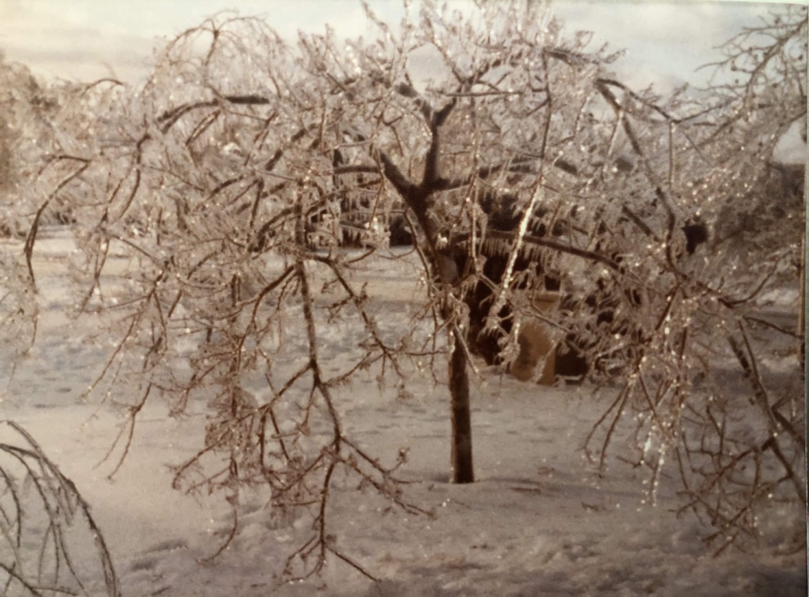
Agree. The pictured event took place with temperatures between 28 and 30. It caused widespread power outages -
Extreme Cold, Snow & Sleet: SECS 1/24 - 1/26
Tatamy replied to TriPol's topic in New York City Metro
Your comment is not correct. These photos were taken on January 14th, 1978 at East Northport on Long Island. Heavy rain fell most of the night with below freezing temperatures resulting in this severe ice storm.


-
Extreme Cold, Snow & Sleet: SECS 1/24 - 1/26
Tatamy replied to TriPol's topic in New York City Metro
I hired a contractor for this weekend. I did my fair share this past weekend. -
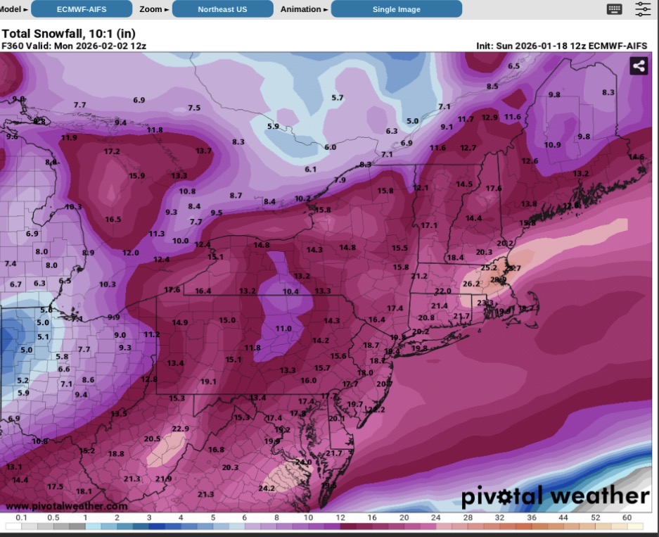
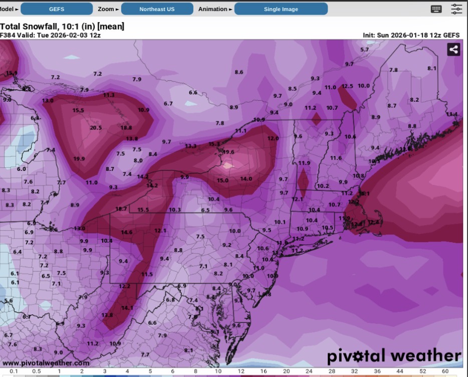
Next weekend. GEFS is a work in progress.


-
January 18th Back Door NW Trend Snow OBS Thread
Tatamy replied to Mikeymac5306's topic in Philadelphia Region
4.2” total for today. 8.4” total for the weekend. I received 2” tonight which I was definitely not expecting. -
Correct- I am at 8.4” for the weekend.
-
It’s been the same here. It’s been going since 4:30 AM. 2.2”
-
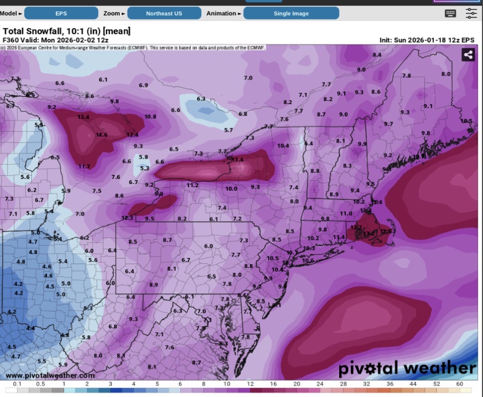
These are today’s ensemble outputs along with the Euro AI output. I do not ever recall seeing the widespread 6”+ amounts over virtually all of the NE part of the country on these models.


-
I think you are correct. The echos where I am in eastern PA are steady very light snow.
-
It is very interesting to watch.