Tatamy
-
Posts
2,581 -
Joined
-
Last visited
Content Type
Profiles
Blogs
Forums
American Weather
Media Demo
Store
Gallery
Everything posted by Tatamy
-
One of the areas that stands the greatest risk WRT flash flooding will be the Coachella Valley of interior southern CA. This is the region along I-10 from Palm Springs down to Indio and beyond. Elevations in the valley itself range from near sea level to a few hundred feet. The Valley is surrounded by high mountains with elevations of 10000 feet or more. These mountains are solid rock and will catch the highest rainfall totals and strongest winds. With no soils to speak of whatever rainfall that comes down will run straight down into the valley. The valley itself has dry washes both natural and man created. This is a desert region with sand only (It has the consistency of concrete) so there are no soils to speak of in which to absorb all of this water. These washes will not be able to handle this runoff. The destruction potential of this event in the deserts of Southern California cannot be over stated.
-
.81” overnight. This trough just keeps on giving.
-
Lol - They have been out here for three years. They eat what they’re going to eat and move on. At this point we have a lot of well fed birds that eat them.
-
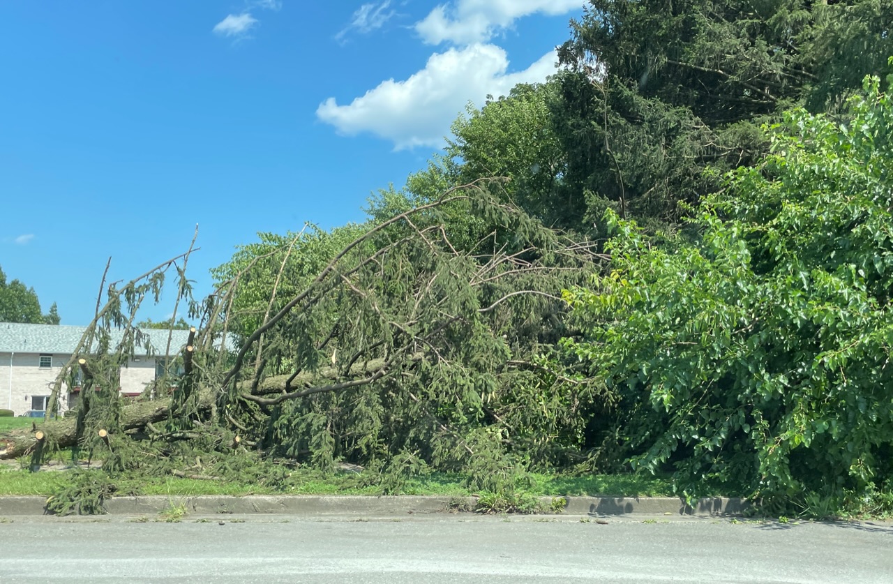
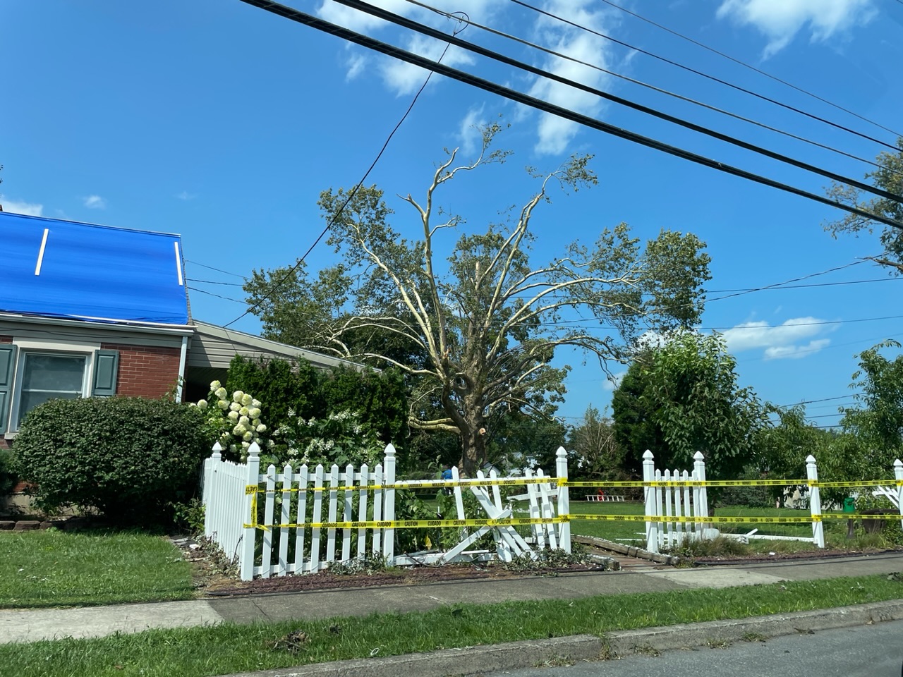
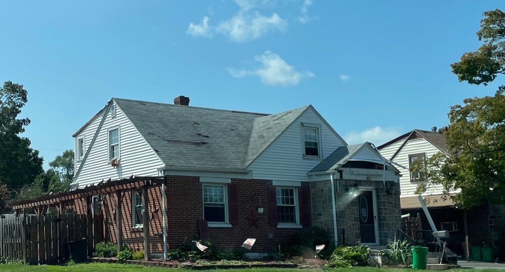
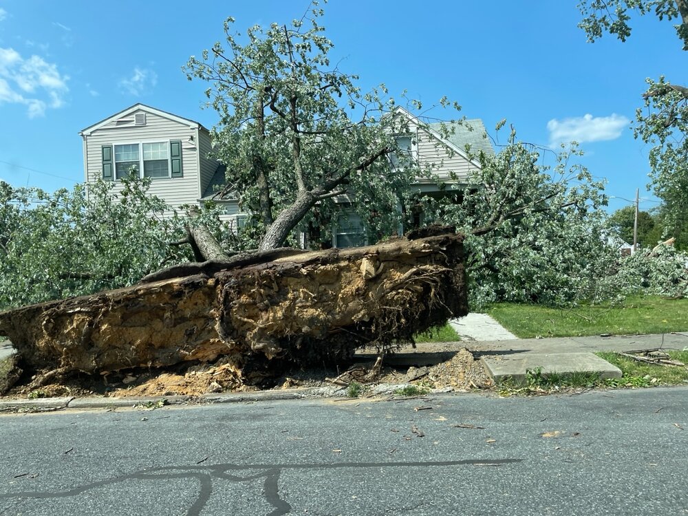
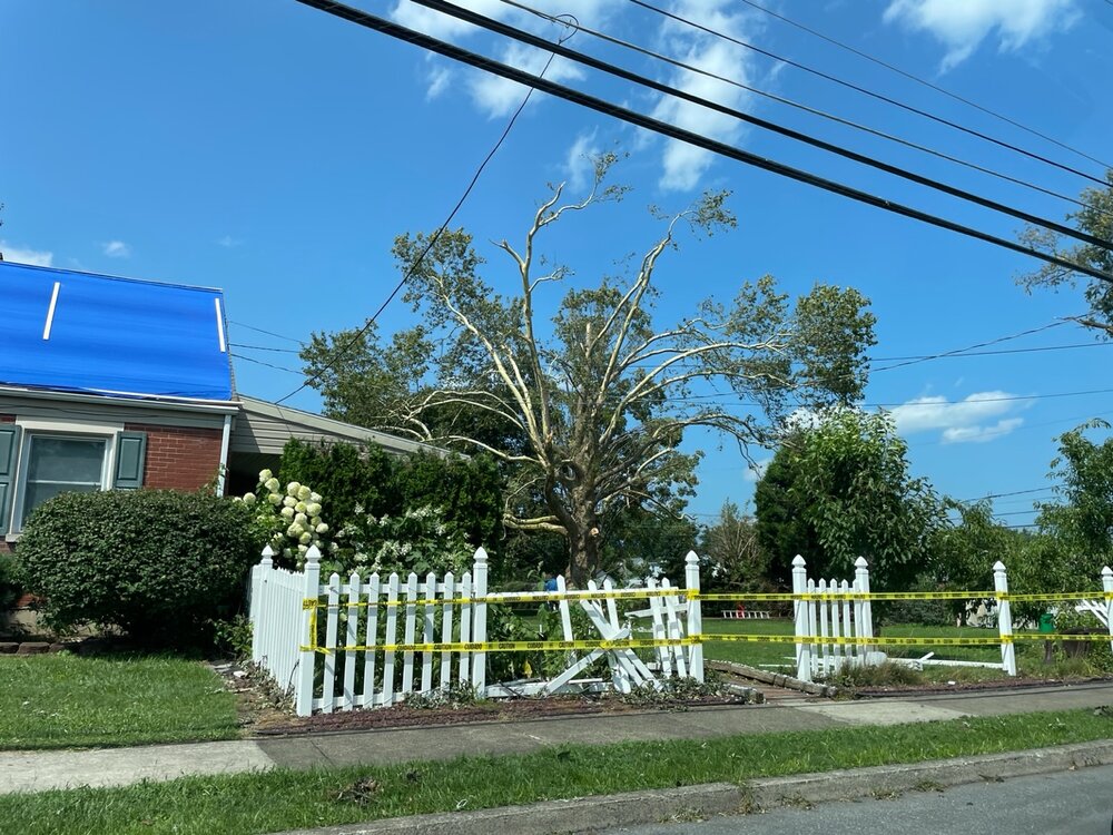
Went through the Midway Manor neighborhood in Allentown that took the tornado hit Monday evening. This was not a TOR warned storm. Damage was mainly to some large trees with some structural damage as well.

-
79/73 here with a low deck of stratus. This low deck has been quite tenacious in holding its ground.
-
Have received 0.70” on the day so far.
-
Had a gust to 35 mph at my station located at Cherry Grove. 0.12” in the rain gauge. These cells are moving much too quick to put down any significant amounts of rain in most places. Multiple reports of wind gusts to 40 mph + in Fire Island Pines.
-
Favorable atmospheric conditions and terrain factors.
-
Some real nasty lightning with these storms out here in the Lehigh Valley. Lots of CTC and CTG lightning with them.
-
Line has passed through here. Nothing out of the ordinary. 0.33” collected in the rain gauge. About an hour’s worth of CTC that I actually slept through. Highest wind gust 16 mph. Yawn.
-
Mt. Holly issues severe thunderstorm watch for all of its PA counties.
-
Timing of this feature looks to be 1:30 - 2:00 AM for when it reaches NW NJ and Warren Cty.
-
Steady rain on Fire Island the past couple of hours. 0.23”
-
Thank goodness for that sea breeze front.
-
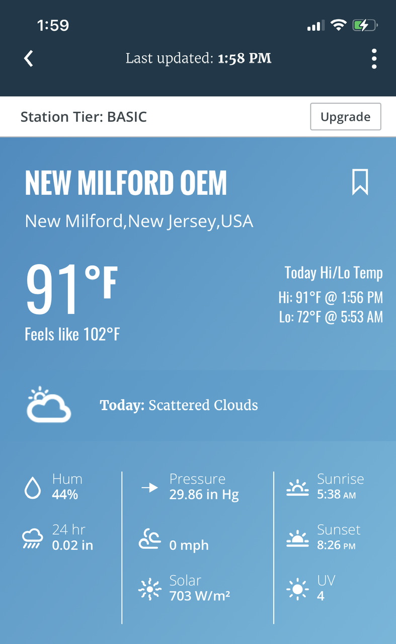
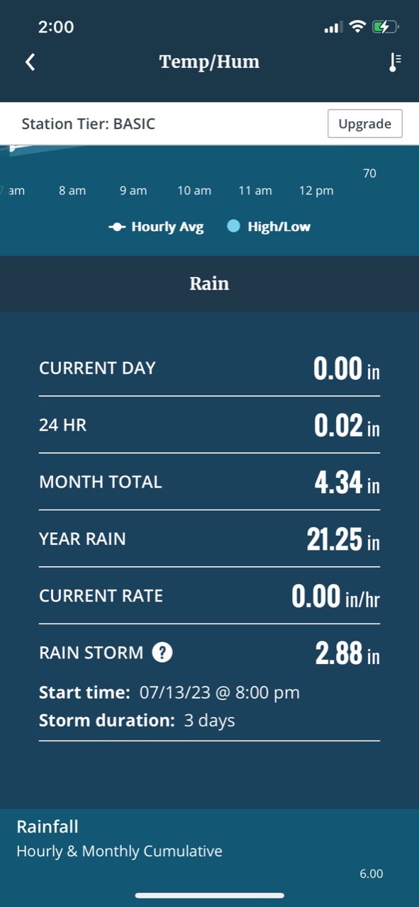
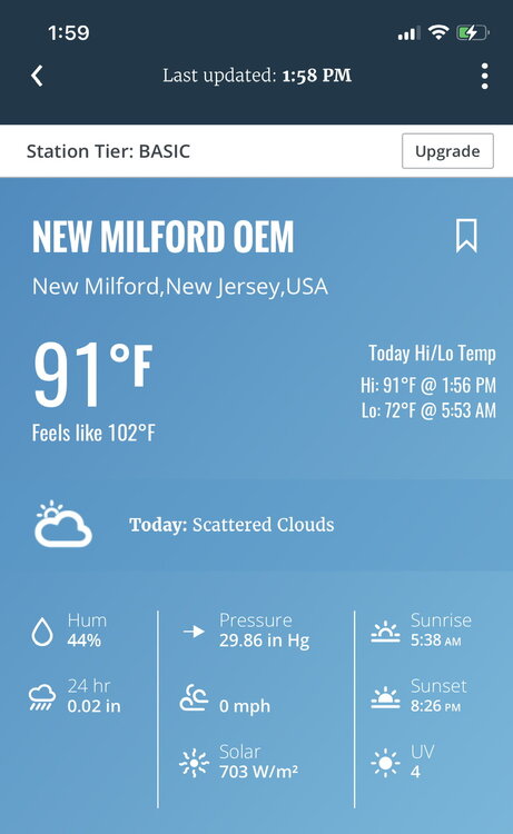
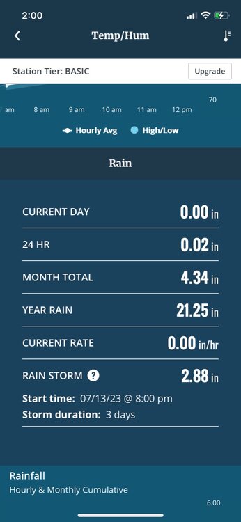
This is from a Davis station situated in New Milford which had 2.88”. Nearby stations with that network had between 3 - 4”
-
Crazy gradient as usual with these events. My station on Fire Island (Cherry Grove) has 0.17” so far today. Nearby stations to there are the same.
-
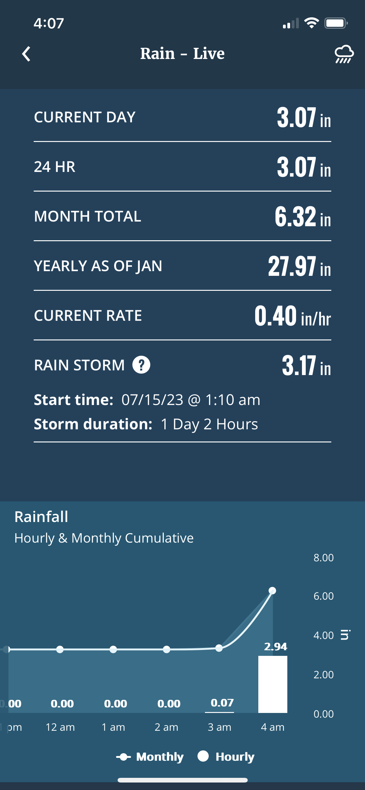
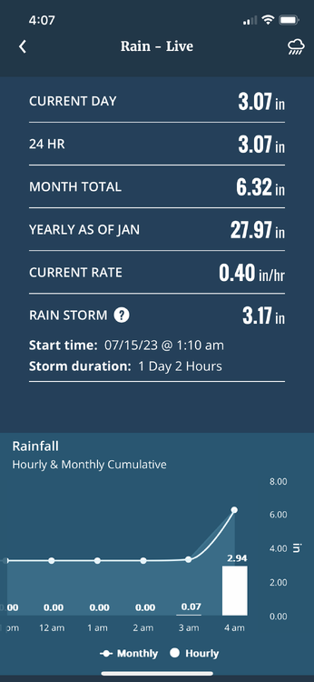
We have done the deed out here this morning. 2.94” in one hour with this crazy band.
-
74/70. Rain missed me in all directions today.
-
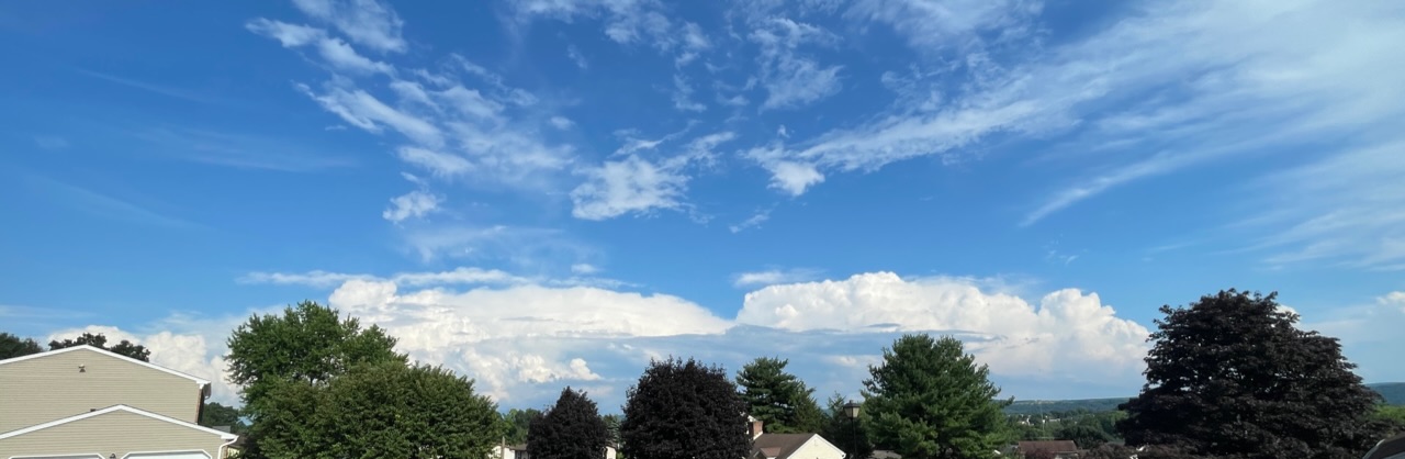
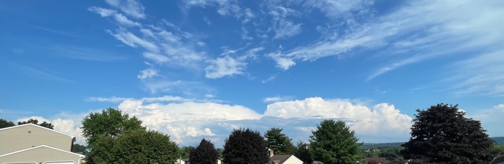
This is a view of the convection complex that has been hammering central NJ.
-
Sea breeze front has been fairly active today right along the north shore particularly in Suffolk Cty.
-
Outflow boundary from the earlier convection over the LHV has dropped south through the NYC metro area and is helping to set off new storms over the boroughs and nearby NJ.
-
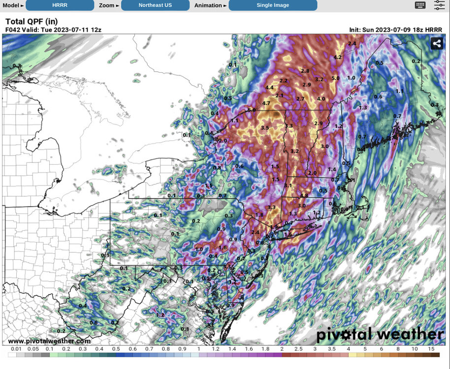
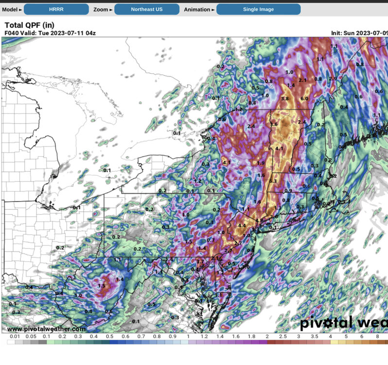
18z HRRR did still have the hole over Nassau. It was not 3-5” island wide.
-
12z HRRR from yesterday. It did pick up on the lower amounts on western LI
-
There were training cells in that area. My station on Fire Island has a storm total of 1.48” so I may have caught the NW edge of that band out there.
-
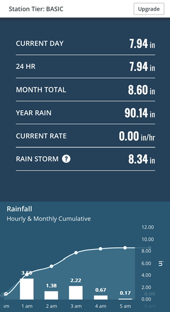
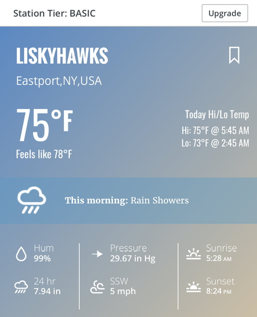
This is data from a Davis station near Eastport. Actual ground truth.