Tatamy
-
Posts
2,323 -
Joined
-
Last visited
Content Type
Profiles
Blogs
Forums
American Weather
Media Demo
Store
Gallery
Everything posted by Tatamy
-
 Let’s hope the LIRR does not get flooded out.
- 886 replies
-
- 1
-

-
- heavy rain
- flooding potential
- (and 2 more)
-
This was never going to be a big hit for eastern or northeastern PA. FWIW I have two weather stations. One here in eastern PA and the other on Fire Island (Both are Davis stations). There is a 12” difference in the YTD rainfall totals between the two. When we were getting deluged back in the summer those areas nearer to the coast were dry a lot of the time. Now that difference is getting worked off - unfortunately a lot of it in one day.
- 886 replies
-
- 3
-
-
- heavy rain
- flooding potential
- (and 2 more)
-
0.37” here in eastern PA. 0.88” at my station on Fire Island.
- 886 replies
-
- 1
-
-
- heavy rain
- flooding potential
- (and 2 more)
-
I guess you were not old enough to remember it with much detail. This was the worst storm to hit LI in the last quarter of the previous century.
-
12z is doomsday for NYC… lol
-
If you want west pay attention to what the GFS is doing with the following system (Nigel?). It’s very much locked in on a potential east coast threat two weeks from now.
-
That westbound outflow boundary has really ignited the atmosphere over NJ and PA. My dry weekend is gone.
-
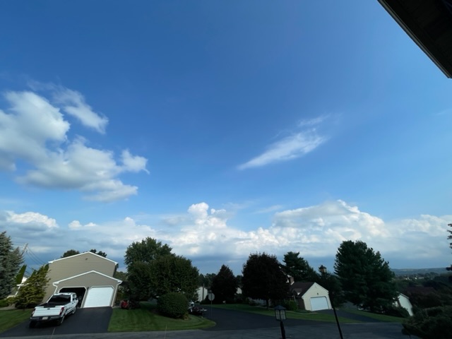
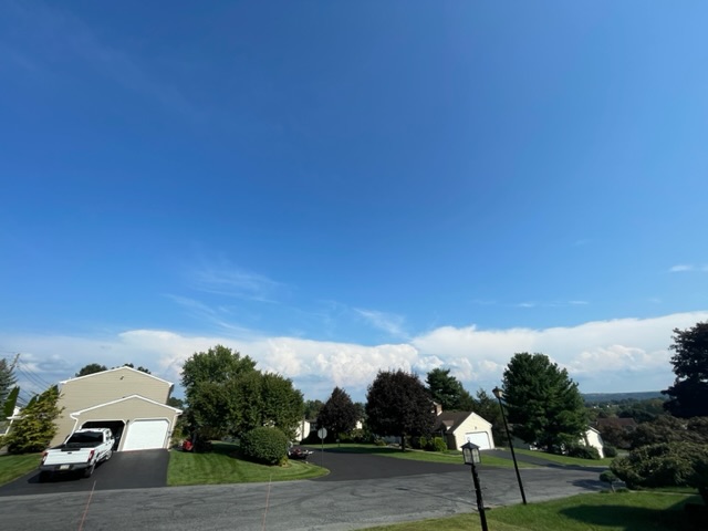
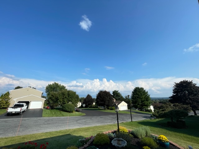
Here comes that outflow boundary. You can see the towering CU behind it.
-
I am hoping for the same here. Especially after the pounding we took Thursday night.
-
I took a new photo and you can see the towering CU over western NJ which will fire new cells.
-
You guys on the island are taking it on the chin with this pattern. My station on Fire Island has not measured so far this month. Meanwhile storms are firing up in NJ and racing off to the north and west.
-
With this one did the trough cut off over the SE or was this a deep meridional trough?
-
This is what it looks like from here
-
I am seeing the same thing. This is actually a repeat of what happened yesterday.
-
Interesting look on the radar with the storms over central NJ pushing an outflow boundary off to the west which in turn fires up new storms further west from there. When the new storms pop it gives additional impetus to this boundary.
-
Getting a violent storm out here currently. You folks in NW NJ should watch out for this one. This strike was about a block from my house. c272dc0ca205f159cb11391b1a050767.mp4
-
Getting it here over in Bethlehem Twp. as well. Looks like this will be going on for a while.
-
This complex over eastern PA has an amazing shelf cloud with it. I am still waiting on the rain. Wind gusts to 30 mph with it.
-
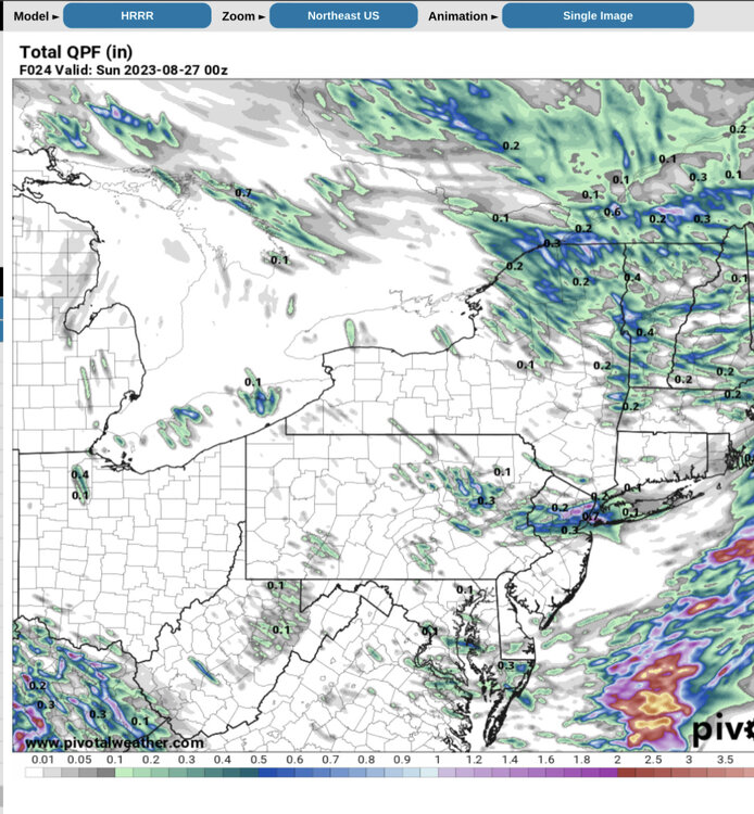
This is the 0z HRRR from last night. It had the complex but was low with amounts. Considering most of the events this summer I don’t think it did all that bad this time.
-
Picked up 0.75” this morning about 3:00 AM from that complex that moved through central NJ and along the south shore.
-
One of the areas that stands the greatest risk WRT flash flooding will be the Coachella Valley of interior southern CA. This is the region along I-10 from Palm Springs down to Indio and beyond. Elevations in the valley itself range from near sea level to a few hundred feet. The Valley is surrounded by high mountains with elevations of 10000 feet or more. These mountains are solid rock and will catch the highest rainfall totals and strongest winds. With no soils to speak of whatever rainfall that comes down will run straight down into the valley. The valley itself has dry washes both natural and man created. This is a desert region with sand only (It has the consistency of concrete) so there are no soils to speak of in which to absorb all of this water. These washes will not be able to handle this runoff. The destruction potential of this event in the deserts of Southern California cannot be over stated.
-
.81” overnight. This trough just keeps on giving.
-
Lol - They have been out here for three years. They eat what they’re going to eat and move on. At this point we have a lot of well fed birds that eat them.
-
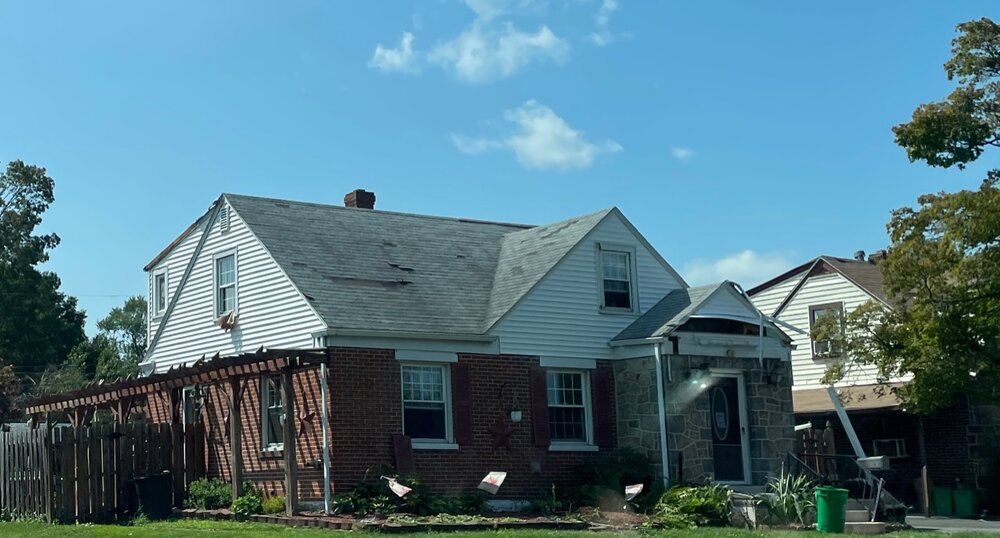
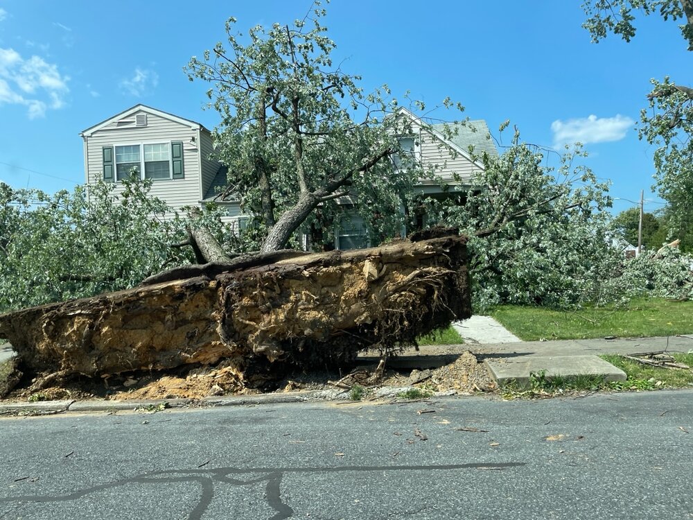
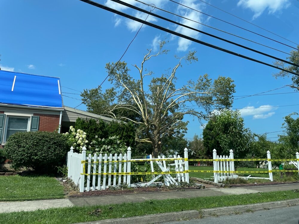
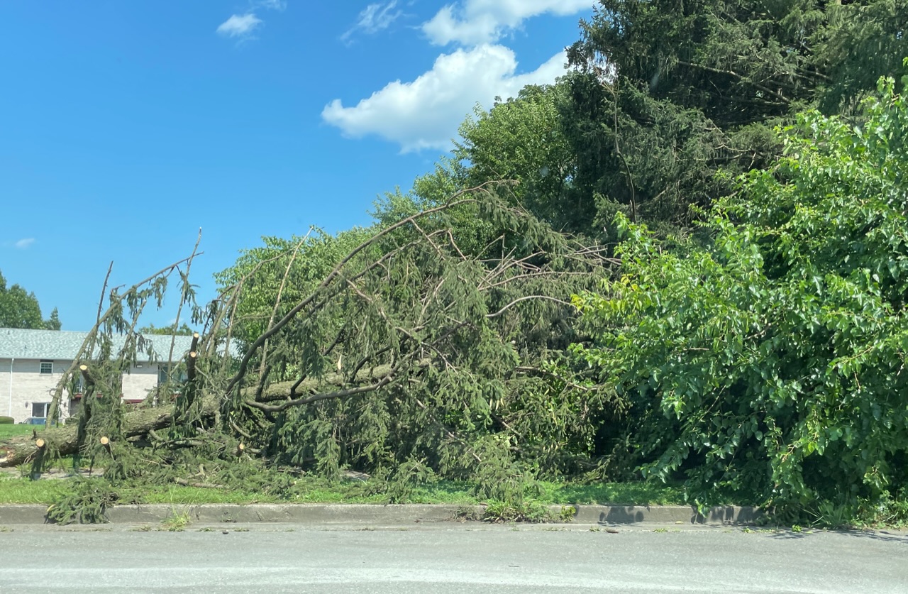
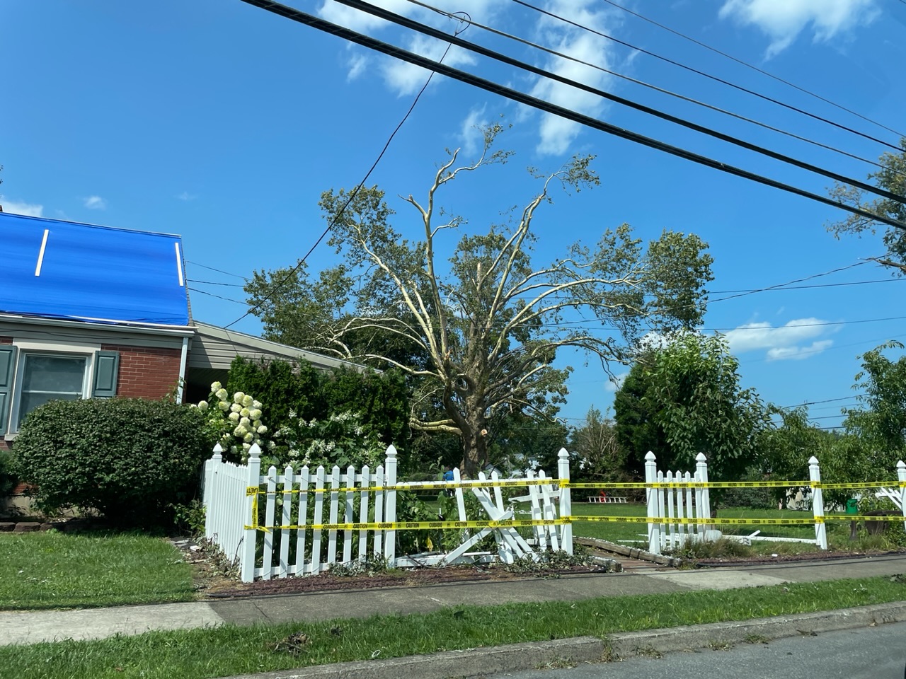
Went through the Midway Manor neighborhood in Allentown that took the tornado hit Monday evening. This was not a TOR warned storm. Damage was mainly to some large trees with some structural damage as well.