Tatamy
-
Posts
2,581 -
Joined
-
Last visited
Content Type
Profiles
Blogs
Forums
American Weather
Media Demo
Store
Gallery
Everything posted by Tatamy
-
Storms are approaching my location now. Lightning activity with these storms is quite minimal currently. Only 6 strikes detected in the past three hours according to my Tempest.
-
My station on Fire Island has recorded 2.08” this morning. Quite a burst of rain going on down there.
-
You don’t see this very often in the Baltimore area.

-
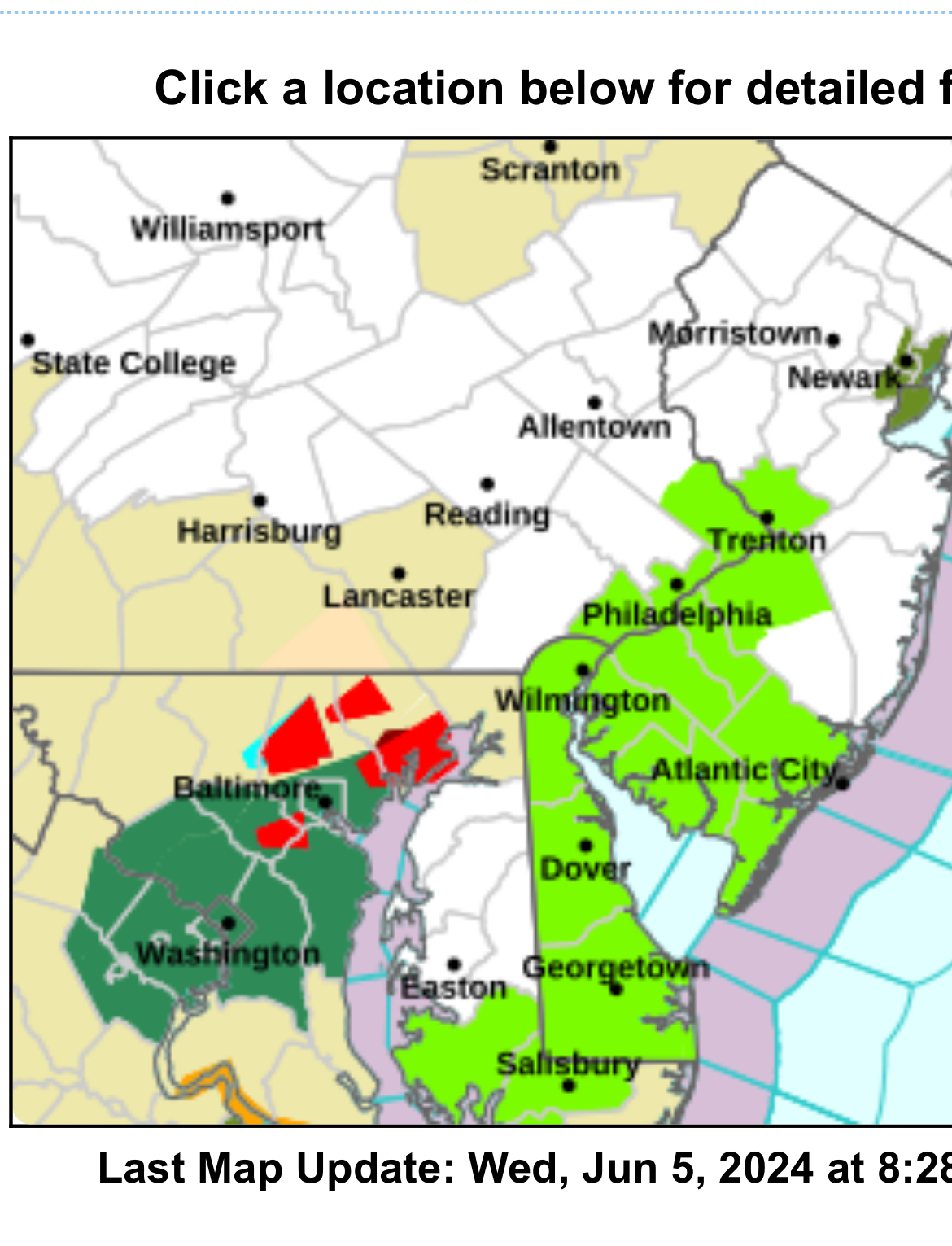
Now a Tornado Warning in Lancaster Cty. PA
-
We definitely do. The FAA has a big radar installation up in Rickets Glen State Park PA which would suffice. This is NW of Wilkes Barre.
-
Tornado reported OTG as of 20 minutes ago to the west of Tamaqua. The storm producing this is west of Lehighton and Jim Thorpe. This is in eastern PA. No recent updates if anything is still OTG.
- 1,603 replies
-
- 2
-

-

-
- spring
- cool temps
- (and 3 more)
-
Got an early start out here with that line now across NW NJ. 0.16” in the rain gauge. One close CTG strike with it here.

-
Local utilities reporting 20,000 power outages in the area out here.
- 1,603 replies
-
- 2
-
-
- spring
- cool temps
- (and 3 more)
-
Storm just blew through here. Nice wind producer and there will undoubtedly be tree damage relating to downbursts in my area.
- 1,603 replies
-
- 1
-
-
- spring
- cool temps
- (and 3 more)
-
Interesting mesocyclone look on radar moving into the Middletown, NY area currently.
- 1,603 replies
-
- 1
-
-
- spring
- cool temps
- (and 3 more)
-
I got real lucky. It was overcast here as late as 1:30 AM. Some time between then and 3:00 AM it cleared out.
- 1,603 replies
-
- 1
-
-
- spring
- cool temps
- (and 3 more)
-
Facing NW
- 1,603 replies
-
- 2
-
-

-
- spring
- cool temps
- (and 3 more)
-
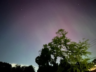
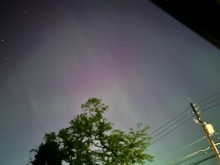
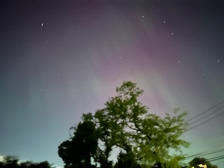
Here’s what I saw with the iPhone
- 1,603 replies
-
- 3
-
-
-
- spring
- cool temps
- (and 3 more)
-
I am 10 miles NE of Allentown in Bethlehem Twp. It was faintly visible to the naked eye. My iPhone saw them very nicely. What was amazing was how the sky cleared out in the middle of the night. It’s not like there was a strong cold front that came through to do that either.
- 1,603 replies
-
- 1
-
-
- spring
- cool temps
- (and 3 more)
-
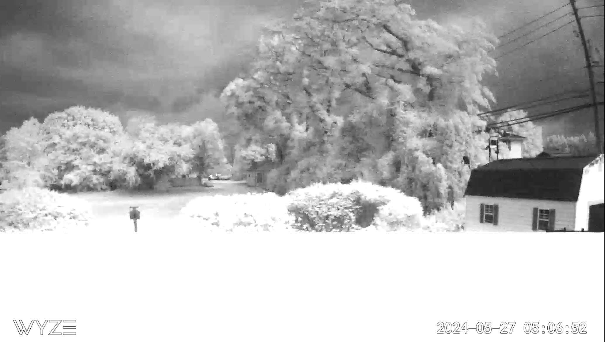
I turned in at 10:00 PM and it was cloudy and drizzly. I woke up at 3:00 AM and somehow the skies had cleared out and I got some great pictures. The website is not letting me upload them. This morning I am all fogged in. What I saw was just like what Don saw.
- 1,603 replies
-
- 1
-
-
- spring
- cool temps
- (and 3 more)
-
0.06” in the gauge this morning with a few claps of thunder. Next..
-
In a recently posted LSR hail with a diameter of 1.25” was reported in Whitehall Twp.
-
We just did get pounded. We had a spectacular lightning storm along with a quick 0.65” of rain. Looks like the storms are weakening some as they move into the more stable atmospheric conditions further east across NJ. I was also watching that hail shown above on radar. I am certain that there was even larger sized hail with this feature up near Jim Thorpe.
-
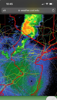
A line of severe thunderstorms has popped up in NE PA ahead of the cold front. NWS has issued a warning for this feature speaking of the threat of 1” hail with it.
-
Same here!
-
You got the flare! Well done. That’s what I saw however I could not get the shot.
-
Incredible experience. The clouds parted just enough so we could get the totality experience. I even saw a bright orange solar flare. Amazing!!
-
Looks like there are people still enroute from the Albany who are hitting traffic on 87. The folks traveling north in VT and NH are in a mess with major back ups on the interstates there.
-
40 miles south.
-
On the SE corner of Lake Ontario near Mexico, NY. Just some patchy cirrus around. Not a whole lot of people out and about here.