powderfreak
-
Posts
75,582 -
Joined
-
Last visited
Content Type
Profiles
Blogs
Forums
American Weather
Media Demo
Store
Gallery
Everything posted by powderfreak
-
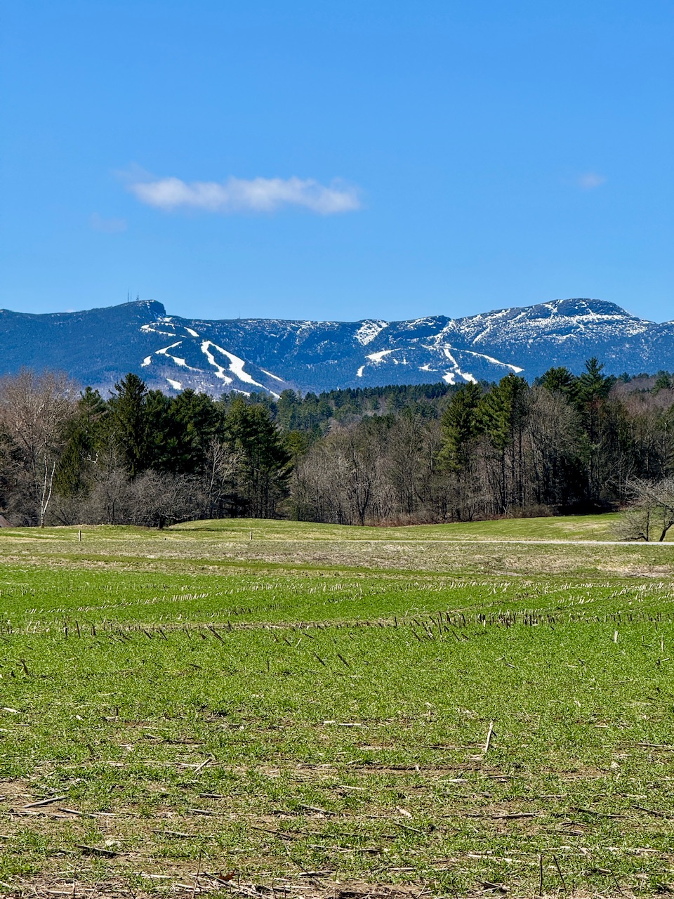
37/21 currently… it should drop now that the wind has gone calm. 28/21 at SLK, ha. Growing season is so short in those high elevation valleys like SLK. Nice day overall though. The fields that got an early application of manure sprayed seem to green up real fast… especially after a heavy 1”+ rain. This is all cow corn in the summer.

-
It’s when the buds unfold right? I honestly can see how there’s some subjectiveness to it. I don’t consider budding trees making the canopy turn a slight color as leaf out… I want to see at least some decent opening of the leaves. I feel like folks judge it on a spectrum, like fall foliage. “Leaves are changing” in the autumn to one person may mean you saw a red tree along a swamp. To another person, it’s all still green. “Leaf out” in spring to one person may mean some green buds mixed with sticks with one warm spot seeing some opening. To another person they are waiting for widespread green and opening of buds.
-
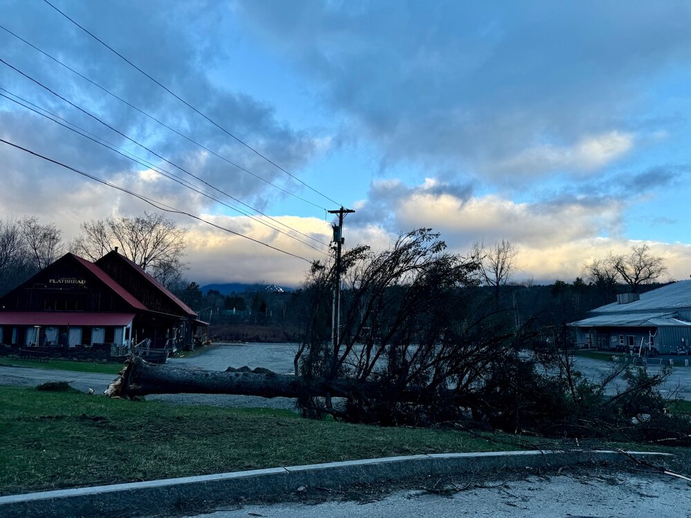
Weather station at Mtn Ops Center had 1.64” rainfall. Now it’s 38F here in town with damaging NW winds. Had to be gusts near 50mph around 4am when I was heading out. Wild ride the past 24-48 hours.
-
Jealous of the dry sunny heater down there today. Must be nice.
-
Just sharing the weather vibe up here. Wish we had sun and dry ground, but it was definitively the first “warm season” day of the year.
-
1.35” and humid. It felt different today. First legit warm season day in terms of how it felt, even with clouds and rain. It wasn’t a nice day though… humid mud season vibe. Standing water, squishy ground everywhere. Could tell the ground was thawing today.
-
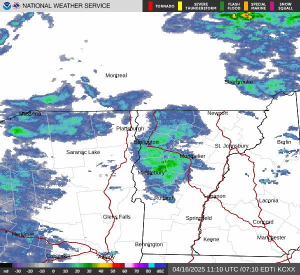
Torrential rains ongoing. River rising rapidly, muddy torrent all the sudden. Every little gully is getting cleaned out right now. The mountain must be releasing a lot of SWE. 1.18” out of the sky so far. 0.70/hr rate.
-
68/58 here. Snow crying for Mamma.
-
Impressive. Jealous.
-
Nope, extended to 4/27. We go straight from upslope snowstorm Wed/Thur to T-storms today, no in between. Always precipitating somehow lol.
-
Some pretty good lightning strikes, bright flashes.
-
Second Thunder of the day. Ski area keeps going on lightning hold, golf course horns going off, feels like warm season.
-
I am thirsty…
-
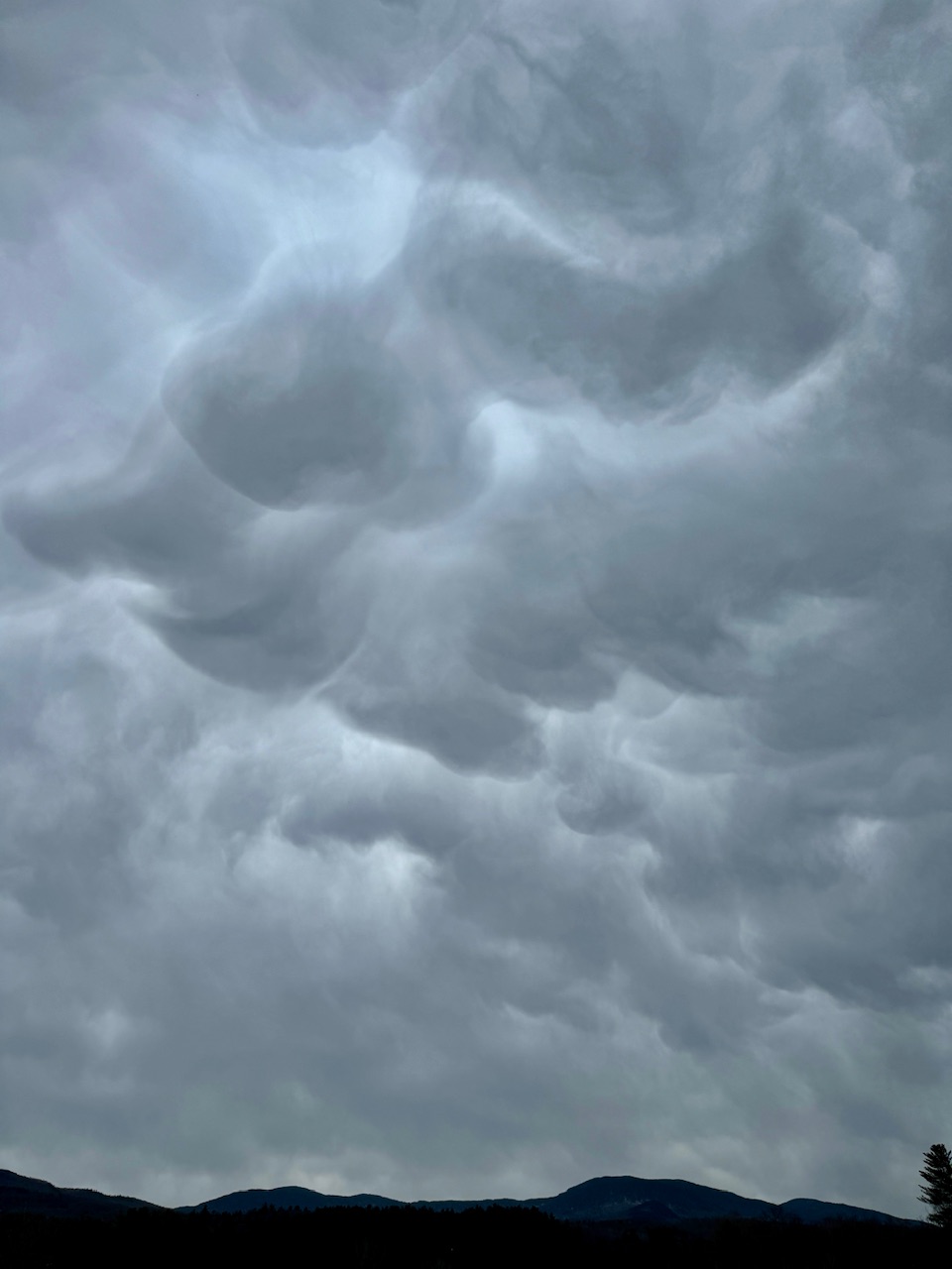
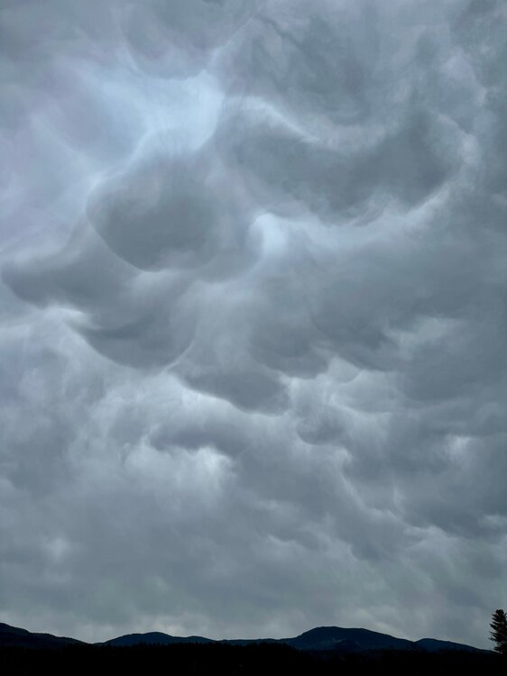
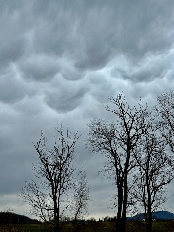
These clouds are trippy right now over the valley.
-
If there’s one person who can find the negative in today’s weather…
-
HHH is much more enjoyable when you have a place to escape it. Same with brutal cold. Heat has always been a requirement, but now AC has as well. Walking inside on a cold winter day and getting warm is the same feeling as walking inside on a HHH day and cooling off. Heat or A/C.
-
28/19 Clear. Cold night on the backside of the trough that brought the mountain snow.
-

2025 Lawns & Gardens Thread. Making Lawns Great Again
powderfreak replied to Damage In Tolland's topic in New England
I’m ready for spring and green. It’s time. -
2025 Lawns & Gardens Thread. Making Lawns Great Again
powderfreak replied to Damage In Tolland's topic in New England
Still have plow piles here and some shaded leftover snowpack in some yards lol. -
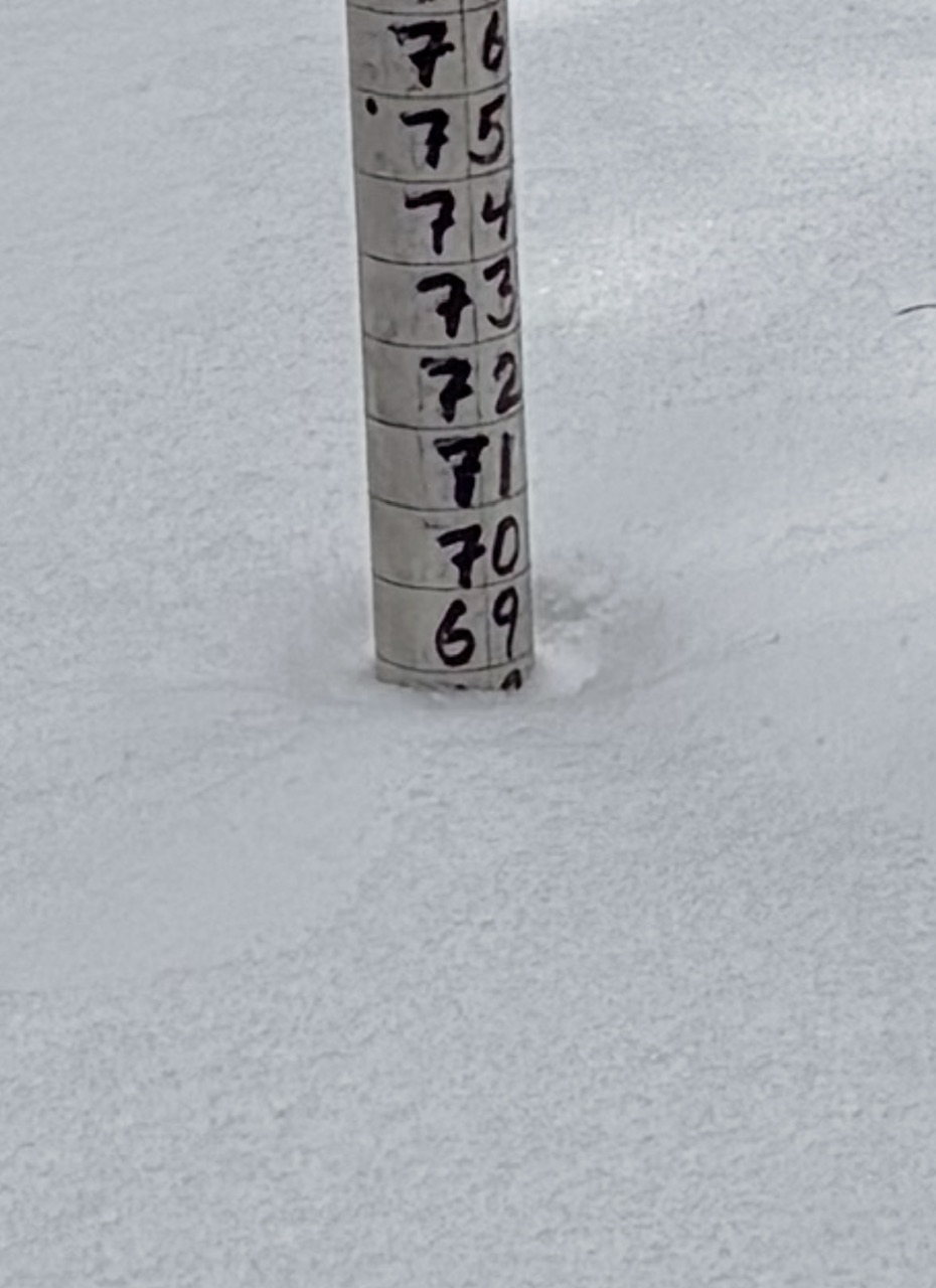
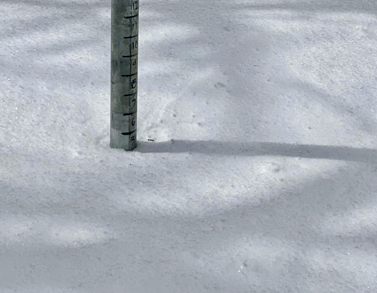
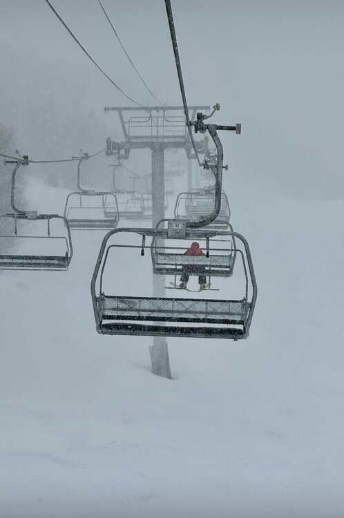
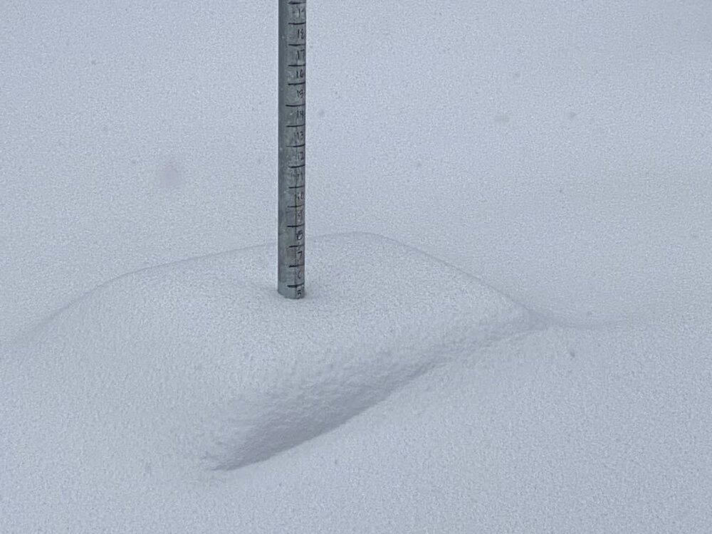
Storm total of 9” at High Road (3,000ft) in past 36 hours with this overnight snow. Depth back up to 69”.


-
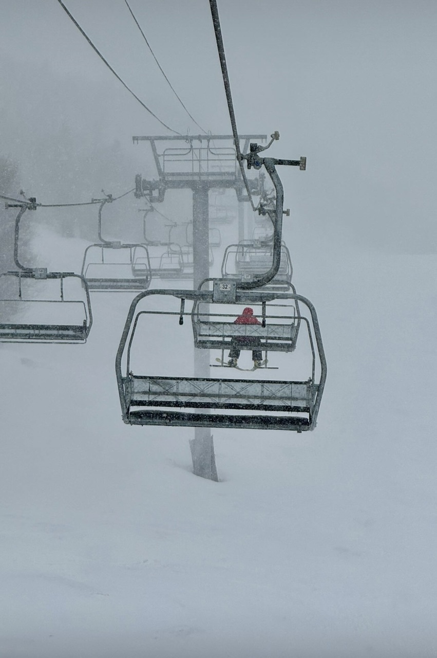
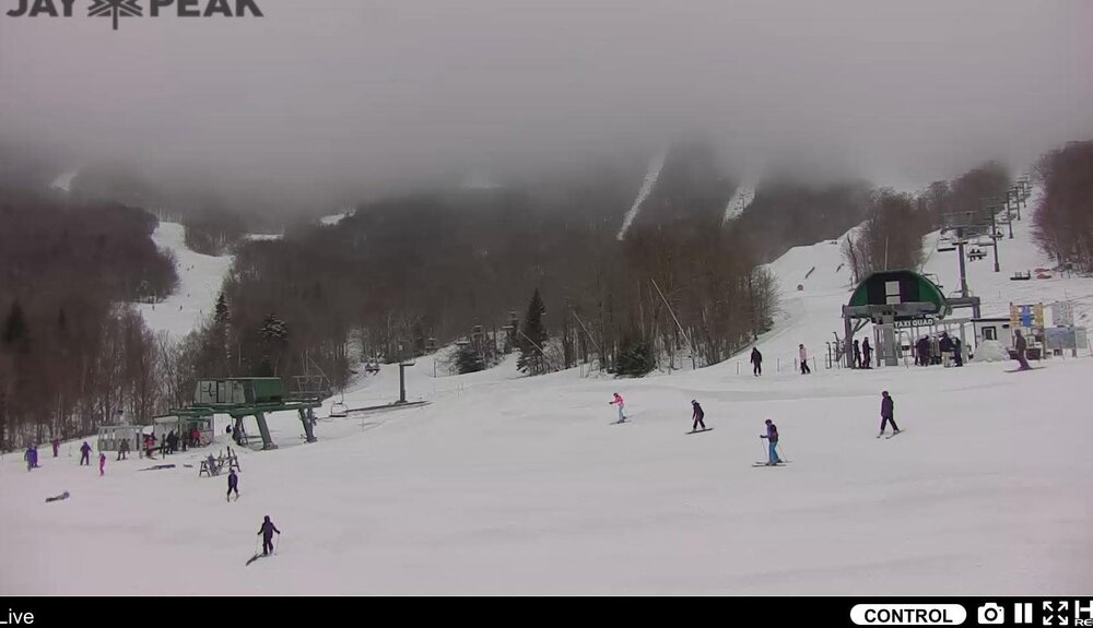
This is why mountains shut it down this time of year. A month ago this lift would be carrying a full load if there was 5” of upper mountain snowfall, and snowing hard.
-
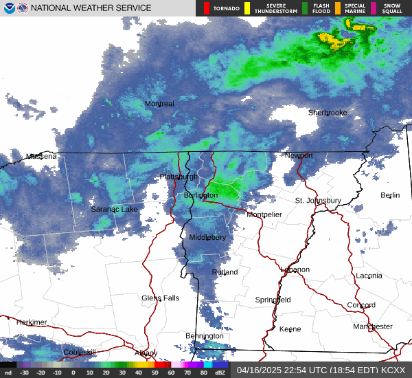
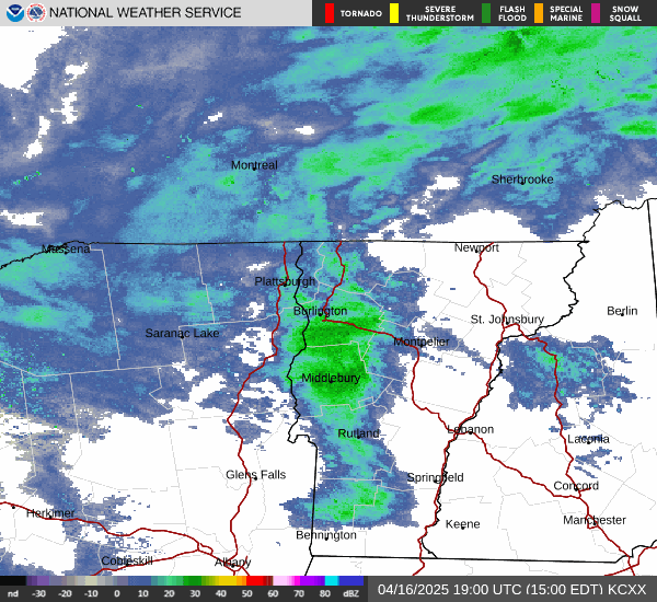
Yup! I think yesterday’s warmth did cause a decent bit more stuff get exposed, especially under like 2500ft. I noticed some accelerated melt yesterday that had been missing for quite some time. Given the moisture feed, would imagine Jay would be favored tonight. To be honest, some of the pics I saw from high up on Sugarbush today looked like the best I saw from anywhere. Sort of matched the radar too. Most models have the real stuff tapering off by 10pm or so, with more persistent flurries after that. Favoring the northern Mtns now.
-
Looping the full radar today, wouldn’t surprise me if like Appalachian Gap and MRG elevations did best today. Or west side of Camels Hump even.
-
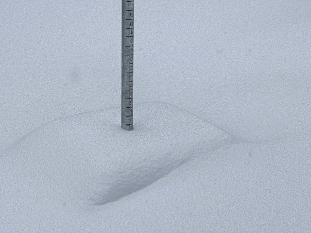
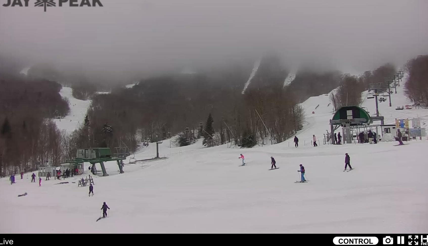
5” so far in last 24 hours at Mansfield 3000ft plot. Was sort of surprised it didn’t seem to be snowing that hard at Jay today. Anyone up there? Models were jackpotting up there but radar seemed even south of Mansfield for most of the afternoon. Looks like it’ll finally start moving in to the north now.
-
Snowing pretty hard right now. Upslope just turned on.