nj2va
-
Posts
13,693 -
Joined
-
Last visited
Content Type
Profiles
Blogs
Forums
American Weather
Media Demo
Store
Gallery
Everything posted by nj2va
-
Gorgeous scene!
-
Few drops of rain. LFG!
-
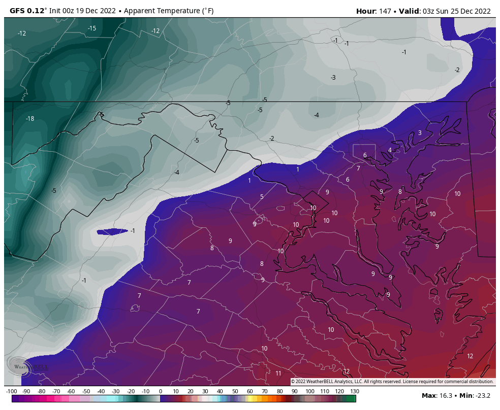
27.9/22 at McHenry 34.3/26 here in Alexandria.
-
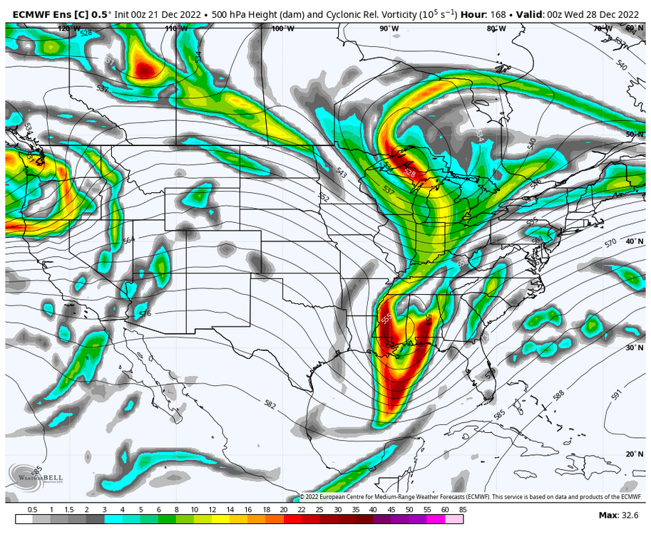
Euro Control actually runs the storm next week up the coast but 850s are above freezing except out towards the mountains. Maybe a cleaner phase of the southern vort with a piece of the TPV would have produced a colder solution.
-
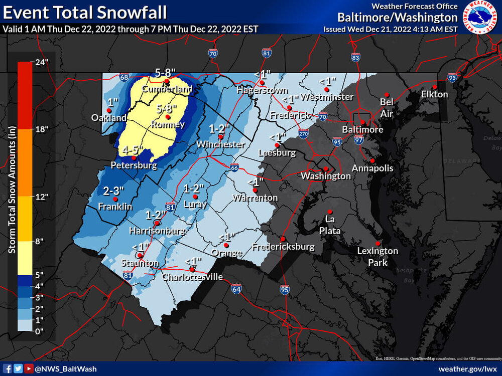
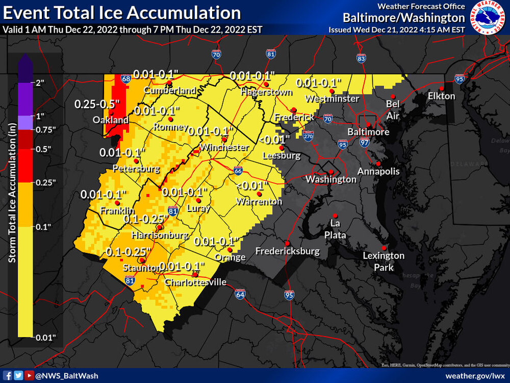
Should central va nats tell LWX to update their snow and ice maps?
-
I still think that initial slug of precip could be sneaky for the western crew towards Winchester, etc and drop a few inches. I think the Cumberland to Frostburg area will be bullseye in that initial batch.
-
ITS GONNA SNOW I CANT HEAR YOU OVER MY SNOWBLOWER SENT FROM MY WEENIE WISHCASTER DEVICE 2000 MAX
-
It’s one of those forecasts where I can see snow showers/squalls/flakes flying Friday morning/afternoon that whiten the ground but certainly not putting my eggs in an anafrontal basket that drops 6” of snow lol
-
I can’t tell what’s more annoying with your posts - the CAPS or the ‘sent from’ blah blah blah after each post.
-
-
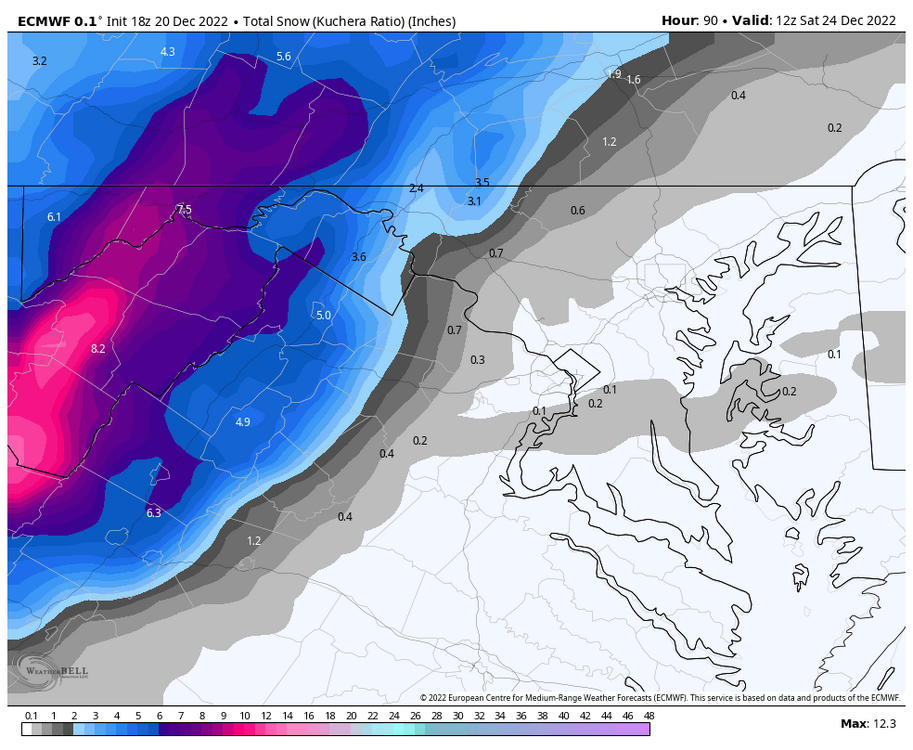
CMC coming in slightly colder for the Winchester crew with the initial precip. ~2” in Winchester. 7” out in Allegany county.
-
7” for DC on Kuchera…GFS just NAM’d us. It seems drunk.
-
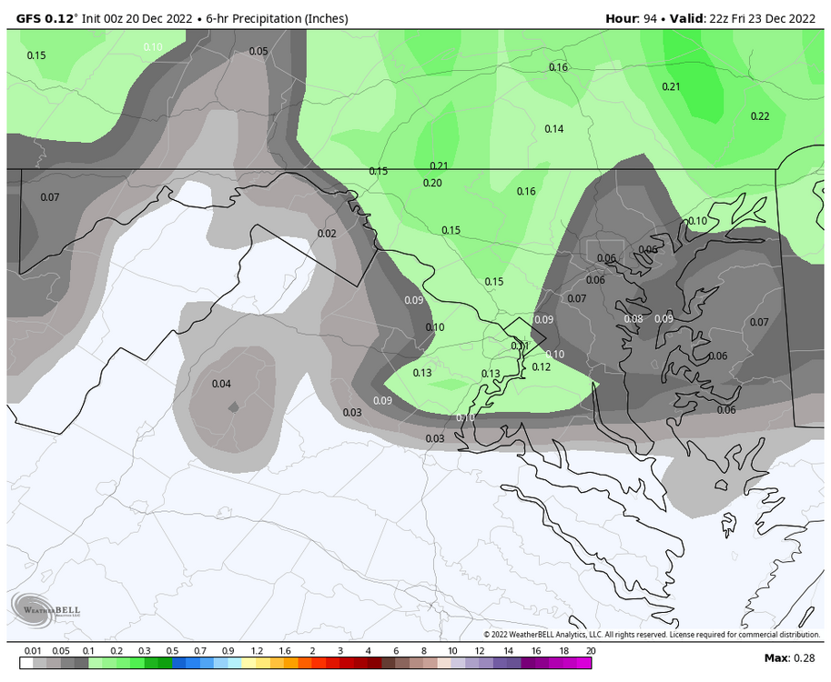
GFS looks pretty wild between 9a and 10a Friday morning.
-
Was that last year (or the year before) that the RGEM gave like 65” to the Baltimore area 12 hours out from an event?
-
You couldn't pay me to camp in that kind of weather.
-
That's a much better evolution for maximizing the upslope.
-
When was the last time it was wrong? Wait, don’t answer that…
-
Where do I sign for that? What could go wrong?
-
Hey, the GFS was right in the depiction of the NS SS in the Northwest for this storm in the face of every other model. A weenie can dream.
-
DC goes from 50 at 10a Friday to 30 at 11a Friday on the GFS. That would be pretty remarkable. ~0.1” QPF falls in DC after 11a.
-
Ovi was so close to scoring tonight. Great win and that OT winner by Orlov was an absolute blast.
-
yeah, similar to this last weekend the track of the low isn’t ideal for optimizing upslope. We want it bombing out and heading N/NE of the area so the winds are coming straight out of the NW off the lakes. This has evolved into bombing out/decaying to our WNW before lifting NE. Will still have upslope but not nearly as much as what could have been.
-
Don’t forget the upslope!
-
Yay, more long range 500 maps to track
-
I hope Santa packs his parka.